- Beauharnois, Quebec
-
Beauharnois — City — 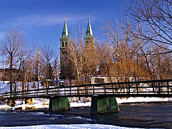 Location within Beauharnois-Salaberry Regional County Municipality.
Coordinates (660, rue Ellice [1]): 45°18′48″N 73°52′41″W / 45.31333°N 73.87806°W Country  Canada
Province  Quebec
Region Montérégie RCM Beauharnois-Salaberry Constitution January 01, 2002 Electoral Districts
Federal
Beauharnois—SalaberryProvincial Beauharnois Government[1][2][3] – Mayor Claude Haineault – Federal MP(s) Anne Minh-Thu Quach (NPD) – Quebec MNA(s) Guy Leclair (PQ) Area[4] – Land 69.09 km2 (26.7 sq mi) Population (2006)[4] – Total 12,058 – Density 172.5/km2 (446.8/sq mi) – Change (2001-06)  4.0%
4.0%– Dwellings 5,257 Time zone EST (UTC-5) – Summer (DST) EDT (UTC-4) Postal code(s) J6N Area code(s) 450 Access Routes[5]  Route 132
 Route 205
 Route 236
Website www.ville.beauharnois.qc.ca Beauharnois is a city located in the Beauharnois-Salaberry Regional County Municipality of southwestern Quebec, Canada and is part of Greater Montreal Area. The city's population as of the Canada 2006 Census was 11,918. It is home to the Beauharnois Hydroelectric Power Station, one of the largest hydroelectric generating stations in the world, as well as the Beauharnois Lock of the Saint Lawrence Seaway.
Contents
History
In 2002, the neighbouring towns of Maple Grove and Melocheville were amalgamated into Beauharnois.
Demographics
Population
Population trend[6]
Census Population Change (%) 2010 12,058 1.17%2006 11,918 (+) 46.4%2001 6,387  0.7%
0.7%1996 6,435 0.2%1991 6,449 N/A (+) Amalgamated with Maple Grove and Melocheville in 2002
Language
Mother tongue language (2006)[4]
Language Population Pct (%) French only 11,055 94.53% English only 395 3.38% Both English and French 45 0.38% Other languages 200 1.71% See also
- List of municipalities in Quebec
- Maple Grove
- Melocheville
References
- ^ a b Ministère des Affaires Municipales et Régions: Beauharnois
- ^ Parliament of Canada Federal Riding History: BEAUHARNOIS--SALABERRY (Quebec)
- ^ Chief Electoral Officer of Québec - 40th General Election Riding Results: BEAUHARNOIS
- ^ a b c 2006 Statistics Canada Community Profile: Beauharnois, Quebec
- ^ Official Transport Quebec Road Map
- ^ Statistics Canada: 1996, 2001, 2006 census
External links

Saint Lawrence River, Lake Saint-Louis Salaberry-de-Valleyfield / Saint-Louis-de-Gonzague 
Léry / Sainte-Martine  Beauharnois

Saint-Étienne-de-Beauharnois Administrative divisions of Montérégie (Region 16)Regional county municipalities
and equivalent territoriesBrome-Missisquoi · La Haute-Yamaska · Acton · Pierre-De Saurel · Les Maskoutains · Rouville · Le Haut-Richelieu · La Vallée-du-Richelieu · Longueuil · Marguerite-d'Youville · Roussillon · Les Jardins-de-Napierville · Le Haut-Saint-Laurent · Beauharnois-Salaberry · Vaudreuil-Soulanges
Municipalities Cowansville · Granby · Sorel-Tracy · Saint-Hyacinthe · Saint-Jean-sur-Richelieu · Chambly · Saint-Basile-le-Grand · Mont-Saint-Hilaire · Belœil · Brossard · Saint-Lambert · Boucherville · Saint-Bruno-de-Montarville · Longueuil · Sainte-Julie · Varennes · La Prairie · Candiac · Sainte-Catherine · Saint-Constant · Mercier · Châteauguay · Beauharnois · Salaberry-de-Valleyfield · Pincourt · Vaudreuil-Dorion · Saint-Lazare
Categories:- Cities and towns in Quebec
- Incorporated places in Montérégie
- Populated places on the Saint Lawrence River
- Greater Montreal
- Montérégie geography stubs


Wikimedia Foundation. 2010.