- Urban agglomeration of Longueuil
-
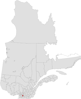
Urban agglomeration of Longueuil — RCM Equivalent Territory — Quebec Country  Canada
Province  Quebec
Region Montérégie Incorporated January 01, 2002 County seat Longueuil Communities 5 Government[1] – Type Prefecture Area[2] – Land 282.42 km2 (109 sq mi) Population (2006)[2] – Total 385,533 – Density 1,365.1/km2 (3,535.6/sq mi) – Change (2001-06)  3.7%
3.7%– Dwellings 164,418 Time zone Eastern (UTC-5) – Summer (DST) EDT (UTC-4) Website www.longueuil.ca The urban agglomeration of Longueuil was created on January 1, 2006 as a result of the de-amalgamation process brought upon by the Charest government. It encompasses all the boroughs that were merged into the previous city of Longueuil and still retains the same area as that mega-city.
The urban agglomeration of Longueuil is coextensive with the territory equivalent to a regional county municipality (TE) and census division (CD) of Longueuil, whose geographical code is 58.
Contents
Structure
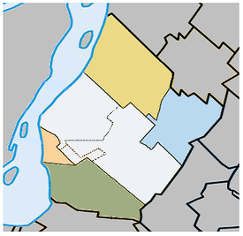
According to the Act respecting the exercise of certain municipal powers in certain urban agglomerations, the cities and boroughs of the urban agglomeration of Longueuil are structured as follows:
Central municipality
- Ville de Longueuil
- Borough of Vieux-Longueuil
- Borough of Greenfield Park
- Borough of Saint-Hubert
Related municipalities
- Ville de Boucherville
- Ville de Brossard
- Ville de Saint-Bruno-de-Montarville
- Ville de Saint-Lambert
Population and Reprensentation by district
2006 Canadian Census / Longueuil
City Population (2006) Pct (%) # of Representatives # of council votes Boucherville 40,480 10.43% 1 1.76 Brossard 71,154 18.33% 1 3.21 Longueuil 230,678 59.44% 6 10.63 Saint-Bruno 24,423 6.29% 1 1.13 Saint-Lambert 21,342 5.50% 1 1 Total 388,077 100% 10 17.73 Agglomeration powers
Under this new system of municipal organization, the agglomeration city and the reconstituted cities (in this case, Boucherville, Brossard, Saint-Bruno-de-Montarville and Saint-Lambert) share powers and responsibilities. The urban agglomeration is headed by an agglomeration council which exercises these agglomeration powers.
Demographics
Language
Mother tongue from Canada 2006 CensusLanguage Population Pct (%) French only 289,215 75.85% English only 30,695 8.05% Both English and French 3,020 0.79% Other languages 58,350 15.3% Access Routes
Highways and numbered routes that run through the municipality, including external routes that start or finish at the county border:
- Secondary Highways:
- None
- External Routes:
- None
Bordering Counties

Marguerite-d'Youville 
Saint Lawrence River
Montréal
La Vallée-du-Richelieu  Longueuil

Roussillon See also
- Longueuil City Council
- Municipal reorganization in Quebec
- Urban agglomerations of Quebec
- Longueuil
- List of mayors of Longueuil
- Boroughs of Longueuil
References
External links
- Bill 6 (An Act to amend various legislative provisions respecting municipal affairs) as applied to the Ville de Longueuil
- Reconstituted municipalities (French)
Urban agglomeration of Longueuil Cities Boroughs of Longueuil Pre-2002 towns and cities (now merged) Jacques-Cartier · Mackayville-Laflèche · LeMoyne · Montreal South (Montréal-Sud) · Notre-Dame-du-Sacré-Cœur · PrévillePolitics Transportation Réseau de transport de Longueuil (RTL) · Longueuil–Université-de-Sherbrooke (Montreal Metro) · Montréal/Saint-Hubert Airport · Jacques-Cartier Bridge · Champlain Bridge · Victoria Bridge · Louis-Hippolyte Lafontaine Bridge-Tunnel · Taschereau Boulevard · Victoria AvenueHealth and Safety Hôpital Charles LeMoyne · Hôpital Pierre-Boucher · Service de police de Longueuil (SPL) · Service de Sécurité incendie de Longueuil (SSIL)Education Media Other  Administrative divisions of Montérégie (Region 16)
Regional county municipalities
and equivalent territoriesBrome-Missisquoi · La Haute-Yamaska · Acton · Pierre-De Saurel · Les Maskoutains · Rouville · Le Haut-Richelieu · La Vallée-du-Richelieu · Longueuil · Marguerite-d'Youville · Roussillon · Les Jardins-de-Napierville · Le Haut-Saint-Laurent · Beauharnois-Salaberry · Vaudreuil-Soulanges
Municipalities Cowansville · Granby · Sorel-Tracy · Saint-Hyacinthe · Saint-Jean-sur-Richelieu · Chambly · Saint-Basile-le-Grand · Mont-Saint-Hilaire · Belœil · Brossard · Saint-Lambert · Boucherville · Saint-Bruno-de-Montarville · Longueuil · Sainte-Julie · Varennes · La Prairie · Candiac · Sainte-Catherine · Saint-Constant · Mercier · Châteauguay · Beauharnois · Salaberry-de-Valleyfield · Pincourt · Vaudreuil-Dorion · Saint-Lazare
 Administrative divisions of Quebec
Subdivisions Communities Major cities Montreal · Quebec · Laval · Gatineau · Longueuil · Sherbrooke · Saguenay · Lévis · Trois-Rivières
Coordinates: 45°32′N 73°31′W / 45.533°N 73.517°W
Categories:- Longueuil
- Populated places on the Saint Lawrence River
- Census divisions of Quebec
- Territories equivalent to a regional county municipality
- Montérégie
- Quebec stubs
- Ville de Longueuil
Wikimedia Foundation. 2010.


