- Urban agglomeration of Montreal
-
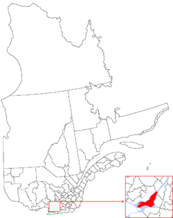
Montréal (06) is one of the administrative regions of Quebec, Canada.
It is also a territory equivalent to a regional county municipality (TE) and a census division (CD), for both of which its geographical code is 66.
It consists of the 2002-2005 territory of the city of Montreal, and is coextensive with the Urban Agglomeration of Montreal (French: Agglomération de Montréal). Following merger of all the municipalities of the agglomeration into one on January 1, 2002, sixteen of its municipalities were reconstituted on January 1, 2006. The urban agglomeration is governed by the Montreal Agglomeration Council (French: Conseil d'agglomération de Montréal). Prior to the merger of the municipalities in Region 06 in 2002, the administrative region was co-extensive with the Montreal Urban Community.
Located in the southwestern part of the province, the territory includes several of the islands of the Hochelaga Archipelago in the Saint Lawrence River, including the Island of Montreal, Nuns' Island (Île des Sœurs), Île Bizard, Saint Helen's Island (Île Sainte-Hélène), Île Notre-Dame, Dorval Island (Île Dorval), and several others.
The region is the second-smallest (499.19 km², or 192.74 sq mi) and most populous (1,854,442 at 2006 census) of Quebec's seventeen administrative regions.
Contents
Montreal Agglomeration Council
The executive of the urban agglomeration is the agglomeration council. The weighting of votes for the council breaks down to 87% for the City of Montreal, and 13% for the other municipalities of the Island of Montreal.[1]
Subdivisions
Cities
- Baie-d'Urfé
- Beaconsfield
- Côte-Saint-Luc
- Dollard-des-Ormeaux
- Dorval
- Hampstead
- Kirkland
- L'Île-Dorval
- Montreal (Montréal in French)
- Borough of Ahuntsic-Cartierville
- Borough of Anjou
- Borough of Côte-des-Neiges–Notre-Dame-de-Grâce
- Borough of L'Île-Bizard–Sainte-Geneviève
- Borough of LaSalle
- Borough of Lachine
- Borough of Le Plateau-Mont-Royal
- Borough of Le Sud-Ouest
- Borough of Mercier–Hochelaga-Maisonneuve
- Borough of Montréal-Nord
- Borough of Outremont
- Borough of Pierrefonds-Roxboro
- Borough of Rivière-des-Prairies–Pointe-aux-Trembles
- Borough of Rosemont–La Petite-Patrie
- Borough of Saint-Laurent
- Borough of Saint-Léonard
- Borough of Verdun
- Borough of Ville-Marie
- Borough of Villeray–Saint-Michel–Parc-Extension
- Montréal-Est
- Montreal West (Montréal-Ouest in French)
- Mount Royal (Mont-Royal in French)
- Pointe-Claire
- Sainte-Anne-de-Bellevue
- Westmount
Village
References
- Montréal region Statistics Canada
Citations
- ^ The Gazette (Montreal), "Tremblay eats crow at council", Linda Gyulal, 4 December 2009 (accessed 12/01/10)
External links
- Portail régional de Montréal (official website)
 Administrative divisions of Montréal (Region 06)
Municipalities Baie-d'Urfé · Beaconsfield · Côte-Saint-Luc · Dollard-des-Ormeaux · Dorval · Hampstead · Kirkland · L'Île-Dorval · Montreal · Montréal-Est · Montreal West · Mount Royal · Pointe-Claire · Sainte-Anne-de-Bellevue · Senneville · Westmount
Administrative divisions of QuebecSubdivisions Communities Major cities Montreal · Quebec · Laval · Gatineau · Longueuil · Sherbrooke · Saguenay · Lévis · Trois-Rivières
Regions Abitibi-Témiscamingue · Bas-Saint-Laurent · Capitale-Nationale · Centre-du-Québec · Chaudière-Appalaches · Côte-Nord · Estrie · Gaspésie–Îles-de-la-Madeleine · Laval · Lanaudière · Laurentides · Mauricie · Montérégie · Montréal · Nord-du-Québec · Outaouais · Saguenay–Lac-Saint-Jean
Categories:- Island of Montreal municipalities
- Territories equivalent to a regional county municipality
- Census divisions of Quebec

Wikimedia Foundation. 2010.