- Chilliwack, British Columbia
-
Chilliwack City of Chilliwack 
Flag
SealNickname(s): The Wack Motto: "Cor Viride Provinciae" (Latin)
"The Green Heart of the Province"Location of Chilliwack in British Columbia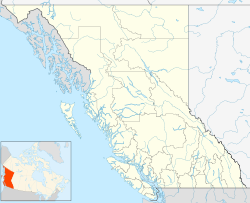
 Chilliwack
Coordinates: 49°09′27.8″N 121°57′03.3″W / 49.157722°N 121.950917°W Country Canada Province British Columbia Region Fraser Valley Founded 1873 Incorporated 1980 Government - Mayor Sharon Gaetz - Governing body Chilliwack City Council Area - City 260.19 km2 (100.5 sq mi) Elevation 10 m (33 ft) Population (2006) - City 69,217 - Density 266.0/km2 (688.9/sq mi) - Urban 59,453 - Metro 80,892 Time zone PST (UTC-8) - Summer (DST) PDT (UTC-7) Postal code span V2P to V2Z Highways Highway 1 Waterways Chilliwack River, Vedder River, Fraser River Coordinates: 49°09′27.8″N 121°57′03.3″W / 49.157722°N 121.950917°W Chilliwack is a Canadian city in the Province of British Columbia. It is a predominantly agricultural community with an estimated population of 80,000 people. Chilliwack is the second largest city in the Fraser Valley Regional District after Abbotsford. The city is surrounded by mountains and recreational areas such as Cultus Lake and Chilliwack Lake Provincial Parks. There are many outdoor opportunities in the area, including hiking, horseback riding, biking, camping, fishing, and golf. Chilliwack is the location of the head offices of the Fraser Valley Regional District.
Contents
History
Between 5,000 and 10,000 years ago the Sto:lo arrived in the Chilliwack area. At the time of their first contact with Europeans it is estimated that there were as many as 30,000 people living within Sto:lo territory.
In 1857, gold was discovered in the Fraser Canyon. By 1858, over 30,000 gold miners had trekked to the goldfields, most travelling through the Chilliwack area. By the mid 1860's several farms had grown up around the steamboat landings on the Fraser River called Miller's Landing, Sumas Landing and Chilliwack Landing.
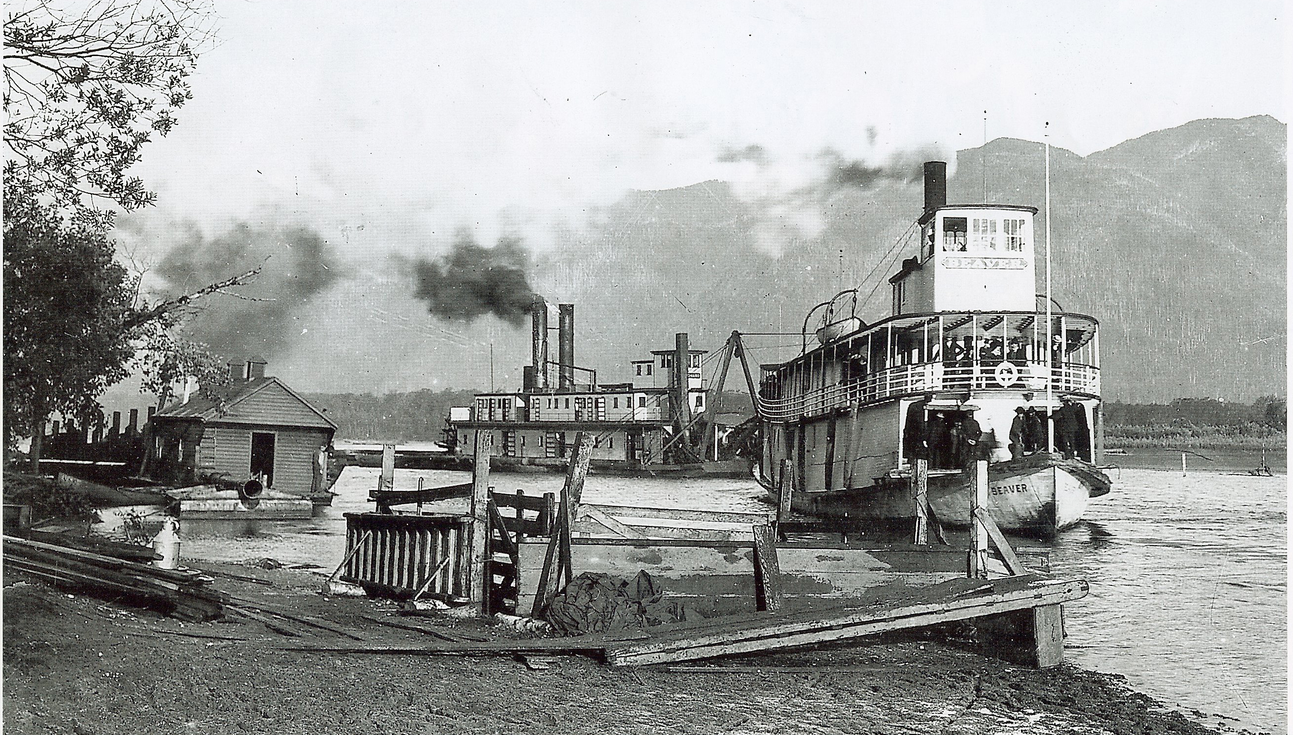
The Township of Chilliwack was incorporated in 1873, the third municipality in British Columbia. Initial settlement was along the Fraser River at Chilliwack Landing. Steamboats were the main mode of transportation, carrying goods and passengers between Chilliwack and New Westminster. After the construction of the Canadian Pacific Railway in 1885, many residents began to cross the Fraser River at Minto Landing to catch the train at Harrison Mills.
With little room for expansion along the river, the commercial area of the town moved south to the junction of the New Westminster-Yale Wagon Road, Wellington Avenue and Young Road, called "Five Corners." A large subdivision called Centreville was built In 1881. The name Centreville was replaced In 1887 by the more popular "Chilliwhack." The area was incorporated in 1908 as a separate municipality, the City of Chilliwack. The City and the Township co-existed for 72 years. In 1980 they merged to form the District of Chilliwack. The District of Chilliwack became the City of Chilliwack in the early 1990s.
The spelling of Chilliwack is sometimes a matter of confusion. Prior to the amalgamation of the City of Chilliwack and the Municipality of Chilliwhack, there were two different spellings. Upon amalgamation, the spelling of the City was used.[1] Archaic spellings include Chilliwhyeuk and other versions closer to the original Halkomelem, the language of the Sto:lo communities around Chilliwack and Sardis.
Geography
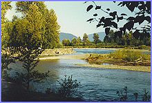
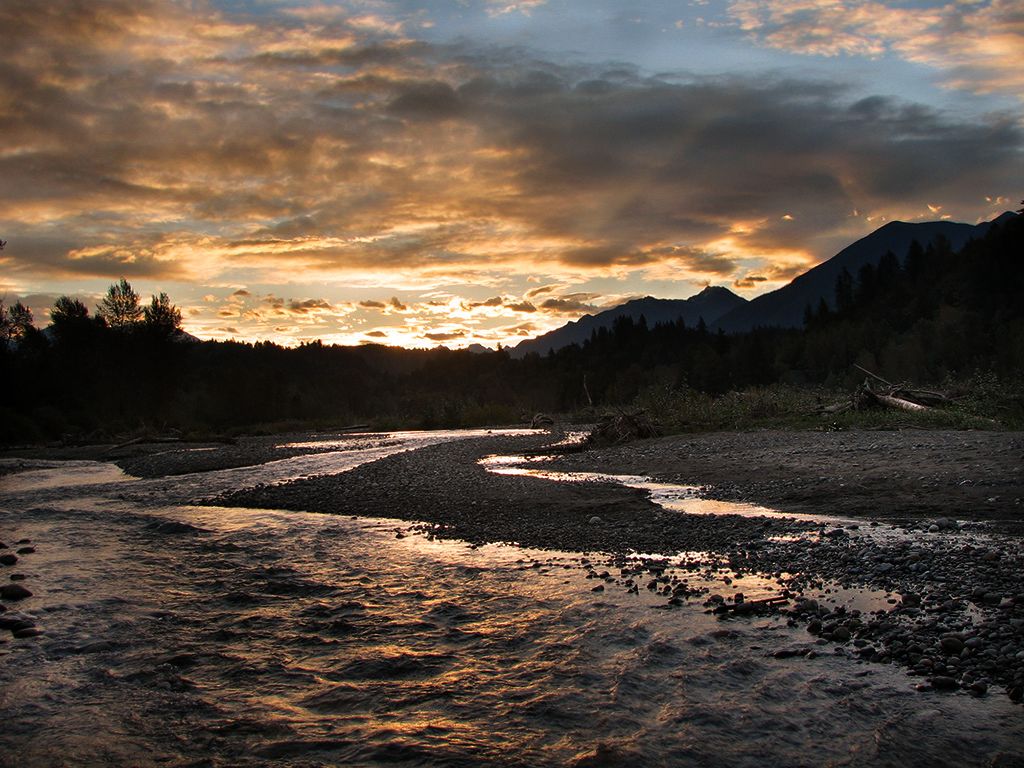
 Vedder River
Chilliwack is located in the Upper Fraser Valley, 100 kilometres (60 mi) east of Vancouver on the Trans Canada Highway. The city is bounded on the north by the Fraser River, and on the south by the Canada-United States border.
Surrounded by tall mountain peaks (such as the dramatic Mount Cheam and Slesse Mountain) and mighty rivers (the Fraser and Vedder), Chilliwack's natural setting is magnificent. Some have argued that the city itself, once a small agricultural town, "has become an example of sprawling suburbia and bad city planning." Efforts to revitalize the languishing downtown, and to curb the spread of housing subdivisions into valuable farmland, have proved challenging.
Climate
Chilliwack's mild climate with limited extremes provides excellent growing conditions for a wide variety of crops and agricultural products. The highest temperature recorded in Chilliwack was 38.2 °C (100.8 °F) on July 29, 2009, and the lowest recorded temperature was −21.7 °C (−7.1 °F) in 1968. Precipitation falls mostly as rain, with snow limited, for the most part, to the surrounding mountains.
Chilliwack receives nearly the same number of days of precipitation (184.6 days at greater than .2 mm) as comparable local communities nearer Vancouver such as Maple Ridge (185.8 days) and the City of Mission (186.0 days) (Environment Canada Statistics). Summers in Chilliwack are usually sunny and hot, with long days (light out until well after 10pm in June with dusk that lasts for hours).
Due to its location at the eastern end of the Fraser Valley, there has been some debate about preserving Chilliwack's air quality. However, the 2011 World Health Organization's study of air quality shows that Chilliwack enjoys air quality among the best in the world. For PM10 ( 10 microns) size particulate, Canada averaged third best in the world (along with Australia) at an average of 13 micrograms per cubic metre. The City of Chilliwack and Metro Vancouver were tied at a low 8.0 MPCM. For smaller particulate of 2.5 micron size, "the City of Chilliwack averaged 4.9 micrograms per cubic metre. Vancouver also had 4.9, Calgary had 5.6, Winnipeg had 5.6, Toronto had 7.9, Montreal had 11.2 and Sarnia had 12.7."
Climate data for Chilliwack Month Jan Feb Mar Apr May Jun Jul Aug Sep Oct Nov Dec Year Record high °C (°F) 18.3
(64.9)20.6
(69.1)24.5
(76.1)32.2
(90.0)34.5
(94.1)36.7
(98.1)38.2
(100.8)36.1
(97.0)36.5
(97.7)27.8
(82.0)21.1
(70.0)19
(66)38.2
(100.8)Average high °C (°F) 5.2
(41.4)8.3
(46.9)11.3
(52.3)15.3
(59.5)18.6
(65.5)21
(70)24.4
(75.9)24.5
(76.1)21.8
(71.2)15.2
(59.4)9.1
(48.4)5.9
(42.6)15.1 Average low °C (°F) −0.5
(31.1)1.1
(34.0)2.7
(36.9)5
(41)8.1
(46.6)10.7
(51.3)12.5
(54.5)12.2
(54.0)9.6
(49.3)6.4
(43.5)3
(37)0.4
(32.7)5.9 Record low °C (°F) −20.6
(−5.1)−16.7
(1.9)−14.4
(6.1)−6.1
(21.0)−1.7
(28.9)1.1
(34.0)3.3
(37.9)2.8
(37.0)−2.8
(27.0)−7.2
(19.0)−14.4
(6.1)−21.7
(−7.1)−21.7
(−7.1)Precipitation mm (inches) 232.2
(9.142)165.2
(6.504)173.2
(6.819)120.4
(4.74)99.3
(3.909)92.6
(3.646)54.3
(2.138)60.8
(2.394)82.4
(3.244)167.3
(6.587)268.3
(10.563)271.8
(10.701)1,727.8
(68.024)Source: Environment Canada[2] Demographics
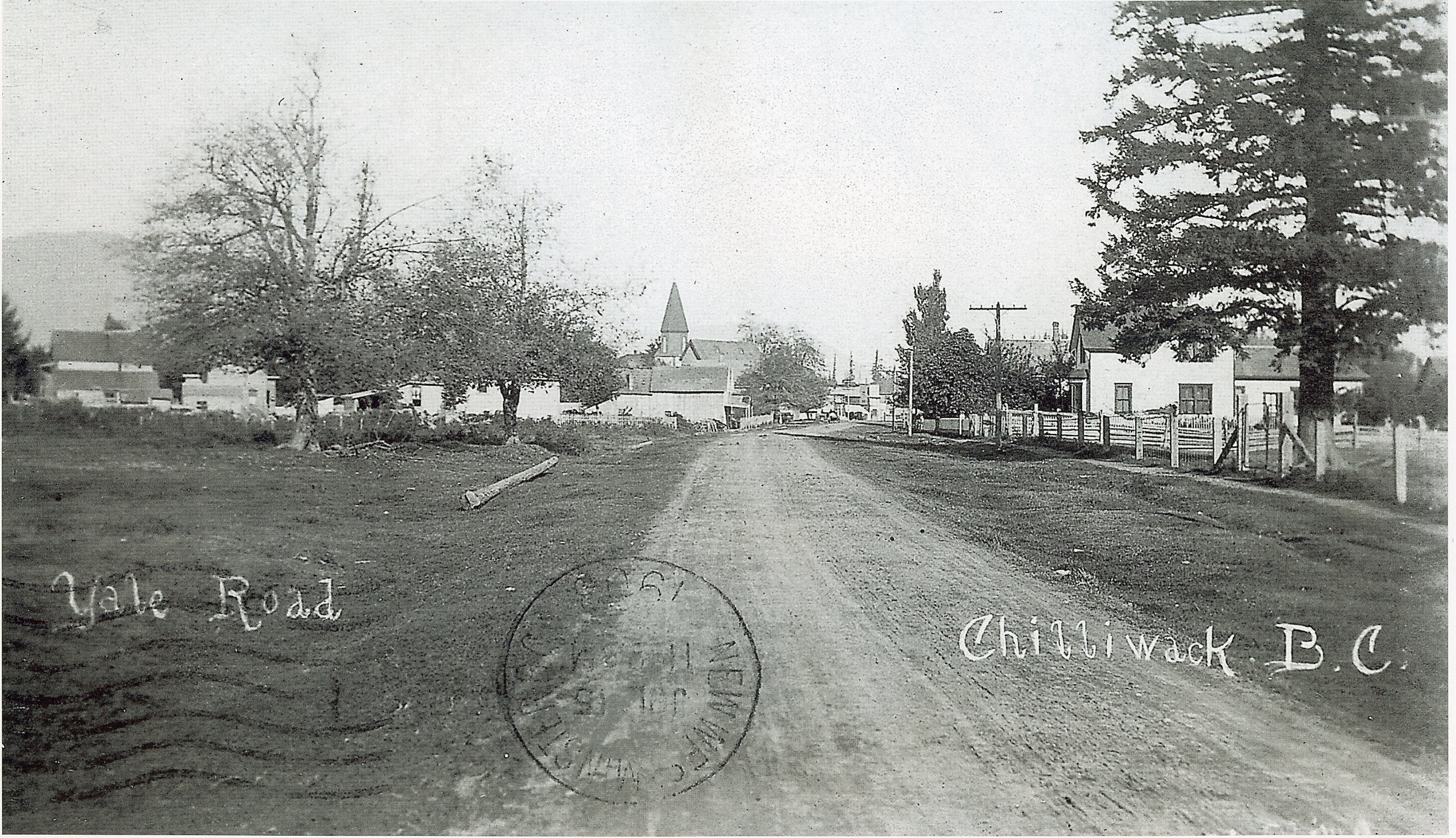
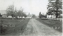 Yale Road Chilliwack circa 1908 Site of City Hall museum
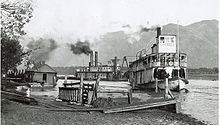 Until the railway and road access was built most travel to Chilliwack was done via Paddlewheelers
(according to Statistics Canada 2006 census)
- Population: 69,217
- Growth Rate (2001–2006): 10.6%
- Total Private Dwellings: 27,929
- Area: 260.19 km².
- Density: 266.0 people per km².
People from Chilliwack
- Dave Archibald, former professional hockey player with Minnesota North Stars and Ottawa Senators.
- Tony Clarke, activist, who graduated from Chilliwack Senior Secondary.
- Allan Fotheringham, columnist. Worked for The Chilliwack Progress as a student.
- Betty Fox, cancer research activist, mother of Terry Fox[3]
- Patrick Gallagher, actor from Glee & Night At The Museum. Graduated from Chilliwack Senior Secondary.
- Keith Hunter Jesperson, serial killer.
- Rick Klassen, former CFL football player.
- Dale Martindale, lead vocalist for the CASBY Award-winning band Images in Vogue.
- Dr. George Pedersen, University president. President of five universities (University of British Columbia, Simon Fraser University, University of Western Ontario, Royal Roads, UNBC), graduated from Chilliwack High School in 1950.
- Steven Point, first aboriginal Lieutenant-Governor of British Columbia
- Diana Swain, television journalist. Graduated from Chilliwack High School in 1983.
- Rita Steblin, famous musicologist in Vancouver and Vienna, Austria
- Rob Tallas, former professional hockey player with Boston Bruins and Chicago Blackhawks.
- These Kids Wear Crowns, winners of MuchMusic's show disBAND
- Homer Thompson, classical archaeologist. Grew up in Chilliwack on a dairy farm.
- Tasha Tilberg, supermodel. Born in Chilliwack on July 23, 1979. Appeared on the covers of magazines such as Vogue, Harper's Bazaar and Marie Claire. CoverGirl model.
Economy
Chilliwack's primary industries are agriculture, manufacturing, and tourism. The city is particularly famous for its fishing, golf, hiking and year round whitewater rafting. The Canadian military used to have an army training base in Vedder Crossing, but it was closed in the mid 1990s. Today all that remains is the Army's area support unit or ASU. The remainder of the base has since been converted into the Canada Education Park, which houses the RCMP's Pacific Regional Training Centre (PRTC) and is the site of the new eastern campus of the University of the Fraser Valley (UFV). UFV's current campus is on Yale Road.
The largest industrial operations in Chilliwack are:
Agriculture[4]
- Rainbow Greenhouses (115 employees, 45 seasonal employees)
- Inline Nurseries (40 employees, 70 seasonal employees)
- Unifeed (Viterra) (80 employees)
- Fraser Valley Duck & Goose (70 employees)
- Cannor Nurseries (65 employees)
Food processing[5]
- Vantage Foods (110 employees)
- Johnston Packers (110 employees)
- Fraser Valley Meats (56 employees)
- Natrel/Island Farms (45 employees)
- Coast Mountain Dairy (45 employees)
- Rogers Foods (20 employees)
Manufacturing[6]
- Uneeda Wood Products (180 employees)
- Masonite International (178 employees)
- IMW Industries (150 employees)
- TY-CROP Manufacturing (140 employees)
- Visscher Lumber (126 employees)
- Westeck Windows (94 employees)
- Soprema (45 employees)
Retail and wholesale trade[7]
- Overwaitea Food Group (450 employees)
- Real Canadian Superstore (340 employees)
- Canada Safeway (178 employees)
- Wal-Mart(156 employees)
- Canadian Tire (125 employees)
- Sears Canada (108 employees)
Technology[8]
- Stream Global Services (900 employees)
- Murphy Air (40 employees)
- TEKSmed Services (32 employees)
Tourism[9]
- Best Western Rainbow Country Inn (83 employees)
- Coast Hotel (64 employees)
- Cultus Lake Park Board (50 employees)
- Minter Gardens (50 employees)
Canadian Forces Base Chilliwack
Chilliwack was home to Canadian Forces Base Chilliwack (CFB Chilliwack), which closed in 1999 due to defense cutbacks as a result of the end of the Cold War in 1991.
The base was first opened in 1941 as Camp Chilliwack after Canada's 1939 entry into the Second World War. A few months after the outbreak of the Second World War in the Pacific after the sudden attack on the United States Naval Base at Pearl Harbor, the camp was expanded to garrison Canadian Army units for the defence of Canada's West Coast. The base was a garrison for army units, but also a recruit training facility; 112 Canadian Army Basic Training Centre, and A6 Canadian Engineering Training Centre was housed at Chilliwack for the duration of the war until its end in 1945.
During the Cold War, the base was used as a permanent training and garrison facility for the Canadian Army units of British Columbia. The based housed the Royal Canadian School of Military Engineering, formerly A6 Canadian Engineering Training Centre, and also housed 58 Field Engineer Squadron which was transferred from CFB Esquimalt on Vancouver Island (Greater Victoria).
Upon the unification of the Canadian Forces in 1968, the base was renamed Canadian Forces Base Chilliwack (CFB Chilliwack). The base housed:
- Canadian Forces School of Military Engineering (formerly Royal Canadian School of Military Engineering)
- Canadian Forces Officer Candidate School (CFOCS) (transferred in 1971 to CFB Chilliwack)
- 1 Combat Engineer Regiment (formerly 58 Field Engineer Squadron)
In 1994, the 3rd Battalion, Princess Patricia's Canadian Light Infantry, was transferred from CFB Esquimalt to CFB Chilliwack, the last unit to be transferred to the base.
Due to Department of National Defence cutback due to the end of the Cold War, the base was closed in 1997. The CFOCS, was transferred to Area Support Unit St-Jean in Quebec (ASU St-Jean), the CFSME transferred to CFB Gagetown, 3 PPCLI and 1 Combat Engineer Regiment were transferred to CFB Edmonton.
The base, which consisted of 2 areas, Vedder Creek, which contained the barracks and schools, was mothballed and sold for civilian development, while the Chilcotin Training Area, or better known as Area C, is still operational and is part of Western Area Training Centre (WATC).
Area C is used by the Primary Reserves units of British Columbia for field training and for the use of its firing ranges. The ASU is also used by Cadets for field training. The ASU also houses supply depots for supplying the Canadian Army units of 39 Canadian Brigade Group, and the cadet units of BC.
Public transportation

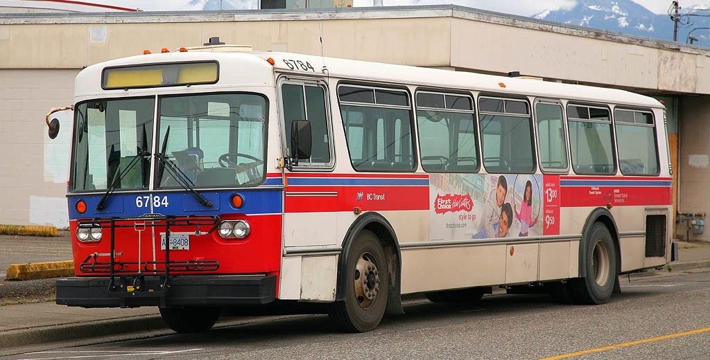
The public transit system is operated by Chilliwack/Agassiz-Harrison Transit System, which is partly funded by BC Transit. There are currently 12 routes. Routes 1-5 primarily serve the downtown core while routes 6, 7, 10 and 12 serve the Sardis/Promontory area. Route 8 serves the southern community of Yarrow. Route 9 is a summer only shuttle to Cultus Lake. Route 11 heads east along Yale Road East towards Agassiz/Harrison.
There are 2 zones, but the only route that covers both is the #11, which crosses the zone boundary at the Agassiz-Rosedale Bridge.
Education
School District 33 Chilliwack contains a total of 31 public schools as well as 1 Catholic school. The two main high schools, Sardis Secondary School (grades 10-12) and Chilliwack Secondary School (grades 10-12) are complemented by G.W. Graham Middle-Secondary School which has students from grade 7 to grade 12. There are five other Middle Schools each taking grades 7 to 9.
Post Secondary institutions in Chilliwack consist mainly of the University of the Fraser Valley, a school consisting of over 21000 students over several campuses all over the Fraser Valley. Starting as a college in 1974, it became a university college in 1988 and in 2008 it became a full university.
Arts and culture
Perhaps the best-known musical act affiliated with the city is the band Chilliwack. Despite being named after Chilliwack, the band actually formed and has always been based, in nearby Vancouver. Since 2004, Chilliwack has hosted the annual Back to the Blues Gospel blues festival.[10] The city of Chilliwack itself has a vibrant (albeit self-contained) rock music scene, centring mostly around young ska and punk rock bands. The drumline from Sardis Secondary played at several venues during the 2010 Winter Olympics in Vancouver. Bands originating in Chilliwack include: These Kids Wear Crowns, Mystery Machine, Acoustic Warfare, and The Darkest of the Hillside Thickets. Chilliwack has a thriving classical music community and there are biannual performances of the Chilliwack Symphony Orchestra. The city hosts an annual Jazz Festival put on by the Chilliwack Happy Times Jazz Society every spring.
The Chilliwack Museum, located in the 1912 former city hall, is a National Historic Site of Canada.[11]
The Book Man is the second-largest used bookstore in the province of British Columbia.
Media
The Chilliwack Progress is British Columbia's oldest community newspaper, published continuously with the same name in the same community since April 1891.
Also, The Chilliwack Times is delivered every Tuesday and Friday to over 30,000 homes in Chilliwack and in surrounding communities
Sports
The British Columbia Hockey League's Chilliwack Chiefs, play at Prospera Centre. The team is formerly the Quesnel Millionaires. The franchise was purchased and moved to Chilliwack by the Chiefs Development group, headed by Moray Keith, Jim Bond and Harvey Smyl. They started in the BCHL's Interior Conference for the 2011/2012 BCHL Season. While the original Junior "A" team, the Chilliwack Chiefs, plays in Langley, British Columbia, as the Langley Rivermen (the Chiefs Development Group sold their interest in the Langley Chiefs but retained the 'Chiefs' name). The Western Hockey League's Chilliwack Bruins, formerly played at the Prospera Centre. The expansion franchise began play in 2006 and ended when the team was sold at the end of the 2011 season. They became the Victoria Royals WHL hockey team in 2011.
Other sports include football, baseball and swimming. The Canadian Junior Football League's Chilliwack Huskers play at Exhibition Stadium. Chilliwack's minor baseball Cougars were the 2006 Western Canadian tier 2 champions. Chilliwack hosted the 2007-2008 Synchronized Skating Canadian Championships at the Prospera Centre.
References
- ^ History of Chilliwack
- ^ Environment Canada—Canadian Climate Normals 1971–2000. Retrieved 2009-07-10.
- ^ Lazaruk, Susan (2011-06-25). "‘Moving, simple and beautiful’ services held for Betty Fox, 73". Postmedia News (Windsor Star). http://www.windsorstar.com/sports/Moving+simple+beautiful+funeral+Betty/5006744/story.html. Retrieved 2011-06-27.
- ^ Economic Sector Profile: Technology/Advanced Manufacturing, Chilliwack Economic Partners Corporation, 2008
- ^ Economic Sector Profile: Food Processing, Chilliwack Economic Partners Corporation, 2008
- ^ Economic Sector Profile: Chilliwack Economic Partners Corporation, 2008
- ^ Economic Sector Profile: Retail and Wholesale Trade, Chilliwack Economic Partners Corporation, 2007
- ^ Economic Sector Profile: Chilliwack Economic Partners Corporation, 2008
- ^ Economic Sector Profile: Chilliwack Economic Partners Corporation, 2007
- ^ Back 2 Blues. Retrieved 2010-01-02.
- ^ Chilliwack City Hall. Canadian Register of Historic Places. Retrieved 29 October 2011.
External links
- City of Chilliwack official site
- Official Tourism Website for Chilliwack, BC
- Lot of photos of Chilliwack and its environment
- Chilliwack Symphony Orchestra
- Chilliwack Photo Gallery

Deroche, Dewdney District of Kent
(Including Agassiz)Abbotsford 
Hope  Chilliwack

Cultus Lake, Whatcom County, USA  Subdivisions of British Columbia
Subdivisions Regions · Regional districts · Forest Regions and Forest Districts · School districts · Land DistrictsSettlements Urban centres Cities Abbotsford · Armstrong · Burnaby · Campbell River · Castlegar · Chilliwack · Colwood · Coquitlam · Courtenay · Cranbrook · Dawson Creek · Duncan · Enderby · Fernie · Fort St. John · Grand Forks · Greenwood · Kamloops · Kelowna · Kimberley · Kitimat · Langford · Langley · Merritt · Nanaimo · Nelson · New Westminster · North Vancouver · Parksville · Penticton · Pitt Meadows · Port Alberni · Port Coquitlam · Port Moody · Powell River · Prince George · Prince Rupert · Quesnel · Revelstoke · Richmond · Rossland · Salmon Arm · Surrey · Terrace · Trail · Vancouver · Vernon · Victoria · White Rock · Williams Lake Category:British Columbia ·
  Portal:British Columbia ·
  WikiProject:British ColumbiaCategories:
- Chilliwack, British Columbia
- Populated places on the Fraser River


Wikimedia Foundation. 2010.