- Terrace, British Columbia
Infobox Settlement
official_name = City of Terrace
other_name =
native_name =
nickname =
settlement_type = City
motto =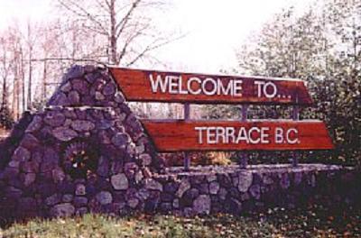
imagesize = 220px
image_caption = Welcome sign
flag_size =
image_
seal_size =
image_shield =
shield_size =
city_logo =
citylogo_size =
mapsize = 220px
map_caption = Location of Terrace inBritish Columbia
mapsize1 =
map_caption1 =
image_dot_
dot_mapsize =
dot_map_caption =
dot_x = |dot_y =
pushpin_
pushpin_label_position =
pushpin_map_caption =
pushpin_mapsize =
subdivision_type = Country
subdivision_name = CAN
subdivision_type1 = Province
subdivision_name1 = BC
subdivision_type2 = Region
subdivision_name2 = North Coast
subdivision_type3 = Regional district
subdivision_name3 = Kitimat-Stikine
subdivision_type4 =
subdivision_name4 =
government_footnotes =
government_type =
leader_title =Mayor
leader_name =Jack Talstra
leader_title1 = Terrace City Council
leader_name1 = Lynne Christiansen
Marylin Davies
Brian Downie
Carol Leclerc
Brad Pollard
leader_title2 =
leader_name2 =
leader_title3 =
leader_name3 =
leader_title4 =
leader_name4 =
established_title =
established_date =
established_title2 =
established_date2 =
established_title3 =
established_date3 =
area_magnitude =
unit_pref =
area_footnotes =
area_total_km2 = 42.23
area_land_km2 =
area_water_km2 =
area_total_sq_mi =
area_land_sq_mi =
area_water_sq_mi =
area_water_percent =
area_urban_km2 =
area_urban_sq_mi =
area_metro_km2 =
area_metro_sq_mi =
area_blank1_title =
area_blank1_km2 =
area_blank1_sq_mi =
population_as_of = 2006
population_footnotes = 11,320
population_note =
population_total =
population_density_km2 =
population_density_sq_mi =
population_metro =
population_density_metro_km2 =
population_density_metro_sq_mi =
population_urban =
population_density_urban_km2 =
population_density_urban_sq_mi =
population_blank1_title = Immigrant population
population_blank1 = 1,670 (14%)
population_density_blank1_km2 =
population_density_blank1_sq_mi =
timezone = PST
utc_offset = −8
timezone_DST = PDT
utc_offset_DST = −7
latd= 54|latm= 30|lats= 59|latNS=N
longd= 128|longm= 35|longs= 59|longEW=W
elevation_footnotes =
elevation_m = 80
elevation_ft =
postal_code_type =
postal_code =
area_code =
blank_name = Value of building permits (2000)
blank_info = $24.9 million
blank1_name = Business licences issued (2001)
blank1_info = 1,159
website = [http://www.city.terrace.bc.ca/ City of Terrace]
footnotes = Terrace is a service community on theSkeena River inBritish Columbia ,Canada .Tsimshian people have lived in the area for thousands of years. The community has a population of 12,109 with a regional population of 19,980 [http://www12.statcan.ca/english/Profil01/CP01/Details/Page.cfm?Lang=E&Geo1=CSD&Code1=5949011&Geo2=PR&Code2=59&Data=Count&SearchText=terrace&SearchType=Begins&SearchPR=01&B1=All&Custom=&PlaceName=terrace (Statistics Canada, 2001)] . The community vies with Prince Rupert as a regional hub for the northern coastal area. It is the seat of the Kitimat-Stikine Regional District.The community sits on the
Grand Trunk Pacific Railway (which is now owned by CN) and theYellowhead Highway . The community is serviced byTerrace Airport , with connections to Prince George, Smithers, and VancouverGeography
Terrace and the surrounding Skeena Valley are located in a hybrid coastal/interior rainforest on the Skeena River, approximately 115 km (71 miles) from its mouth at the
Pacific Ocean . The lush forests in the area consist primarily of cedar, hemlock and fir.Sediment deposits from glaciers over thousands of years ago have produced the natural terraces or "benches" around much of the city, which sits approximately 70 m (230 feet) above sea level and just east of the Skeena and Kitsumkalum River confluence.
TheHazelton Mountains are to the west of the city, while theKitimat Ranges of theCoast Mountains are to the East.History
First Nations peoples
Indigenous peoples have inhabited Northwest BC for over 5,000 years. This region is one of the oldest continuously occupied regions of the world and, long before
Europe an contact, was one of the most densely populated areas north ofMexico .Kitsumkalum andKitselas are two of seven Tsimshian tribes in the Terrace area that have occupied traditional territories in northwest British Columbia. The Skeena River was known initially as the "K'shian" river meaning "water from the clouds". The traditional economy of the Tsimshian Nation was based on hunting, fishing and social gatherings, for domestic consumption or trade, on their traditional lands. For the Native people, the Skeena River was used for transportation, communication, war, trade, as a source of food and at times for protection.teamboats
In 1866 the steamer "Mumford" made it as far as Kitsumkalum with supplies for the Collins Overland Telegraph line. It took an average of three days to travel from Port Essington (at the mouth of the Skeena River, near Prince Rupert) to Hazelton. It was not until 1891 that the
Hudson's Bay Company sternwheeler the "Caledonia" successfully negotiated through theKitselas Canyon and reached Hazelton. A number of other steamers were built around the turn of the century, in part due to the growingfish industry and theKlondike Gold Rush . [cite book |last=Downs |first=Art |title=Paddlewheels on the Frontier Volume 1|year=1971|publisher=Foremost Publishing|isbn=0888260334|pages=61-72] [cite book|last=Bennett |first=Norma |title=Pioneer Legacy: Chronicles of the Lower Skeena River|year=1997|publisher=Dr. REM Lee Hospital Foundation|isbn=0-9683026-0-2|pages=] In honour of its steamboat heritage, Terrace celebrates a festival called Riverboat Days each summer.George Little
A man with a "Little" vision and big dreams arrived in the Skeena River valley in March 1905 by snowshoeing through grueling deep snow along the
Kitimat trail. George Little liked what he saw and knew that this land was indeed the land that he was searching for since he left his native Ontario. His keen interest and faith in Terrace were contagious and soon gave way to a flood of pioneer settlers. Eventually, resulting in a thriving city that respects the man who founded Terrace who recognized the potential of the Skeena Valley.The riverboats operated on the Skeena for only 22 years. The last boat, the "Inlander" finished up in September 1912, when the railroad took over. Fitting nicely into his vision of Terrace, George Little donated 47 acres (190,000 m²) to the Grand Trunk Pacific Railway. The station stop was originally named "Littleton"; however, as there was already a Littleton in
New Brunswick , Little changed the name to "Terrace" in reference to the local geography. Little established a sawmill to accommodate the demand for railway ties. In 1955, Little rode the first C.N.R. train to Kitimat passing over the same route he had trekked one half century earlier.Terrace Mutiny
During
World War II , military units composed primarily ofconscripts from central andeastern Canada were stationed in Terrace. Morale was low due to the poor relationship between the soldiers and the local populace, the isolation, the damp weather, lack of recreation, crowded facilities, and the distance from home. In late 1944, because of declining enlistment and heavy casualties, Prime MinisterWilliam Lyon Mackenzie King was forced to reconsider his promise to not deploy conscripts overseas. Mackenzie King decided to a one-time assignment of conscripts for overseas service. On November 24, 1944, news that conscripts might be sent overseas triggered amutiny amongst the men stationed in Terrace. It took until November 29 for officers to restore order to the troops. TheTerrace Mutiny was the most serious breach of discipline in Canadian military history.Economy
Terrace was once known as the cedar pole capital of the world. Over 50,000 poles were manufactured annually to supply many parts of North America with telephone and electric power poles. The world's tallest pole of 50 metres (162 feet) was cut in Terrace and is currently standing in
New York City [http://www.terracetourism.bc.ca/things_trunk] . For many years, logging has been the major industry in the region. In modern times, Terrace's economy has diversified. Becoming less dependent on one large employer/industry, the city boasts a balanced economy, one which is effectively equipped to withstand the brunt of any cyclic downturn.The community was hit hard in 2001 by the problems and eventual closure of the biggest local employer, the former Skeena Cellulose Inc. pulp mill. The mill was bought by Terrace Lumber Co., a group of local owners, and re-opened in late August 2005, but did not prosper and closed in mid-2006. By the end of 2006, the remaining equipment was auctioned off and the mill was torn down. However, with a possible oil pipeline that would run through Terrace, as well as the recent announcement of a major container port expansion project in nearby Prince Rupert, the economic situation appears to have a brighter future.
Throughout the economic fallout and recovery, the city has been accepting donations and collecting grants to direct at the production of a largely enhanced sportsplex to replace the aging arena and aquatic centre, largely as a symbol of economic resilience. As of March 2006, slightly over four million of the five million dollars required to initiate the project has been collected from various sources. While city reserve funds have not been included in these totals, it is conceivable that they may be required to complete the project.
Educational institutions
Terrace is located within
School District 82 Coast Mountains , along with Kitimat. Prior to amalgamation in 1996 with School District 80 (Kitimat), schools in Terrace were within School District 88 (Terrace). There is one senior secondary school within Terrace itself,Caledonia Senior Secondary School [http://www.caledonia.cmsd.bc.ca] , which serves grades 11 and 12.There is also one junior secondary school,
Skeena Junior Secondary School . Another junior secondary, Thornhill Junior Secondary School, is located in Thornhill, a community directly across the Skeena River from Terrace. Centennial Christian School is also located within the town limits of Terrace.The main campus of the
Northwest Community College [http://www.nwcc.bc.ca] is located in Terrace, where it was established in 1975.Old Skeena Bridge
The Old Skeena Bridge officially opened July 1925, halting the use of the Ferry Island ferry service to Thornhill Creek. In 1944, the Skeena River highway between Terrace and Prince Rupert was ceremoniously opened with a convoy of Canadian and American Army bands that were part of the troops stationed here during
World War II . Terrace could now easily transport to anywhere in British Columbia.This bridge now shares its load with the New Skeena Bridge, a two way bridge crossing Ferry Island and connecting Thornhill, British Columbia with the other side of town. The new bridge, constructed circa 1975, is fully paved and offers uninterrupted two-way traffic flow, as opposed to the metal decking of the one-way old bridge. The foundations of the new bridge are prepared for future twinning. The Old Skeena Bridge was once noted for being the largest curved wooden-plank bridge in
North America until its decking was replaced with metal grates in 2002.Media
Newspaper
* "
Terrace Standard "Radio
* AM 590 - CFTK,
hot adult contemporary
* FM 92.1 - CFNR,First Nations community
* FM 95.3 - CBTH,CBC Radio One
* FM 96.9 - CBUF-3,Première Chaîne
* FM 103.1 - CJFW, countryTelevision
* Channel 3 - CFTK,
CBC Television private affiliate
* Channel 11 -CBUFT , SRCBibliography
*cite book
last=Bennett
first=Norma
title=Pioneer Legacy: Chronicles of the Lower Skeena River
year=1997
publisher=Dr. REM Lee Hospital Foundation
isbn=0-9683026-0-2
* cite book
last=Downs
first=Art
title=Paddlewheels on the Frontier
volume=one
year=1971
isbn=0888260334
*cite book
last=de leeuw
first=Sarah
title=
essay= "Unmarked"Footnotes
External links
* [http://www.city.terrace.bc.ca/ City of Terrace home page]
* [http://www.terracetourism.bc.ca/ Terrace Tourism]
* [http://maps.google.com/maps?ll=54.514085,-128.585111&spn=0.009538,0.013872&t=k&hl=en Satellite Photo]
* [http://www.terracestandard.com Terrace Standard] Newspaper
* [http://www.heritageparkmuseum.com/ Heritage Park Museum]
* [http://www.terracelibrary.ca/ Terrace Public Library]
* [http://www.northernhealth.ca/ Northern Health Authority]
Wikimedia Foundation. 2010.
Terrace (British Columbia) — Terrace Lage in British Columbia … Deutsch Wikipedia
British Columbia — Colombie Britannique (French) … Wikipedia
British Columbia — Colombie Britannique Britisch Kolumbien Wappen Flagge (Details) … Deutsch Wikipedia
Moricetown, British Columbia — Moricetown lies near the Bulkley River. Moricetown is a Wet suwet en village in Central British Columbia, Canada. The current village was built during early 1900s. Evidence of inhabitants date back to around 4,000 years ago. The original name of… … Wikipedia
British Columbia Coast — Howe Sound, along British Columbia s South Coast. The British Columbia Coast or BC Coast is Canada s western continental coastline on the Pacific Ocean. The usage is synonymous with the term West Coast of Canada. In a sense excluding the urban… … Wikipedia
British Columbia Ambulance Service — Infobox company company name = British Columbia Ambulance Service company company type = Crown Agency foundation = July 1, 1974 location = British Columbia, Canada num employees = 3,200 (2006) revenue = $252 Million industry = Emergency Medical… … Wikipedia
British Columbia Youth Parliament — The British Columbia Youth Parliament (BCYP) is a youth service organization that operates in the guise of a parliament in the Canadian province of British Columbia. The BCYP fulfills its motto of Youth Serving Youth by means of legislation… … Wikipedia
British Columbia Highway 16 — Infobox road province=BC type=Hwy route=16 previous type=Hwy previous route=15 next type=Hwy next route=17Highway 16 is the British Columbia, Canada, section of the Yellowhead Highway. The highway closely follows the path of the northern B.C.… … Wikipedia
British Columbia municipal elections, 2005 — The Canadian province of British Columbia held its triannual municipal elections on November 19, 2005. Voters in each of BC s 157 municipalities elected mayors and councillors, and rural voters elected directors for their regional district… … Wikipedia
British Columbia Highway 37 — Infobox road province=BC type=BC route=37 maint= length km= length round= length ref= established= direction a= starting terminus= junction= direction b= ending terminus= counties= cities= previous type=Hwy previous route=35 next type=Hwy next… … Wikipedia
Terrace, British Columbia
18+
© Academic, 2000-2025
- Contact us: Technical Support, Advertising
Dictionaries export, created on PHP, Joomla, Drupal, WordPress, MODx.