- Trail, British Columbia
Infobox Settlement
official_name = City of Trail
other_name =
native_name =
nickname =
settlement_type = City
motto = Home of Champions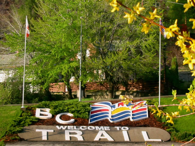
imagesize = 220px
image_caption = Welcome to Trail BC
flag_size =
image_
seal_size =
image_shield =
shield_size =
city_logo =
citylogo_size =
mapsize = 220px
map_caption = Location of Trail inBritish Columbia
mapsize1 =
map_caption1 =
image_dot_
dot_mapsize =
dot_map_caption =
dot_x = |dot_y =
pushpin_
pushpin_label_position =
pushpin_map_caption =
pushpin_mapsize =
subdivision_type = Country
subdivision_name = CAN
subdivision_type1 = Province
subdivision_name1 = BC
subdivision_type2 = Region
subdivision_name2 =Kootenays
subdivision_type3 = Regional district
subdivision_name3 = Kootenay Boundary
subdivision_type4 =
subdivision_name4 =
government_footnotes =
government_type =
leader_title = Governing body
leader_name = Trail City Council
leader_title1 = Mayor
leader_name1 =Dieter Bogs
leader_title2 =
leader_name2 =
leader_title3 =
leader_name3 =
leader_title4 =
leader_name4 =
established_title =
established_date =
established_title2 =
established_date2 =
established_title3 =
established_date3 =
area_magnitude =
unit_pref =
area_footnotes =
area_total_km2 = 34.78
area_land_km2 =
area_water_km2 =
area_total_sq_mi =
area_land_sq_mi =
area_water_sq_mi =
area_water_percent =
area_urban_km2 =
area_urban_sq_mi =
area_metro_km2 =
area_metro_sq_mi =
area_blank1_title =
area_blank1_km2 =
area_blank1_sq_mi =
population_as_of = 2006
population_footnotes =
population_note =
population_total = 7,237
population_density_km2 =
population_density_sq_mi =
population_metro =
population_density_metro_km2 =
population_density_metro_sq_mi =
population_urban =
population_density_urban_km2 =
population_density_urban_sq_mi =
population_blank1_title =
population_blank1 =
population_density_blank1_km2 =
population_density_blank1_sq_mi =
timezone = PST
utc_offset = -8
timezone_DST =
utc_offset_DST =
latd= 49|latm= 05|lats= 50|latNS=N
longd= 117|longm= 42|longs= 38|longEW=W
elevation_footnotes =
elevation_m = 440
elevation_ft =
postal_code_type =
postal_code =
area_code =
blank_name = Highways
blank_info = 3B 22
blank1_name = Waterways
blank1_info =Columbia River
website = [http://www.trail.ca City of Trail]
footnotes = Trail is a city in theWest Kootenay region of the Interior of British Columbia,Canada .Geography
Trail has an area of 34.78
km² . The city is located on both banks of theColumbia River , approximately 10 km north of theUnited States border. This section of the Columbia River valley is located between theMonashee Mountains to the west and theSelkirk Mountains to the east. The Columbia flows directly north-south from Castlegar, turns east near downtown Trail, and then meets theCanada–United States border at Waneta and the Pend d'Oreille River.Summer climate in Trail is generally hot and dry with moderately cool nights. Temperatures often exceed 35 °C during summer afternoons. Thunderstorms are common during the late-Spring and Summer season, often moving into the valley from the south. The fall months brings dense river fog, especially during the overnight and morning hours, as a cold air inversion lingers above the relatively warm river surface. Winters are mild to cold with periods of moderate snowfall. Nearby villages such as Warfield and Fruitvale often receive greater amounts of snow due to higher elevation.
The Monashee Mountains are the first major mountain range east the Coastal Mountains to intercept moisture laden westerly flow from the
Pacific Ocean . As a result, areas west of Trail, including the Christina Range, Rossland Range, the city of Rossland, and the Blueberry-Paulson section of theCrowsnest Highway (Highway 3) receive greater amounts of winter precipitation, mostly in the form of heavy snow. Vegetation in the Trail area, although fairly lush, is noticeably drier than other areas with a more westerly aspect.Demographics
According to
Statistics Canada , Trail's population was 7,320 during theCanada 2001 Census .Statistics Canada (2001 Census). [http://www12.statcan.ca/english/profil01/CP01/Details/Page.cfm?Lang=E&Geo1=CSD&Code1=5905014&Geo2=PR&Code2=59&Data=Count&SearchText=Trail&SearchType=Begins&SearchPR=01&B1=All&Custom= Trail Community Profile] ]The city is also noted for its large Italian community. There are 1,385 people in Trail with Italian ancestry (18.9%). [ [http://www12.statcan.ca/english/census01/products/highlight/ETO/Table1.cfm?T=501&Lang=E&GV=4&GID=5905014&Prov=59&S=1&O=D Selected Ethnic Origins1, for Census Subdivisions (Municipalities) With 5,000-plus Population - 20% Sample Data] ]
*Caucasian: 91%
*Aboriginal: 4% (290 people)Visible minorities
*Chinese: 2% (120 people)
*South Asian: 1.2% (100 people)
*Other: 1.8% (155 people)Education and Employment
Trail is the location of the head office of the
Kootenay Boundary Regional District , which is one of the city's employers.Trail is part of
School District 20 Kootenay-Columbia and schools in the town include:
*Glenmerry Elementary School
*J. Lloyd Crowe Secondary School
*James L Webster Elementary School
*Junior Alternate Program
*Kootenay-Columbia Learning Centre chool district
The school district in the Greater Trail area is focused on improving the district and schools and has a focused, well organized improvement plans in place. The strategies selected to achieve the goals are a blend of research, best practice, and innovative thinking. The district has implemented numerous strategies to support schools in improving student learning. Most schools have comprehensive, innovative and research-based strategies to meet the goals.Fact|date=December 2007
In 2007, the CJ. Lloyd Crowe Secondary School Replacement program started with construction of the new education facility in Trail to replace the outdated secondary education facility that was built in the late 1950s.
Education
Trail’s statistics differ sharply from that of the province in the percentage of the population aged 45-64 with a trades certificate or diploma: Trail—26%, compared to BC—14%. This is directly attributable to
Teck Cominco and the diversified mining and metals company's presence in the area. The percentage of this age group with a university level education is also very different: Trail—12%, compared to BC—22%. In Rossland, however, 33% of this age group has a university level education. The general picture is a working population heavily geared to the trades and historically very reliant on Teck Cominco for employment.Economic Situation
Employing approximately 1,800 people, Teck Cominco is the region’s largest employer. The average age of an employee at Cominco’s Trail operation is 47. It is anticipated that within 15 years Cominco’s Trail operation will have a completely new and different labour force. A younger and perhaps more technical labour force will most likely replace those that are retiring. The big picture for the area is one of an aging population which brings about ongoing employment opportunities in the area. This is evidenced based on the improved housing sales in the years between 2005 to 2007, making the Greater Trail area a target destination for people looking for better quality of life in a smaller community setting.
The City of Trail is also home to the largest hospital in the
West Kootenay region.Attractions
Trail Memorial Centre & Sports Hall of Memories
The Trail Memorial Centre currently plays host to the Trail & District Public Library, the
Trail Smoke Eaters hockey team, the Trail Museum, and the Sports Hall of Memories, in addition to many local sports facilities. This historic landmark, located at 1051 Victoria Street, was home to two world championship Smoke Eaters teams.The arena section of the facility was recently revitalized and is one of the highest capacity arenas in the province, outside of cities like
Vancouver and Kelowna. The Trail Memorial Centre is a hub of civic activity year-round, and has been a focal point of the community since its inception.River Activities and Music in the Park at Gyro Park in Trail
Located at 1090 Charles Lakes Drive in East Trail on the route to Sunningdale, Gyro Park is the home to Music in the Park during the summer. Listen to the melodic tunes under the gazebo in Gyro Park, where you’ll enjoy live music Thursdays in July and August. During long hot summer days, Gyro Park is extremely popular with locals and visitors to the area who enjoy a day at the beach.
The "The Onions" and other popular river currents that wind between the rocks on the East banks of the Columbia River, are a popular summer magnet for river activity. Often, throughout the summer, an abundance of avid swimmers and rapid paddlers with a deep respect of the Columbia River dare to navigate the frosty swift waters to ride the waves, such as the local favorite "Onions" river current at Gyro Park beach.
Teck Cominco Interpretive Centre
Trail is home to the largest non-ferrous
lead andzinc smelter in the world and visitors can learn more about the areas largest employer by taking the 2.5 hour industrial tour of the Cominco smelter which can be arranged in the Teck Cominco interpretive centre through the Trail & District Chamber of Commerce office located above theToronto-Dominion Bank , in the heart of downtown Trail. This centre is the starting point for the free tours beginning at 10 am, Monday to Friday during the summer; by appointment from September to May. Learn about the plants' operations in the mini-science centre featuring hands-on exhibits for the whole family.View video presentations and displays which exhibit sophisticated environmental monitoring systems installed in the Trail area by Teck Cominco. Other presentations illustrate the history of Cominco's Trail smelting operations and provide information on career opportunities in the industry.
The Historic Gulch
In the early 1900s a large influx of Italian immigrants lent a distinctive character to "The Gulch" which is located at the entrance to Trail accessed by the Schofield Highway which drops down the long grade down from the city of Rossland and the village of Warfield and sub-division of Annabel onto Rossland Avenue.
This neighbourhood which runs the length of Rossland Avenue is known as "the Gulch." Originally called the "Dublin Gulch" in the very early days, it eventually became known as "The Gulch" as it filled up with Italians who chose not to live on the original Trail townsite. The Gulch starts as throat of Trail Creek narrows between the high, sandy slope of Smelter Hill on its left bank and the West Trail bank where early pioneer houses were built by immigrants as the purchased properties along the west bank steep terrain.
In the early pioneer days, industrious Chinese launderers and cooks spent time gardening in the defile of the Gulch and few of these immigrants ever acquired rights to own landFact|date=April 2008 in the Gulch and these gardens were gradually displaced by Italian and other
Europe an working families who terraced their properties into level plots. Despite the steep terrain, these immigrant families planted vegetable gardens reminiscent of the old country, fed by plenty of water from Trail Creek and the hot summer sun.The Gulch is home to the "Star Grocery", one the best Italian grocery store in Trail—and other shops and the Terra Nova hotel, located at the entrance to Trail’s central business district at the foot of Rossland Avenue.
Greater Trail BC Area Hiking Trails
Besides producing hockey and baseball talent, the Greater Trail area offers many excellent hiking biking and nature walk trails within 5 to 20 minutes from downtown Trail.
Visit the many popular hiking and biking trails in and around Violin Lake or take a short trip to the
Champion Lakes Provincial Park area for a day hike, or hike up to any of the four Canadian flags that have been placed on various mountain peaks around the Trail area by members of the 44th Field Engineering Squadron.Each hike offers excellent 1 hour to 2 1/2 hour hikes up to the flag viewpoints, and the trails can be accessed by novice to avid hiking enthusiasts. Visitors and residents can hike to the "East Trail Canadian flag viewpoint" via the McQuarrie Creek trail route. The one hour hike to the top sees hikers viewing across the Columbia River towards West Trail, Warfield, and Rossland. The flag can be seen waving in the wind above the regional hospital near the viewpoint. Park in the J.L. Crowe High School parking area and follow the McQuarrie Creek hiking trail up alongside the creek that comes down to meet the road where it intersects to the J. Lloyd Crowe Secondary School or the Kootenay Boundary Regional Hospital. The McQuarrie Creek hiking is a fairly easy trial if you take your time. Parts of the trail can be steep.
An alternative route to the East Trail Flag viewpoint above the hospital is to take the easier trail leading from the upper Miral Heights area of Trail. At the Shavers Bench/Miral Heights traffic lights turn up to Miral heights sub-division and follow McBride Street. to Albert Drive. The trailhead is at the end of Albert Dr. and it is equally enjoyable and scenic route to the flag viewpoint.
Another good hike is the "Upper Sunningdale Sandhill viewpoint" hiking trail. The trail-head can be reached by driving to the Upper Sunningdale Park on Marianna Crescent where you can safely park your car at the park entrance. Walk west (to the right) down Marianna Crescent until you reach the Water Tower Hill Road. Walk up past the chain link fence, and look for the trail-head on the right just past the granite rocks which can be seen in the water runoff ditch. This 40 minute, easy level rating hiking trail is clearly marked, and the steepest part of the trail heads up past the pine trees at the start of the trail, and then you follow the trail along the sandhill ridge until you reach the viewpoint just below the Sandhill plateau above the Upper Sunningdale Park.
Another Canadian flag waves above Sunningdale, and can be viewed from most areas of Upper and Lower Sunningdale. If you want to take a longer hike than the Upper Sunningdale Sandhill viewpoint, you can hike further, by taking the trail that heads from the Sandhill viewpoint, towards the rock cliffs. Take the clearly marked trail up past a number of rock cliffs to the "Sunningdale Canadian Flag viewpoint" to reach the Canadian Flag.
The hike rating for the Sunningdale Canadian Flag viewpoint on Mount Heinze is an intermediate level, and you can amek it up to the viewpoint in approximately 2 1/2 hours, as most of the hiking trail is clearly marked, but sections of the trail up near the swamps below the flag viewpoint on Mount Heinze can be thick with brush. Leave enough time to hike back down, so the best time to make this hike is in the early morning. Be bear and wild animal aware, and make lots of noise if you startle a bear. Always pack enough water, or 1 to 2 litres of your favorite hiking drink, and pack a lunch and your digital camera for this hike, as the views of the Greater Trail BC area are spectacular from this viewpoint.
From each of the Sunningdale hiking trail vantage points, you'll get a beautiful view of the sub-division of Sunningdale, Bingay Bay (Sandy Island), the Columbia River as it flows towards Gyro and past downtown Trail, Teck Cominco's lead and zinc smelter property (which is relatively green and clean looking), Tadanac, Rivervale, and up towards Warfield, Rossland, and Red and Granite Mountain ski hills.
Famous natives and Home of Champions
The Greater Trail Area is known as the "Home of Champions", in recognition of those who reside in the area, or are from the area, and have excelled in their chosen field of endeavour.
In 1995,
Kootenay Savings Credit Union was seeking a project that would represent their commitment and appreciation to the Greater Trail community. The Credit Union decided to sponsor the construction of a monument which was constructed in the summer of 1996 outside their offices in Trail's downtown that would honour the "Champions" of the Greater Trail area in Sports, Industry and Lifestyle.A society was formed to establish criteria for selection of the persons to be honoured on the monument. The monument was constructed in the summer of 1996 and forty-three champions were selected to be honoured at the inaugural dedication ceremony which took place on
September 28 ,1996 . To date, eighty-nine individuals and organizations have been honoured with a place on the Home of Champions monument. [ [http://www.trailhistory.com Trail Historical Society] ]The Home of Champions monument project is an ongoing one, managed by the City of Trail. Additional persons will be honoured regularly for their special contribution to the social, cultural, economic and educational fabric of the community.
A List of Famous Natives of Greater Trail Area
*
Thomas d’Aquino , Chief executive and president of the Canadian Council of Chief Executives CCCE, and one of the private-sector architects of theNorth American Free Trade Agreement
*Jason Bay , current MLB player for the Boston Red Sox
*Lauren Bay , Canadian National Softball Team and National Pro Fastpitch pitcher
*Adam Deadmarsh , former NHL player, won Stanley cup in 1996 with the Colorado Avalanche
*Dallas Drake , former NHL player, wonStanley Cup in 2008 with the Red Wings
*Ray Ferraro , former NHL player for the Islanders, Rangers, Whalers, Thrashers, Kings, Blues
*Bruno Freschi , architect for Expo 86
*Ken Georgetti , current President of the Canadian Labour Congress
*Robert Hampton Gray , one of the last Canadians to die in WWII and the last Canadian recipient of the Victoria Cross
*Tom Harrison , former MLB pitcher for the Kansas City A's, now the Oakland Athletics
*Shawn Horcoff , current NHL player for the Oilers
*Barret Jackman , current NHL player for the Blues
*Mike Kobluk , ofThe Chad Mitchell Trio
*Richard Kromm , former NHL player
*Kerrin Lee-Gartner , Canadian Olympic Women's Ski Team, Downhill Olympic Gold Medal 1992
*Cesare Maniago , former NHL player for the Leafs, Canadiens, Rangers, North Stars, Canucks
*Mike Matteucci , former NHL player for the Wild
*Steve McCarthy , current NHL player for the Blackhawks, Canucks, Thrashers
*Bill McEwan , President and CEO of Sobeys
*Martin Popoff , heavy metal music journalist
*Steve Tambellini , former NHL player & current GM of the Edmonton OilersOther Information
As part of its contribution to the
Manhattan Project , Canada built and operated a 6 T/a electrolyticheavy water plant at Trail, which started operation in 1943. [cite paper
title =An Early History of Heavy Water
author =Chris Waltham
publisher =Department of Physics and Astronomy, University of British Columbia
date =20 June 2002
url =http://arxiv.org/pdf/physics/0206076.pdf
format =PDF] [cite web
title =Project '9' - Heavy-Water (Deuterium) Production
publisher =The Manhattan Project Heritage Preservation Association
url=http://www.mphpa.org/classic/CP/Canada/CM&S/CM&S-01.htm
accessdate = 2007-12-06 ]References
External links
* [http://www.trail.ca City of Trail Official Site]
* [http://www.trailchamber.bc.ca Trail Chamber Of Commerce]
* [http://busonline.ca/regions/kob/?p=search&q=trail Trail Transit]
* [http://www.trailrosslandnews.com Trail Rossland News]
* [http://www.westkootenayunplugged.com/index.php?option=com_news_portal&task=section&id=37&Itemid=12375 Greater Trail area hiking & Outdoor Guides]
Wikimedia Foundation. 2010.