- Renfrew County, Ontario
Infobox Settlement
name =
official_name =Renfrew County
other_name =
native_name =
nickname =
settlement_type =County
total_type =
motto =
imagesize =
image_caption =
flag_size =
image_
seal_size =
image_shield =
shield_size =
image_blank_emblem =
blank_emblem_type =
blank_emblem_size =
imagesize =
image_caption =
flag_size =
image_
seal_size =
image_shield =
shield_size =
image_blank_emblem =
blank_emblem_type =
blank_emblem_size =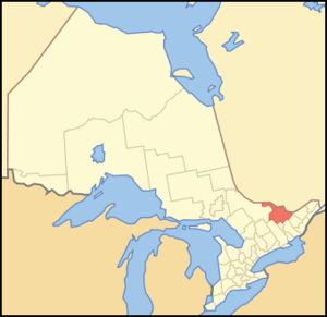
mapsize = 300px
map_caption = Location of Renfrew County
mapsize1 =
map_caption1 =
image_dot_
dot_mapsize =
dot_map_caption =
dot_x = |dot_y =
pushpin_
pushpin_label_position =
pushpin_map_caption =
pushpin_mapsize =
subdivision_type = Country
subdivision_name = CAN
subdivision_type1 = Province
subdivision_name1 = ONT
subdivision_type2 =
subdivision_name2 =
seat_type =County seat
seat =Pembroke
parts_type =Municipalities
parts_style =
parts =
p1 =Town of Arnprior
p2 = Town of Deep River
p3=Town of Laurentian Hills
p4=Town of Petawawa
p5=Town of Renfrew
p6=Township of Admaston Bromley
p7=Municipality of Bonnechere Valley
p8=Township of Brudenell, Lyndoch and Raglan
p9=Township of Greater Madawaska
p10=Township of Head, Clara and Maria
p11 =Township of Horton
p12= Township of Killaloe, Hagarty and Richards
p13=Township of Laurentian Valley
p14=Township of Madawaska Valley
p15= Township of McNab/Braeside
p16= Township of North Algona-Wilberforce
p17= Township of Whitewater Region
government_footnotes =
government_type =
leader_title =
leader_name =
leader_title1 =
leader_name1 =
established_title = Established
established_date = 1861
area_magnitude =
unit_pref =Imperial
area_footnotes =cite web |url=http://www12.statcan.ca/english/census06/data/profiles/community/Details/Page.cfm?Lang=E&Geo1=CD&Code1=3547&Geo2=PR&Code2=35&Data=Count&SearchText=Renfrew&SearchType=Begins&SearchPR=35&B1=All&Custom= |title=Community highlights for Renfrew |accessdate=2007-12-28 |date=2006 |work= |publisher=]
area_total_km2 =
area_land_km2 =7403.46
area_water_km2 =
area_total_sq_mi =
area_land_sq_mi =2858.49
area_water_sq_mi =
area_water_percent =
elevation_footnotes =
elevation_m =
elevation_ft =
elevation_max_m =
elevation_max_ft =
elevation_min_m =
elevation_min_ft =
population_as_of =
population_footnotes =
population_note =
population_total = 97545
population_density_km2 =13.2
population_density_sq_mi =34.1
timezone = EST
utc_offset = -5
timezone_DST = EDT
utc_offset_DST = -4
coor_type =
latd= |latm= |lats= |latNS=
longd= |longm= |longs= |longEW=
postal_code_type =
postal_code =
area_code =
website = [http://www.countyofrenfrew.on.ca/ www.countyofrenfrew.on.ca/]
footnotes =Renfrew is a
county in theCanadian province ofOntario . In 2006, the population was 97,545 and county covered convert|2858.49|sqmi|km2|2, giving apopulation density of PD mi2 to km2|34.2|precision=1|spell=UK. There are 17 official municipalities.Government
The county head of government is in Pembroke. In 2006, the county was represented at the
Canadian House of Commons as part of the riding ofRenfrew—Nipissing—Pembroke .Geography
Renfrew Country is known for its lakeside cottages and white-water rafting along the
Ottawa River , and has more than 900 lakes [ [http://www.countyofrenfrew.on.ca/ Renfrew County, Ontario, Canada located in the Ottawa Valley, County of Renfrew ] ] .Municipalities
*Town of Arnprior
*Town of Deep River
*Town of Laurentian Hills
*Town of Petawawa
*Town of Renfrew
*Township of Admaston Bromley
*Township of Bonnechere Valley
*Township of Brudenell, Lyndoch and Raglan
*Township of Greater Madawaska
*Township of Head, Clara and Maria
*Township of Horton
*Township of Killaloe, Hagarty and Richards
*Township of Laurentian Valley
*Township of Madawaska Valley
*Township of McNab/Braeside
*Township of North Algona-Wilberforce
*Township of Whitewater RegionThe city of Pembroke is a separated municipality.
Original townships
*Admaston (Now part of Admaston Bromley)
*Alice (Now part of Laurentian Valley)
*Bagot (Now part of Greater Madawaska)
*Blythfield (Now part of Greater Madawaska)
*Bromley (Now part of Admaston Bromley)
*Brougham (Now part of Greater Madawaska)
*Brudenell (Now part of Brudenell, Lyndoch and Raglan)
*Buchanan (Now part of the Town of Laurentian Hills)
*Burns (Now part of Madawaska Valley)
*Clara (Now part of Head, Clara, and Maria)
*Fraser (Now part of Laurentian Valley)
*Grattan (Now part of Bonnechere Valley)
*Griffith (Now part of Greater Madawaska)
*Hagarty (Now part of Killaloe, Hagarty and Richards)
*Head (Now part of Head, Clara and Maria)
*Horton (Still exists)
*Jones (Now part of Madawaska Valley)
*Lyndoch (Now part of Brudenell, Lyndoch and Raglan)
*Maria (Now part of Head, Clara and Maria)
*Matawatchan (Now part of Greater Madawaska)
*McKay (Now part of the Town of Laurentian Hills] )
*McNab (Now McNab/Braeside)
*North Algona (Now part of North Algona-Wilberforce)
*Pembroke (Now part of Laurentian Valley)
*Petawawa (Now the Town of Petawawa)
*Radcliffe (Now part of Madawaska Valley)
*Raglan (Now part of Brudenell, Lyndoch and Raglan)
*Richards (Now part of Killaloe, Hagarty and Richards)
*Rolph (Now part of the Town of Laurentian Hills)
*Ross (Now part of Whitewater Region)
*Sebastopol (Now part of Bonnechere Valley)
*Sherwood (Now part of Madawaska Valley)
*South Algona (Now part of Bonnechere Valley)
*Stafford (Now part of Laurentian Valley)
*Westmeath (Now part of Whitewater Region)
*Wilberforce (Now part of North Algona-Wilberforce)
*Wylie (Now part of the Town of Laurentian Hills)Military
The county gives its name to
The Lanark and Renfrew Scottish Regiment .ee also
*
List of Ontario counties References
External links
* [http://www.countyofrenfrew.on.ca/ Renfrew County, Ontario, Canada located in the Ottawa Valley, County of Renfrew]
Wikimedia Foundation. 2010.