- Maskinongé Regional County Municipality, Quebec
-
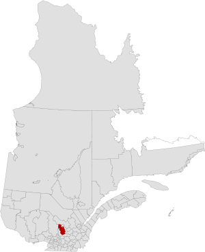
Maskinongé is a county regional municipality of Quebec in central Quebec, Canada in the Mauricie region. The seat is in Louiseville. It is located adjacent on the west of Trois-Rivières on the Saint Lawrence River.
The population of the MCR according to the 2006 Census is 35,637[1]
History
The RCM was formed on January 1, 1982, and it consisted of Hunterstown Township (now part of Saint-Paulin); Belleau Municipality (now part of Saint-Alexis-des-Monts); the parish municipalities of Saint-Alexis-des-Monts, Sainte-Angèle (since renamed to Sainte-Angèle-de-Prémont), Sainte-Anne-d'Yamachiche (now part of Yamachiche), Saint-Antoine-de-la-Rivière-du-Loup (now part of Louiseville), Saint-Barnabé, Saint-Édouard (since renamed to Saint-Édouard-de-Maskinongé), Saint-Joseph-de-Maskinongé (now part of Maskinongé), Saint-Justin, Saint-Léon-le-Grand, Saint-Paulin, Saint-Sévère, and Sainte-Ursule; and the village municipalities of Louiseville, Maskinongé, Saint-Paulin, and Yamachiche.
On January 1, 2002, the municipalities of Charette, Saint-Boniface-de-Shawinigan (since renamed to Saint-Boniface), Saint-Élie (since renamed to Saint-Élie-de-Caxton), Saint-Étienne-des-Grès, and Saint-Mathieu-du-Parc were transferred to the Maskinongé RCM when the Centre-de-la-Mauricie and Francheville Regional Counties were dissolved.
Communities
City
Municipalities
- Charette
- Maskinongé
- Saint-Boniface
- Saint-Édouard-de-Maskinongé
- Saint-Élie-de-Caxton
- Saint-Mathieu-du-Parc
- Saint-Paulin
- Sainte-Angèle-de-Prémont
- Yamachiche
Parish Municipalities
- Saint-Alexis-des-Monts
- Saint-Barnabé
- Saint-Étienne-des-Grès
- Saint-Justin
- Saint-Léon-le-Grand
- Saint-Sévère
- Sainte-Ursule
- ^ http://www12.statcan.gc.ca/census-recensement/2006/dp-pd/prof/92-591/details/page.cfm?Lang=E&Geo1=CD&Code1=2451&Geo2=PR&Code2=24&Data=Count&SearchText=Maskinonge&SearchType=Begins&SearchPR=01&B1=All&GeoLevel=PR&GeoCode=2451
 Administrative divisions of Mauricie (Region 04)
Regional county municipalities
and equivalent territoriesMékinac · Shawinigan · Trois-Rivières · Les Chenaux · Maskinongé · La Tuque
Municipalities Coordinates: 46°12′40.3″N 73°1′0.6″W / 46.211194°N 73.016833°W
Categories:- Census divisions of Quebec
- Regional county municipalities in Mauricie
- Quebec geography stubs

Wikimedia Foundation. 2010.