- North Battleford
-
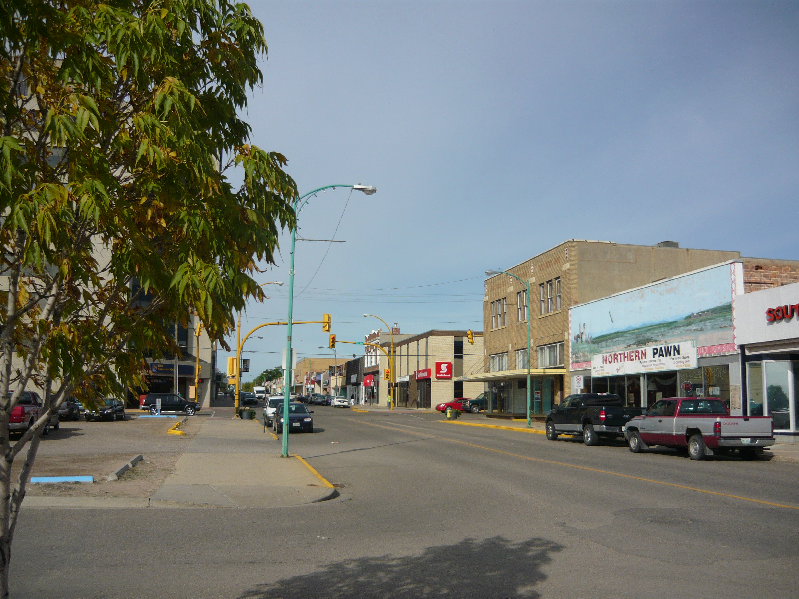
North Battleford Business District
101st Street
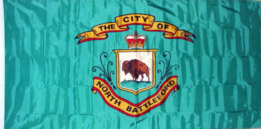
FlagLocation of North Battleford in Saskatchewan
 North Battleford
Coordinates: 52°45′27″N 108°17′10″W / 52.7575°N 108.28611°W Country Canada Province Saskatchewan Census division Division #16 Government - Mayor Ian Hamilton - MLA Herb Cox (SKP) - MP Gerry Ritz (CON) Area - Land 33.55 km2 (12.95 sq mi) - Metro 855.34 km2 (330.25 sq mi) Population (2006) - City 13,190 - Density 393.17/km2 (1,018.32/sq mi) - Metro 17,765 - Metro density 20.77/km2 (53.79/sq mi) Time zone CST (UTC−6) Website City of North Battleford North Battleford is a small city in west central Saskatchewan, Canada. It is located directly across the North Saskatchewan River from the town of Battleford. Together, the two communities are known as the Battlefords. The Battlefords Provincial Park is 40 km north on Highway 4. North Battleford borders the Rural Municipality of North Battleford No. 437, as well as the City of North Battleford and the Hole Battleford "crown colony".[1]
Contents
Demographics
Census Population 1911 2,105 1921 4,108 1931 5,986 1941 4,694 1951 7,473 1961 11,230 1971 12,698 1981 14,030 1991 14,350 2001 13,692 2006 13,190 Canada census – North Battleford Community Profile 2006 Population:
Land area:
Population density:
Median age:
Total private dwellings:
Mean household income:13,190 (−3.7% from 2001)
33.55 km2 (12.95 sq mi)
393.2 /km2 (1,018 /sq mi)
37.6 (males: 35.8, females: 39.2)
5,943
$51,613
References: 2006[2] In the late 2000s a large number of Ruthenians have emigrated to Canada, concentrating in North Battleford.[3]
History
Prior to European settlement, the Battlefords area (including the present city of North Battleford and town of Battleford) was home to several aboriginal groups. These included Cree, Assiniboine and Blackfoot tribes who contested for control of local resources.
Early European settlement began as a result of fur trading activities in the late 18th century. Fort Montaigne d'Aigle (Eagle Hills Fort) was founded nine miles below the confluence of the Saskatchewan and Battle rivers in 1778.[4] A year later the fort was abandoned following conflict between traders and natives.
Permanent European settlement in the area centred around the town of Battleford, founded 1875, located on the south side of the North Saskatchewan River. Battleford served as capital of the North-West Territories between 1876 and 1883.[5]
In 1905 the construction of the Canadian Northern Railway main line to Edmonton placed the line on the north side of the North Saskatchewan River. North Battleford was incorporated as village in 1906, a town in 1907 and a city (with population 5000) in 1913.[6]
Population growth stagnated until the 1940s and then grew to approximately 10,000 by the 1960s. The city has grown into an administrative center and service hub for the economic, education, health and social needs of the region.
North Battleford is the home of one of four branches of the Saskatchewan Western Development Museum. This branch focuses on the agricultural history of Saskatchewan, including a pioneer village.
North Battleford is also the home of the Allen Sapp Gallery, a noted Cree painter in the area.
The Latter Rain Movement started here in 1946–48.[7]
In 2001 a problem with the city's water system led to the infection of approximately 6280 people with cryptosporidiosis; a lawsuit for several million dollars went through in 2003.[8]
Transportation
North Battleford is served by the North Battleford (Cameron McIntosh) Airport, while the North Battleford/Hamlin Airport is no longer in use.
Local media
- Newspaper
The local newspaper is The Battlefords News Optimist. It is published weekly on Wednesdays and Fridays, and has circulation in the surrounding area.
- Radio
Three local radio stations serve the area; CJNB, CJCQ-FM, and CJHD-FM. Some Saskatoon radio stations can also be received.
- Television
Two television stations (CFQC-TV and CBKST) from Saskatoon, are also available over the air, via repeaters.
Notable North Battlefordians
- Lloyd Axworthy: Canadian politician and spokesman
- Wade Belak: NHL forward/defenceman
- Ron Delorme: former NHL player
- Deidra Dionne: Canadian freestyle skier, Olympic medalist
- Lillian Dyck: Canadian senator
- Johnny Esaw: former sports broadcaster, former vice-president of CTV Sports
- Bob Francis: former NHL player, NHL coach
- Emile Francis: former NHL player, coach, and general manager
- Ray Hare: former NFL running back
- Dale Hoganson: former NHL player
- Bill Hunter: hockey coach, owner, and general manager; founder of the Western Hockey League
- Carole James: politician, leader of the British Columbia New Democratic Party in British Columbia
- Dave King: NHL coach
- Skip Krake: former NHL centre
- Jody Lehman: former EIHL netminder[9]
- Bernie Lukowich: former NHL player
- Alistair MacLeod: author
- Merlin Malinowski: former NHL right winger
- Rueben Mayes: former NFL player
- Joni Mitchell: musician, artist
- Lee Richardson: Canadian politician
- Allen Sapp: Canadian Cree painter
- Corey Schwab: former NHL goalie
- Gregg Sheppard: former NHL forward
- Fiona Lesley Smith: Member of the Canada women's national ice hockey team
- Herbert Sparrow: former Canadian senator
- Al Tuer: former NHL defenceman
- W. Brett Wilson: Entrepreneur and Philanthropist
Morris B. Holota Educator and School Principal
Climate
North Battleford experiences a humid continental climate (Köppen climate classification Dfb).
Climate data for North Battleford Month Jan Feb Mar Apr May Jun Jul Aug Sep Oct Nov Dec Year Record high °C (°F) 9.1
(48.4)10.4
(50.7)16.7
(62.1)32.2
(90.0)34.9
(94.8)37.8
(100.0)36.7
(98.1)37.9
(100.2)35.6
(96.1)30
(86)19.5
(67.1)9.8
(49.6)37.9
(100.2)Average high °C (°F) −11.8
(10.8)−7.9
(17.8)−1.1
(30.0)10.3
(50.5)18.2
(64.8)22
(72)24
(75)23.5
(74.3)17.3
(63.1)10.3
(50.5)−2.1
(28.2)−9.6
(14.7)7.8 Daily mean °C (°F) −17
(1)−13.2
(8.2)−6.2
(20.8)4.2
(39.6)11.4
(52.5)15.7
(60.3)17.6
(63.7)16.8
(62.2)10.9
(51.6)4.2
(39.6)−6.6
(20.1)−14.5
(5.9)1.9 Average low °C (°F) −22.2
(−8.0)−18.4
(−1.1)−11.3
(11.7)−2
(28)4.6
(40.3)9.3
(48.7)11.2
(52.2)10
(50)4.4
(39.9)−1.9
(28.6)−11.2
(11.8)−19.5
(−3.1)−3.9 Record low °C (°F) −46.1
(−51.0)−44.1
(−47.4)−37.2
(−35.0)−27.8
(−18.0)−13.2
(8.2)−1.7
(28.9)2.2
(36.0)−1.8
(28.8)−8.9
(16.0)−27.2
(−17.0)−35.8
(−32.4)−44.2
(−47.6)−46.1
(−51.0)Precipitation mm (inches) 17.1
(0.673)10.4
(0.409)15.2
(0.598)25.8
(1.016)38.6
(1.52)61.3
(2.413)71.2
(2.803)53.9
(2.122)31.7
(1.248)13.9
(0.547)17.4
(0.685)16.9
(0.665)373.2
(14.693)Source: Environment Canada[10] References
- ^ geodepot.statcan.ca
- ^ "2006 Community Profiles". Statistics Canada. Government of Canada. 2009-02-24. http://www12.statcan.ca/census-recensement/2006/dp-pd/prof/92-591/index.cfm?Lang=E. Retrieved 2009-02-24.
- ^ "Battlefords ride immigration wave". The StarPhoenix. CanWest. April 28, 2008. http://www.canada.com/saskatoonstarphoenix/news/story.html?id=d47b16e5-aad7-4796-b376-91532517cc3d. Retrieved 2010-07-12.
- ^ atlas.nrcan.gc.ca
- ^ esask.uregina.ca
- ^ esask.uregina.ca
- ^ christianity-guide.com
- ^ "Waterborn cryptosporidosis outbreak, North Battleford, Saskatchewan, Spring 2001". Canada Communicable Disease Report (Public Health Agency of Canada) 27-22. November 15, 2001. http://www.phac-aspc.gc.ca/publicat/ccdr-rmtc/01vol27/dr2722ea.html. Retrieved 2010-11-01.
- ^ Jody Lehman's Statistics at hockeydb.com URL accessed 2009-03-01
- ^ Environment Canada - Canadian Climate Normals 1971-2000—Canadian Climate Normals 1971–2000, accessed 6 December 2010
External links
- City of North Battleford Official Website
- Battlefords Tourism Association
- Local information source for the Battlefords
- Map on Google Maps
- The Battlefords Provincial Park
- Map of North Battleford at Statcan
- North Battleford Census Agglomeration Statistics Canada
- The Encyclopedia of Saskatchewan - North Battleford

Meadow Lake Lloydminster 
Blaine Lake  North Battleford

Battleford  Subdivisions of Saskatchewan
Subdivisions Communities Cities Estevan · Flin Flon (part) · Humboldt · Lloydminster (part) · Martensville · Meadow Lake · Melfort · Melville · Moose Jaw · North Battleford · Prince Albert · Regina · Saskatoon · Swift Current · Weyburn · YorktonTopics  Category ·
  Portal ·
  WikiProject
Coordinates: 52°45′27″N 108°17′10″W / 52.7575°N 108.28611°W
Categories:


Wikimedia Foundation. 2010.