- List of ghost towns in Saskatchewan
-
-
This list is incomplete; you can help by expanding it.
The following is a list of communities that no longer exist or former Villages/Towns that have become unincorporated hamlets in the province of Saskatchewan, Canada.
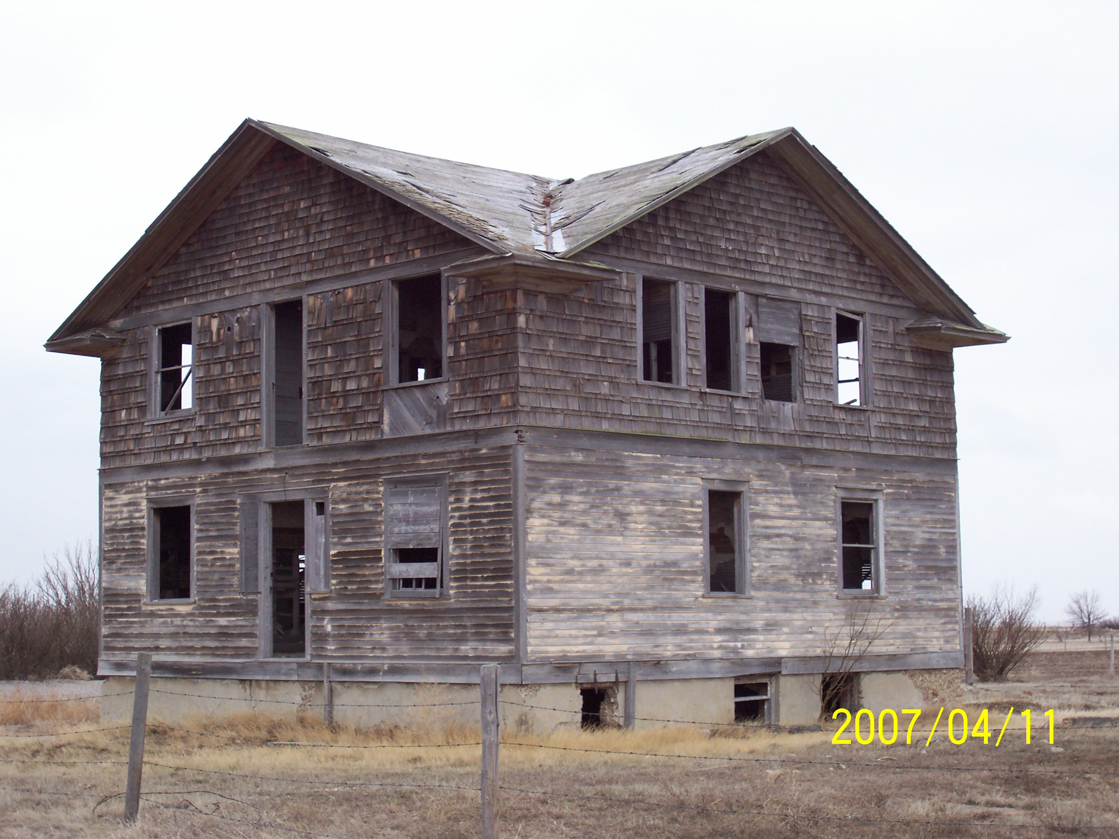
Ghost towns are towns that once had a considerable population, that have since dwindled in numbers causing some or all its business to close, either due to the rerouting of a highway, train tracks being pulled, or exhaustion of a natural resource. One of the more famous stories of Saskatchewan ghost towns arose around Uranium City which was close to achieving city status and utterly collapsed upon the closure of the Eldorado mine and the mass exodus of its population.[1]
Initially travel began by horse and wagon or ox and cart along trails which generally followed animal trails across the North West Territories. Railways would not build across the western frontier without settlement as it would be too costly to provide train service across a barren wilderness.[2] The Clifford Sifton immigration policy encouraged settlers to arrive.[3] Western settlement began and immigration encroached across the Manitoba border into the North West Territories later to become the Province of Saskatchewan in 1905. Rail stations, post offices, schools and towns sprang up approximately 6 miles (9.7 km) to 10 miles (16 km) apart to accommodate ox and cart as well as horse and wagon travel.[4][5] As travel evolved to automobiles, there was no longer a need for centers this close together. In the 1940s when the highway became more popular, and the rail branch lines started to close down, saw the demise of sidings and villages located on the rail line but not on the highway. In the late 1950s and 1960s when highways were straightened and developed from gravel to asphalt and oil surface highways many of the bypassed towns and villages folded. Businesses set up shop in towns on the new straightened highway,[6] and children could be bussed to composite schools in the larger centers. The following placenames may exist only as commemorative road names which intersect the current highways and have disappeared altogether or they may be unincorporated areas of the RM such as Floral, the birthplace of Gordie Howe. Floral would be currently located off the Yellowhead highway for example but it was on Provincial Highway 5 when the road was on the square. Floral currently is demarked by an old church at the Floral Cemetery, and the Floral one room school is now the community hall for meetings and socials. The only remembrance of Floral is a road named Floral road. The road traveled on the 'square' connecting many small country towns was a different one from the highway of today connecting larger urban centers.
A rural municipality, often abbreviated RM, is a form of municipality consisting of an elected reeve for the elected head along with aldermen or Councillors of a rural municipality, performing a similar role to the mayor of a village, town or city.[7] An RM may have its office in a town or village, which has its own separate and distinct civic administration, but the RM administers the rural affairs of a large land area including unincorporated areas or ghost towns. The RM administers the remaining population of the ghost town providing any needed civic infrastructure, safety, health, educational, or tourism affairs. Localities with small populations are enumerated in census taking by Statistics Canada as a population belonging to the RM. For instance Churchbridge No. 211 includes the localities of Beresina and the Melville Airport.[8]
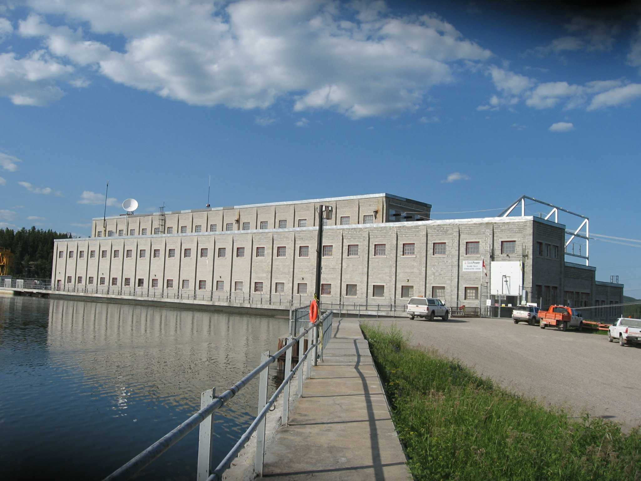
 Island Falls powerhouse
List of ghost towns
Contents Town Name Rural
MunicipalityPeak year Peak Population Location Arena Frontier No. 19 Baildon Baildon No. 131 Bateman Gravelbourg No. 104 1920s 300 Battrum Saskatchewan Bayard Terrell No. 101 Bents Saskatchewan 51.816°N 107.734°W Birch Creek Emerald No. 277 1910s Sec.10, Twp.30, R.14, W2 Blewett Saskatchewan Bounty Fertile Valley No. 286 200 Breeze Saskatchewan Bresaylor Saskatchewan Bromhead Saskatchewan Brooking Saskatchewan Bryant Benson No. 35 Cactus Lake Heart's Hill No. 352 Chandler Saskatchewan Clansman Saskatchewan Claydon Saskatchewan Clearfield Saskatchewan Coalfields Saskatchewan Colgate Lomond No. 37 Court Saskatchewan Crichton Wise Creek No. 77 Cullen Saskatchewan Cummings Maple Creek No. 111 Divide Reno No. 51 Diana Saskatchewan Dneiper Saskatchewan Dunning Saskatchewan Dummer Caledonia No. 99 Elcott Saskatchewan Elswick Saskatchewan Estuary Deer Forks No. 232 1914 800 Expance Lake Johnson No. 102 Flintoft Stonehenge No. 73 Floral City of Saskatoon Forget Tecumseh No. 65 Forward Norton No. 69 Froude Griffin No. 66 Fusilier Antelope Park No. 322 1920s 125 Garwood Saskatchewan Gibbs Longlaketon No. 219 Girvin Arm River No. 252 Glen Bain Glen Bain No. 105 Goodwater Lomond No. 37 N 49.400055 W 103.7010298 Gouverneur Auvergne No. 76 Govenlock Reno No. 51 1920s 200 Grassdale Weyburn No. 67 Halkett Estavan No. 5 Handsworth Golden West No. 95 Hatton Maple Creek No. 111 Hearne Redburn No. 130 1930s 30 Hoffer Souris Valley No. 7 Holloway Saskatchewan Horizon Bengough No. 40 Hughton Monet No. 257 Hume Griffin No. 66 Huntoon Griffin No. 66 Innes Griffin No. 66 Insinger Insinger No. 275 1920s 100 Instow Bone Creek No. 108 1928 60 Island Falls Northern Administration District 200 Kayville Key West No. 70 Kingsford Browning No. 34 Lakenheath Stonehenge No. 73 Loomis Frontier No. 19 Loverna Antelope Park No. 322 1920s 500 Luxton Browning No. 34 Masefield Val Marie No. 17 Maxim Lomond No. 37 Minard Browning No. 34 Neidpath Coulee No. 136 Neville Whiska Creek No. 106 Nashlyn Reno No. 51 Neptune Lomond No. 37 New Finland Willowdale No. 153 1899 250 50°25′34″N 102°12′45″W Old Wives Hillsborough No. 132 N 50.200061 W 106.001177 Oungre Souris Valley No. 7 Oxarat Reno No. 51 Parkbeg Wheatlands No. 163 Pinto Coalfields No. 4 Polwarth Canwood No. 494 Rangeview Reno No. 51 Ravenscrag White Valley No. 49 1920s 200 Reynaud Three Lakes No. 400 Robinhood Medstead No. 497 1940 60 Robsart Reno No. 51 1920s 350 Romance Leroy No. 339 Roseray Pittville No. 169 Rutland Colonsay No. 342 Scotsguard Bone Creek No. 108 1916–1935 350 Senate Reno No. 51 1940s 63 Shand Estavan No. 5 Smuts Grant No. 372 Southall Souris Valley No. 7 South Fork Arlington No. 79 St. Boswells Glen Bain No. 105 1919–1929 350 Tableland Saskatchewan Tarnopol Invergordon No. 430 Tatagwa Weyburn No. 67 Tate Mount Hope No. 279 Taylorton Coalfields No. 4 Trossachs Brokenshell No. 68 Truax Elmsthorpe No. 100 Union Jack Weyburn No. 67 Uren Chaplin No. 164 Valjean Chaplin No. 164 Valley Center Marriott No. 317 Vantage Sutton No. 103 Verlo Pittville No. 169 Vesper Lac Pelletier No. 107 N 50.016766334 W 108.018071486 Vidora Reno No. 51 1920s 200 Viewfield Benson No. 35 Woodley Browning No. 34 Xena Morris No. 312 Yonker N 52.652645 W 109.638748 See also
- List of places with fewer than ten residents
- List of Canadian Cities, Towns & Villages
- List of ghost towns in Canada
- List of towns in Saskatchewan
- List of rural municipalities in Saskatchewan
- List of Indian reserves in Saskatchewan
- Census divisions of Saskatchewan
- List of ghost towns in Alberta
References
- ^ Martel, Karin (2005-08-15). "Uranium City". 100 Saskatchewan Stories. Dacian.
- ^ "Saskatchewan Settlement Experience". Saskatchewan Archives Board. OH! Media. 2005. http://www.sasksettlement.com/display.php?cat=1900-1910&subcat=Railway%20Expansion. Retrieved 2008-03-24.
- ^ Bélanger, Claude (2005). "Clifford Sifton - Canadian History". Marianopolis College. http://faculty.marianopolis.edu/c.belanger/quebechistory/encyclopedia/CliffordSifton-CanadianHistory.htm. Retrieved 2008-03-24.
- ^ Youck, Alex; Jim Slough (2006). "Saskatchewan Schools: Early History". The Encyclopedia of Saskatchewan. CANADIAN PLAINS RESEARCH CENTER, UNIVERSITY OF REGINA. http://esask.uregina.ca/entry/saskatchewan_schools_early_history.html.
- ^ Adamson, J. "Saskatchewan, Canada, Rand Mcnally 1924 Indexed Pocket Map Tourist and Shipper's Guide". Online Canadian Maps Digitization Project. Rootsweb. http://www.rootsweb.ancestry.com/~canmaps/RandMcNally1924/index.html. Retrieved 2008-04-01.
- ^ (Anderson 1998:67)
- ^ "Municipal Directory System". Ministry of Municipal affairs. Government of Saskatchewan. http://www.mds.gov.sk.ca/apps/Pub/MDS/welcome.aspx.
- ^ "Economic Regions 2006 4705093 - Churchbridge No. 211, geographical codes and localities ,2006". Statistics Canada. Government of Canada. http://stds.statcan.gc.ca/sgc-cgt/2006/ersl-rerl-fin-eng.asp?criteria=4705093. Retrieved 2009-09-06.
External links
 List of ghost towns in Canada (by province or territory)
- Alberta
- British Columbia
- Manitoba
- New Brunswick
- Newfoundland and Labrador
- Nova Scotia
- Ontario
- Prince Edward Island
- Quebec
- Saskatchewan
- Northwest Territories
- Nunavut
- Yukon
 Subdivisions of Saskatchewan
Subdivisions Communities Cities Estevan · Flin Flon (part) · Humboldt · Lloydminster (part) · Martensville · Meadow Lake · Melfort · Melville · Moose Jaw · North Battleford · Prince Albert · Regina · Saskatoon · Swift Current · Weyburn · YorktonTopics Categories:- Ghost towns in Saskatchewan
- Lists of ghost towns in Canada
- Saskatchewan-related lists
-
Wikimedia Foundation. 2010.