- Claydon, Saskatchewan
-
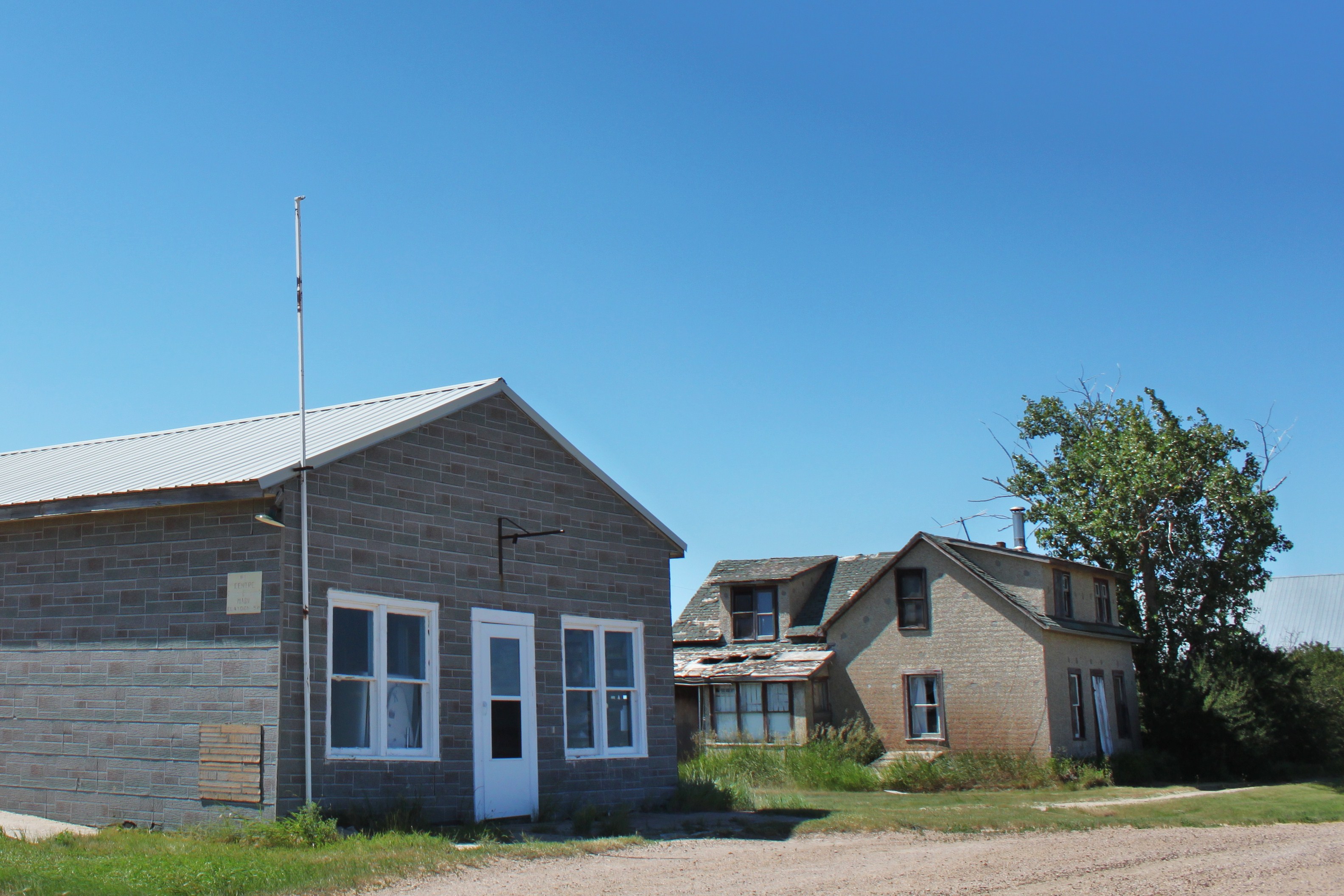
Claydon, Saskatchewan — Hamlet — Claydon Post Office and house, Main Street. Location of Claydon in Saskatchewan
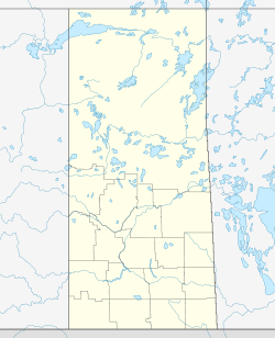

Coordinates: 49°07′44″N 108°32′31″W / 49.129°N 108.542°W Country Canada Province Saskatchewan Region South West Saskatchewan Census division 4 Rural Municipality Frontier Established 1917 Village Incorporated N/A Government - Former Mayor - Administrator Barb Webber - Governing body Frontier No. 19 Area - Total 500.488 km2 (193.2 sq mi) Population (2001) - Total 10 Postal code S0N 0M0 Area code(s) 306 Highways Highway 18 [1][2][3][4] Claydon was once a small hamlet in Frontier Rural Municipality No. 19, Saskatchewan, Canada. The hamlet is located 60 km southeast of the hamlet of Robsart and 50 km south of the town of Eastend on Highway 18. Very little remains of the former community, only a home used as a post office and a couple of other buildings still stand as of 2007.
Contents
Population
Claydon, like so many other smaller communities throughout Saskatchewan, has struggled to maintain a sturdy population causing it to become a ghost town.
In 2006 Claydon had a population of 0 living in 0 dwellings, a 0% increase from 1996. The village had a land area of 0 km2 (0 sq mi) and a population density of 0 /km2 (0 /sq mi).
Education
Claydon no longer has a school, but those who live in or near Claydon are now bused to the neighboring village of Frontier which has a school that covers Kindergarten to Grade 12 serving approximately 200 students.
Climate
Climate data for Claydon Month Jan Feb Mar Apr May Jun Jul Aug Sep Oct Nov Dec Year Record high °C (°F) 13
(55)19
(66)20.5
(68.9)30
(86)34
(93)38
(100)37.5
(99.5)39.5
(103.1)35.5
(95.9)31
(88)22
(72)13
(55)39.5
(103.1)Average high °C (°F) −6.5
(20.3)−2.8
(27.0)3.5
(38.3)11.9
(53.4)17.9
(64.2)22.6
(72.7)26.2
(79.2)26.1
(79.0)19.2
(66.6)12.2
(54.0)1.8
(35.2)−4.3
(24.3)10.6 Daily mean °C (°F) −11.6
(11.1)−8.1
(17.4)−2.1
(28.2)5.2
(41.4)11
(52)15.6
(60.1)18.7
(65.7)18.3
(64.9)11.9
(53.4)5.6
(42.1)−3.5
(25.7)−9.6
(14.7)4.3 Average low °C (°F) −16.7
(1.9)−13.4
(7.9)−7.6
(18.3)−1.6
(29.1)4
(39)8.6
(47.5)11
(52)10.5
(50.9)4.6
(40.3)−1
(30)−8.8
(16.2)−14.9
(5.2)−2.1 Record low °C (°F) −39.5
(−39.1)−39
(−38)−31.7
(−25.1)−22.2
(−8.0)−8.5
(16.7)−2.5
(27.5)2.8
(37.0)−2
(28)−9.4
(15.1)−26
(−15)−34
(−29)−42.5
(−44.5)−42.5
(−44.5)Precipitation mm (inches) 18.4
(0.724)12.6
(0.496)21
(0.83)24.8
(0.976)57.6
(2.268)59.7
(2.35)52.4
(2.063)31.9
(1.256)38.2
(1.504)17.4
(0.685)18.3
(0.72)21.5
(0.846)373.9
(14.72)Source: Environment Canada[5] See also
- List of places with fewer than ten residents
- List of communities in Saskatchewan
- Hamlets of Saskatchewan
- List of ghost towns in Canada
- Ghost towns in Saskatchewan
References
- ^ National Archives, Archivia Net, Post Offices and Postmasters, http://www.collectionscanada.ca/archivianet/post-offices/001001-100.01-e.php
- ^ Government of Saskatchewan, MRD Home (– Scholar search), Municipal Directory System, http://www.municipal.gov.sk.ca/index.html[dead link]
- ^ Canadian Textiles Institute. (2005), CTI Determine your provincial constituency, http://www.textiles.ca/eng/nonAuthProg/redirect.cfm?path=IssPolContacts§ionID=7601.cfm
- ^ Commissioner of Canada Elections, Chief Electoral Officer of Canada (2005), Elections Canada On-line, http://www.elections.ca/home.asp
- ^ Environment Canada Canadian Climate Normals 1971–2000, accessed 24 July 2010
External links

Robsart Eastend Shaunavon Rangeview 
Loomis  Claydon

Divide Staynor Hall Port of Climax  Subdivisions of Saskatchewan
Subdivisions Communities Cities Estevan · Flin Flon (part) · Humboldt · Lloydminster (part) · Martensville · Meadow Lake · Melfort · Melville · Moose Jaw · North Battleford · Prince Albert · Regina · Saskatoon · Swift Current · Weyburn · YorktonTopics  Category ·
  Portal ·
  WikiProjectCategories:
- Frontier No. 19, Saskatchewan
- Populated places established in 1917
- Populated places established in 1910
- Hamlets in Saskatchewan
- Ghost towns in Saskatchewan

Wikimedia Foundation. 2010.