- Geography of Saskatchewan
Country geography
name = Saskatchewan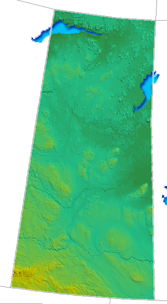
continent = America
region =North America Western Canada
coordinates = coord|49|00|00|N|101|21|41|W|region:CA --
coord|60|00|N|110|00|W|region:CA
area|ranking = 7th among provinces
km area = 651900
area ref = [ [http://www40.statcan.ca/l01/cst01/phys01.htm Land and Freshwater area by province] URL accessed april 5, 2007] [ [http://schools.hpedsb.on.ca/smood/provinces/saskan.htm Saskatchewan Quiz] URL accessed 2007-04-04]
percent land = 90.8
km coastline = 0
borders = Total land borders:U.S. statesNorth Dakota ; Canadian provincesAlberta ,Manitoba andNorthwest Territories
highest point =Cypress Hills
1,468 metres (4,816 ft)
lowest point =Lake Athabasca shoreline
longest river =Saskatchewan River
largest lake =Lake Athabasca
7935 km²The
geography ofSaskatchewan (suskăch'uwun, –wän", săs"–), province (2001 pop. 978,933), 251,700 sq mi (651,900 km²), describes the land formations and physical features of this prairieprovince inwestern Canada . The various geographical branches provide an analysis of natural and human area studies. The changes of either the natural or human in an area will force an adaptation of evolution in relation to the variousecozones and terrain features. The physical land area is described by political boundaries which have changed through history. Cultural and technological changes have affected the adaptation of the human lifestyle with the regional environmental area throughout the history of Saskatchewan.The name "Saskatchewan" is derived from the Cree word "kisiskaciwan" that means "swift flowing water" referring to the South Saskatchewan river which served as a major waterway in the eighteenth century by European explorers and fur traders. As a plains region, with the
Central Lowlands to the south and wooded country in the north, it supports rich and varied wildlife, or zoogeography. The northern third is part of theCanadian Shield whereas the southwestern triangle is part of theGreat Plains . Its principal rivers are the North and South Saskatchewan, theChurchill River , and theQu'Appelle River .cite web |url=http://www.answers.com/topic/saskatchewan |title=Answers.com on Saskatchewan |accessdate=2006-12-03] Moreover, between the Saskatchewan and Churchill rivers, locates a mixed forest belt that produces much timber. A sector of which is preserved asPrince Albert National Park . Saskatchewan's economy can be described asoil ,gas ,potash production,grains ,coal , andlivestock . Saskatchewan is surrounded, to the north in 1905 by the Provisional District of Mackenzie [ [http://www.rootsweb.com/~canmaps/1922-atlas/Saskatchewan.html The New World Atlas and Gazetteer 1922 Edition Province of Saskatchewan. Physical and Commercial Analysis of the Dominion of Canada:] URL accessed 2007-04-08] which later became theNorthwest Territories , to the east by Manitoba, to the south by theUnited States 'Montana , and to the west byAlberta .The
Cree Indians inhabited the plains and parkland region about five thousand years ago, living a first nation’s tribal lifestyle where the men followed the movement ofbison livestock — a form oftranshumance — and the women and children remained at home engaged in hunting and gathering activities. TheDene or caribou hunter resided in the northernCanadian Shield area. The Hudson's Bay Company controlled the area namedRupert's Land beginning in 1670. The French established settlements in the region c. 1750, though the Hudson’s Bay Company made the first permanent settlement in 1774. The Hudson’s Bay Co. ceded Rupert’s land in 1869, and by 1870, the North West became a member of theDominion of Canada as a part of theNorthwest Territories . From 1882 into the early 1900s, the extension of therailroad brought in large numbers of European settlers, as well during this period thebison virtually became extinct. The province was established in 1905. [ [http://www.attractionscanada.com/saskatchewan/index.html Saskatchewan Canada] URL accessed 2007-04-04] The biogeography of Saskatchewan'secozones saw the development of agriculture science as plantcultivation combined with pastoralism orranching settlements sprang up. Technological advancements resulted in the departure from subsistence techniques towardsindustrial agriculture andcash crops . As labour from the rural agricultural sector was not as intensive because of mechanization, other urban sectors have been developed such as business and market economic geographies as well as mineral economic geographies. [Agriculture in Canada] ] Regina stands as its second largest city and capital.Historical geography
Original peoples of the Saskatchewan consist of three linguistics groups: the
Athabascan ,Algonquian , andSiouan . Henry Kelsey of the Hudson's Bay Company is considered the first European person to see this area. the earliest trading posts were made by the French; however, the first permanent settlement was established atCumberland House in 1774 by the HBC. In addition, several more ports were set up by British fur traders among the area's waterways. Settlement was favoured in the forested area of the Canadian Shield, and hunting/ trapping was the main economy.In 1870, the Hudson Bay's Company (HBC) had combined with the
North West Company in 1821, and then ceded its rights from theCanadian government . The region became a part of the Northwest Territories. The majority of the Canadians of the indigenous descent in the Northwest Territories sold their lands to the government in the 1870s and was settled on reservations. Additional native peoples andMétis (people of mixed French and indigenous Canadian ancestry), led by Louis Riel rebelled between 1884 and 1885 and were suppressed.The arrival of settlements and the rail lines also brought agricultural economies and development in the Central Lowlands Area. The Great Plains or
Palliser Triangle area to the south was mainly used for ranching economies. In the beginning of the 20th century, Saskatchewan farmers created cooperative organizations to maintain grain marketization. During the drought and depression of the 1930s, the population decreased as immigration nearly ended and numerous families left. During World War II, conservation programs and the increased demand for grain survived the economy.Climate
Saskatchewan climate can be described as
temperate in the south and with cold winters in the north. The greatestrainfall occurs between April and June.cite web |url=http://homeschooling.about.com/gi/dynamic/offsite.htm?zi=1/XJ&sdn=homeschooling&cdn=education&tm=11&gps=20_758_1020_548&f=21&su=p532.8.150.ip_p554.2.150.ip_p284.2.420.ip_&tt=2&bt=0&bts=0&zu=http%3A//www.travelguide.com/data/sas/sas500.asp |title=Saskatchewan climate can be described astemperate in the south and with cold winters in the north |accessdate=2006-12-03] Summers are hot and humid, dry with tedious hours of sunshine. plough winds, cyclones,Supercell hail or high precipitation rain storms and tornadoes are eventful summer occurrences. Midale has the hottest recorded temperature in Canada registering at 45 °C (113 °F) on July 5, 1937. Winter temperatures are frequently cold and snowy until late March, but sunny. Light to medium weights clothing during warmer months. Heavyweights are worn for the winter. Waterproof apparel is common throughout the year.Annual precipitations ranges are of 320 to 450 mm in the southern portion (below about 54 degrees North) where the majority of the population live.cite web |url=http://interactive.usask.ca/ski/factfig/geography.html |title=Saskatchewan geography |accessdate=2006-12-03] The northern
forest area is wetter in precipitation. In the far north there is few frost-free days and the subsoils remain frozen all around the year.:""Urban Areas", as defined by Statistics Canada, are areas of continuous population density, ignoring municipal borders."
Vegetation
*see also|Prairie
*see also|Canadian Prairies
*see also|Canada's landforms#The Canadian Shield
*see also|Canada's landforms#The Interior Plains
*see also|Canadian Shield
Saskatchewan has three major landforms, the
Most farms were grain and
;LivestockSince 1996 and 2001 census showed that
At the turn of the century, the early 1900s saw settlers who needed to import their butter. By the roaring twenties dairy production in Saskatchewan not only filled domestic needs, but Saskatchewan dairy farmers were able to export to Britain. [ [http://www.rootsweb.com/~canmaps/1926/v.html 1926 Highway 
Albeit dairy cow numbers have been constantly declining, milk production, it had remained fairly constant. Increased production per dairy cow, has been achieved by improved breeding, feeding and milking methods, including a growth of three milkings per day from the traditional two by some operations.
The amount of hogs in Canada increased to 26.4% to a record 13.9 million, as farmers responded to strong export markets for live hogs and
There were 126.2 million hens and
Over 1.3 million sheep were now on Canadian farms, an increase of over 50% from 1996 and much below the peak of 3.6 million in 1931. The sheep mainly were bred for meat production instead of
;CropsAccording to the 2001 census the number of farms in Saskatchewan (50, 598) declined by 11.2% from the amounts reported from the prior census in 1996. Farms were fewer by 24.8 % a decade ago. In 1936, about seven decades ago the highest census for farms occurred and the number was 142,391.
Saskatchewan accounts for 20% of all Canadian farmers and has the largest farms with an average farm size of 1283 acres (up from convert|1152|acre|km2|0 in the last census). The province had nearly 40% of the agricultural land in Canada, nearly 13 million acres (53,000 km²) more than second-place Alberta.
About 64.9 million acres (263,000 km²) of the province is farmland. Thirty-eight million acres (154,000 km²) were cropped in 2001.
Distribution of farmland:
# Cropped: 38 million acres (154,000 km²)
# Summer fallow: 7.7 million acres (31,000 km²)
# Tame (seeded) pasture: 3.5 million acres (14,000 km²)
# Natural pasture: 12.7 million acres (51,000 km²)
# Other: 3.0 million acres (12,000 km²) Spring wheat still dominated the prairie landscape, though the crop is losing ground to oilseeds and specialty crops.
The five major crops in 2001 were:
# Spring wheat (10.7 million acres)
# Barley (4.7 million acres)
# Durum wheat (4.6 million acres)
# Canola (4.3 million acres)
# Alfalfa/alfalfa mixtures (2.8 million acres)
The numbers of large animals for 2001 were:
# Cattle and calves (2.9 million)
# Sheep and lambs (149,000)
# Pigs (1.1 million)
# Other animals (184,000)
The province also supported a large poultry industry with 9.7 million birds.
Farm Cash receipts for 2001 Farm Cash receipts accumulated to over $5.8 billion in 2001. Wheat accounted for 26% of the total and cattle 19%.
Saskatchewan (GPD) (2002) In 2002, Agriculture,
Agriculture-food exports Saskatchewan exported $4,152.2 million of agriculture and
Economic overview
Excluding a semi-arid area of the southwest used for
Saskatchewan is rich in
Additional information
* Motto: "Multis E Gentibus Vires" (From many peoples strength)
* Saskatchewan is Canada’s fifth-largest province and has 44% of Canada’s farmland.
* Saskatchewan’s land mass is nearly 1/3 Precambrian rock; 1/3 agricultural land; 23% commercial forest and 12% lakes and rivers
* Shield: authorized by Royal Warrant of
* Coat of Arms: This is a crest, supporters, and motto was officially added to the
* Flag: The green upper half represents the northern, the largely forested area of the province; the gold on the lower half represents the southern, the largely grain growing area. The flag is formally adopted in 1969.
* The state flower is a western red lily, lilium philadelphicum var. andinum, selected 1941
* The state bird is sharp-tailed grouse, pedioectes phasianellus jamesi, chosen in 1945.
* The state tree is white birch, betula papyrifera; chosen in 1988
* Mammal: White-tailed
* Provincial colours:
;Weather
* Coldest recorded temperature: -57 °C at Prince Albert,
* Hottest recorded temperature: 45 °C at Yellow Grass and Midale,
* Average annual percentage of daylight with bright sunshine: 53.3
* Highest number of hours, bright sunshine: 2,701 at Estevan, 1980
See also
*
*
*
*
*
*
*
*
*
*
*
*
*
*
*
*
References
Wikimedia Foundation. 2010.