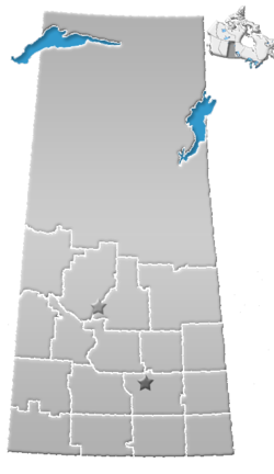
- Division No. 4, Saskatchewan
-
Division No. 4, Saskatchewan, Canada, is one of the eighteen Census divisions within the province, as defined by Statistics Canada. It is located in the southwest corner of the province, bordering Alberta and Montana. The most populous community in this division is Maple Creek.
According to the 2006 census, 11,086 people lived in this division. It has a land area of 21,364.96 km² (8,249.06 sq mi).
Contents
List of rural municipalities in Division No. 4
No. Name 17 Val Marie 18 Lone Tree 19 Frontier 49 White Valley 51 Reno 77 Wise Creek 78 Grassy Creek No. Name 79 Arlington 107 Lac Pelletier 108 Bone Creek 109 Carmichael 110 Piapot 111 Maple Creek Source: Statistics Canada 2002 2001 Community Profiles. [1] Communities
The following communities are located in this Census division:
Towns
Villages
Hamlets
- Battle Creek
- Beaver Valley
- Belanger
- Blumenort
- Bracken
- Canuck
- Carnagh
- Claydon
- Cross
- Cummings
- Darlings Beach
- Divide
- East Fairwell
- Edgell
- Fort Walsh, National historic site
- Garden Head
- Govenlock
- Hatton
- Hillandale
- Illerbrun
- Instow
- Kealey Springs
- Klintonel
- Lac Pelletier
- Loomis
- Masefield
- Merryflat
- Nashlyn
- Neighbour
- Neuhoffnung
- Olga
- Oxarat
- Palisade
- Rangeview
- Ravenscrage
- Rosefield
- Scotsguard
- Senate
- Sidewood
- Skull Creek
- South Fork
- Staynor Hall
- Vidora
- West Plains
- Willow Creek
Indian Reserves
- Nekaneet Cree Nation
References
- Division No. 4, Saskatchewan Statistics Canada
Footnotes
- ^ Released June 27, 2002. Last modified: 2005-11-30. Statistics Canada Catalogue no. 93F0053XIE. Page accessed January 5, 2007.
 Subdivisions of Saskatchewan
Subdivisions Communities Cities Estevan · Flin Flon (part) · Humboldt · Lloydminster (part) · Martensville · Meadow Lake · Melfort · Melville · Moose Jaw · North Battleford · Prince Albert · Regina · Saskatoon · Swift Current · Weyburn · YorktonCensus divisions Topics Categories:- Census divisions of Saskatchewan
- Saskatchewan geography stubs
Wikimedia Foundation. 2010.

