- Deer Forks No. 232, Saskatchewan
-
Deer Forks No. 232 — Rural Municipality — Location of Deer Forks No. 232 in Saskatchewan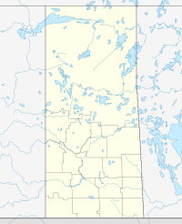

Coordinates: 50°39′18″N 109°54′32″W / 50.655°N 109.909°W Country Canada Province Saskatchewan Region Southwest Saskatchewan Census division 15 Established 1905 Incorporated 1905 Government[1] – Governing body Deer Forks No. 232 Council – Municipal seat Burstall – Reeve Dough Smith Population (2006) – Total 462 – Density 0.1/km2 (0.3/sq mi) – Dwellings 235 Time zone UTC (UTC-6) Area code(s) 306 Highways Highway 321
Highway 635
Highway 741Waterways South Saskatchewan River Website Deer Forks No. 232 Deer Forks No. 232 is a rural municipality in the Canadian province of Saskatchewan, located in the Census Division 4, just north of the USA border, and east of the Alberta border, in the southwestern corner of the province. The seat of the municipality is located in the town of Burstall.
Contents
Demographics
In 2006, the Rural municipality had a population of 213 in 46 dwellings, a -5.8% decrease from 2001. On a surface of 735.49.66 km² it has a density of 0.3 inhabitants/km².[2]
History
Before 1905, Deer Forks No. 232 would have been part of the North West Territories
Communitys
The following communities are located in this municipality:
Towns
- Burstall, Seat of municipality.
Hamlets
- Estuary
- Gascoigne
See also
External links
References
- ^ Official website http://www.municipal.gov.sk.ca/apps/Pub/MDS/muniDetails.aspx?cat=10&mun=2527
- ^ 2006 Community Profiles http://www12.statcan.ca/census-recensement/2006/dp-pd/prof/92-591/details/page.cfm?B1=All&Code1=4708061&Code2=47&Custom=&Data=Count&Geo1=CSD&Geo2=PR&Lang=E&SearchPR=01&SearchText=Deer+Forks+No.+232&SearchType=Begins
 Subdivisions of Saskatchewan
Subdivisions Communities Cities Estevan · Flin Flon (part) · Humboldt · Lloydminster (part) · Martensville · Meadow Lake · Melfort · Melville · Moose Jaw · North Battleford · Prince Albert · Regina · Saskatoon · Swift Current · Weyburn · YorktonRural municipalities Aberdeen · Abernethy · Antelope Park · Antler · Arborfield · Argyle · Arlington · Arm River · Auvergne · Baildon · Barrier Valley · Battle River · Bayne · Beaver River · Bengough · Benson · Big Arm · Biggar · Big Quill · Big River · Big Stick · Birch Hills · Bjorkdale · Blaine Lake · Blucher · Bone Creek · Bratt's Lake · Brittania · Brock · Brokenshell · Browning · Buchanan · Buckland · Buffalo · Calder · Caledonia · Cambria · Cana · Canaan · Canwood · Carmichael · Caron · Chaplin · Chester · Chesterfield · Churchbridge · Clayton · Clinworth · Coalfields · Colonsay · Connaught · Corman Park · Cote · Coteau · Coulee · Craik · Cupar · Cut Knife · Cymri · Deer Forks · Douglas · Duck Lake · Dufferin · Dundurn · Eagle Creek · Edenwold · Elcapo · Eldon · Elfros · Elmsthorpe · Emerald · Enfield · Enniskillen · Enterprise · Estevan · Excel · Excelsior · Eyebrow · Eye Hill · Fertile Belt · Fertile Valley · Fillmore · Fish Creek · Flett's Springs · Foam Lake · Fox Valley · Francis · Frenchman Butte · Frontier · Gainsborough · Garden River · Garry · Glen Bain · Glen McPherson · Glenside · Golden West · Good Lake · Grandview · Grant · Grass Lake · Grassy Creek · Gravelbourg · Grayson · Great Bend · Greenfield · Griffin · Gull Lake · Happyland · Happy Valley · Harris · Hart Butte · Hazel Dell · Hazelwood · Heart's Hill · Hillsborough · Hillsdale · Hoodoo · Hudson Bay · Humboldt · Huron · Indian Head · Insinger · Invergordon · Invermay · Ituna Bon Accord · Kellross · Kelvington · Keys · Key West · Kindersley · King George · Kingsley · Kinistino · Lacadena · Lac Pelletier · Laird · Lajord · Lake Alma · Lake Johnston · Lakeland · Lake Lenore · Lake of the Rivers · Lakeside · Lakeview · Langenburg · Last Mountain Valley · Laurier · Lawtonia · Leask · Leroy · Lipton · Livingston · Lomond · Lone Tree · Longlaketon · Loon Lake · Loreburn · Lost River · Lumsden · Manitou Lake · Mankota · Maple Bush · Maple Creek · Mariposa · Marquis · Marriott · Martin · Maryfield · Mayfield · McCraney · McKillop · McLeod · Meadow Lake · Medstead · Meeting Lake · Meota · Mervin · Milden · Milton · Miry Creek · Monet · Montmartre · Montrose · Moose Creek · Moose Jaw · Moose Mountain · Moose Range · Moosomin · Morris · Morse · Mountain View · Mount Hope · Mount Pleasant · Newcombe · Nipawin · North Battleford · North Qu'Appelle · Norton · Oakdale · Old Post · Orkney · Paddockwood · Parkdale · Paynton · Pense · Perdue · Piapot · Pinto Creek · Pittville · Pleasantdale · Pleasant Valley · Ponass Lake · Poplar Valley · Porcupine · Prairiedale · Prairie Rose · Preeceville · Prince Albert · Progress · Reciprocity · Redberry · Redburn · Reford · Reno · Riverside · Rocanville · Rodgers · Rosedale · Rosemount · Rosthern · Round Hill · Round Valley · Rudy · Runnymede · Saltcoats · Sarnia · Saskatchewan Landing · Sasman · Scott · Senlac · Shamrock · Shellbrook · Shell Lake · Sherwood · Silverwood · Sliding Hills · Snipe Lake · Souris Valley · South Qu'Appelle · Spalding · Spiritwood · Spy Hill · St. Andrews · Stanley · Star City · St. Louis · St. Peter · St. Philips · Stonehenge · Storthoaks · Surprise Valley · Sutton · Swift Current · Tecumseh · Terrell · The Gap · Three Lakes · Tisdale · Torch River · Touchwood · Tramping Lake · Tullymet · Turtle River · Usborne · Val Marie · Vanscoy · Victory · Viscount · Wallace · Walpole · Waverley · Wawken · Webb · Wellington · Weyburn · Wheatlands · Whiska Creek · White Valley · Willner · Willow Bunch · Willow Creek · Willowdale · Wilton · Winslow · Wise Creek · Wolseley · Wolverine · Wood Creek · Wood River · WrefordTopics Subdivisions of SaskatchewanSubdivisions Communities Cities Estevan · Flin Flon (part) · Humboldt · Lloydminster (part) · Martensville · Meadow Lake · Melfort · Melville · Moose Jaw · North Battleford · Prince Albert · Regina · Saskatoon · Swift Current · Weyburn · YorktonTopics Categories:- Rural municipalities in Saskatchewan

Wikimedia Foundation. 2010.