- North Battleford No. 437, Saskatchewan
-
North Battleford No. 437, Saskatchewan, Location of North Battleford No. 437, Saskatchewan, in Saskatchewan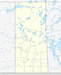

Coordinates: 52°45′35″N 108°13′40″W / 52.75972°N 108.22778°WCoordinates: 52°45′35″N 108°13′40″W / 52.75972°N 108.22778°W Country Canada Province Saskatchewan Rural Municipality Local Improvement District Local improvement district May 14, 1905. Rural Municipality October 1909. Government – Reeve – Administrator – Councilor – Councilor – Councilor Area – Total 797.20 km2 (307.8 sq mi) Population (2006) – Total 737 Time zone UTC (UTC-6) Website http://www.saskbiz.ca/communityprofiles/CommunityProfile.Asp?CommunityID=937 This article is about the rural municipality in Canada. For other places with the same name, see Battleford
North Battleford No. 437, Saskatchewan is a rural municipality of 737 rural residents (2006 census) in the northwestern part of Saskatchewan, Canada. It comprises the rural area generally to the north and east of the city of North Battleford. The RM was incorporated December 12, 1910 .[1][2][3][4]
The North Battleford Energy Centre, a 260 MW generating station, is under construction in the RM of North Battlerford. Newman Matchim, the Operations Manager for NBEC, has recently moved to North Battleford No. 437. In addition, Michael Fox has taken the position of Project Administrator for the project and now lives in the RM of North Battleford. The population is now 739.
A rural municipality is an administrative district consisting of an elected reeve, councilors, administrator who provide essential services within their area.
The Battlefords are the crossroads for the Yellowhead Highway Route and highways 4, 26, 29, and 40. — North Battleford No. 43, Saskatchewan,[5]
Contents
Statistics
Canada census – North Battleford No. 437, Saskatchewan Community Profile 2006 Population:
Land area:
Population density:
Median age:
Total private dwellings:
Mean household income:737 (-10.3% from 2001)
797.20 km2 (307.80 sq mi)
0.9 /km2 (2.3 /sq mi)
N/A (males: N/A, females: N/A)
278
$Not Available
References: 2006[6]Area statistics
- Lat 52° 45' 35" N
- Long 108° 13' 40" W
- Time zone (est) UTC-6
References
- ^ "MRD Municipal Status Information" ([dead link] – Scholar search), Ministry of Municipal Affairs (Government of Saskatchewan), archived from the original on 2008-03-25, http://web.archive.org/web/20080325234139/http://www.municipal.gov.sk.ca/div/munadvisory/incorp/rmincorpdatenum.html, retrieved 2008-03-27
- ^ Saskatchewan Genealogy Association, http://www.saskgenealogy.com/cemetery/cem_rmname.asp, retrieved 2008-03-27
- ^ "geographical codes and localities ,2006", Statistics Canada (Government of Canada), http://www12.statcan.ca/english/census06/data/profiles/community/Details/Page.cfm?Lang=E&Geo1=CSD&Code1=4716028&Geo2=PR&Code2=47&Data=Count&SearchText=north%20battleford&SearchType=Begins&SearchPR=01&B1=All&Custom=, retrieved 2008-03-27
- ^ "North Battleford No. 437, Saskatchewan,", Sask biz (Government of Saskatchewan), http://www.saskbiz.ca/communityprofiles/communityprofile.asp?CommunityID=937, retrieved 2008-03-27
- ^ Sask Biz, Government of Saskatchewan (2004), North Battleford No. 437, Saskatchewan,, http://www.saskbiz.ca/communityprofiles/CommunityProfile.Asp?CommunityID=1032, retrieved 2008-03-27
- ^ "2006 Community Profiles". Statistics Canada. Government of Canada. 2009-02-24. http://www12.statcan.ca/census-recensement/2006/dp-pd/prof/92-591/index.cfm?Lang=E. Retrieved 2009-02-24.
- ^ "North Battleford No. 437, Saskatchewan, Canada, North America". World Index. Rumbletum.org. 2004. http://rumbletum.org/North%20America/Canada/Saskatchewan/_6089405_North+Battleford+No.+437.html. Retrieved 2008-03-27.
External links
- Saskatoon Regional Economic Development Authority - SREDA
- Saskatchewan, Canada, Rand McNally 1924 Indexed Pocket Map Tourists' and Shippers' Guide
- GeoNames Query
- Post Offices and Postmasters - ArchiviaNet - Library and Archives Canada
- Saskatchewan Gen Web - One Room School Project
- Canadian Maps: January 1925 Waghorn's Guide. Post Offices in Man. Sask. Alta. and West Ontario.
- Saskatoon Gen Web
- Map of North Battleford No. 437 at Statcan
 Subdivisions of Saskatchewan
Subdivisions Communities Cities Estevan · Flin Flon (part) · Humboldt · Lloydminster (part) · Martensville · Meadow Lake · Melfort · Melville · Moose Jaw · North Battleford · Prince Albert · Regina · Saskatoon · Swift Current · Weyburn · YorktonRural municipalities Aberdeen · Abernethy · Antelope Park · Antler · Arborfield · Argyle · Arlington · Arm River · Auvergne · Baildon · Barrier Valley · Battle River · Bayne · Beaver River · Bengough · Benson · Big Arm · Biggar · Big Quill · Big River · Big Stick · Birch Hills · Bjorkdale · Blaine Lake · Blucher · Bone Creek · Bratt's Lake · Brittania · Brock · Brokenshell · Browning · Buchanan · Buckland · Buffalo · Calder · Caledonia · Cambria · Cana · Canaan · Canwood · Carmichael · Caron · Chaplin · Chester · Chesterfield · Churchbridge · Clayton · Clinworth · Coalfields · Colonsay · Connaught · Corman Park · Cote · Coteau · Coulee · Craik · Cupar · Cut Knife · Cymri · Deer Forks · Douglas · Duck Lake · Dufferin · Dundurn · Eagle Creek · Edenwold · Elcapo · Eldon · Elfros · Elmsthorpe · Emerald · Enfield · Enniskillen · Enterprise · Estevan · Excel · Excelsior · Eyebrow · Eye Hill · Fertile Belt · Fertile Valley · Fillmore · Fish Creek · Flett's Springs · Foam Lake · Fox Valley · Francis · Frenchman Butte · Frontier · Gainsborough · Garden River · Garry · Glen Bain · Glen McPherson · Glenside · Golden West · Good Lake · Grandview · Grant · Grass Lake · Grassy Creek · Gravelbourg · Grayson · Great Bend · Greenfield · Griffin · Gull Lake · Happyland · Happy Valley · Harris · Hart Butte · Hazel Dell · Hazelwood · Heart's Hill · Hillsborough · Hillsdale · Hoodoo · Hudson Bay · Humboldt · Huron · Indian Head · Insinger · Invergordon · Invermay · Ituna Bon Accord · Kellross · Kelvington · Keys · Key West · Kindersley · King George · Kingsley · Kinistino · Lacadena · Lac Pelletier · Laird · Lajord · Lake Alma · Lake Johnston · Lakeland · Lake Lenore · Lake of the Rivers · Lakeside · Lakeview · Langenburg · Last Mountain Valley · Laurier · Lawtonia · Leask · Leroy · Lipton · Livingston · Lomond · Lone Tree · Longlaketon · Loon Lake · Loreburn · Lost River · Lumsden · Manitou Lake · Mankota · Maple Bush · Maple Creek · Mariposa · Marquis · Marriott · Martin · Maryfield · Mayfield · McCraney · McKillop · McLeod · Meadow Lake · Medstead · Meeting Lake · Meota · Mervin · Milden · Milton · Miry Creek · Monet · Montmartre · Montrose · Moose Creek · Moose Jaw · Moose Mountain · Moose Range · Moosomin · Morris · Morse · Mountain View · Mount Hope · Mount Pleasant · Newcombe · Nipawin · North Battleford · North Qu'Appelle · Norton · Oakdale · Old Post · Orkney · Paddockwood · Parkdale · Paynton · Pense · Perdue · Piapot · Pinto Creek · Pittville · Pleasantdale · Pleasant Valley · Ponass Lake · Poplar Valley · Porcupine · Prairiedale · Prairie Rose · Preeceville · Prince Albert · Progress · Reciprocity · Redberry · Redburn · Reford · Reno · Riverside · Rocanville · Rodgers · Rosedale · Rosemount · Rosthern · Round Hill · Round Valley · Rudy · Runnymede · Saltcoats · Sarnia · Saskatchewan Landing · Sasman · Scott · Senlac · Shamrock · Shellbrook · Shell Lake · Sherwood · Silverwood · Sliding Hills · Snipe Lake · Souris Valley · South Qu'Appelle · Spalding · Spiritwood · Spy Hill · St. Andrews · Stanley · Star City · St. Louis · St. Peter · St. Philips · Stonehenge · Storthoaks · Surprise Valley · Sutton · Swift Current · Tecumseh · Terrell · The Gap · Three Lakes · Tisdale · Torch River · Touchwood · Tramping Lake · Tullymet · Turtle River · Usborne · Val Marie · Vanscoy · Victory · Viscount · Wallace · Walpole · Waverley · Wawken · Webb · Wellington · Weyburn · Wheatlands · Whiska Creek · White Valley · Willner · Willow Bunch · Willow Creek · Willowdale · Wilton · Winslow · Wise Creek · Wolseley · Wolverine · Wood Creek · Wood River · WrefordTopics Categories:- Rural municipalities in Saskatchewan
- Saskatchewan geography stubs

Wikimedia Foundation. 2010.