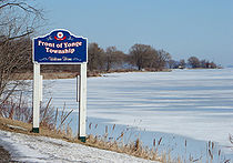
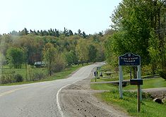
- Front of Yonge, Ontario
-
Front of Yonge — Township — Coordinates: 44°32′N 75°52′W / 44.533°N 75.867°W Country  Canada
Province  Ontario
County Leeds and Grenville Settled Incorporated Government - Reeve Roger Haley - Federal riding Leeds–Grenville - Prov. riding Leeds–Grenville Area[1] - Land 127.85 km2 (49.4 sq mi) Population (2006)[1] - Total 2,803 - Density 21.9/km2 (56.7/sq mi) Time zone EST (UTC-5) - Summer (DST) EDT (UTC-4) Postal Code K0E Area code(s) 613 Website www.frontofyonge.com Front of Yonge is a township in the Canadian province of Ontario, located within Leeds and Grenville United Counties. The township had a population of 2,639 in the Canada 2001 Census.
Contents
Communities
The township comprises the communities of Ballycanoe, Caintown, Mallorytown, Mallorytown Landing, McIntosh Mills, Trevelyan and Yonge Mills.
Mallorytown
Largest settlement area of the township is the Village of Mallorytown, founded by United Empire Loyalist Nathanial Mallory. He came ashore at Mallorytown Landing in 1784, and later moved inland in search of better farmland. This village is the site of Canada's first glassworks factory, which began in 1839, and closed in 1840. Only a few pieces of Mallorytown glass still exist, the most famous being the ‘Mallorytown Pitcher' which is on display at the Royal Ontario Museum. A reproduction of this piece is currently on display at the Mallory Coach House, an 1850's stone home which has been renovated and is open to visitors on weekends during the spring and summer months.[2]
Mallorytown Landing
On the St. Lawrence River and location of the Visitor Centre for St. Lawrence Islands National Park, which consists of several ecologically important mainland properties and more than 20 islands between Kingston and Brockville. Established in 1904 as the first Canadian national park east of the Rockies, it is also the smallest of the national parks.[3]
Demographics
Population trend:[4]
- Population in 2006: 2803 (2001 to 2006 population change: 6.2 %)
- Population in 2001: 2639
- Population in 1996: 2530
- Population in 1991: 2357
Private dwellings occupied by usual residents: 1065 (total dwellings: 1218)
Mother tongue:[1]
- English as first language: 94.8 %
- French as first language: 1.4 %
- English and French as first language: 0.4 %
- Other as first language: 3.4 %
References
External links

Athens 
Leeds and the Thousand Islands 
Elizabethtown-Kitley  Front of Yonge

Saint Lawrence River / Alexandria (New York, USA) Saint Lawrence River / Hammond (New York, USA) Categories:- Municipalities in Leeds and Grenville United Counties, Ontario
- Township municipalities in Ontario
- Eastern Ontario geography stubs
Wikimedia Foundation. 2010.


