- Reassurance marker
-
A reassurance marker or road identification sign is a road sign that repeats the name or number of the current route. Typically posted at intervals alongside a numbered highway, the signs are intended to reassure drivers that they are traveling on the desired road (or to inform them that they are not).
Contents
North America
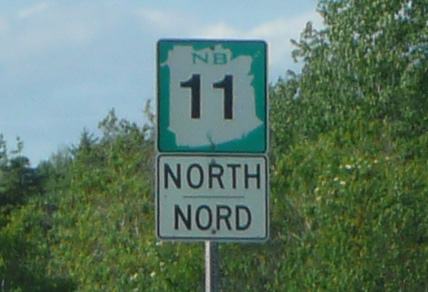
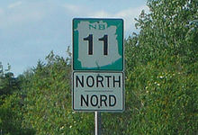 Ressurance markers on New Brunswick's provincial highways feature bilingual (English/French) direction tabs.
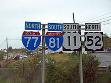
In the United States and Canada, reassurance markers (also called reassurance shields or confirming shields) usually take the form of a shield displaying the road number on an elevated pole, with a plate above or below it indicating the "official" direction of that side of the route. (The official long-range direction may differ from the short-range direction; for example, a large stretch of I-90 near Buffalo, New York runs north-south, although the route is officially east-west.) The direction portion of the sign confirms that the driver is going the right way along the desired road. On larger roads, reassurance markers are sometimes posted on a sign that is elevated on a gantry.
In the United States, reassurance shields are defined in Section 2D.31 of the Manual on Uniform Traffic Control Devices (MUTCD).[1] The MUTCD recommends that reassurance assemblies be placed:
- 25–200 feet (8–61 m) after intersections of numbered highways
- Between intersections in urban areas as needed
- After leaving the limits of any incorporated city or town
- Periodically in other places for reassurance purposes
The MUTCD requires a cardinal directional sign to be posted with the route shield to further reassure travelers that they are traveling the correct direction on their route. However, this standard is not always followed, especially in urban areas. One example of this is found in the Hampton Roads area of Virginia, where directional signs for Interstate 64 are not posted between the road's eastern terminus in Chesapeake and Interstate 264 in Norfolk, because the road travels in the opposite compass direction from its official designation (although the route in the Norfolk-to-Chesapeake direction is a continuation of I-64 east, it travels westward at that point).
Australia
Australia has followed different trends pertaining to highway shields. Alpha-numeric route numbering has been in use in Tasmania since the 1970s, but in 1996 states on the mainland began conversion to the alpha-numeric system. The state of Victoria was the first to implement the policy. Prior to this conversion and concurrently, Federal Highway (gold-on-green squared-off bullet), National Highway (black-on-white squared-off bullet), State Highway (blue bullet), and Tourist Route (white-on-brown rounded isosceles trapezoid) shields existed. In Victoria, Freeway shields were used (white-on-green with "F" prefix) until the late 1980s, while during the 1990s Queensland and New South Wales implemented a hexagonal blue-on-white Metroad system of urban arterial routes. When it opened, the M80 Ring Road used a shield similar to that of the U.S. Interstate Highway shield, with "Ring Road" written instead of "Interstate" and with two peaks rather than three.
With the introduction of the alpha-numeric system, roads that are Federally funded (Federal Highways) have a squared-off bullet encompassing the alpha-numeric designation. Freeways and dual-carriageway roads often use an "M" prefix, particularly in Victoria. In addition, trapezoidal signs are placed every 5 km on major regional highways and freeways indicating the distance to the post office of the next city or major town on the route. These signs usually only have the first letter of the destination; two or three letters are used if there is ambiguity between nearby towns or when the place name consists of two words.
New Zealand
Similar to prevalent route numbering in the Pacific region, New Zealand routes are similar to the bullet-shaped markers used in Hong Kong, but are red rather than yellow.
Europe
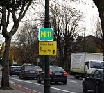 A simple identification sign attached to a lamp post on Leeson Street, Dublin, near the start of Ireland's N11
The Vienna Convention on Road Signs and Signals specifies that "road identification signs" consist of the route number framed in a rectangle, a shield, or the relevant state's route classification symbol (if one exists).[2] The extent to which such signs are used varies between countries.
In the Republic of Ireland, such signs appear normally on national routes and upgraded regional roads. Officially known as route confirmation signs, there are two variants; the smaller (featuring just the road number) is common after minor junctions, and a full route confirmation sign will feature the route number and several destinations and the distances to them (with distances not directly reached by that particular route number in brackets). Euroroute numbers have begun to appear on these signs but are not yet commonplace. On motorways and high quality dual carriageways, they appear after every junction (except on the M50, on which they are not typically used). On other national, roads they appear when leaving built-up areas. Some regional roads feature route confirmation signs, but they are not common on these roads.
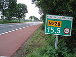
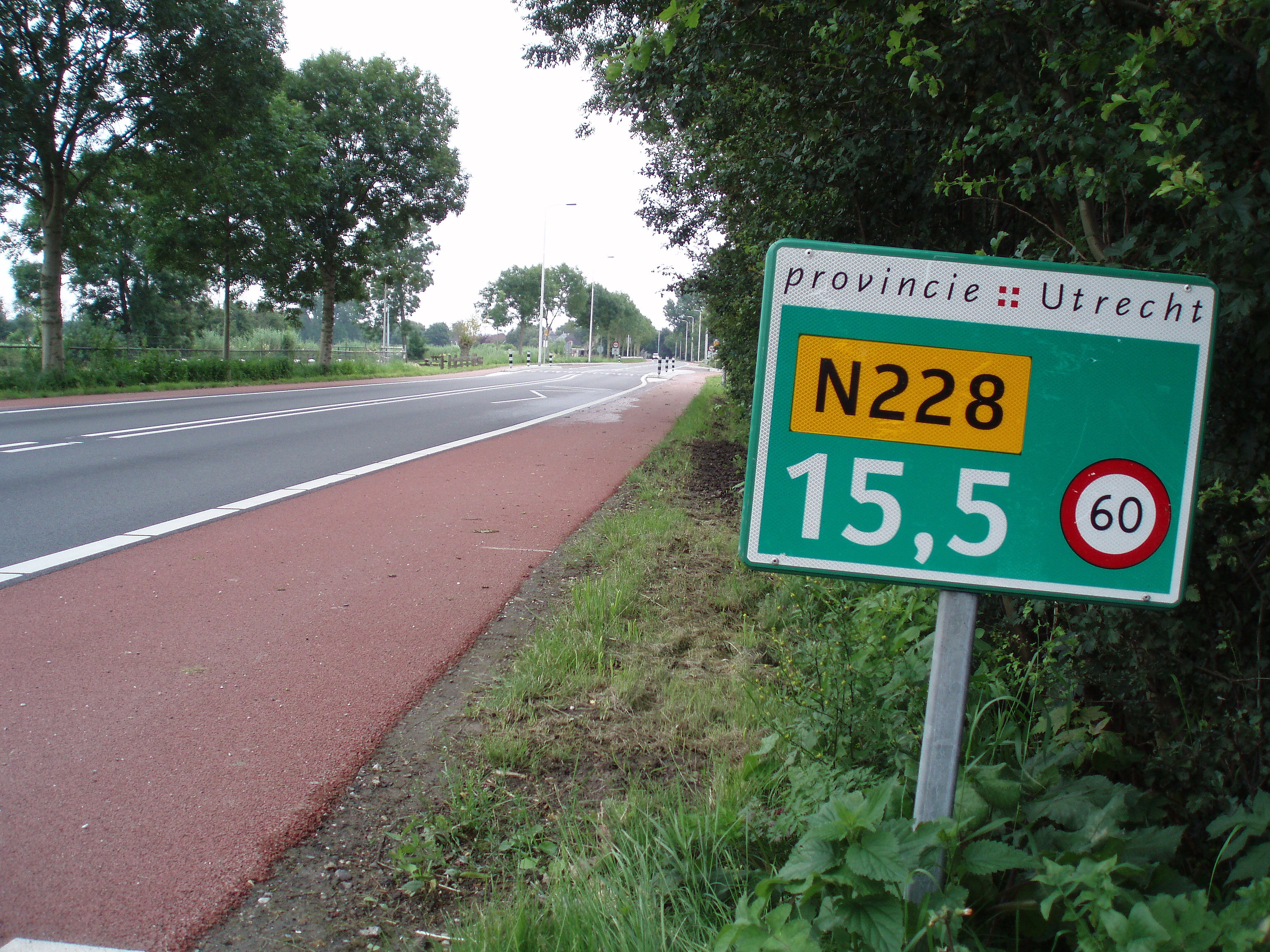
In the Netherlands, frequently-positioned hectometer posts include the route number, the distance in hectometers, and the current speed limit. In some European countries, distance posts similar to milestones are placed at regular intervals along roadsides. As well as giving the distance to or from one end of the route, these posts include the route number.
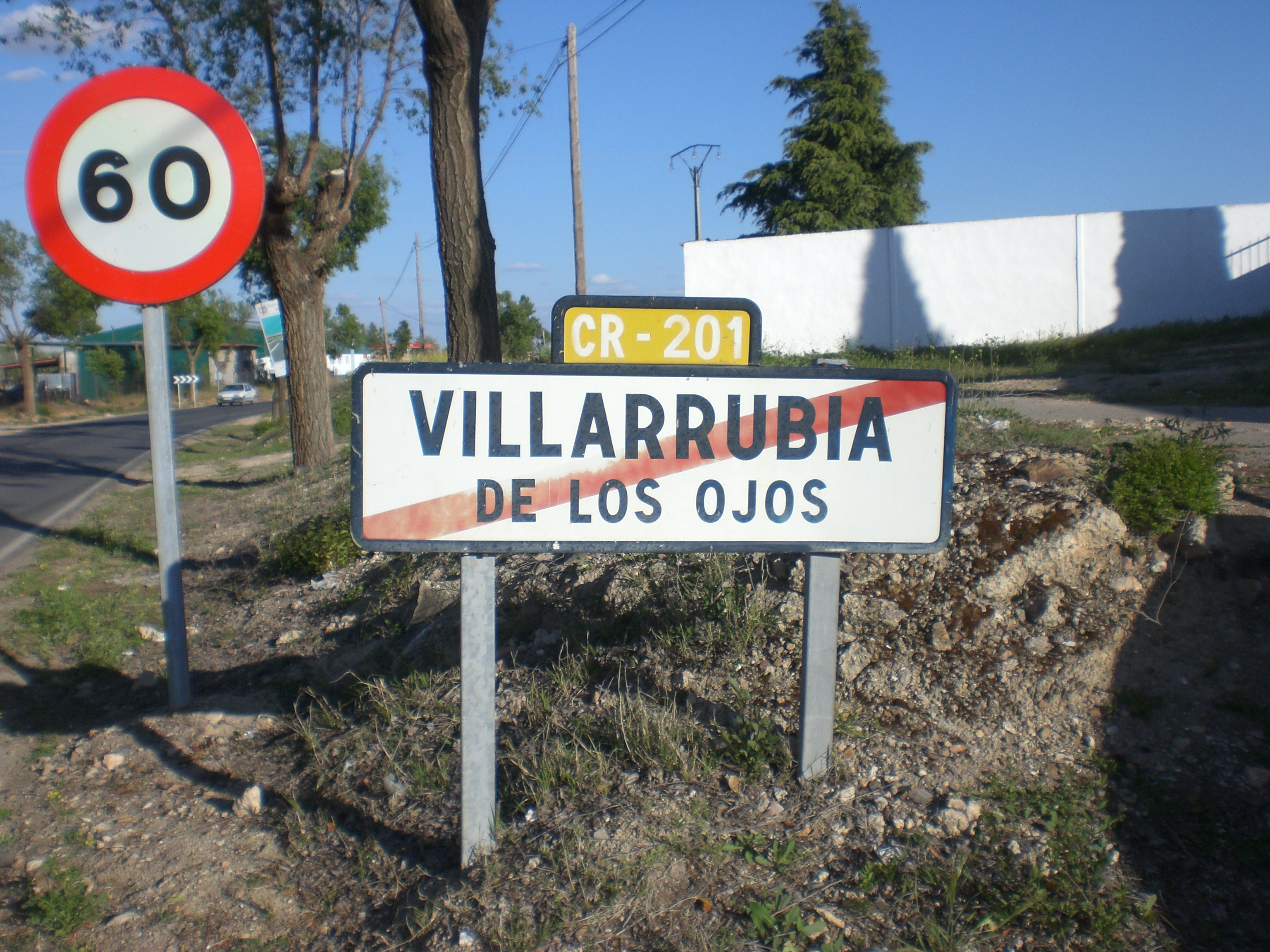
 A simple identification sign attached to a town exit sign in Villarrubia de los Ojos, Ciudad Real, Spain
References
- ^ Section 2D.31 Confirming or Reassurance Assemblies. Manual on Uniform Traffic Control Devices, 2003 ed.
- ^ "CONVENTION ON ROAD SIGNS AND SIGNALS" (PDF). United Nations. pp. Art.17; p.14. http://www.unece.org/trans/conventn/signalse.pdf. Retrieved 2007-11-17.
Categories:- Traffic signs


Wikimedia Foundation. 2010.