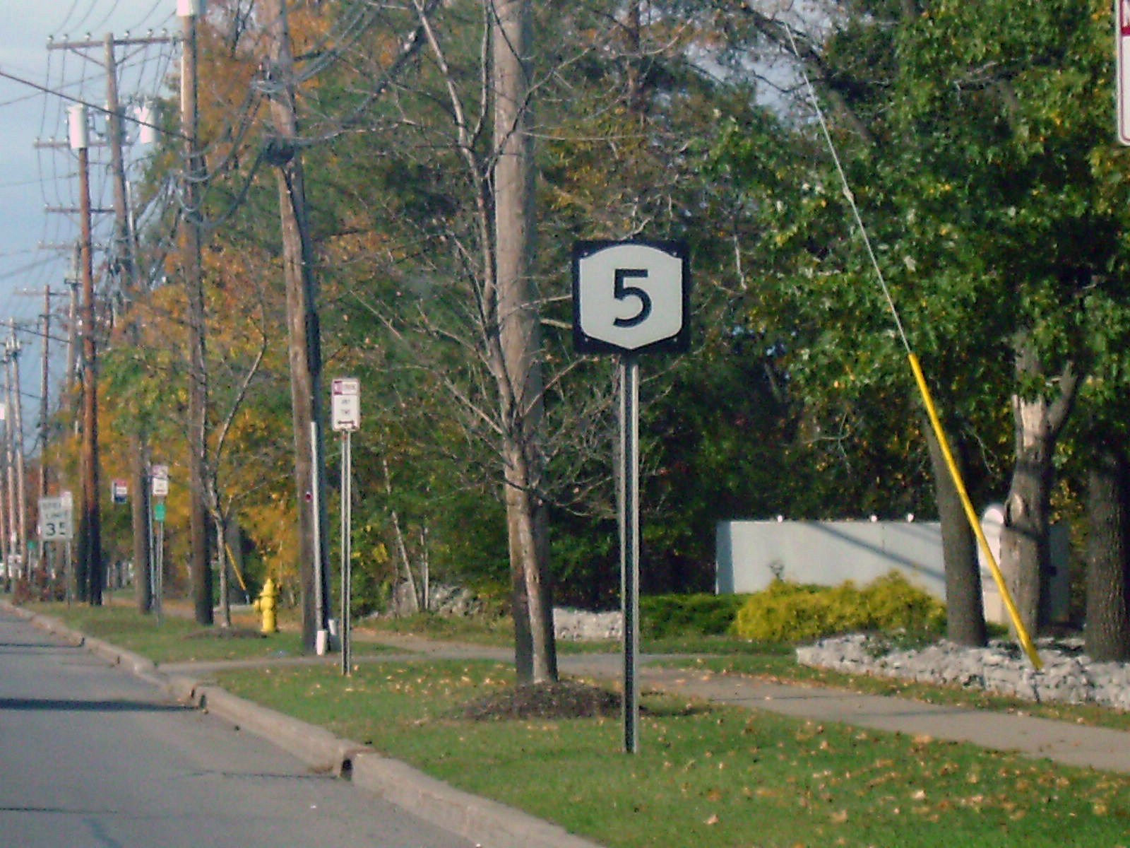
- New York State Route 5
-
NYS Route 5
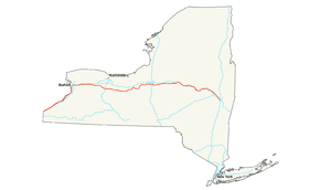
Map of New York with NY 5 highlighted in redRoute information Maintained by NYSDOT and the cities of Buffalo, Syracuse, Utica, Amsterdam, Schenectady, and Albany Length: 370.87 mi[2] (596.86 km) Existed: 1924[1] – present Major junctions West end:  PA 5 at Ripley
 US 20 in Silver Creek

 I-190 / Thruway in Buffalo


 NY 33 / NY 63 / NY 98 in Batavia

 NY 21 / NY 332 in Canandaigua
US 20 in Auburn
 US 11 in Syracuse

 NY 8 / NY 12 in Utica
 NY 7 in Schenectady
 I-87 in Colonie
East end: 
 I-787 / US 9 in Albany
Location Counties: Chautauqua, Erie, Genesee, Livingston, Ontario, Seneca, Cayuga, Onondaga, Madison, Oneida, Herkimer, Montgomery, Schenectady, Albany Highway system Numbered highways in New York
Interstate • U.S. • N.Y. (former) • Reference • County←  US 4
US 4NY 5A  →
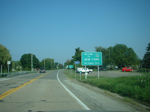
→New York State Route 5 (NY 5) is a state highway that extends for 370.87 miles (596.86 km) across the state of New York in the United States. It begins at the Pennsylvania state line in the Chautauqua County town of Ripley and passes through Buffalo, Syracuse, Utica, Schenectady, and several other smaller cities and communities on its way to downtown Albany in Albany County, where it terminates at U.S. Route 9 (US 9), here routed along the service roads for Interstate 787 (I-787). Prior to the construction of the New York State Thruway, it was one of two main east–west highways traversing upstate New York, the other being US 20. West of New York, NY 5 continues as Pennsylvania Route 5 (PA 5) to Erie.
NY 5 overlaps with US 20 twice along its routing. The second, a 68-mile (109 km) overlap through western and central New York, is the second-longest concurrency in the state, stretching from Avon east to the city of Auburn in Cayuga County. The concurrency is known locally as "Routes 5 and 20".[2][3] As the route proceeds across the state, it also directly or indirectly meets every major north–south highway in upstate New York, including all three north–south Interstate Highways (I-390 in Avon, I-81 in Syracuse via US 11, and I-87 in Albany).
NY 5 was assigned in 1924 as a true cross-state highway, extending from the Pennsylvania state line in the west to the Massachusetts state line in the east, mostly by way of modern US 20. At the time, modern NY 5 between Buffalo and Albany was designated as New York State Route 5A. By 1926, NY 5 was moved onto the routing of NY 5A while the old routing of NY 5 became NY 7. It was truncated in 1927 to Athol Springs in the west and Albany in the east following the assignment of US 20, and again in 1930 to downtown Buffalo. NY 5 was reextended to the Pennsylvania state line ca. 1932 by way of its old routing to Athol Springs, an old alignment of US 20, and a lakeside spur route of US 20 that had been assigned in 1930. Only local realignments have occurred since.
Contents
Route description
Although it is no longer commonly used for long distance travel, NY 5 is still regionally important. NY 5 is named Main Street in Buffalo, Erie Boulevard and West Genesee Street in Syracuse, State Street in Schenectady, and Central Avenue in Albany, the state capital. It is a major local road in many other locations along its path.
NY 5 runs concurrent to US 20 twice between its endpoints: for three miles (5 km) between Silver Creek and Irving and for 68 miles (109 km) across western and central New York. At 67.6 miles (108 km) in length, the eastern overlap between NY 5 and US 20 is the longest surface-road concurrency in New York State, behind only the concurrency of NY 17 and I-86 in the Southern Tier. When the length of east–west NY 17 is officially designated I-86 (scheduled for 2012), NY 17 will be truncated to a short north–south segment in downstate and the Routes 5 and 20 concurrency will become the longest in the state. In addition, NY 5 will then overtake NY 17 as the longest New York state route.
 The western terminus of NY 5 at the Pennsylvania state line, from where the first reference and reassurance markers on NY 5 eastbound are visible.
Maintenance of the majority of NY 5's 371 miles (597 km) is performed by the New York State Department of Transportation. However, locally-owned and maintained sections exist in six cities. The city-maintained sections of NY 5 are in Buffalo from NY 16 north to the city line (except of the Goodell Street portion, which is state-maintained);[4] in Syracuse between the western city line and just west of NY 635;[5] in Utica from Leland Avenue east to the city line;[6] in Amsterdam between Division and West Main Streets;[7] in Schenectady from Washington Avenue to the eastern city line;[8] and the entirety of NY 5 within Albany.[9]
Pennsylvania to Buffalo
At the New York – Pennsylvania border in Ripley, PA 5 becomes NY 5 upon entering New York. It very closely follows the shore of Lake Erie through all of Chautauqua County. Once reaching the village of Silver Creek it briefly overlaps US 20 until entering Erie County at the Cattaraugus Reservation and Route 438 where the roads once again split. Once in Erie County it pulls slightly inward from the lake shore from Brant to the hamlet of Wanakah. Once past Wanakah, the road once again closely borders the lake shore and goes through steadily more heavily developed areas, particularly the Ford Stamping Plant and the Bethlehem Steel plant in the city of Lackawanna where the road is called the Hamburg Turnpike and eight wind powered turbines, which pump power into the national grid are visible. Near the northern edge of the city, NY 5 begins to ascend onto an elevated roadway as connects to Ridge Road by way of an interchange. Here, the route becomes the Skyway. After a quarter-mile, NY 5 passes seamlessly into Buffalo.[10]

A short distance past the city line, NY 5 passes over the Union Ship Canal on a span of the elevated road known as the Father Baker Bridge. North of the waterway, the Skyway gains a pair of frontage roads, both named Fuhrmann Boulevard. Both the service roads and the Skyway run parallel to Lake Erie until the northern end of the Buffalo Outer Harbor. Here, the frontage roads end while NY 5 turns to the northeast, crossing the Buffalo River and entering downtown. On the north bank, the Skyway returns to a northerly routing as it passes First Niagara Center, located directly to the east, and Buffalo and Erie County Naval & Military Park, situated to the west, and meets I-190 at exit 7. Past the interchange, the Skyway ends and the route descends in elevation, becoming an at-grade roadway once more at Church Street in the shadow of Buffalo City Hall. NY 384 begins here, following Delaware Avenue north into the heart of downtown, while NY 5 turns east onto Church.[10]
At Main Street, Church Street splits into a pair of one-way streets and becomes North and South Division Street. The route follows South Division eastward for two blocks to an intersection with Ellicott Street located one block north of Coca-Cola Field. At the junction, which includes the northern terminus of NY 16, NY 5 turns northward, rejoining NY 5 westbound one block later at North Division. The route continues on Ellicott for nine blocks to the unidirectional East Tupper Street, where NY 5 westbound separates from the route once more. NY 5 eastbound, however, continues north on Ellicott for an additional block to the one-way Goodell Street. NY 5 heads west on Goodell for two blocks before turning north onto Main Street, rejoining NY 5 westbound at the intersection.[10]
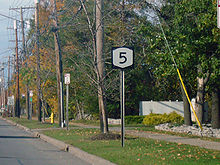
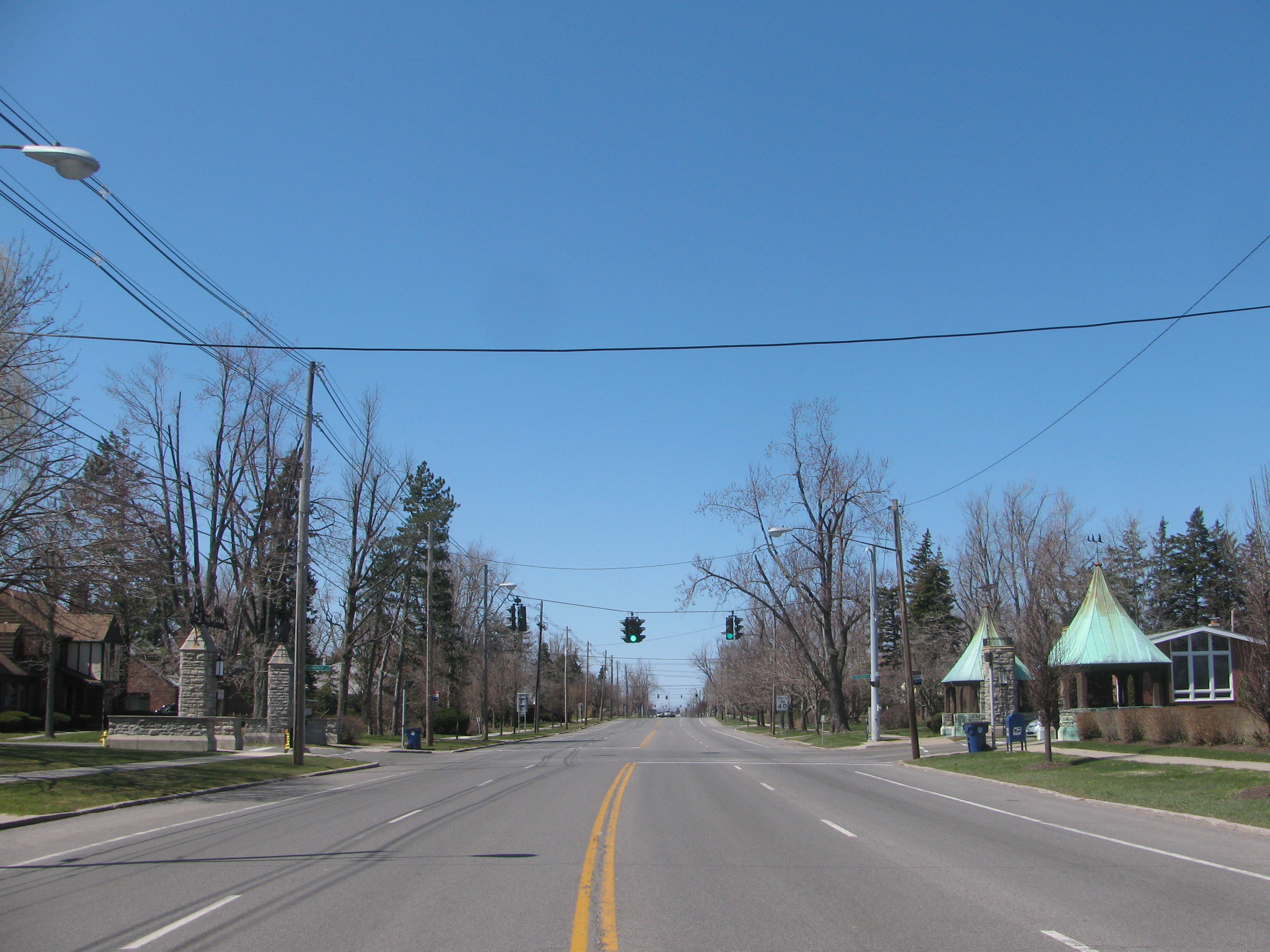
 NY 5 heading past the Register of Historic Places-listed Entranceways at Main Street at Lamarck Drive and Smallwood Drive in Snyder
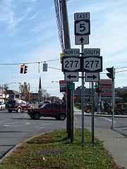
The route continues along Main Street throughout the remainder of its length in Buffalo, cutting through the city diagonally from southwest to northeast until it enters the town of Amherst at the intersection of Bailey Avenue (US 62) at the south campus of the University at Buffalo.[10]
Buffalo to Avon
Once leaving the city of Buffalo, NY 5 heads east through the densely populated suburban town of Amherst, including the hamlets of Snyder and Eggertsville and the village of Williamsville and is heavily developed through the entire length of the town, particularly at the intersection with Transit Road (NY 78). In the town of Clarence, the road dips into a significant depression known as Clarence Hollow. Once leaving Clarence, NY 5 goes through predominantly rural areas until reaching the city of Batavia in Genesee County, closely paralleling the New York State Thruway through much of the county. The road travels eastward until reaching Livingston County and the village of Caledonia.[10]
NY 5 heads southeast from the village of Caledonia, paralleling the former right-of-way of an Erie-Lackawanna Railroad branch line that connected the villages of Caledonia and Avon as it heads through spacious fields containing little more than farmland. At a rural intersection controlled by single-head flashing traffic signals west of Avon, NY 5 meets US 20 for the second time. The routes embark on a second concurrency, merging onto the right-of-way of NY 5 as they cross the Genesee River and enter both the town and village of Avon.[10]
Avon to Ontario County
NY 5 and US 20 become West Main Street upon entering the village, underscoring the road's status as the primary east–west highway through the town. The route continues southeast from the Genesee, passing through the forested but sparsely populated western area of the village. As the route approaches the Livonia, Avon and Lakeville Railroad (LAL) grade crossing, the number of homes increases rapidly, only to be replaced by businesses in the area surrounding the LAL mainline. Located on the western edge of this transition is NY 39, which terminates at this junction. Past the tracks, West Main intersects Rochester Street, a locally important north–south two-lane arterial that continues north of the village to the Rochester suburb of Brighton as East River Road. Shortly after this intersection, the homes return, following NY 5 and US 20 as West Main enters the heart of the village.[10]
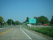
 US 20 and NY 5 eastbound at NY 444 near Bloomfield
In the center of Avon, West Main feeds into Park Place, a large traffic circle providing access to two local streets from NY 5 and US 20. The routes follow the circle counter-clockwise, departing the roundabout on East Main Street. The street proceeds east, passing through four blocks of densely populated neighborhoods before exiting the village and abruptly entering vast, barren fields to the east. NY 5 and US 20, now named Avon-Lima Road, intersects NY 15 two miles (3 km) to the east in East Avon, a community based around the intersection and the streets comprising it, and connects to I-390 at exit 10 a half-mile from NY 15. Continuing on, the road intersects a number of county routes over the next four miles (6 km) before becoming West Main Street once more, this time for the village of Lima. At an intersection with NY 15A in the village center, NY 5 and US 20 become East Main Street, retaining the name to the Ontario County line at Honeoye Creek.[10]
Western Ontario County
In the town of West Bloomfield, Routes 5 and 20 go unnamed as they proceed eastward. Roughly one mile from the county line in the hamlet of West Bloomfield, Routes 5 and 20 meet the southern terminus of NY 65. Exiting the hamlet, NY 5 and US 20 head through another area dominated by open land, intersecting County Route 38 (CR 38) before passing seamlessly into East Bloomfield. A mile and a half from the town line, Routes 5 and 20 intersect NY 64, a road running northwest–southeast from the Monroe County line south to NY 5 and US 20. NY 64, whose right-of-way ends at Routes 5 and 20 at the foot of a small hill, joins the two routes eastward on a triple overlap, entering the village of Bloomfield and intersecting the southern terminus of NY 444 south of the portion of Bloomfield once known as Holcomb. Near the junction with NY 444, Routes 5, 20 and 64 take on a due east alignment, absorbing the routing used by Gauss Road west of this point.[10]
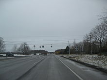 West end of the NY 21 overlap as seen from US 20 and NY 5 westbound
A mile to the east at Whalen Road, NY 64 separates from NY 5 and US 20, following the road, and US 20A, which has its eastern terminus at this intersection, south toward Bristol. Routes 5 and 20 continue on through rural Ontario County before splitting from its easterly alignment at an intersection four miles (6 km) west of NY 64 and US 20A in the town of Canandaigua. West Avenue, the former routing of NY 5 and US 20 into downtown Canandaigua, continues east from the junction while NY 5 and US 20 turn south onto a bypass around Canandaigua.[10]
Canandaigua area
Half a mile from the start of the bypass and a short distance before the arterial makes a turn eastward to traverse Canandaigua Lake to the southeast, NY 5 and US 20 meet NY 21 at a four-way intersection. Like Routes 5 and 20, NY 21 once continued directly into downtown, in this instance via Bristol Street to the east of the junction, but now follows Routes 5 and 20 along the east–west leg of the bypass. Past Bristol Street, the bypass widens from two to four lanes and, after meeting two local streets, enters the city of Canandaigua as the limited-access Western Boulevard, albeit with no exits. The route loses this distinction prior to intersecting South Main Street, where Routes 5 and 20 meet the southern terminus of NY 332. NY 21 departs the bypass, following NY 332 into downtown, while NY 5 and US 20 continue onto the four-laned, median separated Eastern Boulevard, the original section of the Routes 5 and 20 bypass of Canandaigua. The roadway acts a center of commerce for the city, sporting restaurants, hotels, and supermarkets along its length within the city limits.[10]
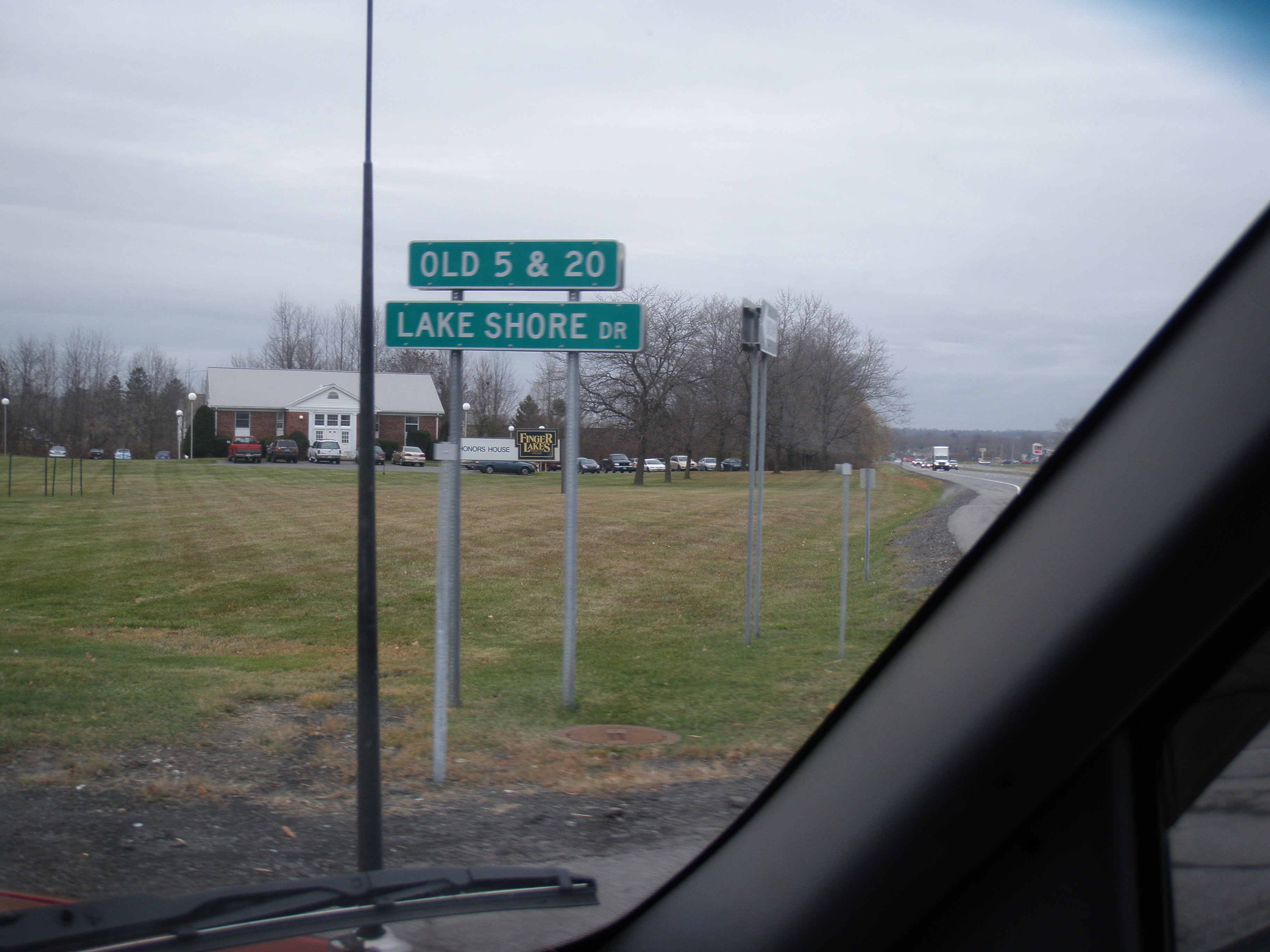
Upon exiting the city, the establishments become a pair of shopping plazas centered around the intersection with the northern terminus of NY 364. Across the town line in Hopewell a quarter-mile to the east, a third plaza, once anchored by a Wal-Mart, dominates the northeast corner of County Road 10 and Eastern Boulevard. On the adjacent parcel is another plaza containing a new Wal-Mart. At the entrance to the second plaza, Routes 5 and 20 intersect Lakeshore Drive, the former routing of NY 5 and US 20 to the south of the bypass. Past the junction, the divided highway comes to an end and, after another half-mile, narrows to two lanes.[10]
Canandaigua to Auburn
Deeper into Hopewell, the area surrounding Routes 5 and 20 become rural once more. Roughly 1.5 miles (2.4 km) from the end of the bypass, NY 5 and US 20 meet NY 247. After 10.3 miles (16.6 km) of eastward progression through open land, the routes meet the northern terminus of both NY 14A and NY 245, concurrent at this location, in the town of Geneva. A half-mile past NY 14A and NY 245, Routes 5 and 20 enter the city of Geneva and widens into a four lane road. In the city, NY 5 and US 20 intersect NY 14 by way of a pseudo-interchange on the bank of Seneca Lake. Routes 5 and 20 turn into a divided highway again at this point. At the interchange, NY 14 Truck joins Routes 5 and 20, bypassing a sharp turn on NY 14 downtown. NY 5 and US 20 continues as a divided highway around the northern tip of Seneca Lake, crossing the Preemption Line and entering Seneca County at its midpoint. A mile to the east in East Geneva, just east of a railroad underpass, Routes 5 and 20 meet the northern terminus of NY 96A at a former trumpet interchange that has been converted to an intersection with a traffic signal.[10]
From NY 96A east to the village of Waterloo, a distance of roughly four miles, Routes 5 and 20 becomes a two lane road and runs parallel to the Cayuga-Seneca Canal. In Waterloo, the concurrency meets NY 96 in the village center. East of the village, the distance between the canal and the roadway decreases, making NY 5 and US 20 the closest road to the water for the next one and a half miles to NY 414 in the town of Seneca Falls. NY 414 joins NY 5 and US 20, overlapping the road for 4.3 miles (6.9 km) into the village of Seneca Falls. At Cayuga Street, NY 414 turns south, crossing the water body that is the canal and the Seneca River and becoming Ovid Street while NY 5 and US 20 turns north onto Cayuga, following the street around the small Van Cleef Lake, through the Finger Lakes Railway grade crossing, and exiting the village. Three miles from NY 414, just west of Montezuma National Wildlife Refuge, NY 5 and US 20 meets NY 318 and NY 89 at intersections close enough to be considered a single junction. The intersection with Route 89 has a traffic signal.[10]
About three miles (5 km) later, after entering Cayuga County over the Seneca River/Cayuga and Seneca Canal, just north of Cayuga Lake, the two routes meet NY 90 in the town of Aurelius, at a traffic signal. A few miles east of that intersection, the highway meets the Finger Lakes Railway again, but crosses it via an overpass. The routes continue eastward through Aurelius to the city of Auburn where it turns into a divided four lane highway again. On the western edge of the city, just after passing Finger Lakes Mall, NY 5 and US 20 meet the eastern terminus of NY 326, which is also a four lane divided highway for a short stretch. In downtown Auburn, NY 5 and US 20's east and west lanes split apart from each other for a short distance as an arterial over the alignments of Clark Street, Franklin Street, and Grant Avenue. The arterial runs concurrent with NY 38 for 0.2 miles (0.3 km). NY 38 then splits from the concurrency and joins NY 34. A quarter-mile to the east, US 20 separates from NY 5 at the northern terminus of NY 38A. Route 5 continues on after the split as the four-lane Grant Avenue passing by a high number shopping areas.[10]
Auburn to Syracuse
From NY 174 in Camillus to Fairmount, NY 5 is a 5-mile (8 km) limited-access highway traversing the western suburbs of Syracuse. At one time, the highway was to be extended to West Street in Syracuse, via the current Grand Avenue.[11] The freeway has partial access to NY 173 from westbound NY 5. East of NY 173, the freeway connects to NY 695 at a directional-T interchange and passes over NY 297 without access. East of Fairmount, NY 5 alters to the south before turning east onto West Genesee Street and converting to grade-level intersections.[12]

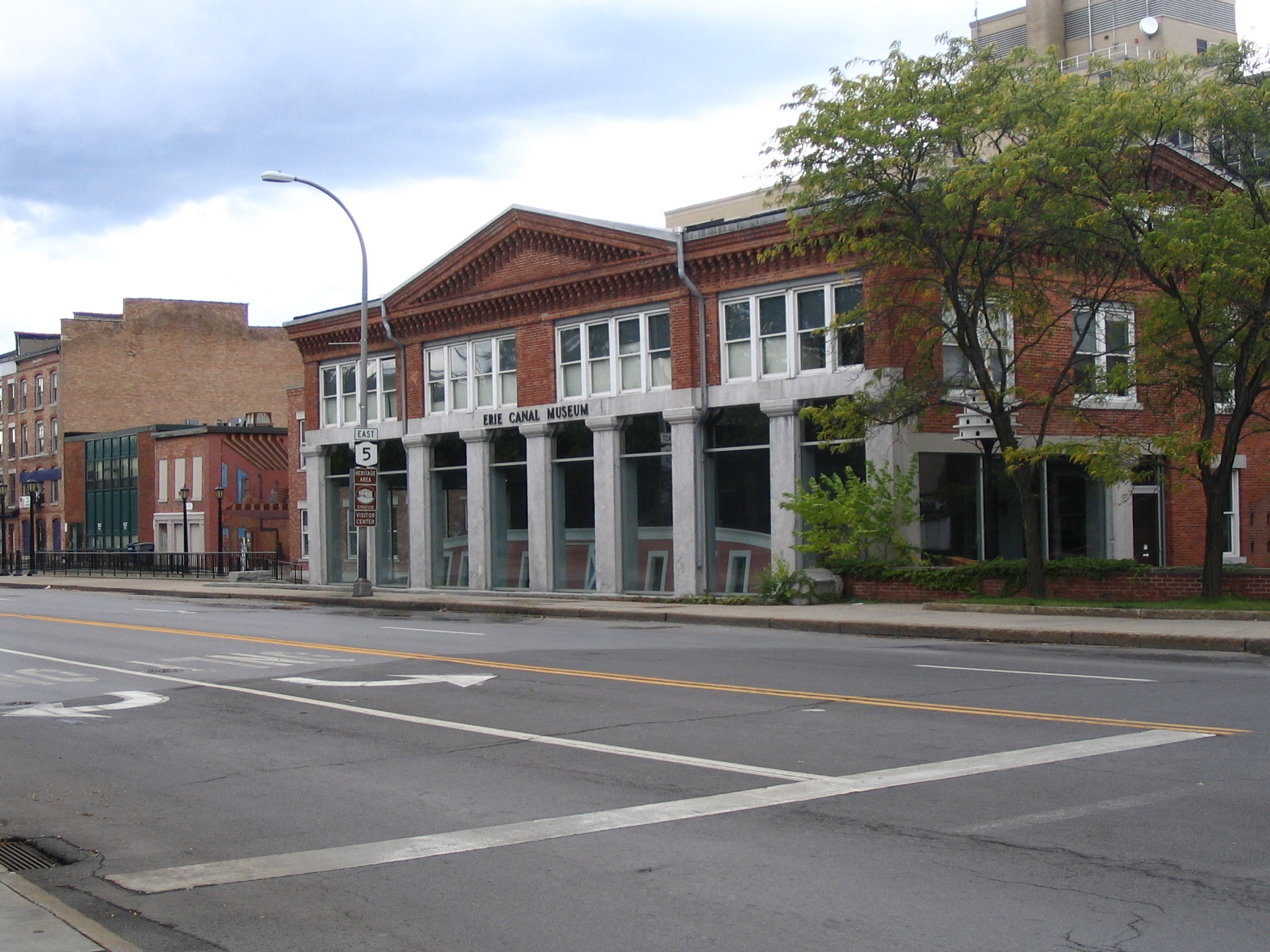
In Syracuse, NY 5 is parallel to I-690 for much of its routing but never encounters the highway, thus making the north–south streets that intersect NY 5 entry points to and from I-690. In downtown Syracuse, West Genesee Street becomes James Street. At the southern tip of the interchange between I-690 and I-81, NY 5 transfers onto Erie Boulevard and intersects State Street (US 11), but passes under I-81 without access.[12] From the downtown area to DeWitt, NY 5 is divided.[13] At the Syracuse-DeWitt boundary, NY 5 intersects NY 635 and eastward, it curves to a southeast course. Near Shoppingtown Mall, NY 5 turns east onto Genesee Street to begin an overlap with NY 92. Less than a mile east of the mall, NY 5 and NY 92 intersect I-481 at a cloverleaf interchange.[14]
Syracuse to Utica
NY 5 and NY 92 remain concurrent up to Highbridge Road, where NY 92 splits from NY 5 and heads southeast to Manlius. The segment of the overlap with NY 92 between I-481 and the eastern split is the busiest area of NY 5 in the Syracuse area and in all of Onondaga County.[15] Past the split, NY 5 continues east through Onondaga and Madison counties, passing Fayetteville, Chittenango, and Canastota before entering the vicinity of Oneida. West of the city, NY 5 intersects NY 365A, a spur route of NY 365 leading directly into downtown. To the east, NY 5 (which forms the southern boundary of the city) meets NY 46 before crossing over Oneida Creek and into Oneida County.[10]
Just past the county line in Oneida Castle, NY 5 intersects NY 365, a route leading northward to the New York State Thruway in Verona. NY 5 presses on, passing through the villages of Sherrill and Vernon (briefly overlapping NY 31) and the town of Westmoreland to the town of Kirkland, where NY 5 intersects NY 233, crosses over Oriskany Creek, and meets the western terminus of NY 5B. The spur of NY 5 later rejoins its parent yards from where NY 5A departs NY 5 to serve western Utica. NY 5 itself continues eastward through New Hartford, meeting NY 12B prior to merging with NY 12 at Genesee Street. Both routes continue eastward across the Sauquoit Creek into Utica.[10]
Utica to Albany
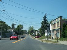
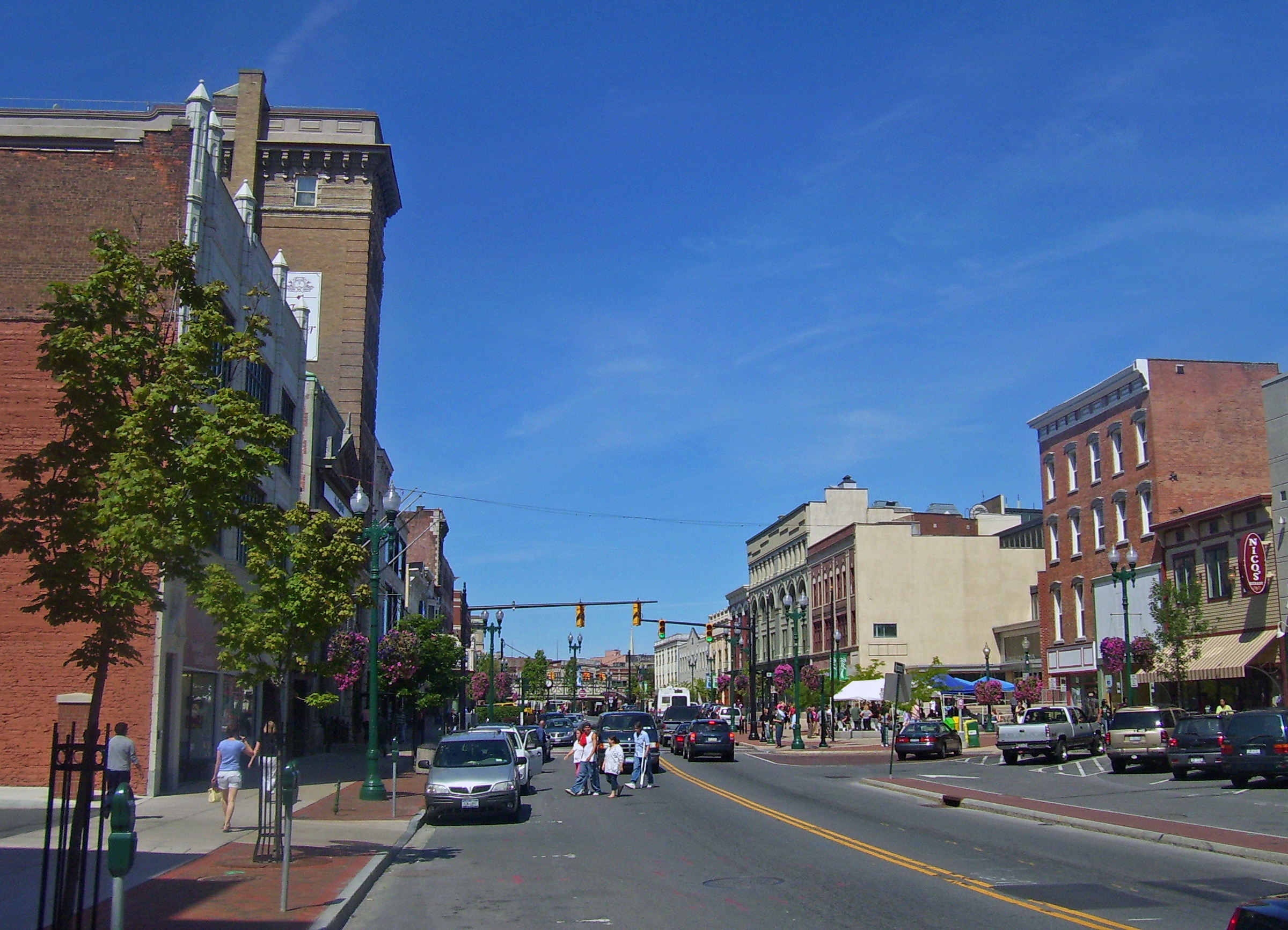
 State Street in downtown Schenectady
NY 5 enters the city of Utica on a concurrency with NY 12 heading in a northeast direction. It shortly picks up NY 8, and all three cross the city together. NY 5 also intersects with the terminus of NY 840 at this point. Just south of the New York State Thruway, I-790 begins as a short expressway, also including NY 5, 8, and 12. After crossing out of the city, they meet the Thruway, with NY 8 and 12 continuing northeast, while NY 5 and I-790 turn to the east-south-east, picking up the tail-end of NY 49. These three, still as an expressway, straddle each side of the Thruway for a short way, with I-790 technically ending at the ramps for I-90. NY 5 continues to the end of the expressway, only a few hundred feet later, dropping to Leland Avenue. A few hundred feet to the north of the Thruway, NY 5 turns eastward again to continue down Herkimer Road. It closely parallels the Thruway all the way to Herkimer, where NY 5 moves slightly northward through the center of the village, becoming State Street, while I-90 crosses the Erie Canal and goes south for a short distance. There is a short concurrency with NY 28 in the village.[10]
After exiting Herkimer, NY 5 continues east, closely paralleling this time the canal, through the city of Little Falls as Main Street, where two more concurrencies occur, with NY 167 and NY 169. Route 5 continues to parallel the canal, and in some instances again, the Thruway, through Amsterdam, becoming Amsterdam Road all the way to Scotia, where it crosses the canal into Schenectady as Mohawk Avenue, turning into State Street upon entering the city limits. It continues fairly straight on a southeast course into Albany as Central Avenue until it reaches Townsend Park. At this point, Route 5 turns into Washington Avenue and all signage referring to NY 5 ceases. The New York State Department of Transportation recognizes the route, however, as it continues down Washington Ave past the New York State Capitol building, turning south for a short distance as Eagle Street. NY 5 then continues east on State Street to Broadway, where it again turns south east shortly before returning east on a small spur of Broadway, traveling underneath US 9 and I-787. NY 5 ends at the Hudson River.[10]
History
Early roads
Soon after the end of the American Revolution in 1783, a surge of westward migration into Central and Western New York began. At the time, most travel west of the Albany area was by water. While rudimentary roads were laid out following the Mohawk River, there were no major land routes west of Fort Schuyler (present day Utica), except for an old east–west Iroquois trail that was a simple foot path. By the late 1780s many companies began to set up their operations in the new settlements in the Central and Western New York. As a result, there was a clamor for the building of a main road running west from Utica.[16]
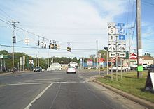 Junction of NY 5 and NY 46 in Oneida
On March 22, 1794, the New York State Legislature passed a law calling for the laying out and improvement of a public road from old Fort Schuyler on the Mohawk River to the settlement of Canawaugus on the Genesee River, in as straight a line as the topography of the land would allow. This road was officially known as the "Great Genesee Road" and is one of the earliest state roads in New York,[16] intended to provide access to the New Military Tract. As planned, it generally followed the old Iroquois trail through Oneida, Manlius, Onondaga Valley (south of modern Syracuse), Skaneateles, Auburn, Seneca Falls, Geneva, and Canandaigua[17] before ending at the Genesee River. Four years later, another legislative act authorized the extension of the Genesee Road to Buffalo.[16]
By the end of the 18th century, while the Genesee Road had been greatly improved and saw heavy traffic, many portions were still substandard and some sections had still not been completed.[17][18] Partly because of this, and also because of the success of the Lancaster Turnpike in Pennsylvania, the state outsourced the task of improving and maintaining the Genesee Road to a private company. On April 1, 1800, the Seneca Road Company was chartered for this purpose and the portion of the Genesee Road from Utica to Canandaigua was improved and operated as a toll road known as the Seneca Turnpike,[18] which was 157 miles (253 km) long and, at the time, the longest turnpike in the state.[17][19] Three days later, the old road following the Mohawk River between Utica and Schenectady also became a turnpike, known as the Mohawk Turnpike.[18]
With the road leading from Albany northwest to Schenectady having been already established as a turnpike (the Albany and Schenectady Turnpike) in 1797, an all-turnpike route over good quality roads was now available from Albany to Canandaigua. The western extension of the Genesee Road to Buffalo soon followed suit and also became an improved Macadam toll road,[20] the Ontario and Genesee Turnpike, in 1805. The Seneca Road Company was authorized to create a more northerly alternate route of the Seneca Turnpike in 1806.[21] This branch left the original turnpike east of Seneca Falls and crossed more level terrain through Elbridge, Geddes, and Fayetteville before rejoining the old path at Chittenango.[17][19] As the city of Syracuse developed, traffic patterns changed and the northern branch route became more heavily used than the original road.[21]
The construction and opening of the Erie Canal in 1825 along the same alignment as the Albany to Buffalo route began to eat away at the revenues of these turnpike companies. In time, the turnpike business had become unprofitable and the companies were dissolved by 1852, causing the roads to revert to public control.[21] The Seneca Road Company dissolved in 1852. The old, southern path of the Seneca Turnpike is now Franklin Street and Old Seneca Turnpike from Auburn to Marcellus, NY 175 between Marcellus and Onondaga Hill, and NY 173 from there east to Chittenango.[17][19]
Designation
The improvement of the road from Buffalo southwest to Pennsylvania in the mid-19th century soon allowed for continuous travel across the entire state of New York. With the advent of the automobile, the state began to take over and pave major throughfares at the beginning of the 20th century. In 1908, the state legislature created a statewide system of unsigned legislative routes. One of the routes assigned at this time was Route 6, an Albany–Buffalo highway that followed the path of the Genesee Road and the Seneca Turnpike from Buffalo to Utica, the Mohawk Turnpike between Utica and Schenectady, and the Albany and Schenectady Turnpike from Schenectady to Albany. From Auburn to Chittenango, Route 6 utilized most of the newer, northern branch of the Seneca Turnpike.[22][23]
The automobile allowed people to quickly travel long distances and a way to mark routes became needed. One early means of marking routes was the establishment of various auto trail associations in the 1910s. These associations selected good quality roads and marked them with symbols or colors on telephone poles. Most of legislative Route 6 eventually became part of the Yellowstone Trail,[24] a cross-country auto trail established in 1912 that ran from Washington to Massachusetts.[25] In New York, the trail used modern US 20 from Pennsylvania to Silver Creek, most of modern NY 5 from Silver Creek to Albany, and modern US 20 again from Albany to Massachusetts.[24]
In 1924, following what other states did, New York began to assign route numbers to its main thoroughfares. The Albany to Buffalo portion of the Yellowstone Trail, which ran through the cities of Syracuse and Utica, was assigned the number NY 5A. The portion of the Yellowstone Trail southwest of Buffalo and east of Albany became part of NY 5, which bypassed Syracuse and Utica to the south. The Buffalo to Albany portion of NY 5's original alignment used a new road, Broadway Road, from Buffalo to Avon and the old Cherry Valley Turnpike alignment from Skaneateles to Albany. In between Avon and Skaneateles, NY 5 and 5A overlapped.[1][24]
By 1926, however, the Buffalo to Albany section of Route 5 was relocated onto the Genesee Road alignment, replacing NY 5A. NY 5's former, more southerly alignment was redesignated as NY 7.[24] In 1927, the establishment of the U.S. Highway System created more numbering changes. US 20, which mainly followed the Yellowstone Trail elsewhere in the country, was designated in New York along NY 5 southwest of Hamburg and east of Albany and along old NY 7 from Skaneateles to Albany. Between the towns of Hamburg and Avon, the new US 20 used an even more southerly alignment, running via East Aurora and Warsaw. This truncated both ends of NY 5 to Athol Springs (south of Buffalo in the town of Hamburg) in the west, and to Albany in the east.[26]
In the 1930 state highway renumbering, NY 5 was truncated even further to begin in downtown Buffalo. The portion between Buffalo and Athol Springs was assigned as part of NY 62.[27] Southwest of Buffalo, Southwestern Boulevard, an alternate route of US 20 between Irving and Big Tree (east of Athol Springs) became NY 20B.[28] Further southwest, another alternate route of US 20 between the Pennsylvania line and Silver Creek, running along the shore of Lake Erie, was designated as NY 20A.[27] The NY 20A and NY 20B designations proved to be short-lived. Ca. 1932, US 62 was extended into New York, causing NY 62 to be renumbered. Around the same time, US 20 was realigned to follow NY 20B from Irving to Big Tree. NY 5 was extended along part of old NY 62 to Athol Springs, from where it continued to the Pennsylvania state line by way of US 20's old routing to Irving and all of NY 20A.[29][30]
Expressway relocations
Originally, NY 5 entered Buffalo from the south on Fuhrmann Boulevard and Michigan Avenue and followed South Park Avenue and Main Street through the city before rejoining its modern alignment at Goodell Street. In the mid-1950s, a new limited-access highway was constructed along Fuhrmann Boulevard from Lackawanna to the Buffalo River. At the river, the new roadway broke from Fuhrmann and continued directly into downtown, returning to grade level two blocks south of Niagara Square. The expressway, known as the Buffalo Skyway, became part of a rerouted NY 5 by 1956.[31][32] Visually, the Skyway cuts off the city from the Buffalo inner harbor. In 2008, there was momentum to tear it down, but the momentum has passed.[33]
 Approaching Genesee Street on NY 174 northbound in Camillus. Until the Camillus Bypass was constructed, NY 5 followed Genesee Street and NY 174 ended at this junction.
Farther east in Utica, construction began in the early 1950s on a new arterial highway—known as the North–South Arterial—through the city center. The new roadway bypassed NY 5, which was initially routed on Genesee Street and Herkimer Road through Utica.[31][34] The first portion of the highway to open was the segment north of River Road, which was completed by 1956.[32] It was extended southward to Oriskany Street (NY 5A) by 1961[35] and completed entirely by 1964, at which time it became part of a rerouted NY 5 and NY 12.[36] Two portions of Genesee Street, from NY 12 in New Hartford to the Utica city line and from NY 5S to Herkimer Road in Utica, remain state maintained to this day as unsigned NY 921E and NY 921C, respectively.[37]
In the Syracuse suburbs of Camillus and Geddes, NY 5 was initially routed on West Genesee Street between the villages of Camillus and Solvay.[38] Construction on a bypass of this segment of NY 5 began in the early 1970s[39][40] and was completed between NY 695 and Genesee Street by 1977.[41] By the following year, the freeway was open to traffic up to Hinsdale Road; however, NY 5 remained on Genesee Street between Hinsdale and the Solvay village limits.[42] The remainder of the Camillus Bypass was completed ca. 1979, at which time NY 5 was realigned to follow the freeway.[42][43] Genesee Street is now largely maintained by Onondaga County as CR 98; however, two portions of the street remain state maintained. Near the western end of the expressway, the former routing of NY 5 became part of an extended NY 174.[44][45] Between the Camillus town line and the eastern end of the bypass, Genesee Street is unsigned NY 930W.[37]
 Lakeshore Drive in Canandaigua
Smaller realignments also took place in other cities along the route. In Canandaigua, NY 5 originally entered the city on West Avenue and followed South Main Street and Lakeshore Drive through the city limits before rejoining its current routing in Hopewell. In the mid-1950s, a new bypass was built north of Lakeshore Drive from South Main Street to Hopewell. It became part of a realigned NY 5 by 1956.[31][32] The remainder of the bypass around the southwestern extents of the city was built in the late 1970s and early 1980s.[43][46] The former routing of NY 5 on South Main Street remains state maintained as NY 942T;[37] until 1996, the portion of West Avenue between the west end of the bypass and the Canandaigua city line was maintained by the New York State Department of Transportation (NYSDOT) as NY 942W. Even though maintenance of the road had been transferred to the town of Canandaigua in 1996,[47][48] the designation remained in NYSDOT documents until 2007.[49][50]
In Geneva, NY 5 was initially routed on East North Street and Border City Road, overlapping NY 14 through the city and rejoining its modern routing in East Geneva.[28] The overlap was eliminated ca. 1931 when NY 5 was moved onto a new roadway located along the edge of Seneca Lake.[28][29] NY 5 was realigned again in the 1960s to use a new divided highway built midway between the lake shore road and Border City Road.[51][38] Border City Road is now maintained by Seneca County as CR 110.[52]
Suffixed routes
NY 5 has three suffixed routes, all located in Oneida County, with NY 5S extending eastward into three other counties. The NY 5A designation was also used for two other routes.
- The NY 5A designation has been used for three distinct highways:
- The first NY 5A was a short-lived designation for the portion of modern NY 5 east of Buffalo. When it existed from 1924 to the mid-1920s, NY 5 was routed on what is now US 20.[1][24]
- The second NY 5A was a northerly alternate route of NY 5 between Aurelius and Sennett in Cayuga County. It was assigned ca. 1933[30][53] and renumbered to NY 135 ca. 1937.[54][55] That route was removed ca. 1939.[56][57] Its former routing is now maintained by Cayuga County as CR 10A, CR 10B, and CR 10C.[58][59]
- The current NY 5A (5.65 miles or 9.09 kilometres) is a short alternate route of NY 5 between New Hartford and downtown Utica in Oneida County.[2] It was assigned in the mid-1930s.[54][60]
- NY 5B (3.12 miles or 5.02 kilometres) is a short alternate route southwest of Utica in Oneida County, connecting NY 5 to NY 12B.[2] The route was assigned in the 1930s.[28][55]
- NY 5S (73.03 miles or 117.53 kilometres) is an alternate route of NY 5 on the south side of the Mohawk River between Utica, Oneida County, and Rotterdam, Schenectady County. The route parallels NY 5 (which follows the north side of the river) and is partially a limited-access highway.[2] It was assigned as part of the 1930 renumbering of state highways in New York.[61]
Major intersections
County Location Mile[2] Destinations Notes Chautauqua Ripley 0.00  PA 5 / LECT
Continuation into Pennsylvania 0.58  I-90 / Thruway via Shortman Road
Exit 61 (I-90 / Thruway) 2.34  NY 76
NY 76Town of Westfield 9.98  NY 394
Hamlet of Barcelona; western terminus of NY 394 City of Dunkirk 27.92  NY 60
NY 60Northern terminus of NY 60 Silver Creek 38.53 US 20 westWestern terminus of US 20 / NY 5 overlap Hanover 40.48 I-90 / ThruwayHamlet of Irving; exit 58 (I-90/Thruway) Erie Brant 41.37 US 20 eastEastern terminus of US 20 / NY 5 overlap 41.41  NY 438
Northern terminus of NY 438 Farnham 43.45  NY 249
Western terminus of NY 249 Town of Hamburg 61.25  NY 75
NY 75Hamlet of Athol Springs; northern terminus of NY 75 62.33  NY 179 (Milestrip Expressway)
Western terminus of NY 179 Buffalo 68.82 I-190 / ThruwayExit 7 (I-190 / Thruway) 73.03  NY 198
75.93  US 62
US 62Amherst 77.54  NY 240
Hamlet of Snyder 78.48  I-290
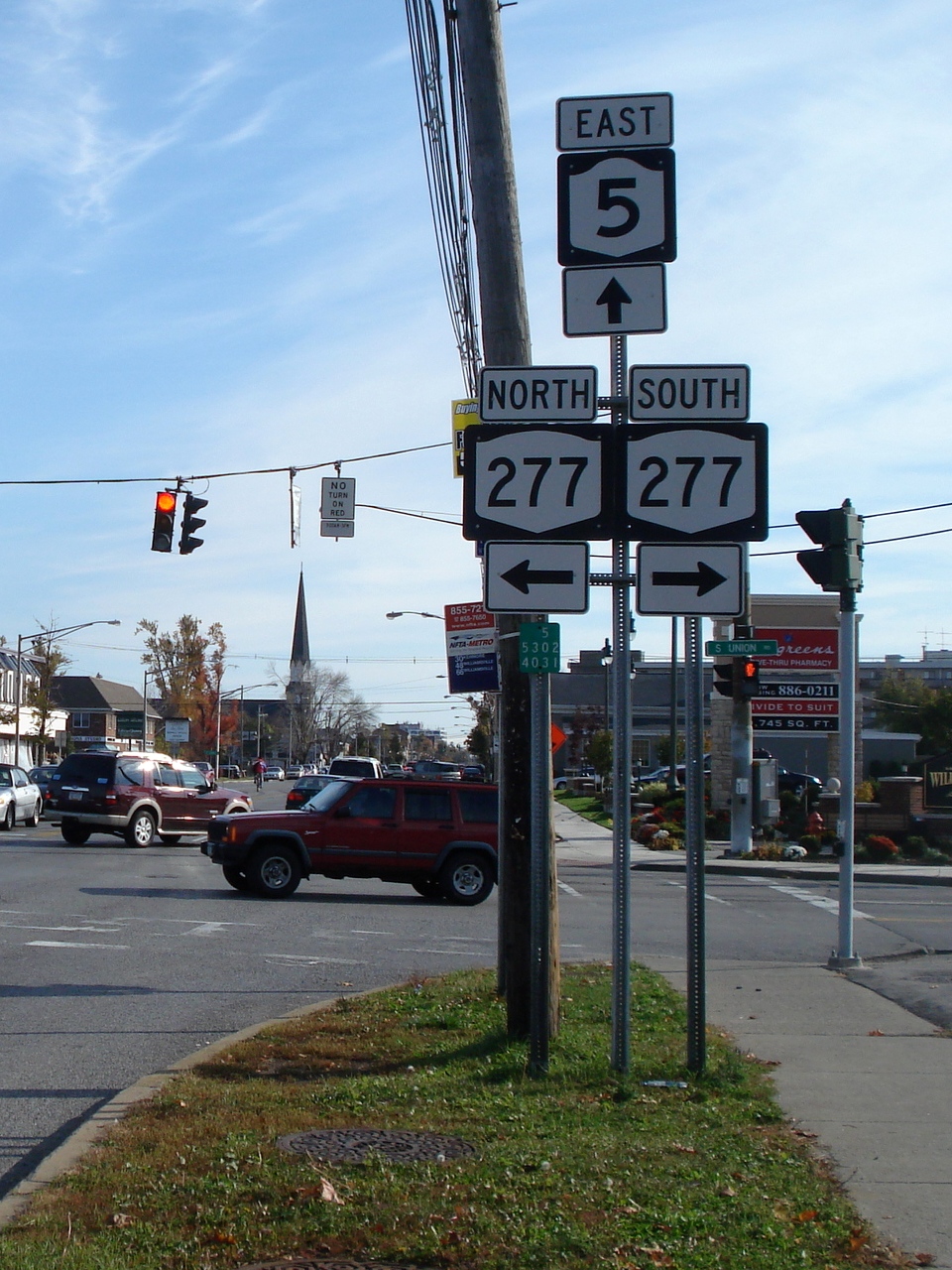
I-290Exit 7B (I-290) Williamsville 79.06  NY 277
Amherst–Clarence town line 82.07  NY 78
NY 78Clarence 84.64  NY 324
Newstead 92.33  NY 93
NY 93Eastern terminus of NY 93 Genesee Pembroke 97.33  NY 77
NY 77City of Batavia 107.66 NY 63 northWestern terminus of NY 5 / NY 63 overlap 108.41 NY 33 west / NY 98Western terminus of NY 5 / NY 33 overlap 108.68 NY 63 southEastern terminus of NY 5 / NY 63 overlap 109.88 NY 33 eastEastern terminus of NY 5 / NY 33 overlap Stafford 114.58  NY 237
Southern terminus of NY 237 Village of Le Roy 118.70  NY 19
NY 19Livingston Village of Caledonia 125.47  NY 36 south
Western terminus of NY 5 / NY 36 overlap 125.85 NY 36 northEastern terminus of NY 5 / NY 36 overlap Town of Caledonia 131.73 US 20 westWestern terminus of US 20 / NY 5 overlap Village of Avon 132.63  NY 39
NY 39Eastern terminus of NY 39 Town of Avon 134.90  NY 15
NY 15Hamlet of East Avon 135.51  I-390
I-390Exit 10 (I-390) Village of Lima 139.87  NY 15A
Ontario West Bloomfield 143.68  NY 65
NY 65Southern terminus of NY 65 East Bloomfield 148.55  NY 64 north
Western terminus of NY 5 / NY 64 overlap 150.36  NY 444
Southern terminus of NY 444 151.62  US 20A / NY 64 south
Eastern terminus of NY 5 / NY 64 overlap; eastern terminus of US 20A Town of Canandaigua 156.43 NY 21 southWestern terminus of NY 5 / NY 21 overlap City of Canandaigua 158.06 NY 21 north / NY 332Eastern terminus of NY 5 / NY 21 overlap; southern terminus of NY 332 Town of Canandaigua 159.30  NY 364
Northern terminus of NY 364 Hopewell 161.36  NY 247
Northern terminus of NY 247 Town of Geneva 171.66 
 NY 14A / NY 245
Northern termini of NY 14A and NY 245 City of Geneva 173.28 

 NY 14 / NY 14 Truck
Western terminus of NY 5 / NY 14 Truck overlap 173.99
NY 14 Truck northEastern terminus of NY 5 / NY 14 Truck overlap Seneca Town of Waterloo 175.91  NY 96A
Hamlet of East Geneva; northern terminus of NY 96A Village of Waterloo 180.61  NY 96
NY 96Town of Seneca Falls 182.04  NY 414 north
Western terminus of NY 5 / NY 414 overlap Village of Seneca Falls 184.26 NY 414 southEastern terminus of NY 5 / NY 414 overlap Town of Seneca Falls 187.31  NY 318
Eastern terminus of NY 318 187.41  NY 89
NY 89Cayuga Montezuma 189.36  NY 90
NY 90Aurelius 197.46  NY 326
Eastern terminus of NY 326 Auburn 198.84  NY 38 north
Western terminus of NY 5 / NY 38 overlap 199.01  NY 34 / NY 38 south
Eastern terminus of NY 5 / NY 38 overlap 199.30  US 20 east / NY 38A south
Eastern terminus of US 20 / NY 5 overlap; northern terminus of NY 38A Onondaga Town of Elbridge 206.93 Old Route 31B (CR 99) Former eastern terminus of NY 31B Village of Elbridge Valley Drive Former southern terminus of NY 31C 209.00  NY 317
Southern terminus of NY 317 Town of Camillus 213.30  NY 321
Hamlet of Bennetts Corners; northern terminus of NY 321 Village of Camillus 215.50  NY 174
Northern terminus of NY 174; western terminus of expressway portion Town of Camillus 219.94 
 NY 173 to NY 297
Neighborhood of Fairmount; interchange; westbound exit and entrance 220.53  NY 695
Interchange; southern terminus of NY 695 Geddes 223.50 Genesee Street Pre-expressway routing of NY 5; eastern terminus of expressway portion Syracuse 225.78 US 11 NY 598
East Syracuse 229.07  NY 635
DeWitt 230.95  NY 92 west
Western terminus of NY 5 / NY 92 overlap 231.31  I-481
I-481Exit 3 (I-481) 232.08 NY 92 eastEastern terminus of NY 5 / NY 92 overlap Fayetteville 234.17  NY 257
Northern terminus of NY 257 Town of Manlius 238.23  NY 290
Madison Chittenango 241.46 NY 173Eastern terminus of NY 173 241.63  NY 13 south
Western terminus of NY 5 / NY 13 overlap Canastota 248.21 NY 13 northEastern terminus of NY 5 / NY 13 overlap Oneida 251.36  NY 365A
Western terminus of NY 365A 253.84  NY 46
NY 46Oneida Oneida Castle 254.19  NY 365
Western terminus of NY 365 Village of Vernon 259.18  NY 31 west
Western terminus of NY 5 / NY 31 overlap Town of Vernon 259.91 NY 31 eastEastern terminus of NY 5 / NY 31 overlap 261.14  NY 26
NY 26Westmoreland 266.84  NY 233
Kirkland 267.69  NY 5B
NY 5BWestern terminus of NY 5B Town of New Hartford 270.31 NY 5BEastern terminus of NY 5B 270.39 NY 5AWestern terminus of NY 5A 271.51 NY 12 southWestern terminus of NY 5 / NY 12 overlap Utica 272.16  NY 8 south / NY 840
Cloverleaf interchange; southern terminus of NY 5 / NY 8 overlap; eastern terminus of NY 840 275.45 
 I-790 / NY 5A / NY 5S
Interchange; southern terminus of I-790; western terminus of I-790 / NY 5 overlap; eastern terminus of NY 5A; western terminus of NY 5S 276.70  NY 8 north / NY 12 north / NY 49
Interchange; northern terminus of NY 5 / NY 8 overlap; eastern terminus of NY 5 / NY 12 overlap; eastern terminus of NY 49 277.29 I-90 / ThruwayExit 31 (I-90 / Thruway) 277.86 I-790Northern terminus of I-790; eastern terminus of I-790 / NY 5 overlap Herkimer Town of Herkimer 289.53  NY 51
NY 51Northern terminus of NY 51 Village of Herkimer 291.51  NY 28 south
Western terminus of NY 5 / NY 28 overlap 292.20 NY 28 northEastern terminus of NY 5 / NY 28 overlap City of Little Falls 299.01  NY 167 south
Western terminus of NY 5 / NY 167 overlap 299.46  NY 169 north
Western terminus of NY 5 / NY 169 overlap 299.68 NY 169 southEastern terminus of NY 5 / NY 169 overlap 300.08 NY 167 northEastern terminus of NY 5 / NY 167 overlap Montgomery Town of St. Johnsville 310.61  NY 67
NY 67Western terminus of NY 67 Nelliston 315.06  NY 80
NY 80Eastern terminus of NY 80 Palatine Bridge 317.78  NY 10 north
Western terminus of NY 5 / NY 10 overlap 317.95 NY 10 southEastern terminus of NY 5 / NY 10 overlap Fonda 329.35  NY 334
Southern terminus of NY 334 329.52  NY 30A north
Western terminus of NY 5 / NY 30A overlap 329.89 NY 30A southEastern terminus of NY 5 / NY 30A overlap Fort Johnson 336.85 NY 67 westWestern terminus of NY 5 / NY 67 overlap City of Amsterdam 339.82  NY 30 / NY 67 east
Eastern terminus of NY 5 / NY 67 overlap Schenectady Glenville 348.66  NY 103
Northern terminus of NY 103 351.30  NY 890
Northern terminus of NY 890 Scotia 354.01  NY 147
Southern terminus of NY 147 354.32  NY 50
NY 50Southern terminus of NY 50 Schenectady 356.82  NY 146
358.23 NY 7Diamond interchange Niskayuna 359.55 Balltown Road (NY 914T) Albany Village of Colonie 362.99  NY 155
364.97 I-87 (Adirondack Northway)Exit 2 (I-87) 365.15 Wolf Road (NY 910B) Albany 369.78  US 9W (Lark Street)
NY 5 not signed east of this intersection; US 9W not signed from NY 5 370.54  NY 32 (Pearl Street)
No left turns at intersection 370.87 I-787 / US 9 (Broadway)Exit 3 (I-787) 1.000 mi = 1.609 km; 1.000 km = 0.621 mi See also
- New York State Bicycle Route 5
References
- ^ a b c "New York's Main Highways Designated by Numbers". The New York Times: p. XX9. December 21, 1924.
- ^ a b c d e f "2008 Traffic Data Report for New York State" (PDF). New York State Department of Transportation. June 16, 2009. pp. 86–94. https://www.nysdot.gov/divisions/engineering/technical-services/hds-respository/NYSDOT_Traffic_Data_Report_2008.pdf. Retrieved December 8, 2009.
- ^ "Routes 5 and 20 New York". http://www.routes5and20.com/index.cfm. Retrieved March 28, 2007.
- ^ "Erie County Inventory Listing" (CSV). New York State Department of Transportation. October 1, 2009. https://www.nysdot.gov/divisions/engineering/technical-services/hds-repository2/INV_2009-10-01_Erie.csv. Retrieved December 9, 2009.
- ^ "Onondaga County Inventory Listing" (CSV). New York State Department of Transportation. October 1, 2009. https://www.nysdot.gov/divisions/engineering/technical-services/hds-repository2/INV_2009-10-01_Onondaga.csv. Retrieved December 9, 2009.
- ^ "Oneida County Inventory Listing" (CSV). New York State Department of Transportation. October 1, 2009. https://www.nysdot.gov/divisions/engineering/technical-services/hds-repository2/INV_2009-10-01_Oneida.csv. Retrieved December 9, 2009.
- ^ New York State Department of Transportation (1992). Amsterdam Digital Raster Quadrangle (Map). 1:24,000. http://www.nysgis.state.ny.us/gisdata/quads/drg24/dotpreview/index.cfm?code=q45. Retrieved December 9, 2009.
- ^ "Schenectady County Inventory Listing" (CSV). New York State Department of Transportation. October 1, 2009. https://www.nysdot.gov/divisions/engineering/technical-services/hds-repository2/INV_2009-10-01_Schenectady.csv. Retrieved December 9, 2009.
- ^ "Albany County Inventory Listing" (CSV). New York State Department of Transportation. October 1, 2009. https://www.nysdot.gov/divisions/engineering/technical-services/hds-repository2/INV_2009-10-01_Albany.csv. Retrieved December 9, 2009.
- ^ a b c d e f g h i j k l m n o p q r s I Love New York (2008). New York State Map (Map). Cartography by Map Works.
- ^ "Syracuse Highways: A Brief Historical Overview". http://www.gribblenation.net/nypics/planned/syracuse/syrhist.html. Retrieved March 28, 2007.
- ^ a b MapQuest. New York State Route 5 in downtown Syracuse (Map). http://www.mapquest.com/maps/map.adp?formtype=address&addtohistory=&address=%5b200%2d299%5d%20Erie%20Blvd%20E&city=Syracuse&state=NY&zipcode=13202&country=US&location=cHx1QKX9Y5JxQ%2bWpjvQdmcOSNO1mhiiDPDZU8zwLVjdRzu%2f612lHnBIL6ZBzg%2fjVgz2imV69IMTUyqflix0ymgpOPrM5HhyX8J9bx2YBYh8%2b5V4U8INolyHVF9S7EOHjGPtG4qJ0vwu9B8NsjwPBIA%3d%3d&ambiguity=1#east. Retrieved May 28, 2007.
- ^ Rand McNally (2007). Motor Carrier's Atlas (Map) (Deluxe ed.). p. 70, section NF9.
- ^ MapQuest. New York State Route 5 in DeWitt (Map). http://www.mapquest.com/maps/map.adp?formtype=address&addtohistory=&address=%5b200%2d299%5d%20Erie%20Blvd%20E&city=Syracuse&state=NY&zipcode=13202&country=US&location=cHx1QKX9Y5JxQ%2bWpjvQdmcOSNO1mhiiDPDZU8zwLVjdRzu%2f612lHnBIL6ZBzg%2fjVgz2imV69IMTUyqflix0ymgpOPrM5HhyX8J9bx2YBYh8%2b5V4U8INolyHVF9S7EOHjGPtG4qJ0vwu9B8NsjwPBIA%3d%3d&ambiguity=1#east. Retrieved May 28, 2007.
- ^ "NYSDOT Traffic Counts - Onondaga County" (PDF). https://www.nysdot.gov/divisions/engineering/technical-services/hds-respository/onondagatvbk.pdf. Retrieved March 28, 2007.
- ^ a b c Hulbert, Archer Butler (1904). "The Genesee Road". Pioneer Roads and Experiences of Travelers. 2. Arthur H. Clark Company. p. 95. http://books.google.com/books?id=a71pj9gURHYC&pg=PA95. Retrieved February 3, 2010.
- ^ a b c d e Rivette, Barbara S. (2005). "Genesee Road". In Eisenstadt, Peter R.; Moss, Laura-Eve. The Encyclopedia of New York State. Syracuse University Press. p. 631. ISBN 9780815608080.
- ^ a b c Hulbert, Archer Butler (1971). Historic Highways of America. Ams Pr Inc.
- ^ a b c Baer, Christopher T. (2005). "Turnpikes". In Eisenstadt, Peter R.; Moss, Laura-Eve. The Encyclopedia of New York State. Syracuse University Press. pp. 1588–1589. ISBN 9780815608080.
- ^ Grande, Joseph A. (2004). Images of America: Amherst. Arcadia Publishing. p. 50. ISBN 0-7385-3680-6.
- ^ a b c Klein, D.B.; Majewski, J. (1992). "Economy, Community, and Law: The Turnpike Movement in New York, 1797–1845". Law and Society Review. 26. p. 469.
- ^ State of New York Department of Highways (1909). The Highway Law. Albany, New York: J. B. Lyon Company. pp. 56–57. http://books.google.com/books?id=jZ0AAAAAMAAJ&pg=PA56. Retrieved December 10, 2010.
- ^ New York State Department of Highways (1920). Report of the State Commissioner of Highways. Albany, New York: J. B. Lyon Company. pp. 509–512. http://books.google.com/books?id=Sj4CAAAAYAAJ&pg=PA509. Retrieved December 10, 2010.
- ^ a b c d e State of New York Department of Public Works (1926). Official Map Showing State Highways and other important roads (Map). Cartography by Rand McNally and Company.
- ^ Kruse, Laura (June 17, 2010). "Life in the past lane". New Richmond News (New Richmond, Wisconsin). http://www.newrichmond-news.com/event/article/id/29613/. Retrieved December 10, 2010.
- ^ Automobile Blue Book. 1 (1927 ed.). Chicago: Automobile Blue Book, Inc. 1927. This edition shows U.S. Routes as they were first officially signed in 1927.
- ^ a b Automobile Legal Association (ALA) Automobile Green Book, 1930–31 and 1931–32 editions, (Scarborough Motor Guide Co., Boston, 1930 and 1931). The 1930–31 edition shows New York state routes prior to the 1930 renumbering
- ^ a b c d Standard Oil Company of New York (1930). Road Map of New York (Map). Cartography by General Drafting.
- ^ a b Kendall Refining Company (1931). New York (Map). Cartography by H.M. Gousha Company.
- ^ a b Texas Oil Company (1932). Texaco Road Map – New York (Map). Cartography by Rand McNally and Company.
- ^ a b c Esso (1954). New York with Special Maps of Putnam–Rockland–Westchester Counties and Finger Lakes Region (Map). Cartography by General Drafting (1955–56 ed.).
- ^ a b c Esso (1956). New York with Special Maps of Putnam–Rockland–Westchester Counties and Finger Lakes Region (Map). Cartography by General Drafting (1957 ed.).
- ^ Fink, James (July 11, 2008). "Skyway to stay, most say". Business First of Buffalo. http://buffalo.bizjournals.com/buffalo/stories/2008/07/14/story1.html. Retrieved August 23, 2010.
- ^ Sunoco (1952). New York (Map). Cartography by Rand McNally and Company.
- ^ Sunoco (1961). New York and Metropolitan New York (Map). Cartography by H.M. Gousha Company (1961–62 ed.).
- ^ Sinclair Oil Corporation (1964). New York and Metropolitan New York (Map). Cartography by Rand McNally and Company.
- ^ a b c New York State Department of Transportation (January 2009) (PDF). Official Description of Highway Touring Routes, Bicycling Touring Routes, Scenic Byways, & Commemorative/Memorial Designations in New York State. https://www.nysdot.gov/divisions/operating/oom/transportation-systems/repository/2009%20tour-bk.pdf. Retrieved July 16, 2009.
- ^ a b Esso (1968). New York (Map). Cartography by General Drafting (1969–70 ed.).
- ^ New York State Thruway Authority (1971). New York Thruway (Map). Cartography by Rand McNally and Company.
- ^ Shell Oil Company (1973). New York (Map). Cartography by H.M. Gousha Company (1973 ed.).
- ^ Exxon (1977). New York (Map). Cartography by General Drafting (1977–78 ed.).
- ^ a b United States Geological Survey (1978). Camillus Quadrangle - New York - Onondaga Co. (Map). 1 : 24,000. 7.5 Minute Series (Topographic). http://www.nysgis.state.ny.us/gisdata/quads/drg24/usgspreview/index.cfm?code=o43076a3. Retrieved March 3, 2008.
- ^ a b Exxon (1979). New York (Map). Cartography by General Drafting.
- ^ New York State Department of Transportation (1990). Camillus Digital Raster Quadrangle (Map). 1:24,000. http://www.nysgis.state.ny.us/gisdata/quads/drg24/dotpreview/index.cfm?code=p28. Retrieved December 26, 2009.
- ^ New York State Department of Transportation (1990). Syracuse West Digital Raster Quadrangle (Map). 1:24,000. http://www.nysgis.state.ny.us/gisdata/quads/drg24/dotpreview/index.cfm?code=p29. Retrieved December 26, 2009.
- ^ State of New York (1981). I Love New York Tourism Map (Map). Cartography by Rand McNally and Company.
- ^ New York State Department of Transportation (October 2004) (PDF). Official Description of Highway Touring Routes, Scenic Byways, & Bicycle Routes in New York State. https://www.nysdot.gov/divisions/operating/oom/transportation-systems/repository/tour_route_0.pdf. Retrieved July 16, 2009.
- ^ New York State Legislature. "New York State Highway Law § 341". http://public.leginfo.state.ny.us/LAWSSEAF.cgi?QUERYTYPE=LAWS+&QUERYDATA=$$HAY341$$@TXHAY0341+&LIST=LAW+&TARGET=VIEW. Retrieved January 21, 2011.
- ^ "2007 Traffic Data Report for New York State" (PDF). New York State Department of Transportation. July 25, 2008. https://www.nysdot.gov/divisions/engineering/technical-services/hds-respository/NYSDOT_Traffic_Data_Report_2007.pdf. Retrieved March 3, 2008.
- ^ New York State Department of Transportation (October 2007). Official Description of Highway Touring Routes, Bicycling Touring Routes, Scenic Byways, & Commemorative/Memorial Designations in New York State.
- ^ Esso (1962). New York with Sight-Seeing Guide (Map). Cartography by General Drafting (1962 ed.).
- ^ New York State Department of Transportation (2000). Geneva North Digital Raster Quadrangle (Map). 1:24,000. http://www.nysgis.state.ny.us/gisdata/quads/drg24/dotpreview/index.cfm?code=q23. Retrieved December 26, 2009.
- ^ Texas Oil Company (1933). Texaco Road Map – New York (Map). Cartography by Rand McNally and Company.
- ^ a b Shell Oil Company (1936). Road Map – New York (Map). Cartography by H.M. Gousha Company.
- ^ a b Shell Oil Company (1937). Shell Road Map – New York (Map). Cartography by H.M. Gousha Company.
- ^ Thibodeau, William A. (1938). The ALA Green Book (1938–39 ed.). Automobile Legal Association.
- ^ Standard Oil Company (1939). New York (Map). Cartography by General Drafting.
- ^ New York State Department of Transportation (1981). Auburn Digital Raster Quadrangle (Map). 1:24,000. http://www.nysgis.state.ny.us/gisdata/quads/drg24/dotpreview/index.cfm?code=q26. Retrieved January 22, 2011.
- ^ New York State Department of Transportation (1981). Cayuga Digital Raster Quadrangle (Map). 1:24,000. http://www.nysgis.state.ny.us/gisdata/quads/drg24/dotpreview/index.cfm?code=q25. Retrieved January 22, 2011.
- ^ Esso (1938). New York Road Map for 1938 (Map). Cartography by General Drafting.
- ^ Dickinson, Leon A. (January 12, 1930). "New Signs for State Highways". The New York Times: p. 136.
External links
- Alps' Roads – New York State Route 5
- New York Routes – New York State Route 5
- New York State Highway Termini – New York State Route 5
- WNY Heritage Press Skyway Page
New York State Route 20SY New York State Route 5 • New York State Route 20N • New York State Route 92 • New York State Route 173 • New York State Route 321
Categories:- State highways in New York
- Limited-access roads in New York
- Transportation in Chautauqua County, New York
- Transportation in Erie County, New York
- Transportation in Buffalo, New York
- Transportation in Genesee County, New York
- Transportation in Livingston County, New York
- Transportation in Ontario County, New York
- Transportation in Seneca County, New York
- Transportation in Cayuga County, New York
- Transportation in Onondaga County, New York
- Transportation in Madison County, New York
- Transportation in Oneida County, New York
- Transportation in Herkimer County, New York
- Transportation in Montgomery County, New York
- Transportation in Schenectady County, New York
- Transportation in Albany County, New York
- Transportation in Albany, New York
- Transportation in Syracuse, New York
- The NY 5A designation has been used for three distinct highways:


Wikimedia Foundation. 2010.