- New York State Route 90
-
NYS Route 90
Route information Maintained by NYSDOT Length: 53.05 mi[2] (85.38 km) Existed: 1930[1] – present Major junctions South end: 
 US 11 / NY 41 in Homer
 NY 34 in Genoa

 US 20 / NY 5 in Montezuma
North end:  NY 31 in Montezuma
Location Counties: Cortland, Cayuga Highway system Numbered highways in New York
Interstate • U.S. • N.Y. (former) • Reference • County←  I-90
I-90NY 91  →
→New York State Route 90 (NY 90) is a north–south state highway in the Finger Lakes region of New York, United States. All but five of the route's 53 miles (85 km) are located in Cayuga County, with the remaining 5 miles (8 km) situated in Cortland County. The southern terminus of the route is at an intersection with U.S. Route 11 and NY 41 in the village of Homer. Its northern terminus is at a junction with NY 31 in the town of Montezuma. Although the route is signed as north–south, the portion of NY 90 from King Ferry to Homer follows an east–west alignment.
It is not to be confused with Interstate 90, which also passes through Montezuma. The two 90s in fact cross, the only time when two same numbered highways intersect in the state, but there is no access between them.
Contents
Route description
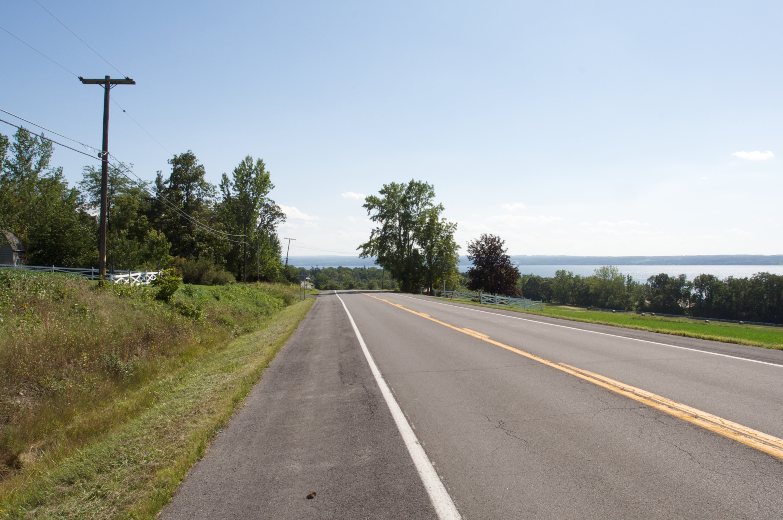
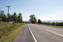 Southbound NY 90 between Levanna and Union Springs
NY 90 begins at an intersection with U.S. Route 11 and NY 41 in the village of Homer. It heads westward from the village and passes through rural portions of Cortland County on its way into Cayuga County. In Cayuga County, the route traverses the rural towns of Summerhill and Locke to the hamlet of Locke, where it intersects NY 38. NY 90 continues west into Genoa, intersecting with NY 34 and NY 34B in the hamlets of Genoa and King Ferry, respectively, before turning northward as it approaches Cayuga Lake.
The route heads northward along the eastern lakeshore, passing Long Point State Park in the town of Ledyard and Wells College in the village of Aurora. NY 90 continues north through Ledyard and southern Springport to the village of Union Springs, where NY 90 intersects NY 326. Past this point, NY 90 runs through the remainder of Springport into the town of Aurelius. Here, the route serves the village of Cayuga before entering the town of Montezuma and meeting U.S. Route 20 and NY 5 just north of the tip of Cayuga Lake and east of the Montezuma National Wildlife Refuge.
North of Routes 5 and 20, NY 90 follows the Cayuga and Seneca Canal northward for a short distance before turning to the east as it enters the vicinity of the New York State Thruway (Interstate 90). NY 90 parallels the Thruway for just under 1 mile (1.6 km) before turning back to the north and passing over the toll road as it enters the hamlet of Montezuma. NY 90 ends at an intersection with NY 31 north of the hamlet.
History
NY 90 was assigned as part of the 1930 renumbering of state highways in New York. It originally began at U.S. Route 11 in the hamlet of Messengerville and passed through Virgil, Cortland to King Ferry, where it ran along the eastern edge of Cayuga Lake to its terminus at NY 31 in Montezuma. In Cortland, NY 90 had an overlap with NY 13 along Tompkins Street from Owego Street to Main Street. At Main Street, NY 90 turned north to follow US 11 and NY 41 to Homer, where NY 90 split from the two routes and headed west toward Cayuga County.[1]
In the early 1980s, the state of New York assumed maintenance of an east–west highway connecting NY 90 in Virgil to the village of Dryden.[3] Around the same time, NY 90 was truncated on its southern end to its junction with US 11 and NY 41 in Homer. The Dryden–Virgil highway and NY 90's former routing from Virgil to Messengerville became NY 392; from Virgil to Cortland, old NY 90 was redesignated as NY 215.[4][5] Today, at least two signs showing NY 90 signed concurrently with US 11 and NY 41 still exist in the village of Homer as remnants of its former southward extension.[citation needed]
Major intersections
County Location Mile[2] Destinations Notes Cortland Village of Homer 0.00 US 11 / NY 41Town of Homer 0.63  NY 281
Cayuga Locke 13.52  NY 38
NY 38Genoa 20.26 NY 3424.82  NY 34B
Hamlet of King Ferry Union Springs 40.77  NY 326
Western terminus of NY 326 Montezuma 48.58 US 20 / NY 553.05 NY 311.000 mi = 1.609 km; 1.000 km = 0.621 mi References
- ^ a b Standard Oil Company of New York (1930). Road Map of New York (Map). Cartography by General Drafting.
- ^ a b "2008 Traffic Volume Report for New York State" (PDF). New York State Department of Transportation. June 16, 2009. p. 149. https://www.nysdot.gov/divisions/engineering/technical-services/hds-respository/NYSDOT%20TVR%202008%20by%20Route.pdf. Retrieved January 31, 2010.
- ^ New York State Legislature. "Highway Law, Article 12, Section 341". http://public.leginfo.state.ny.us/menugetf.cgi?COMMONQUERY=LAWS. Retrieved June 19, 2009.
- ^ State of New York (1981). I Love New York Tourism Map (Map). Cartography by Rand McNally and Company.
- ^ Rand McNally (1985). New York (Map). ISBN 0-528-91040-X.
External links
Categories:- State highways in New York
- Transportation in Cayuga County, New York
- Transportation in Cortland County, New York

Wikimedia Foundation. 2010.