- List of reference routes in New York
-
Part of the series on
Highways in New York
Interstate Highways 
U.S. Routes 
State routes (former) 
Reference routes 
County routes 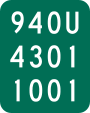 An example of a typical reference marker
Reference routes are unsigned highways assigned by the New York State Department of Transportation (NYSDOT) to highways that possess a signed name (mainly parkways), that NYSDOT has determined are too minor to have a signed touring route number, or are former touring routes that are still state-maintained. The majority of reference routes are owned by the state of New York and maintained by NYSDOT; however, some exceptions exist. The reference route designations are normally posted on reference markers, small green signs located every tenth-mile on the side of the road, though a few exceptions exist to this practice as well.
Every road maintained by NYSDOT also has a state highway (SH) number,[1] used in state laws.[2]
Contents
Region 1
NYSDOT Region 1 primarily covers the Capital District, Saratoga–Champlain and Upper Hudson Valley areas. The counties comprising this region are Albany, Essex, Greene, Rensselaer, Saratoga, Schenectady, Warren, and Washington.
# From Via To Length
(mi)(km) Notes 910A NY 32 (Elm Avenue) Feura Bush Road and Glenmont Road (SH 367) in Bethlehem NY 144 (River Road) 4.02 6.47 Former routing of NY 32 910B NY 5 (Central Avenue) Wolf Road (SH 69001) in Colonie Albany-Shaker Road at I-87 exit 4 1.91 3.07 910C Albany north city line Broadway (SH 977) in Menands NY 32 (Wolfert Avenue) 0.06 0.10 Former routing of NY 32 910D NY 155 (Karner Road) in Albany Washington Avenue Extension (SH 67015) Fuller Road in Albany 2.91 4.68 910E NY 85 (Maher Road) New Scotland Road (SH 5237) in Bethlehem Albany city line 0.38 0.61 Former routing of NY 85 910F US 20 (Western Avenue) in Guilderland Fuller Road Alternate (SH 59008 and SH 59005) I-87/I-90 in Albany 0.86 1.38 910G Scott Patent Road Potter Hollow Road (CR 364) in Rensselaerville NY 81/NY 145 1.10 1.77 910J NY 443 Thacher Park Road (SH 5501) in Berne NY 157A 0.38 0.61 910K I-87 exit 29 Boreas Road in North Hudson US 9 0.72 1.16 910L NY 9N/NY 22 Bridge Road (SH 1796) in Crown Point Crown Point Bridge 4.11 6.61 Former number; formerly NY 903; now NY 185 910M John Brown's Grave John Brown Road (SH 1945) in North Elba NY 73 0.81 1.30 910P US 9W US 9W north ramps (SH 8482) in Catskill NY 23 0.29 0.47 910U NY 385 Mansion Street Extension (SH 5198) in Coxsackie US 9W 0.18 0.29 Former routing of US 9W 911E NY 32 (Highland Avenue) Lower Warren Street (SH 656) in Queensbury NY 254 (Quaker Road) 0.20 0.32 911F Nott Street in Schenectady Erie Boulevard and Freemans Bridge Road (SH 82020 and SH 1172) NY 50 in Glenville 2.24 3.60 911G NY 146/NY 914T Union Street (SH 1) in Niskayuna NY 7 0.33 0.53 Formerly NY 950; former routing of NY 7 911H NY 7 (Curry Road) Altamont Avenue (SH 577) in Rotterdam Schenectady city line 0.96 1.54 Formerly NY 951; former routing of NY 7 911P I-87 exit 8 Crescent Road (SH 9385) in Halfmoon US 9 1.96 3.15 Formerly NY 819 911T I-87 exit 10 Ushers Road (SH 9386) in Clifton Park US 9 0.55 0.89 Formerly NY 822 911U I-87 exit 11 in Malta Round Lake Road (SH 9387) US 9 in Round Lake 0.87 1.40 Formerly NY 823 911V Austin Acres Road Mohican Trail (SH 613) in Catskill I-87 exit 21 0.63 1.01 912C NY 156 Main Street (one block of SH 849) in Altamont NY 146 0.08 0.13 912E NY 85A Wye connection (SH 8461) in New Scotland NY 155 Eliminated due to construction of a roundabout 912F US 9/US 20 Miller Road (SH 9394) in Schodack Reno Road 0.75 1.21 Crosses I-90 at exit 10 912G US 20 (Madison Avenue) Grand Street in Albany Market Street 0.14 0.23 912M I-87 in Coeymans Berkshire Spur I-90 in Schodack 6.58 10.59 Maintained by the New York State Thruway Authority 912Q I-87 exit 22 Ramp connection (SH 63006) in Lake George NY 9N 0.66 1.06 Connects I-87 with US 9 and NY 9N 912S US 9W (McCarty Avenue) Ramp connection (SH 62004) in Albany I-787 at exit 1 0.57 0.92 912T NY 373 Wye connection (SH 1946) in Chesterfield US 9 0.12 0.19 912V NY 146 Wye connection (SH 5721) in Clifton Park NY 146A 0.11 0.18 912W NY 337 (Campbell Road) at I-890 exit 2 Rice Road (SH 641 and SH 1853) in Rotterdam I-890 exit 4 1.27 2.04 Former extension of NY 5S 913B NY 85 Wye connection (SH 1280) in Westerlo NY 143 0.05 0.08 913C NY 157 Wye connection (SH 8244) in New Scotland NY 85 0.07 0.11 913D NY 157 Wye connection (SH 5724) in Berne NY 157A 0.06 0.10 913E NY 156 Wye connection (SH 978) in Knox NY 157 0.03 0.05 913G NY 7 at I-890 exit 9 Curry Road (SH 9371) in Guilderland East of I-890 0.04 0.06 913H US 9W/NY 32 Wye connection (SH 5499) in Bethlehem NY 32 0.06 0.10 913J NY 32 Wye connection (SH 5499) in Bethlehem US 9W 0.06 0.10 913M NY 30 Wye connection (SH 789) in Duanesburg NY 159 0.05 0.08 913P NY 9P Wye connection (SH 1528) in Stillwater NY 423 0.06 0.10 913Q Mount Van Hoevenberg Bobsled Run Road (SH 67017) in North Elba NY 73 0.74 1.19 913T NY 32 Ramp connection (SH 68002) in Menands I-787 exit 6 0.28 0.45 913V Empire State Plaza South Mall Expressway (SH 74001) in Albany US 20/NY 32 (Pearl Street) 0.30 0.48 914A NY 22 Moses Road and Main Street in Petersburg NY 2 0.41 0.66 Two connecting roads; former routing of NY 2 914B NY 337 (Campbell Road) at I-890 exit 2 Campbell Road Extension (SH 70004) in Rotterdam Old Rice Road 0.45 0.72 914C Washington Avenue Ring Road ramps in Albany Washington Avenue 0.87 1.40 914D NY 915D (Broadway) at I-890 exit 5 Broadway (SH 53007) in Schenectady Millard Street and Edison Avenue 0.24 0.39 914E Millard Street Veeder Avenue (SH 63006) in Schenectady NY 5 (State Street) 0.29 0.47 914F US 20 Wye connection (SH 439) in Nassau NY 66 0.08 0.13 914T NY 5 Balltown Road (SH 9420) in Niskayuna NY 146/NY 911G 1.93 3.11 Reference markers show NY 546 914V NY 50 in Glenville Glenridge Road (SH 9421 and SH 9459) NY 146 in Clifton Park 2.27 3.65 915B Hudson Avenue in Green Island Green Island Bridge (SH 75) US 4 in Troy 0.36 0.58 915C US 4/NY 32 (Hudson Avenue) in Stillwater Stillwater Bridge (SH 1791) Stillwater Bridge Road in Schaghticoke 0.20 0.32 Former routing of NY 67 915D NY 914D (Broadway) at I-890 exit 5 Broadway (SH 53007) in Schenectady Weaver Street 0.15 0.24 915E NY 151 3rd Avenue Extension (SH 5533) in East Greenbush US 4 1.67 2.69 Former routing of NY 43 915F I-87 exit 27 South Schroon Road (SH 65010) in Schroon US 9 0.34 0.55 915G NY 7 Bennington Bypass in Hoosick VT 279 1.19 1.92 915H I-87 New York State Thruway in Albany I-90 1.39 2.24 Maintained by the New York State Thruway Authority 915J NY 911U near I-87 exit 11 in Malta Round Lake Bypass US 9/NY 67 in Round Lake 1.50 2.41 Opened 2009 915K I-87 frontage road Connector highway at I-87 exit 33 in Chesterfield NY 22 0.19 0.31 Assigned between 2007 and 2009[3][4] 917A US 9 Prospect Mountain Veterans Memorial Highway (SH 66001) in Lake George Prospect Mountain 5.88 9.46 Maintained by the New York State Department of Environmental Conservation Region 2
Region 2 primarily covers the Central, Mohawk Valley, and south-central Adirondack areas of New York. The counties comprising this region are Fulton, Hamilton, Herkimer, Madison, Montgomery, and Oneida.
# From Via To Length
(mi)(km) Notes 920A NY 67 South East Avenue in Johnstown Johnstown city line 0.06 0.10 920B Yanney Road Extension of CR 140 in Ephratah NY 10 0.14 0.23 Former routing of NY 10 920C Oakwood Avenue Briggs Street in Johnstown NY 30A 0.25 0.40 920D NY 29 Harrison Street in Johnstown NY 30A 0.68 1.09 920H NY 30 Bridge Street in Northampton Northville village line 0.23 0.37 Former routing of NY 30 920J Gloversville city line Saratoga Boulevard and Steele Avenue in Johnstown NY 29A 2.08 3.35 Former routing of NY 29A 920P NY 30A in Fultonville Riverside Drive NY 5S in Glen 2.20 3.54 920T Midway between Maple and 3rd Avenues Moyer Street in Canajoharie Montgomery Street 0.56 0.90 920V NY 365 in Prospect Prospect Street NY 12/NY 28 in Remsen 2.79 4.49 Formerly NY 28B 920W NY 13 Lakeshore Road in Verona NY 13 Former number; former routing of NY 13; gap in designation at Verona Beach State Park 921B Main Street in New York Mills Burrstone Road Bennett Street in Utica 1.93 3.11 921C NY 5S Genesee Street in Utica Herkimer Road 1.31 2.11 Former routing of NY 5/NY 8/NY 12 921D NY 12/NY 28 Mappa Avenue in Barneveld NY 365 0.69 1.11 Former routing of NY 12/NY 28 921E NY 12 Genesee Street in New Hartford Utica city line 1.06 1.71 Former routing of NY 5/NY 12 921F Utica city line Barnes Avenue in Marcy Penn Central Transportation railroad crossing 0.82 1.32 921G NY 29 Mechanic Street in Salisbury NY 29A 0.13 0.21 Wye connection 921K Lakeshore Road Forest Avenue in Verona Spencer Avenue Former number 921P NY 5S John Street in Utica Broad Street 0.10 0.16 921T NY 8 Campion and Oxford Roads and Mill Street in New Hartford NY 8 0.49 0.79 921V NY 5 eastbound Schuyler Street in Amsterdam NY 5 westbound 0.02 0.03 Former number; now part of NY 5 921W Utica city line French Road, Champlin Avenue and Whitesboro Street in Utica NY 5A 2.02 3.25 922A NY 69 in Whitesboro Mohawk Street NY 49 in Marcy 1.59 2.56 922B NY 5S in German Flatts Washington Street NY 5/NY 28 in Herkimer 0.69 1.11 922C Oneida County Route 13 College Hill Road in Kirkland NY 233 0.03 0.05 Wye connection 922E NY 69 in Whitesboro River Street NY 49 in Marcy 0.44 0.71 926A NY 8/NY 12 northbound in Utica Horatio Street NY 8/NY 12 northbound in Deerfield 1.13 1.82 Region 3
Region 3 primarily covers the eastern Finger Lakes area. The counties comprising this region are Cayuga, Cortland, Onondaga, Oswego, Seneca, and Tompkins.
# From Via To Length
(mi)Length
(km)Notes 930B Onondaga Street West Street Arterial in Syracuse I-690 exit 11 0.94 1.51 930C West Street Arterial Seymour and Adams Streets in Syracuse I-81 exit 18 0.61 0.98 930F Ithaca city line East Shore Drive in Ithaca NY 34 0.52 0.84 Former routing of NY 34 930J US 11 Bear Road in North Syracuse South Bay Road 0.47 0.76 930M NY 298 in Salina New Court Street Syracuse city line in DeWitt 0.76 1.22 Former number; formerly part of NY 433; now part of NY 598 930P NY 5 Bridge Street in DeWitt NY 290 0.85 1.37 930Q NY 281 Ramp connection (SH 62013) in Cortlandville I-81 exit 12 0.68 1.09 930T NY 5 in Camillus Expressway connection I-690 exit 6 in Geddes 2.30 3.70 Former number; now NY 695 930W Camillus town line West Genesee Street in Geddes NY 5 0.23 0.37 Former routing of NY 5 931B NY 297 State Fair Boulevard in Geddes I-690 exit 6 0.90 1.45 Formerly part of NY 48 931E NY 326 Half Acre Road in Aurelius US 20/NY 5 0.69 1.11 Former routing of NY 326 931F NY 321 Forward Road in Camillus NY 174 1.16 1.87 Former routing of NY 321 931G NY 370 Oswego Street in Liverpool Tulip Street 0.19 0.31 Formerly part of NY 57 931H US 11 Circle Drive in Cicero Culvert east of NY 481 exit 10 0.22 0.35 931J NY 31 Pardee Road in Cicero Ramp to I-81 northbound 0.18 0.29 931K Ramp to NY 481 southbound Soule Road in Clay NY 31 0.21 0.34 931L Brighton Avenue South State Street in Syracuse US 11 0.25 0.40 931M Teall Avenue Arterial Road in Salina NY 298 0.18 0.29 931P Ramp to NY 690 southbound Sorrell Hill Road in Van Buren NY 31 0.17 0.27 936A US 11 in Salina I-81 northbound service road East Taft Road in Cicero 1.47 2.37 936B US 11 in Salina I-81 southbound service road East Taft Road in Cicero 1.46 2.35 936C Syracuse east city line I-690 eastbound service road in East Syracuse Bridge Street 1.03 1.66 936D Syracuse east city line I-690 westbound service road in East Syracuse Bridge Street 1.03 1.66 936E Hiawatha Boulevard I-81 northbound service road in Syracuse NY 370 westbound 0.53 0.85 936F NY 298 southbound I-81 southbound service road in Syracuse Ramp to I-81 southbound 0.83 1.34 Region 4
Region 4 primarily covers the western Finger Lakes and Genesee Valley areas. The counties comprising this region are Genesee, Livingston, Monroe, Ontario, Orleans, Wayne, and Wyoming.
# From Via To Length
(mi)(km) Notes 940D NY 15A Wye connection (SH 1868) in Mendon West Main Street 0.20 0.32 940G NY 252 East River Road (SH 1367) in Brighton Rochester city line 1.74 2.80 Designation removed November 26, 2007[5] 940H Livingston County line River Road (SH 5507) in Wheatland NY 251 1.17 1.88 Formerly part of NY 35 940J NY 15A in Mendon Monroe Street (SH 575 and SH 1803) NY 65 in Honeoye Falls 1.65 2.66 Formerly NY 363 from ca. 1932 to the late 1950s[6][7][8][9] 940K NY 33 Mount Read Boulevard (SH 57010 and SH 50005) in Rochester Joanne Drive 4.00 6.44 940L NY 33A Howard Road (SH 9350) in Gates NY 31 2.37 3.81 Formerly part of NY 47 940M Lyell Avenue Lake Avenue (SH 48005) in Rochester NY 104 2.20 3.54 940P NY 386 Spencerport Expressway (SH 61007) in Gates I-490 1.03 1.66 Former number; now part of NY 531 940T I-490 exit 13 Inner Loop in Rochester I-490 exit 15 2.68 4.31 940U I-490 exit 24 West Commercial Street (SH 64007) in East Rochester NY 153 0.88 1.42 941A NY 18 Latta Road (SH 399) in Greece Rochester city line 1.25 2.01 941B Rochester city line Empire Boulevard (SH 98) in Irondequoit NY 404 at NY 590 exit 8 0.71 1.14 Formerly part of US 104 941C County Road 25 Outlet Road in Phelps NY 88 0.33 0.53 Designation removed ca. 2004[10][11] 941D Hickox Road Bristol Road (SH 187) in Canandaigua NY 21 1.14 1.83 Designation removed between 2004 and 2007[3][10] 941E NY 245 SH 203 in Gorham CR 18 northwest of NY 245 1.14 1.83 Designation removed between 2004 and 2007[3][10] 941F Hershey Road South Street (SH 662) in Gorham NY 245 0.52 0.84 Designation removed between 2004 and 2007[3][10] 941G US 20/NY 5 Pre-Emption Road and Washington Street in Geneva Geneva city line 0.47 0.76 Designation removed between 2004 and 2007[3][10] 941H NY 245 Blodgett Road (SH 662) in Gorham NY 247 Wye connection; designation removed between 2004 and 2007[3][10] 941K NY 63 in Geneseo Court Street (SH 49011) Lower Court in Geneseo 0.14 0.23 941L Irondequoit Bay Outlet Lake Road (SH 573) in Webster NY 250 5.66 9.11 Former extension of NY 18; designation removed November 26, 2007[5] 941M NY 98 Roosevelt Highway (SH 1926) in Carlton NY 18 0.21 0.34 Wye connection 941P NY 360 Redman Road (SH 286) in Hamlin Cook Road 2.17 3.49 Formerly NY 215; designation removed November 26, 2007[5] 941V Rochester city line Blossom Road (SH 408) NY 286 in Penfield 2.20 3.54 Formerly NY 286A 942B NY 441 Washington Street (SH 1337) in Penfield Irondequoit Creek bridge 0.17 0.27 Designation removed November 26, 2007[5] 942D NY 63 Mary Jemison Drive (SH 49011) in Geneseo US 20A/NY 39 0.46 0.74 Connection for NY 63 south to US 20A/NY 39 east 942G I-490 exit 14 Plymouth Avenue (SH 54015 and SH 52012) in Rochester Inner Loop 0.50 0.80 942J NY 251 Wye connection (SH 9223) in Victor NY 96 Designation removed between 2004 and 2007[3][10] 942T Lakeshore Drive South Main Street in Canandaigua US 20/NY 5 0.17 0.27 Former routing of US 20/NY 5 942W US 20/NY 5 West Avenue (SH 5576) in Canandaigua Canandaigua city line 0.47 0.76 Former routing of US 20/NY 5; designation removed between 2004 and 2007[3][10] 943A US 20/NY 5/NY 21 Bristol Road (SH 187) in Canandaigua Canandaigua city line 0.44 0.71 Former routing of NY 21; designation removed between 2004 and 2007[3][10] 943B NY 31 (Redman Road) West Avenue (SH 5425) in Brockport NY 19 1.52 2.45 Former routing of NY 31; designation removed November 26, 2007[5] 943C NY 65 Calkins Road (SH 497) in Pittsford NY 64 1.68 2.70 Former extension of NY 253 943E NY 253 Erie Station Road (SH 1499A) in Henrietta NY 15 0.96 1.54 Former routing of NY 253 943F Lake Ontario State Parkway in Rochester Colonel Patrick O'Rorke Memorial Bridge Thomas Avenue in Irondequoit Assigned November 26, 2007[5] 946A Clinton Avenue in Rochester NY 104 eastbound service road Goodman Street in Irondequoit 1.87 3.01 Assigned between 2004 and 2007[3][10] 946B Clinton Avenue in Rochester NY 104 westbound service road Culver Road in Irondequoit 2.67 4.30 Assigned between 2004 and 2007[3][10] 946C Five Mile Line Road NY 104 eastbound service road in Webster NY 250 2.26 3.64 Assigned between 2004 and 2007[3][10] 946D Five Mile Line Road NY 104 westbound service road in Webster NY 250 2.26 3.64 Assigned between 2004 and 2007[3][10] 946E Manitou Road NY 531 eastbound service road in Gates NY 386 1.08 1.74 Assigned between 2004 and 2007[3][10] 946F Manitou Road NY 531 westbound service road in Gates NY 386 1.08 1.74 Assigned between 2004 and 2007[3][10] 947A Lakeside Beach Road in Carlton Lake Ontario State Parkway Lake Avenue in Rochester 35.05 56.41 Maintained by the New York State Department of Transportation (partially under New York State Office of Parks, Recreation and Historic Preservation jurisdiction) 948A NY 18 Lakeside Beach Road in Carlton Lakeside Beach State Park access road 0.55 0.89 Maintained by the New York State Office of Parks, Recreation and Historic Preservation Region 5
Region 5 primarily covers the Niagara Frontier and southwestern New York. The counties comprising this region are Cattaraugus, Chautauqua, Erie, and Niagara.
# From Via To Length
(mi)(km) Notes 950A Pennsylvania state line in South Valley Brown Run Road and West Bank Perimeter Road I-86/NY 17/NY 394 in Coldspring 12.76 20.54 950B West State Street North State Street in Salamanca Salamanca city line at CR 94 0.51 0.82 950C NY 266 Grand Island Boulevard in Tonawanda NY 324 1.51 2.43 Former routing of NY 324 950D US 20 Shortman Road in Ripley NY 5 1.22 1.96 Connection to Thruway exit 61 950E NY 5/NY 384 Church and Division Streets in Buffalo Elm Street 0.45 0.72 Overlaps NY 5 for 0.30 mi (0.48 km) 950H I-290 exit 2 in Tonawanda Twin Cities Memorial Highway Wheatfield Street in North Tonawanda 2.87 4.62 Former number; now part of NY 425 950J NY 75 Camp Road in Hamburg NY 5 0.21 0.34 Former routing of NY 75 950K Buffalo city line Niagara Falls Boulevard in Tonawanda/Amherst US 62/NY 324 1.57 2.53 950M Buffalo city line Potters Road in West Seneca NY 240 0.69 1.11 Former routing of NY 240 950U Maryland Avenue Highland Avenue in Niagara Falls NY 61 0.22 0.35 951A Rainbow Bridge customs plaza in Niagara Falls Niagara Street and LaSalle Expressway Williams Road in Wheatfield 3.04 4.89 Gap in designation from 5th Street to I-190 951B NY 31 Walnut Street in Lockport Pound Street 0.40 0.64 951C NY 60/NY 394 Washington Street in Jamestown NY 430 1.08 1.74 Former routing of NY 17 951E US 62 Big Tree Road in Hamburg US 20/US 20A 0.63 1.01 951J Massachusetts Avenue Ramp connection in Buffalo I-190/Thruway southbound 0.89 1.43 Maintained by New York State Thruway Authority 951K NY 5 east Ramp connection in Buffalo I-190/Thruway northbound 0.21 0.34 951L I-190/Thruway northbound Ramp connection in Buffalo NY 266 0.33 0.53 951M Salamanca city line Parkway Drive in Salamanca I-86/US 219/NY 17 exit 21 0.90 1.45 Connection to Allegany State Park Route 1 951N Temple Street Old Main Drive, Ring Road, and College Parkway in Fredonia Central Avenue 1.50 2.41 Former number 951T NY 394 in Coldspring Allegheny Reservoir service road NY 417 in Salamanca 4.02 6.47 Formerly part of NY 417; gap in designation in Red House 951V NY 16/NY 400 Olean Road in Aurora NY 16/NY 400 2.24 3.60 Former routing of NY 16 952A Buffalo city line Genesee Street in Cheektowaga NY 33 3.17 5.10 Formerly part of NY 33B 952B Robert Moses State Parkway John B. Daly Boulevard in Niagara Falls Niagara Street 0.42 0.68 952G I-190/Thruway exit 7 Church Street in Buffalo NY 384 0.40 0.64 952H NY 5 Central Avenue in Silver Creek US 20 0.04 0.06 Former routing of NY 5; part of U.S. Route 20 Truck 952J Murphy and Duerr Roads New Armor Duells Road in Orchard Park NY 240/NY 277 1.04 1.67 952M I-86/NY 17 exit 16 West Main Street in Randolph NY 394 1.06 1.71 952P Pennsylvania state line in Busti Forest Avenue NY 60 in Jamestown 7.61 12.25 952Q Buffalo city line in Cheektowaga Walden Avenue NY 33 in Alden 14.08 22.66 Longest non-parkway reference route 952T Maple Road Sweet Home Road in Amherst North Ellicott Creek Road 2.24 3.60 952V NY 265/NY 384 in Wheatfield Williams Road US 62 in Niagara Falls 1.94 3.12 952W NY 417 West Five Mile Road in Allegany I-86/NY 17 exit 24 0.45 0.72 953A I-86/NY 17 exit 15 School House Road in Randolph NY 394 0.21 0.34 953B NY 430 Strunk Road in Jamestown I-86/NY 17 exit 11 0.44 0.71 953C NY 16 Ramp connection in West Seneca NY 400 0.40 0.64 954D NY 16 Oak and Elm Streets in Buffalo NY 33 0.95 1.53 954E Reed Street Buffalo Street in Olean I-86/NY 17 exit 25 0.62 1.00 954F I-990 exit 1 Ramp connector in Amherst SUNY Buffalo North Campus 0.48 0.77 954G US 20A/NY 78 in Wales Two Rod Road NY 354 in Marilla 6.14 9.88 Part is former NY 358 954J NY 430 Southern Tier Expressway spur in Ellery I-86/NY 17 exit 10 1.62 2.61 Former routing of NY 17 954K NY 394 McDaniel Avenue and Third Street in Jamestown NY 60 1.09 1.75 954L Washington Street Broadway in Buffalo Fillmore Avenue 1.64 2.64 Formerly part of NY 130 954M Lockport city line in Lockport Akron Road NY 93 in Royalton 3.47 5.58 Former routing of NY 93 954P Robert Moses State Parkway Upper Mountain Road in Lewiston NY 265 0.60 0.97 954T I-86/US 219/NY 17 exit 23 Access road in Carrollton NY 417 0.62 1.00 Former routing of US 219; part of US 219 Business 955A United States-Canada border Rainbow Bridge in Niagara Falls NY 384 0.30 0.48 Maintained by Niagara Falls Bridge Commission 955B United States-Canada border Peace Bridge in Buffalo Peace Bridge customs plaza 0.30 0.48 Maintained by Peace Bridge Authority 955C United States-Canada border Whirlpool Rapids Bridge in Niagara Falls NY 182 0.14 0.23 Maintained by Niagara Falls Bridge Commission 957A LaSalle Expressway in Niagara Falls Robert Moses State Parkway NY 18 in Porter 18.42 29.64 Maintained by New York State Parks Department 957B West River Road South Parkway on Grand Island I-190/East River Road 2.72 4.38 Maintained by New York State Parks Department 957C South Parkway West River Parkway on Grand Island I-190 8.51 13.70 Maintained by New York State Parks Department 958A Robert Moses State Parkway Spur to Fort Niagara in Porter Fort Niagara State Park 1.16 1.87 Maintained by New York State Parks Department Region 6
Region 6 primarily covers the western and central portions of the Southern Tier. The counties comprising this region are Allegany, Chemung, Schuyler, Steuben, Tioga, and Yates.
# From Via To Length
(mi)Length
(km)Notes 960B University Street North Main Street in Alfred NY 244 0.80 1.29 960D Steuben-Chemung county line Sagetown Road in Southport NY 328 Former number; former routing of NY 328; now Chemung County Route 78 960H NY 96 Mill Street in Candor NY 96B 0.20 0.32 Former routing of NY 96B 960J NY 434 NY 17 exit 65 connection in Owego NY 17C 0.73 1.17 960M NY 415 in Erwin Meads Creek Road I-86/NY 15/NY 17 exit 42 in Campbell 0.39 0.63 960Q NY 352 Madison Avenue in Elmira Washington Avenue 0.70 1.13 Former number; formerly part of NY 13 960U I-86/NY 15/NY 17 exit 39 Babcock Hollow Road in Bath NY 415 0.79 1.27 Former routing of NY 15 961A NY 17 exit 59 Wyncoop Creek Road in Chemung Chemung County Route 60 0.14 0.23 961B Pennsylvania state line Wilawana Road in Chemung NY 427 0.12 0.19 Former routing of NY 427 961F NY 70 in Burns West Avenue NY 36 in Hornellsville 5.90 9.50 Former routing of NY 70; signed as a touring route 961G NY 244 Connection in Alfred NY 21 0.07 0.11 961H NY 54 Connection in Torrey NY 14 0.41 0.66 961J NY 415 Michigan Hollow Road in Avoca I-390/NY 15 exit 1 0.52 0.84 961K NY 427 Maple Avenue in Elmira Elmira city line 0.80 1.29 Former number; former routing of NY 427 961L Steuben-Schuyler county line Hammondsport-Wayne Road in Tyrone NY 230 0.10 0.16 Former routing of NY 230 961M NY 14 Clemens Center Parkway in Elmira Grand Central Avenue 0.20 0.32 961Q I-86/NY 17 exit 47 Connection in Corning NY 352 0.12 0.19 961T NY 352 Connection in Corning I-86/NY 17 exit 48 0.35 0.56 Former routing of NY 17 962A I-86/NY 17 exit 33 Karr Valley Road in Almond NY 21 0.52 0.84 962B Steuben County Route 70A Mill Road in Howard I-86/NY 17 exit 35 0.27 0.43 962C NY 14A Connection in Reading NY 14 0.32 0.51 962D I-390/NY 15 exit 2 Loon Lake Road in Cohocton NY 415 0.57 0.92 Formerly part of NY 371 962E I-86/NY 17 exit 52A Extension of Chemung County Route 64 in Horseheads NY 14 0.71 1.14 962F NY 14 Extension of NY 962E in Horseheads Lackawanna Avenue 0.39 0.63 962G NY 434 Halstead and Lackawanna Avenues in Owego NY 17 exit 64 0.33 0.53 962J NY 434 Valley View Drive in Owego NY 17C 0.41 0.66 Connection to NY 17 exit 66; signed as a touring route Region 7
Region 7 primarily covers the North Country and the northern portion of the Adirondacks. The counties comprising this region are Clinton, Franklin, Jefferson, Lewis, and St. Lawrence.
# From Via To Length
(mi)Length
(km)Notes 970B NY 37/NY 420 Main Street in Massena NY 37B 0.95 1.53 Former extension of NY 420 970C NY 37/NY 56 Andrew Street in Massena Main Street 1.44 2.32 Former extension of NY 56 970E NY 812 in Oswegatchie State Street NY 68 in Ogdensburg 0.48 0.77 Formerly part of NY 87 970F NY 374 Connection in Plattsburgh NY 3 0.08 0.13 Former routing of NY 374 970G NY 3 Northbound ramp connection in Plattsburgh NY 374 0.30 0.48 970H NY 374 Southbound ramp connection in Plattsburgh NY 3 0.45 0.72 970J NY 12D McAlpine Street in Lyons Falls Railroad crossing 0.03 0.05 Formerly part of NY 337 970K Ramp from I-81 southbound Old Rome State Road in Watertown NY 232 0.36 0.58 970L NY 12/NY 12E James Street, Riverside Drive, and Webb Street in Clayton NY 12 1.16 1.87 970T NY 37 Water Street in Fort Covington United States-Canada border 0.98 1.58 Connection to Quebec Route 132 971A NY 37/NY 812 Ford Street in Ogdensburg Greene Street 0.56 0.90 Former routing of NY 37 971B US 9/ramp to I-87 northbound East Service Road in Champlain Cul-de-sac at United States-Canada border 0.54 0.87 Formerly part of US 9 971D NY 421 Mountain Camp Road in Piercefield Warren Point 0.58 0.93 Former number; former routing of NY 421 971G NY 37 Rooseveltown traffic circle in Massena NY 37 0.56 0.90 971H NY 12F in Hounsfield Paddy Hill Road NY 12E in Brownville 0.16 0.26 971J NY 131 Wye connection in Massena St. Lawrence County Route 43 0.10 0.16 Former routing of NY 131 971K NY 12/NY 26 Church, James, and Market Streets in Alexandria Bay Fuller Street 0.55 0.89 971L NY 190 Connection in Ellenburg US 11 0.04 0.06 Former routing of NY 190 971P 0.1-mile (0.16 km) west of ramp to I-81 southbound Kellogg Hill Road in Adams US 11 0.76 1.22 971Q US 11 Fort Drum Memorial Drive in Le Ray East end of railroad bridge 0.23 0.37 971T NY 56 Park Street in Potsdam US 11 0.06 0.10 971U US 11 Maple Street in Potsdam NY 56 0.43 0.69 Former routing of US 11 971V Fort Drum Gate 1 Connection in Rutland NY 3 0.87 1.40 972A Ramp from I-87 southbound West Service Road in Champlain Cul-de-sac at United States-Canada border 0.82 1.32 972B I-87 exit 37 Ramp connection in Plattsburgh NY 3 0.32 0.51 972C Massena traffic circle Seaway International Bridge in Massena United States-Canada border 0.95 1.53 Maintained by Seaway International Bridge Corporation 972D US 9 West Service Road in Champlain Ramp from I-87 southbound 0.95 1.53 Region 8
Region 8 primarily covers the Middle and Lower Hudson Valley. The counties comprising this region are Columbia, Dutchess, Orange, Putnam, Rockland, Ulster, and Westchester.
# From Via To Length
(mi)(km) Notes 980B US 9 Main Street (SH 8141) in Valatie NY 203 0.35 0.56 980C US 20 Wye connection (SH 615) in New Lebanon NY 22 0.32 0.51 980D NY 22 Albany Street (SH 8514) in Canaan Massachusetts state line (Route 102) 0.21 0.34 980E NY 71 Wye connection (SH 1780) in Hillsdale NY 22 0.15 0.24 980F NY 22 Old Route 22 (SH 5347) in Copake NY 344 0.31 0.50 980G NY 22 Old Route 22 (SH 5460) in Washington NY 343 0.90 1.45 980J Beacon city line Fishkill Avenue (SH 567) in Fishkill NY 52 at I-84 exit 12 1.73 2.78 NY 52 Business 980P NY 52 at I-84 exit 8 in Newburgh South Street Arterial (SH 8408 and SH 61007) Liberty Street in Newburgh 2.18 3.51 Former routing of NY 52 980T US 9W in New Windsor Old Route 9W, River Road, Water Street, North Street, and Plank Road (SH 415, SH 1808, SH 85002, and SH 9525) US 9W/NY 32 in Newburgh 4.06 6.53 980U US 9W Main Street (SH 8078) in Highlands NY 218 1.31 2.11 980W NY 218 West Point Highway (SH 9115) in Highlands U.S. Military Academy 0.64 1.03 981B I-684 at I-84 exit 20 SH 5203 in Southeast NY 22 0.38 0.61 981F US 202 West Side Avenue (SH 1660) in Haverstraw US 9W 0.48 0.77 981G NY 17 Seven Lakes Road in Sloatsburg Seven Lakes Parkway 0.36 0.58 981H NY 340 Highland Avenue (SH 1697) in Orangetown US 9W 0.11 0.18 981J NY 340 Highland Avenue (SH 8250) in Orangetown US 9W 0.17 0.27 981K Hurley Avenue in Kingston Washington Avenue (SH 62021 and SH 5173) NY 28 in Ulster 0.41 0.66 Former routing of NY 28 981L Van Steenberg Lane Reservoir Road (SH 118) in Olive NY 28 0.21 0.34 981M Kingston city line Albany Avenue (SH 5000) in Ulster US 9W 1.27 2.04 Former routing of US 209 981U Memorial Highway Cross Avenue (SH 65020) in New Rochelle I-95 at exit 16 0.26 0.42 981V US 1 (Main Street) Memorial Highway (SH 65020 and SH 64007) in New Rochelle Lincoln Avenue 0.69 1.11 982B Rye city line Midland Avenue (SH 63007 and SH 9479) in Port Chester US 1 0.94 1.51 982C NY 120A Putnam Avenue (SH 9369) in Port Chester US 1 0.74 1.19 982E US 9W Crystal Lake Cross Road (SH 9328) in Highlands NY 218 0.33 0.53 982H NY 55 Burnett Boulevard (SH 549) in Poughkeepsie US 44 0.32 0.51 982J US 1 (Main Street) River Street, Palmer Avenue, and Petersville Road (SH 66022) in New Rochelle Potter Avenue 1.31 2.11 982L New Jersey state line Garden State Parkway Connection in Ramapo I-87 at exit 14A 2.40 3.86 Maintained by the New York State Thruway Authority 982M Railroad bridge in Rhinecliff Rhinecliff Road US 9 2.29 3.69 982P NY 94 (Academy Avenue) Main Street (SH 5297) in Chester NY 17M (Brookside Avenue) 0.35 0.56 983B South Broadway Nepperhan Avenue Arterial and Old Nepperhan Avenue (SH 82007 and SH 72008) in Yonkers NY 9A (Saw Mill River Road) 2.48 3.99 983C Nepperhan Avenue Yonkers Avenue (SH 73011) in Yonkers Saw Mill River Parkway at exit 5 0.71 1.14 983D NY 124 Spring Street (SH 899) in Lewisboro NY 35 0.37 0.60 983F NY 32 Albany Avenue Arterial (SH 78021) in Kingston Ulster town line 0.50 0.80 Former routing of US 209 983G Broadway Albany Avenue (SH 75030) in Kingston NY 32 0.14 0.23 983T NY 376 (Raymond Avenue) Hooker Avenue (SH 1529) in Poughkeepsie Poughkeepsie city line 0.73 1.17 983W Fairmont Avenue East West Arterial in Poughkeepsie US 44/NY 55 0.19 0.31 984A Poughkeepsie city line Salt Point Turnpike (SH 9451) in Poughkeepsie NY 115 0.23 0.37 984C NY 17 SH 53015 in Woodbury I-87 at exit 16 0.34 0.55 984D US 9W in Esopus Old Route 9W (SH 5599) Abeel Street in Kingston 0.49 0.79 984E Saw Mill River Parkway at exit 5 Yonkers Avenue (SH 79012) in Yonkers Bronx River Road 2.51 4.04 984G NY 984J Manhattanville Road (SH 81008) in Harrison NY 120 0.50 0.80 984H New York city line Riverdale Avenue Arterial (SH 82016 and SH 82013) in Yonkers Warburton Avenue 1.57 2.53 984J Hutchinson River Parkway I-684 east spur (SH 65017) in Harrison I-684 1.46 2.35 984K US 9W River Road in New Windsor NY 980T (Old Route 9W) 0.40 0.64 984L NY 9A Tuckahoe Road in Yonkers I-87 exit 6 0.47 0.76 984M Saw Mill River Parkway SH 9539 in Hastings-on-Hudson NY 9A 0.06 0.10 984P NY 82/NY 343 North Avenue and Franklin Avenue (SH 1114) in Millbrook US 44 1.55 2.49 Former routing of US 44 987A Seven Lakes Parkway in Haverstraw Lake Welch Parkway Palisades Interstate Parkway in Stony Point 5.60 9.01 Maintained by the New York State Department of Transportation (under Palisades Interstate Park Commission jurisdiction) 987C New Jersey state line Palisades Interstate Parkway US 6/US 9W/US 202 in Highlands 26.77 43.08 Maintained by the New York State Department of Transportation (under Palisades Interstate Park Commission jurisdiction) 987D New York city line Saw Mill River Parkway (SH 9484, SH 9485, and SH 9486) I-684 exit 5 in Bedford 29.83 48.01 Maintained by the New York State Department of Transportation 987E Johnsontown Road in Sloatsburg Seven Lakes Parkway US 9W/US 202 in Stony Point 17.43 28.05 Maintained by the New York State Department of Transportation (under Palisades Interstate Park Commission jurisdiction) 987F Bronx River Parkway in Yonkers Sprain Brook Parkway (SH 9488) Taconic State Parkway in Mount Pleasant 12.65 20.36 Maintained by the New York State Department of Transportation 987G Bronx River Parkway in Mount Pleasant Taconic State Parkway (SH 9480, SH 9481, SH 9482, and SH 9483) I-90 in Chatham 104.12 167.56 Maintained by the New York State Department of Transportation 987H US 6/US 9/US 202 in Peekskill Bear Mountain State Parkway (SH 9500 and SH 9480) Taconic State Parkway in Yorktown 4.58 7.37 Maintained by the New York State Department of Transportation 987J Saw Mill River Parkway Farragut Parkway in Hastings-on-Hudson Farragut Avenue 0.43 0.69 Region 9
Region 9 primarily covers the eastern Southern Tier and the Central Leatherstocking and Catskill regions. The counties comprising this region are Broome, Chenango, Delaware, Otsego, Schoharie, and Sullivan.
# From Via To Length
(mi)(km) Notes 990D Binghamton city line Riverside Drive (SH 444) in Johnson City NY 201 1.10 1.77 Formerly part of NY 17H 990E NY 201 Floral Avenue (SH 54007) in Johnson City Orchard Avenue 0.07 0.11 990F US 11 Francis Street (SH 834) in Windsor NY 990G 0.39 0.63 990G US 11 Old Route 17 (SH 5022) in Windsor NY 17 at I-81 exit 2 1.05 1.69 990H Binghamton city line Chenango Street (SH 5506) in Port Dickinson NY 7 1.07 1.72 990J NY 369 SH 1871 in Fenton Pigeon Hill Road at Chenango Valley State Park 0.61 0.98 990K NY 369 in Fenton SH 5242 and SH 266 NY 7 in Colesville Former number; former routing of NY 7; now NY 7B 990L NY 12 in Norwich East Main Street (SH 59018 and SH 59024) NY 23 in Norwich 1.43 2.30 Erroneously signed as a touring route 990T NY 8/NY 10 SH 5045 in Deposit NY 17 at exit 84 0.10 0.16 Short connection from the underpass to the eastbound NY 17 ramps 990V NY 30 in Gilboa SH 1784 and SH 1347 Bear Kill Road in Conesville 6.15 9.90 Formerly NY 342; erroneously signed as a touring route 991A NY 220 Steere Road in McDonough Bowman Lake State Park 2.07 3.33 991C NY 201 at NY 17 exit 70 SH 68008 in Johnson City Harry L. Drive 0.33 0.53 991D Susquehanna River bridge in Oneonta Ramp connection (SH 71018) NY 205 at I-88 exit 13 in Oneonta 0.17 0.27 991F CR 47 at I-88 exit 16 SH 71006 in Oneonta NY 7 0.26 0.42 991H I-88 exit 10 in Sidney Ramp connection and Susquehanna River bridge (SH 73012) NY 7 in Unadilla 0.72 1.16 991J CR 48 in Otego Ramp connection and Susquehanna River bridge (SH 73008) NY 7 in Otego 0.54 0.87 991L NY 41 in Afton Ramp connection I-88 exit 7 in Afton 0.43 0.69 991T South of I-88/NY 28 Gersoni Road (SH 77020) in Milford NY 28 at I-88 exit 17 0.16 0.26 992D NY 28 in Oneonta Main Street (SH 77014 and SH 77038) NY 7/NY 23 in Oneonta 0.67 1.08 Former routing of NY 28; crosses I-88 at exit 14 992E Washington Street Riverside Drive (SH 63027) in Binghamton NY 363/NY 434 0.14 0.23 992G NY 7 D.K. Lifgren Drive (SH 318) in Milford NY 28 0.50 0.80 Former routing of NY 28; now connects it with NY 7 because the new alignment passes over NY 7 992H CR 56 at I-88 exit 18 SH 77009 in Maryland NY 7 0.84 1.35 992J I-88 exit 19 Hollenbeck Road (SH 77005) in Worcester NY 7 0.38 0.61 992K NY 7/NY 10 Ramp connection (SH 77027) in Richmondville I-88 exit 20 0.32 0.51 992L I-88 exit 21 Mickle Road (SH 77021) in Richmondville NY 7/NY 10 0.27 0.43 992P I-88 exit 5 Martin Hill Road (SH 72001) in Colesville NY 7 0.71 1.14 Regions 10 and 11
Regions 10 and 11 collectively cover the core of Downstate New York, with Region 10 covering Long Island and Region 11 covering New York City. As such, Nassau and Suffolk Counties comprise Region 10 and the five boroughs of New York City—The Bronx, Brooklyn (Kings County), Manhattan (New York County), Queens, and Staten Island (Richmond County)—comprise Region 11.
# From Via To Length
(mi)(km) Notes 900A Greenport Marina Main Street (SH 1719) in Greenport NY 25 0.07 0.11 900B Hempstead town line Glen Cove Road (SH 52007) in Oyster Bay NY 107 1.95 3.14 Formerly NY 904 900C Orient Beach State Park Orient Park Road (SH 1902) in Orient Point NY 25 0.68 1.09 900D NY 27A (Carman Mill Road) Old Sunrise Highway (SH 5701) in Oyster Bay Suffolk County line 0.37 0.60 Former routing of NY 27 900F New York city line Union Turnpike (SH 42001) in Hempstead Marcus Avenue 0.81 1.30 Former NY 25C 900G Second Avenue Robert F. Kennedy Bridge spur in Manhattan I-278 0.56 0.90 900J Beach Channel Drive Cross Bay Bridge in Queens Toll booth 0.60 0.97 900P New York city line Jericho Turnpike (SH 1831) in Floral Park NY 25 (Braddock Avenue) 0.40 0.64 Former routing of NY 25 900V Atlantic Beach Bridge toll booth Nassau Expressway in Lawrence Seagirt Boulevard 0.25 0.40 900W Knoll Road Montauk Highway (SH 1274) in Southampton Tuckahoe Lane 2.85 4.59 Former routing of NY 27A 901A I-495 north service road Simeon Woods Road (SH 9521) in Islip Kings Highway 0.50 0.80 Serves Suffolk County and New York State government offices 901B Rockaway Point Boulevard in Queens Marine Parkway Bridge Toll booth at Flatbush Avenue in Brooklyn 0.80 1.29 901C New York city line Seagirt Boulevard (SH 52007) in Lawrence Nassau Expressway 0.22 0.35 906A New York city line I-495 eastbound service road Sills Road in Brookhaven 39.93 64.26 906B New York city line I-495 westbound service road Sills Road in Brookhaven 39.58 63.70 906C NY 109 NY 27 eastbound service road Hospital Road in Brookhaven 21.17 34.07 906D NY 109 NY 27 westbound service road NY 112 in Brookhaven 19.88 31.99 907A Laurelton Parkway in Queens Cross Island Parkway (Belt System) I-678 (Whitestone Expressway) in Queens 10.57 17.01 Maintained by the New York City Department of Transportation 907B NY 27 Laurelton Parkway (Belt System) in Queens Southern State Parkway 1.62 2.61 Maintained by the New York City Department of Transportation 907C I-278 (Gowanus Expressway) in Brooklyn Shore Parkway (Belt System) Lefferts Boulevard in Queens 18.30 29.45 Maintained by the New York State Department of Transportation and New York City Department of Transportation 907D Lefferts Boulevard Southern Parkway (Belt System) in Queens NY 27 5.37 8.64 Maintained by the New York State Department of Transportation and New York City Department of Transportation 907E Southern State Parkway Bethpage State Parkway in Oyster Bay Bethpage State Park 2.49 4.01 Maintained by the New York State Department of Transportation (under New York State Office of Parks, Recreation and Historic Preservation jurisdiction) 907F Bronx River Parkway Bronx and Pelham Parkway in the Bronx I-95 (Bruckner Expressway) 2.25 3.62 Maintained by the New York City Department of Transportation 907H Story Avenue Bronx River Parkway in the Bronx Westchester County line 5.90 9.50 Maintained by the New York City Department of Transportation 907J Shore Front Parkway Cross Bay Parkway in Queens Cross Bay Bridge 0.33 0.53 Maintained by the New York City Department of Transportation 907K Saw Mill River Parkway in Yonkers Cross County Parkway (SH 9487) Hutchinson River Parkway in Pelham and Eastchester 4.46 7.18 Maintained by the New York State Department of Transportation; located in Region 8 907L I-478 (Battery Tunnel) Franklin D. Roosevelt Drive in Manhattan Robert F. Kennedy Bridge 9.44 15.19 Maintained by the New York State Department of Transportation and New York City Department of Transportation 907M 31st Street Grand Central Parkway in Queens Nassau County line 14.61 23.51 Maintained by the New York State Department of Transportation 907P Robert F. Kennedy Bridge Harlem River Drive in Manhattan Dyckman Street and Tenth Avenue 4.20 6.76 Maintained by the New York State Department of Transportation 907T[12] Heckscher State Parkway Former number; now part of NY 908M 907V 72nd Street in Manhattan Henry Hudson Parkway Westchester County line 11.05 17.78 Maintained by the New York State Department of Transportation, New York City Department of Transportation, and Port Authority of New York and New Jersey 907W New York city line Hutchinson River Parkway (SH 9489) in Westchester County Connecticut state line 14.32 23.05 Maintained by the New York State Department of Transportation; located in Region 8 908A I-95 (Cross Bronx Expressway) Hutchinson River Parkway in the Bronx Westchester County line 4.46 7.18 Maintained by the New York City Department of Transportation 908B Jamaica Avenue in Brooklyn Jackie Robinson Parkway I-678 and Grand Central Parkway in Queens 4.95 7.97 Maintained by the New York State Department of Transportation (under New York City Department of Transportation jurisdiction) 908C Lido Boulevard Loop Parkway in Hempstead Meadowbrook State Parkway 2.65 4.26 Maintained by the New York State Department of Transportation (under New York State Office of Parks, Recreation and Historic Preservation jurisdiction) 908D[12] Marine Parkway 908E Ocean Parkway in Hempstead Meadowbrook State Parkway Northern State Parkway 12.52 20.15 Maintained by the New York State Department of Transportation (under New York State Office of Parks, Recreation and Historic Preservation jurisdiction) 908F Bronx Park East Dr. Theodore Kasimiroff Boulevard and Mosholu Parkway in the Bronx Henry Hudson Parkway 3.03 4.88 Maintained by the New York State Department of Transportation and New York City Department of Transportation 908G New York city line Northern State Parkway NY 347/NY 454 in Smithtown 28.88 46.48 Maintained by the New York State Department of Transportation (under New York State Office of Parks, Recreation and Historic Preservation jurisdiction) 908H Sea Breeze Avenue Ocean Parkway in Brooklyn Church Avenue 4.86 7.82 Maintained by the New York State Department of Transportation and New York City Department of Transportation 908J Robert Moses State Park Robert Moses Causeway in Islip Southern State Parkway 8.10 13.04 Maintained by the New York State Department of Transportation (under New York State Office of Parks, Recreation and Historic Preservation jurisdiction) 908K Southern State Parkway in Islip Sagtikos State Parkway and Sunken Meadow State Parkway Sunken Meadow State Park in Smithtown 11.33 18.23 Maintained by the New York State Department of Transportation (under New York State Office of Parks, Recreation and Historic Preservation jurisdiction) 908L Bay 108th Street Shore Front Parkway in Queens Bay 73rd Street 1.60 2.57 Maintained by the New York City Department of Transportation 908M New York city line Southern State Parkway and Heckscher State Parkway Heckscher State Park in Islip 33.77 54.35 Maintained by the New York State Department of Transportation (under New York State Office of Parks, Recreation and Historic Preservation jurisdiction) 908P[12] Sunken Meadow State Parkway Former number; now part of NY 908K 908T Ocean Parkway in Hempstead Wantagh State Parkway Northern State Parkway in North Hempstead 13.33 21.45 Maintained by the New York State Department of Transportation (under New York State Office of Parks, Recreation and Historic Preservation jurisdiction) 908V[12] Woodhaven Boulevard in Queens Maintained by the New York City Department of Transportation 908W[12] West Shore Expressway Former number; now part of NY 440 909A[12] Meadowbrook Causeway Former number; now part of NY 908E 909B[12] Wantagh Causeway Former number; now part of NY 908T 909C Outerbridge Crossing Korean War Veterans Parkway in Staten Island Richmond Avenue 4.50 7.24 Maintained by the New York State Department of Transportation 909D Meadowbrook State Parkway in Hempstead Ocean Parkway Captree State Park in Islip 15.59 25.09 Maintained by the New York State Department of Transportation (under New York State Office of Parks, Recreation and Historic Preservation jurisdiction) 909E Ocean Parkway Bay Parkway in Hempstead Wantagh State Parkway 1.80 2.90 Maintained by the New York State Department of Transportation (under New York State Office of Parks, Recreation and Historic Preservation jurisdiction) 909G 182nd Street and 150th Drive Rockaway Boulevard (SH 9526) in Queens Nassau County line 1.91 3.07 References
- New York State Department of Transportation (January 2009) (PDF). Official Description of Highway Touring Routes, Bicycling Touring Routes, Scenic Byways, & Commemorative/Memorial Designations in New York State. https://www.nysdot.gov/divisions/operating/oom/transportation-systems/repository/2009%20tour-bk.pdf. Retrieved July 16, 2009.
- New York State Department of Transportation, Traffic Volume Report, July 16, 2007
- New York State Department of Transportation, 1:24,000 Digital Raster Quadrangles: shows the SH numbers
- Empire State Roads - Reference Routes
- NYSDOT information on reference markers
- ^ "Bridge Inventory Manual" (PDF). New York State Department of Transportation. 2006. p. 107. https://www.nysdot.gov/divisions/engineering/structures/repository/manuals/inventory/2006_nysdot_inventory_manual_r.pdf. Retrieved April 1, 2010.
- ^ For example, from 15 NYCRR 2042.01 City of Schenectady: "State Street, Route 5, SH 9213, at its intersection with Washington Avenue."
- ^ a b c d e f g h i j k l m n o New York State Department of Transportation (October 2007). Official Description of Highway Touring Routes, Bicycling Touring Routes, Scenic Byways, & Commemorative/Memorial Designations in New York State.
- ^ New York State Department of Transportation (January 2009) (PDF). Official Description of Highway Touring Routes, Bicycling Touring Routes, Scenic Byways, & Commemorative/Memorial Designations in New York State. https://www.nysdot.gov/divisions/operating/oom/transportation-systems/repository/2009%20tour-bk.pdf. Retrieved March 31, 2009.
- ^ a b c d e f New York State Legislature. "Bills of New York State – bill number-based search". http://public.leginfo.state.ny.us/menugetf.cgi. Retrieved February 5, 2010. The relevant bill is number S4856, passed during the 2007 legislative session.
- ^ Kendall Refining Company (1931). New York (Map). Cartography by H.M. Gousha Company.
- ^ Texas Oil Company (1932). Texaco Road Map – New York (Map). Cartography by Rand McNally and Company.
- ^ Esso (1958). New York with Special Maps of Putnam–Rockland–Westchester Counties and Finger Lakes Region (Map). Cartography by General Drafting (1958 ed.).
- ^ Gulf (1960). New York and New Jersey Tourgide Map (Map). Cartography by Rand McNally and Company.
- ^ a b c d e f g h i j k l m n o New York State Department of Transportation (October 2004) (PDF). Official Description of Highway Touring Routes, Scenic Byways, & Bicycle Routes in New York State. https://www.nysdot.gov/divisions/operating/oom/transportation-systems/repository/tour_route_0.pdf. Retrieved July 16, 2009.
- ^ "Ontario County traffic counts" (PDF). New York State Department of Transportation. 2003. https://www.nysdot.gov/divisions/engineering/technical-services/hds-respository/ontariotvbk.pdf. Retrieved August 5, 2009.
- ^ a b c d e f g "Bridge Inventory Manual – Appendix G: State Touring Route Numbers for Named Roads" (PDF). New York State Department of Transportation. April 2005. https://www.nysdot.gov/divisions/engineering/structures/repository/manuals/inventory/appendix_g_named_roads_april05.pdf. Retrieved April 1, 2010.
Categories:- Reference routes in New York
- New York transport-related lists

Wikimedia Foundation. 2010.