- New York State Route 34B
-
NYS Route 34B
Route information Auxiliary route of NY 34 Maintained by NYSDOT Length: 34.03 mi[2] (54.77 km) Existed: 1930[1] – present Major junctions South end:  NY 38 in Dryden
North end:  NY 34 in Fleming
Location Counties: Tompkins, Cayuga Highway system Numbered highways in New York
Interstate • U.S. • N.Y. (former) • Reference • County← NY 34NY 35  →
→←  NY 228
NY 230  →
→New York State Route 34B (NY 34B) is a north–south state highway located within Tompkins and Cayuga Counties in Central New York. Its northern terminus is located at a junction with NY 34 by the hamlet of Fleming within the town of the same name in Cayuga County. The southern terminus is located at a junction with NY 38 in the town of Dryden in Tompkins County.
Contents
Route description
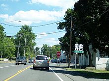
 Southern terminus of NY 34B
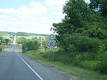
The concurrency with NY 34 in Lansing is a wrong-way concurrency as drivers traveling on NY 34B north are simultaneously driving on NY 34 south.
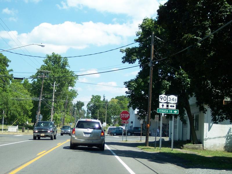
 NY 34B at the intersection along NY 90
History
In 1908, the New York State Legislature created Route 11, an unsigned legislative route extending from Ithaca to Auburn via the hamlets of South Lansing, Lake Ridge, King Ferry, Scipioville, and Fleming.[3][4] No route was assigned to the Ithaca–Auburn corridor when the first set of posted routes in New York were assigned in 1924;[5] however, the primary north–south highway between the two cities was included as part of NY 40 by 1926. NY 40 followed a more easterly alignment than legislative Route 11 between South Lansing and Fleming, bypassing Lake Ridge, King Ferry, and Scipioville on what is now NY 34.[6]
The NY 40 designation was reassigned to another highway in the Capital District as part of the 1930 renumbering of state highways in New York. Its former routing south of Cato became part of the new NY 34, which extended south through Ithaca to Waverly.[7][8] At the same time, the former alignment of legislative Route 11 between South Lansing and Fleming was designated as NY 34B.[1] Also assigned as part of the renumbering was NY 229, an extension of NY 34B east to NY 38 in the Dryden hamlet of Peruville. NY 34B and NY 229 were separated by less than 1 mile (1.6 km) of NY 34.[8] The NY 229 designation was removed ca. 1939.[9][10]
On April 1, 1980, the road from South Lansing to Peruville became a state highway once again as ownership and maintenance of the roadway was transferred from Tompkins County to the state of New York as part of a highway maintenance swap between the two levels of government.[11] The new state highway became part of an extended NY 34B.[12][13]
Major intersections
County Location Mile[2] Destinations Notes Tompkins Town of Dryden 0.00 NY 38Hamlet of Peruville Town of Lansing 6.99 NY 34 northEastern terminus of NY 34 / NY 34B overlap 7.47 NY 34 southHamlet of South Lansing; western terminus of NY 34 / NY 34B overlap Cayuga Genoa 19.33  NY 90
NY 90Hamlet of King Ferry Fleming 34.03 NY 341.000 mi = 1.609 km; 1.000 km = 0.621 mi References
- ^ a b Dickinson, Leon A. (January 12, 1930). "New Signs for State Highways". The New York Times: p. 136.
- ^ a b "2008 Traffic Volume Report for New York State" (PDF). New York State Department of Transportation. June 16, 2009. p. 102. https://www.nysdot.gov/divisions/engineering/technical-services/hds-respository/NYSDOT%20TVR%202008%20by%20Route.pdf. Retrieved January 31, 2010.
- ^ State of New York Department of Highways (1909). The Highway Law. Albany, New York: J. B. Lyon Company. p. 58. http://books.google.com/books?id=jZ0AAAAAMAAJ&pg=PA58. Retrieved May 25, 2010.
- ^ New York State Department of Highways (1920). Report of the State Commissioner of Highways. Albany, New York: J. B. Lyon Company. p. 520. http://books.google.com/books?id=Sj4CAAAAYAAJ&pg=PA520. Retrieved May 25, 2010.
- ^ "New York's Main Highways Designated by Numbers". The New York Times: p. XX9. December 21, 1924.
- ^ Rand McNally and Company (1926). Rand McNally Auto Road Atlas (western New York) (Map). http://www.broermapsonline.org/members/NorthAmerica/UnitedStates/Midatlantic/NewYork/unitedstates1926ra_008.html. Retrieved May 25, 2010.
- ^ Standard Oil Company of New York (1929). New York in Soconyland (Map). Cartography by General Drafting.
- ^ a b Standard Oil Company of New York (1930). Road Map of New York (Map). Cartography by General Drafting.
- ^ Thibodeau, William A. (1938). The ALA Green Book (1938–39 ed.). Automobile Legal Association.
- ^ Standard Oil Company (1939). New York (Map). Cartography by General Drafting.
- ^ New York State Legislature. "New York State Highway Law § 341". http://public.leginfo.state.ny.us/menugetf.cgi?COMMONQUERY=LAWS. Retrieved December 4, 2009.
- ^ Exxon (1977). New York (Map). Cartography by General Drafting (1977–78 ed.).
- ^ State of New York (1981). I Love New York Tourism Map (Map). Cartography by Rand McNally and Company.
External links
Categories:- State highways in New York
- Transportation in Cayuga County, New York
- Transportation in Tompkins County, New York


Wikimedia Foundation. 2010.