- New York State Route 40
-
"NY 40" redirects here. NY 40 may also refer to New York's 40th congressional district.This article is about the current alignment of NY 40. For the former alignment of NY 40 in Central New York, see New York State Route 40 (1920s–1930).
NYS Route 40
Route information Maintained by NYSDOT, Rensselaer County and the city of Troy Length: 54.67 mi[2] (87.98 km) Existed: 1930[1] – present Major junctions South end:  NY 7 in Troy
 NY 29 near Greenwich
North end:  NY 22 in Granville
Location Counties: Rensselaer, Washington Highway system Numbered highways in New York
Interstate • U.S. • N.Y. (former) • Reference • County←  NY 39
NY 39NY 41  →
→New York State Route 40 (NY 40) is a north–south state highway in eastern New York, United States. It is 54.67 miles (87.98 km) long and runs from NY 7 in the city of Troy north to NY 22 in the town of Granville. NY 40 also passes through the villages of Schaghticoke and Argyle and enters the vicinity of the village of Greenwich. It intersects three east–west highways of note: NY 67 just outside Schaghticoke, NY 29 west of Greenwich, and NY 149 in the hamlet of Hartford. Incidentally, NY 40 has overlaps with all three routes.
NY 40 originally extended south to East Greenbush and north to Comstock when it was assigned as part of the 1930 renumbering of state highways in New York. The route was truncated south to NY 149 in Hartford in the early 1940s and north to U.S. Route 4 in North Greenbush in the late 1950s. It was re-extended northward to its current northern terminus in the 1960s, but also truncated northward to its current southern terminus in the early 1970s. In 1980, ownership and maintenance of the portion of NY 40 south of NY 142 and outside of Troy was transferred from the state of New York to Rensselaer County as part of a highway maintenance swap. This section of the route is co-designated and co-signed as County Route 145 and has no reference markers.
Contents
Route description
NY 40 begins at an intersection with NY 7 (Hoosick Street) in the Rensselaer County city of Troy. It heads north as 10th Street for one block, then veers northeast onto Oakwood Avenue. NY 40 continues through Troy, passing St. Mary Hospital and later the Frear Park Golf Course. North of the golf course, NY 40 passes through Oakwood Cemetery and begins to straddle the boundary between the city of Troy and the town of Brunswick. Most of this section is in Brunswick and maintained by Rensselaer County as County Route 145, a designation that is visibly signed along NY 40. Meanwhile, the portion of the route in Troy is maintained by the city.
Past the cemetery, the route re-enters the city of Troy and has a brief, 0.08-mile (0.13 km) long overlap with NY 142. It continues northward along Leversee Road into the town of Schaghticoke, where it becomes Speigletown Road. NY 40 intersects NY 67 southwest of the village of Schaghticoke, and the two routes come together to cross the Hoosic River and enter the village. NY 67 leaves NY 40 just north of the village line and heads east toward the town of Pittstown. NY 40, meanwhile, continues northward as Reservoir Road into Washington County.
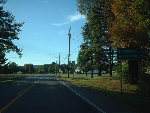
 Northern terminus of NY 40 as seen from NY 22 northbound
Now in the town of Easton, NY 40 progresses onward on a slightly northeasterly alignment that loosely parallels that of the Hudson River 3 miles (5 km) to the west. It passes through mostly rural terrain to the vicinity of the village of Greenwich, where it intersects NY 29. Like NY 67, NY 29 joins NY 40 north to cross a waterbody, this time Batten Kill. The routes enter the town of Greenwich and split on the north bank of the river not long afterward. While NY 29 travels east into Greenwich village, NY 40 continues northeast into the town of Argyle.
In the hamlet of South Argyle, NY 40 intersects with County Route 49, once designated as NY 338. NY 40 continues on through rural surroundings to the village of Argyle, a small community situated around NY 40's junction with NY 197. The route heads northeastward from Argyle to the town of Hartford, passing Tamarack Swamp near the town line. To the north of the swamp is the hamlet of South Hartford, where NY 40 intersects with NY 196. Just over 1 mile (1.6 km) to the north, NY 40 enters the hamlet of Hartford. It intersects NY 149 south of the community and the two routes overlap for roughly 0.5 miles (0.8 km) through the hamlet. Northeast of Hartford, NY 40 passes through the southeastern tip of the town of Fort Ann on its way to the town of Granville, where it ends at a junction with NY 22.
History
Establishment and realignments
NY 40 was assigned as part of the 1930 renumbering of state highways in New York to an alignment extending from East Greenbush in the south to Comstock in the north via the city of Troy and the hamlet of Middle Granville. It began at U.S. Route 9 and U.S. Route 20 and ran concurrent with U.S. Route 4 to Troy, where it split from US 4 at 125th Street. From there, it followed 125th Street, Northern Drive, and Brickyard Road out of the city. NY 40 joined its modern alignment shortly afterward at Leversee Road.[3]
The current and original routings of NY 40 remained identical until the town of Hartford. The route left its current alignment north of the hamlet of Hartford and headed northeast to Middle Granville, where it met NY 22. NY 40 and NY 22 came together, forming an overlap westward to Truthville. NY 22 split from NY 40 here, veering off to the northwest, while NY 40 continued west to US 4 in Comstock, where it ended.[3] The Middle Granville – Comstock segment of NY 40 was part of NY 24 prior to the renumbering; in fact, it was the only part of NY 40 that was part of a route prior to 1930.[1]
NY 40 was realigned slightly by the following year to bypass Middle Granville entirely. Instead of heading northeast from Hartford, NY 40 went northward to West Granville, where it rejoined its previous alignment.[4] By 1932, NY 40 was rerouted in the vicinity of Troy. It now left US 4 in the town of North Greenbush (south of Troy) and followed Winter Street northeastward into the city. Within Troy, NY 40 overlapped NY 66 to its end at Congress Avenue (then-NY 96 and now NY 2) and briefly joined NY 96 westward to 15th Street. NY 40 turned north here, following 15th Street to Oakwood Avenue, where the route joined its modern routing.[5]
Truncations and other developments
Following the 1930s, NY 40 began to be reduced in size. In the early 1940s, NY 22 was realigned between Truthville and Whitehall to serve Comstock by way of NY 40 and US 4. As a result, NY 40 was truncated south to its junction with NY 149 in Hartford. The portion of NY 40's routing between Hartford and West Granville was a sub-par road at the time (deemed as a second and third-class highway by map cartographer General Drafting),[6][7] which led the state to place the end of the route in Hartford instead.[citation needed] In the late 1950s, NY 40 was cut back on its southern end to begin at what had been the northern terminus of its overlap with US 4 in North Greenbush.[8][9]
NY 40 was re-extended on its northern end ca. 1962 to follow its former routing northeastward to Middle Granville, where it ended at NY 22.[10][11] The alignment proved to be temporary as the Hartford – West Granville highway was improved during the mid-1960s and became part of a realigned NY 40 by 1968.[12][13] The last change to NY 40's routing came in the early 1970s when it was truncated on its southern end to the junction of Hoosick Street (NY 7) and 10th Street in Troy. As a result, NY 40 was also realigned slightly to use 10th Street and Oakwood Avenue between Hoosick and 15th Streets. NY 40's former routing on Winter Street was redesignated as NY 405.[14][15]
On April 1, 1980, ownership and maintenance of the portion of NY 40 that lies south of NY 142 and outside of the Troy city limits was transferred from the state of New York to Rensselaer County as part of a large highway maintenance swap between the two levels of government.[16] The routing of NY 40 was not altered; however, the part of the route given to the county is now co-designated as County Route 145 and is also co-signed as such.[17]
NY 40A
NY 40A was an alternate route of NY 40 in the town of Schaghticoke. It connected NY 40 to the Tomhannock Reservoir and the village of Valley Falls and had an overlap with NY 67 between Valley Falls and the village of Schaghticoke. The southern terminus of the route was at an intersection with NY 40 in the hamlet of Melrose. NY 40A's northern terminus was at the junction of NY 40 and NY 67 just north of the Schaghticoke village limits. The route was assigned ca. 1933[5][18] and removed in the late 1940s.[19][20] However, the portion of NY 40A's old alignment between the southern Valley Falls village line and NY 67 remained state-maintained until April 1, 1980, when ownership and maintenance of it was transferred to Rensselaer County as part of a large highway maintenance swap between the state and the county.[16] The entirety of NY 40A's former routing south of NY 67 is now County Route 117.[21][22]
Major intersections
County Location Mile[2] Destinations Notes Rensselaer Troy 0.00 NY 73.45  NY 142 north
Western terminus of NY 40 / NY 142 overlap 3.53 NY 142 southEastern terminus of NY 40 / NY 142 overlap Village of Schaghticoke 11.53  NY 67 west
Southern terminus of NY 40 / NY 67 overlap 13.08 NY 67 eastNorthern terminus of NY 40 / NY 67 overlap Washington Town of Greenwich 26.64 NY 29 westWestern terminus of NY 29 / NY 40 overlap 27.65 NY 29 eastEastern terminus of NY 29 / NY 40 overlap Village of Argyle 37.27  NY 197
Eastern terminus of NY 197 Hartford 46.22  NY 196
Eastern terminus of NY 196 47.49  NY 149 west
Southern terminus of NY 40 / NY 149 overlap 47.84 NY 149 eastNorthern terminus of NY 40 / NY 149 overlap Town of Granville 54.67 NY 221.000 mi = 1.609 km; 1.000 km = 0.621 mi References
- ^ a b Dickinson, Leon A. (January 12, 1930). "New Signs for State Highways". The New York Times: p. 136.
- ^ a b "2008 Traffic Data Report for New York State" (PDF). New York State Department of Transportation. June 16, 2009. pp. 187–188. https://www.nysdot.gov/divisions/engineering/technical-services/hds-respository/NYSDOT_Traffic_Data_Report_2008.pdf. Retrieved January 27, 2010.
- ^ a b Standard Oil Company of New York (1930). Road Map of New York (Map). Cartography by General Drafting.
- ^ Kendall Refining Company (1931). New York (Map). Cartography by H.M. Gousha Company.
- ^ a b Texas Oil Company (1932). Texaco Road Map – New York (Map). Cartography by Rand McNally and Company.
- ^ Gulf Oil Company (1940). New York Info-Map (Map). Cartography by Rand McNally and Company.
- ^ Esso (1942). New York with Pictorial Guide (Map). Cartography by General Drafting.
- ^ Esso (1958). New York with Special Maps of Putnam–Rockland–Westchester Counties and Finger Lakes Region (Map). Cartography by General Drafting (1958 ed.).
- ^ Gulf (1960). New York and New Jersey Tourgide Map (Map). Cartography by Rand McNally and Company.
- ^ Sunoco (1961). New York and Metropolitan New York (Map). Cartography by H.M. Gousha Company (1961–62 ed.).
- ^ Sinclair (1962). New York and Metropolitan New York (Map). Cartography by Rand McNally and Company.
- ^ Sinclair (1964). New York and Metropolitan New York (Map). Cartography by Rand McNally and Company.
- ^ Esso (1968). New York (Map). Cartography by General Drafting (1969–70 ed.).
- ^ State of New York Department of Transportation (January 1, 1970) (PDF). Official Description of Touring Routes in New York State. http://www.greaternyroads.info/pdfs/state70.pdf. Retrieved June 10, 2009.
- ^ Shell Oil Company (1973). New York (Map). Cartography by H.M. Gousha Company (1973 ed.).
- ^ a b New York State Legislature. "New York State Highway Law § 341". http://public.leginfo.state.ny.us/LAWSSEAF.cgi?QUERYTYPE=LAWS+&QUERYDATA=$$HAY341$$@TXHAY0341+&LIST=LAW+&TARGET=VIEW. Retrieved June 10, 2010.
- ^ New York State Department of Transportation (1991). Troy North Digital Raster Quadrangle (Map). 1:24,000. http://www.nysgis.state.ny.us/gisdata/quads/drg24/dotpreview/index.cfm?code=r49. Retrieved June 10, 2009.
- ^ Texas Oil Company (1933). Texaco Road Map – New York (Map). Cartography by Rand McNally and Company.
- ^ Sinclair Oil Corporation (1947). New York Road Map and Pictorial Sight-Seeing Guide (Map). Cartography by Rand McNally and Company.
- ^ Socony-Vacuum Oil Company (1950). New York (Map). Cartography by Rand McNally and Company.
- ^ New York State Department of Transportation (1992). Schaghticoke Digital Raster Quadrangle (Map). 1:24,000. http://www.nysgis.state.ny.us/gisdata/quads/drg24/dotpreview/index.cfm?code=q50. Retrieved June 10, 2009.
- ^ New York State Department of Transportation (1974). Tomhannock Digital Raster Quadrangle (Map). 1:24,000. http://www.nysgis.state.ny.us/gisdata/quads/drg24/dotpreview/index.cfm?code=r50. Retrieved June 10, 2009.
External links
Categories:- State highways in New York
- Transportation in Rensselaer County, New York
- Transportation in Washington County, New York

Wikimedia Foundation. 2010.