- New York State Route 66
-
NYS Route 66
Route information Maintained by NYSDOT and the city of Troy Length: 46.30 mi[3] (74.51 km) Existed: mid-1920s[1][2] – present Major junctions South end:  NY 23B in Hudson
 US 20 in Nassau
North end:  NY 2 in Troy
Location Counties: Columbia, Rensselaer Highway system Numbered highways in New York
Interstate • U.S. • N.Y. (former) • Reference • County←  NY 65
NY 65NY 67  →
→New York State Route 66 (NY 66) is a state highway in the Capital District of New York in the United States. The route begins at an intersection with NY 23B in the Columbia County city of Hudson and ends at a junction with NY 2 in the Rensselaer County city of Troy. While both Hudson and Troy are located on the Hudson River, NY 66 follows a more inland routing between the two locations to serve several rural villages and hamlets, including Chatham and Sand Lake. NY 66 overlaps with U.S. Route 20 and NY 43, two regionally important east–west highways, in Nassau and Sand Lake, respectively.
The route was assigned in the mid-1920s to an alignment extending from Claverack to Nassau via Ghent. It was extended north to Troy as part of the 1930 renumbering of state highways in New York and rerouted south of Ghent to serve Hudson ca. 1933. Originally, NY 66 directly served Averill Park via modern County Route 45 and part of NY 43; however, it was realigned in 1980 to bypass the hamlet to the northeast. The segment of NY 66 between Sand Lake and US 20 was part of Route 21, an unsigned legislative route, in the early 1920s.
Contents
Route description
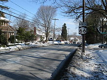 NY 66 begins here at NY 23B in Hudson.
NY 66 is not a direct link between Hudson and Troy, heading instead northeasterly to reach Chatham and Sand Lake. NY 66 is a two-lane highway its entire length.
Columbia County
NY 66 leaves Hudson as Union Turnpike, passes through Ghent, then enters Chatham as Hudson Avenue, then Main Street. A tight left turn around a village roundabout leads to its northern egress from Chatham. From there, NY 66 follows the Kinderhook Creek, taking a winding, serpentine path around abandoned aqueducts and the creek itself. This is a heavily-wooded area.
Rensselaer County
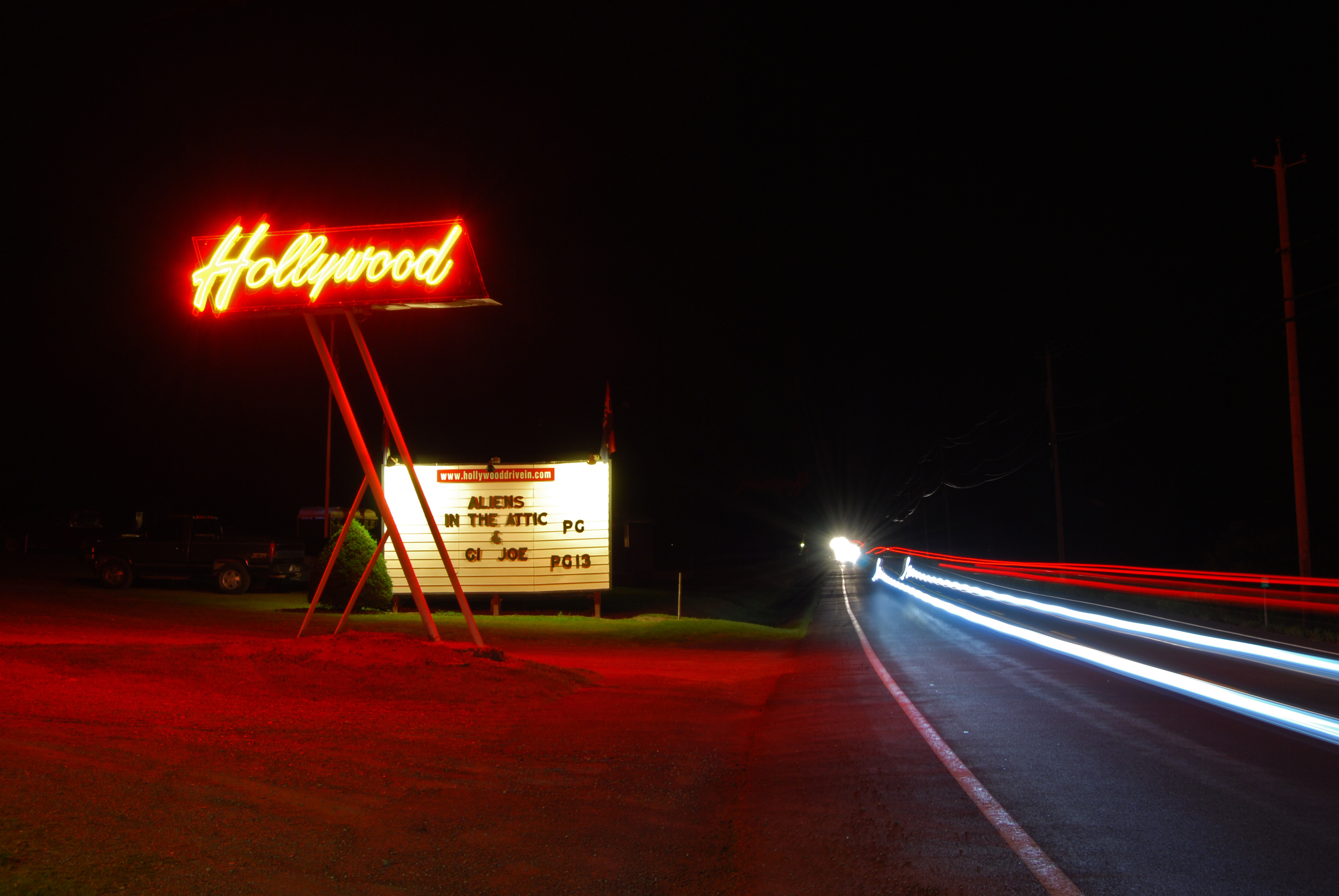
 Hollywood Drive In on Rte. 66 in Averill Park
NY 66 continues to follow the Kinderhook Creek until well above its concurrency with US 20 in the town of Nassau. After the split, the route passes by several lakes and hamlets in the southeast part of the county, including several along a concurrency with NY 43 through the town of Sand Lake. After that split, the highway straightens out a bit as it heads through the town of Poestenkill toward the hamlet of Wynantskill as Main Avenue. In Troy, it becomes Pawling Avenue, ending at a Y intersection at Congress St., NY 2.
History
When the New York State Legislature assigned Route 21, an unsigned legislative route, in 1908, it followed modern County Routes 15 and 51 between Averill Park and the village of Nassau.[4][5] The route was realigned on March 1, 1921, to use what is now NY 66 between Averill Park and current U.S. Route 20 instead.[6] This leg of Route 21 was included in NY 66 when it was assigned in the mid-1920s. At the time, NY 66 began at NY 23 in Claverack and followed modern NY 217 to Mellenville (west of Philmont). Here, NY 66 turned onto what is now County Route 9 and proceeded north to Ghent, where it joined its modern alignment.[1][2] On its north end, NY 66 originally ended at NY 45 (now NY 43) just south of the Sand Lake town line. The remainder of modern NY 66 north to Troy was part of NY 45, which was assigned around the same time as NY 66 and utilized modern County Route 45 in the vicinity of Averill Park.[1][7]
In the 1930 renumbering of state highways in New York, the NY 45 designation was reassigned elsewhere in the state while its former routing was split up into several routes. One of these was NY 66, which was extended northward over former NY 45 to Troy.[8] NY 66 was altered ca. 1933 to follow Union Turnpike southwest from Ghent to Hudson, bypassing Claverack and Philmont to the west.[9][10] On April 1, 1980, ownership and maintenance of NY 66 between NY 43 in Averill Park and then-County Route 48 (CR 48, named Miller Hill Road) north of the hamlet was transferred from the state of New York to Rensselaer County as part of a highway maintenance swap between the two levels of government. One of the highways the state received in exchange was CR 48, a northerly bypass of Averill Park that began at NY 43 and NY 66 in the hamlet of Sand Lake and went northwest around Averill Park to NY 66 north of the latter hamlet.[11][12] The new state highway became part of a realigned NY 66[13][14] while the route's old alignment into Averill Park became CR 45.[15]
Major intersections
County Location Mile[3] Destinations Notes Columbia Hudson 0.00 NY 23BClaverack 3.06  NY 9H
NY 9HVillage of Chatham 12.15 
 NY 203 (Coleman Street) to Taconic Parkway
12.55  NY 295 (Railroad Avenue)
Western terminus of NY 295 Rensselaer Town of Nassau 24.59 US 20 westWestern terminus of US 20 / NY 66 overlap 26.34 US 20 eastHamlet of Brainard; eastern terminus of US 20 / NY 66 overlap 33.86  NY 43 east
Eastern terminus of NY 43 / NY 66 overlap Sand Lake 36.82 NY 43 westWestern terminus of NY 43 / NY 66 overlap 39.64  NY 351
Town of Poestenkill 42.33  NY 355
Western terminus of NY 355 North Greenbush 43.29  NY 150
Hamlet of Wynantskill; northern terminus of NY 150 Troy 45.20 Spring Avenue Former western terminus of NY 154 46.30 NY 2 (Congress Street)1.000 mi = 1.609 km; 1.000 km = 0.621 mi References
- ^ a b c "New York's Main Highways Designated by Numbers". The New York Times: p. XX9. December 21, 1924.
- ^ a b Rand McNally and Company (1926). Rand McNally Auto Road Atlas (eastern New York) (Map). http://www.broermapsonline.org/members/NorthAmerica/UnitedStates/Midatlantic/NewYork/unitedstates1926ra_009.html. Retrieved May 30, 2010.
- ^ a b "2008 Traffic Volume Report for New York State" (PDF). New York State Department of Transportation. June 16, 2009. p. 126. https://www.nysdot.gov/divisions/engineering/technical-services/hds-respository/NYSDOT%20TVR%202008%20by%20Route.pdf. Retrieved January 31, 2010.
- ^ State of New York Department of Highways (1909). The Highway Law. Albany, New York: J. B. Lyon Company. p. 61. http://books.google.com/books?id=jZ0AAAAAMAAJ&pg=PA61. Retrieved May 30, 2010.
- ^ New York State Department of Highways (1920). Report of the State Commissioner of Highways. Albany, New York: J. B. Lyon Company. p. 530. http://books.google.com/books?id=Sj4CAAAAYAAJ&pg=PA530. Retrieved May 30, 2010.
- ^ New York State Legislature (1921). "Tables of Laws and Codes Amended or Repealed". Laws of the State of New York passed at the One Hundred and Forty-Fourth Session of the Legislature. Albany, New York: J. B. Lyon Company. pp. 42, 59. http://books.google.com/books?id=6pE4AAAAIAAJ&pg=PA42. Retrieved May 30, 2010.
- ^ Rand McNally and Company (1926). Rand McNally Auto Road Atlas (southern New Hampshire and Vermont) (Map). http://www.broermapsonline.org/members/NorthAmerica/UnitedStates/NewEngland/New%20Hampshire/unitedstates1926ra_005.html. Retrieved May 30, 2010.
- ^ Dickinson, Leon A. (January 12, 1930). "New Signs for State Highways". The New York Times: p. 136.
- ^ Texas Oil Company (1932). Texaco Road Map – New York (Map). Cartography by Rand McNally and Company.
- ^ Texas Oil Company (1933). Texaco Road Map – New York (Map). Cartography by Rand McNally and Company.
- ^ New York State Legislature. "New York State Highway Law § 341". http://public.leginfo.state.ny.us/LAWSSEAF.cgi?QUERYTYPE=LAWS+&QUERYDATA=$$HAY341$$@TXHAY0341+&LIST=LAW+&TARGET=VIEW. Retrieved May 30, 2010.
- ^ New York State Department of Transportation (1974). Averill Park Digital Raster Quadrangle (Map). 1:24,000. http://www.nysgis.state.ny.us/gisdata/quads/drg24/dotpreview/index.cfm?code=s50. Retrieved May 30, 2010.
- ^ State of New York (1981). I Love New York Tourism Map (Map). Cartography by Rand McNally and Company.
- ^ Rand McNally and Company (1985). New York (Map). ISBN 0-528-91040-X.
- ^ "Rensselaer County Inventory Listing" (CSV). New York State Department of Transportation. March 2, 2010. https://www.nysdot.gov/divisions/engineering/technical-services/hds-repository2/INV_2010-03-02_rensselaer.csv. Retrieved May 30, 2010.
External links
Categories:- State highways in New York
- Transportation in Rensselaer County, New York
- Transportation in Columbia County, New York

Wikimedia Foundation. 2010.