New York State Route 9H

New York State Route 9H

NYS Route 9H marker

NYS Route 9H
Route information
Auxiliary route of US 9
Maintained by NYSDOT
Length: 18.70 mi[3] (30.09 km)
Existed: ca. 1932[1][2] – present
Major junctions
South end: US 9 / NY 23 / NY 82 in Livingston
  US 9 in Valatie
North end: US 9 in Kinderhook
Location
Counties: Columbia
Highway system

Numbered highways in New York
Interstate • U.S. • N.Y. (former) • Reference • County

NY 9G NY 9J

New York State Route 9H (NY 9H) is a state highway located within Columbia County, New York, United States. It runs from US 9, NY 82, and NY 23 at its southern end in Bell Pond to its northern end in Valatie, also at US 9.

Contents

History

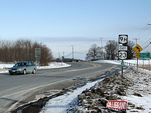
NY 9H begins at US 9, NY 23 and NY 82 here in Bell Pond.

NY 9H was assigned ca. 1932 to the portion of its modern alignment south of US 9 southwest of Valatie.[1][2] It was extended north around the western edge of Valatie to its current northern terminus ca. 1940.[4][5]

Major intersections

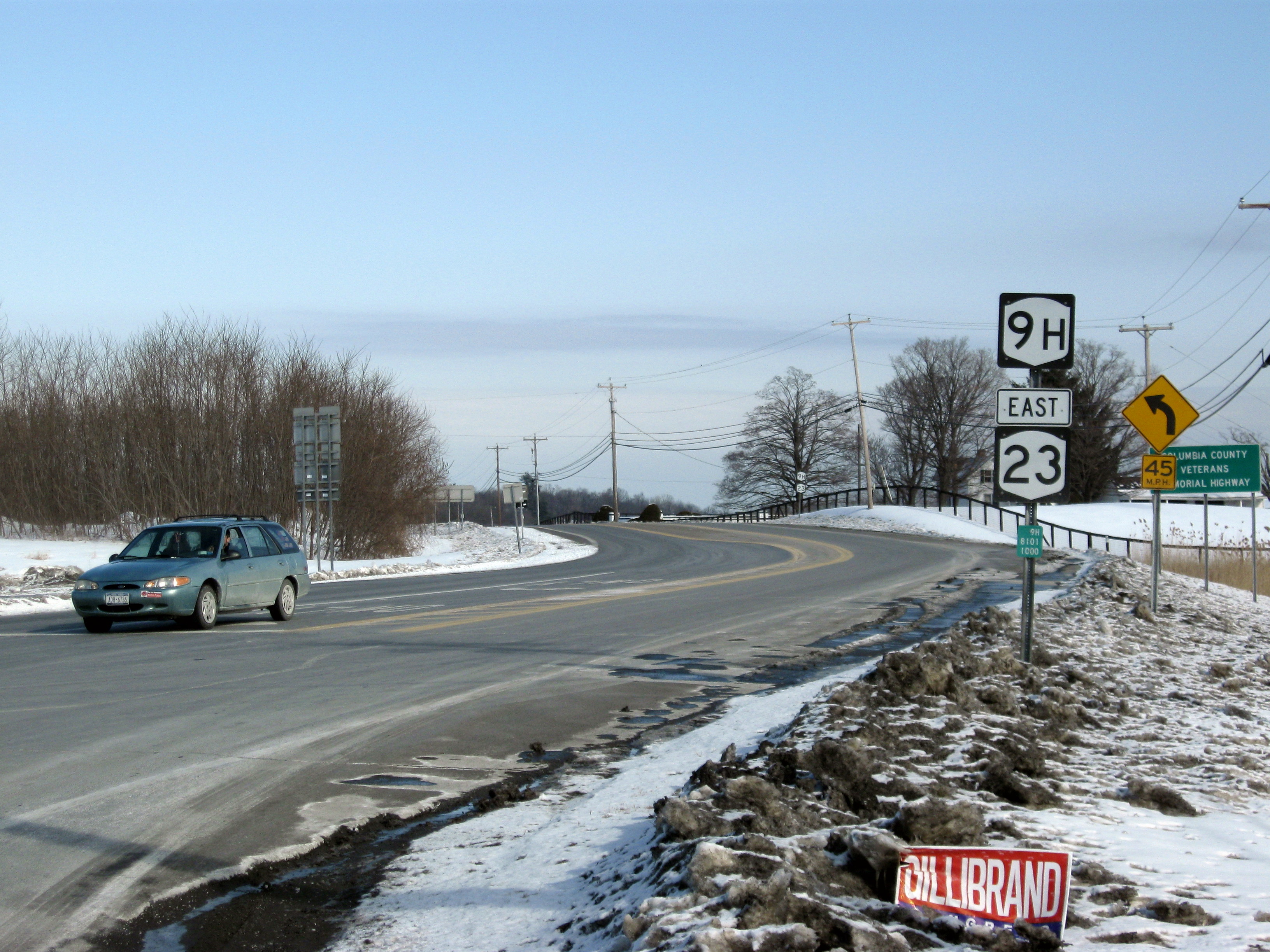
NY 9H's northern terminus at US 9 in Valatie.

The entire route is in Columbia County.

Location Mile[3] Destinations Notes
Livingston 0.00 US 9 / NY 23 west / NY 82 Northern terminus of NY 82; southern terminus of NY 9H / NY 23 overlap
Claverack 3.89 NY 23 east / NY 23B Eastern terminus of NY 23B; northern terminus of NY 9H / NY 23 overlap
7.40 NY 66 Hamlet of Brick Tavern
Valatie 17.37 US 9 Southbound-only interchange
Kinderhook 18.70 US 9
1.000 mi = 1.609 km; 1.000 km = 0.621 mi

References

NY-blank (cutout).svg New York Roads portal
  1. ^ a b Kendall Refining Company (1931). New York (Map). Cartography by H.M. Gousha Company. 
  2. ^ a b Texas Oil Company (1932). Texaco Road Map – New York (Map). Cartography by Rand McNally and Company. 
  3. ^ a b "2008 Traffic Volume Report for New York State" (PDF). New York State Department of Transportation. June 16, 2009. p. 28. https://www.nysdot.gov/divisions/engineering/technical-services/hds-respository/NYSDOT%20TVR%202008%20by%20Route.pdf. Retrieved January 31, 2010. 
  4. ^ Standard Oil Company (1939). New York (Map). Cartography by General Drafting. 
  5. ^ Esso (1940). New York (Map). Cartography by General Drafting. 

External links


Wikimedia Foundation. 2010.

Игры ⚽ Поможем сделать НИР

Look at other dictionaries:

  • New York State Route 62 — may refer to: New York State Route 62 (1920s–1930) in Allegany, Wyoming, Genesee, and Orleans Counties New York State Route 62 (1930–1932) in Cattaraugus and Erie Counties U.S. Route 62 in New York, the only route numbered 62 in New York since ca …   Wikipedia

  • New York State Route 2A — may refer to: New York State Route 2A (mid 1920s–1927) in St. Lawrence County New York State Route 2A (1930–1939) in the Finger Lakes region New York State Route 2A (1939 – early 1940s) in Seneca County This article includes a list of roads,… …   Wikipedia

  • New York State Route 11 — may refer to: New York State Route 11 (1924–1927) in Central New York U.S. Route 11 (New York), the only route numbered 11 in New York since 1926 This article includes a list of roads, streets, highways, or other routes that are associated with… …   Wikipedia

  • New York State Route 20 — may refer to: New York State Route 20 (1924–1927) in Central New York U.S. Route 20 (New York) U.S. Route 20A (New York) This article includes a list of roads, streets, highways, or other routes that are associated with the same title. If an …   Wikipedia

  • New York State Route 4 — may refer to: New York State Route 4 (1924–1927) in the Finger Lakes region U.S. Route 4 in New York, the only route numbered 4 in New York since 1926 This article includes a list of roads, streets, highways, or other routes that are associated… …   Wikipedia

  • New York State Route 3C — may refer to: New York State Route 3C (1930–1932) in Cayuga, Oswego, and Jefferson Counties New York State Route 3C (1932–1935) in Monroe County This article includes a list of roads, streets, highways, or other routes that are associated with… …   Wikipedia

  • New York State Route 3E — may refer to: New York State Route 3E (1930–1932) in Wayne, Cayuga, and western Oswego Counties New York State Route 3E (1932–1935) in central Oswego County This article includes a list of roads, streets, highways, or other routes that are… …   Wikipedia

  • New York State Route 3B — may refer to: New York State Route 3B (1930–1932) in Orleans and Monroe Counties New York State Route 3B (1932–1935) in Niagara and Orleans Counties This article includes a list of roads, streets, highways, or other routes that are associated… …   Wikipedia

  • New York State Route 3D — may refer to: New York State Route 3D (1931–1932) in central Oswego County New York State Route 3D (1932–1935) in Cayuga, Oswego, and Jefferson Counties This article includes a list of roads, streets, highways, or other routes that are associated …   Wikipedia

  • New York State Route 3F — may refer to: New York State Route 3F (1931–1932) in Jefferson County New York State Route 3F (1932–1935) in Wayne, Cayuga, and Oswego Counties This article includes a list of roads, streets, highways, or other routes that are associated with the …   Wikipedia

  • New York State Route 9C — may refer to: New York State Route 9C (1920s–1930) in the Capital District New York State Route 9C (1930 – early 1930s) in the Lower Hudson Valley This article includes a list of roads, streets, highways, or other routes that are associated with… …   Wikipedia

Share the article and excerpts

Direct link
Do a right-click on the link above
and select “Copy Link”