- New York State Route 2
-
"NY 2" redirects here. NY 2 may also refer to New York's 2nd congressional district.This article is about the current alignment of NY 2. For previous alignments of NY 2, see New York State Route 2 (disambiguation).
NYS Route 2
Route information Maintained by NYSDOT and the cities of Watervliet and Troy Length: 30.89 mi[3] (49.71 km) Existed: early 1940s[1][2] – present Major junctions West end: 
 I-87 / NY 7 in Colonie
 US 4 in Troy
 NY 22 in Petersburgh
East end:  Route 2 at Petersburgh
Location Counties: Albany, Rensselaer Highway system Numbered highways in New York
Interstate • U.S. • N.Y. (former) • Reference • County←  US 2
US 2NY 3  →
→New York State Route 2 (NY 2) is a state highway in the Capital District of New York, United States. It extends from an interchange with Interstate 87 and NY 7 in the hamlet of Latham within the town of Colonie to the Massachusetts state line, where it continues to Boston as Route 2. Cities along the highway include Troy and Watervliet. Grafton Lakes State Park is off this highway in Grafton.
At Petersburg Pass just west of the state line, Route 2 reaches 2,400 feet (730 m) in elevation, one of the highest points on New York's state highway system.
Contents
Route description
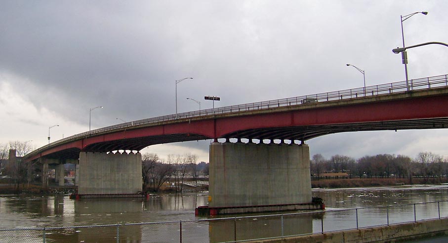
NY 2 begins at Interstate 87 exit 6 in the hamlet of Latham as a continuation of NY 7, which leaves Troy–Schenectady Road at the interchange to join I-87. The route continues east on Troy–Schenectady Road to U.S. Route 9, which it intersects via the Latham Circle. Instead of directly intersecting US 9, NY 2 meets a series of ramps leading to and from the road while US 9 itself crosses under the circle, allowing for a continuous flow of traffic on US 9. Past US 9, NY 2 continues east through the town of Colonie to Watervliet, where it becomes 19th Street and meets NY 32 a short distance from the Hudson River. NY 2 then passes over Interstate 787 before crossing the Hudson via the Congress Street Bridge and entering Troy on the opposite bank. Here, the route splits into a one-way pair along Congress Street (westbound) and Ferry Street (eastbound) through the Central Troy Historic District.
Four blocks into Troy, NY 2 intersects U.S. Route 4, also routed along a one-way pair through the city. At 3rd Street, NY 2 meets US 4 southbound; it then intersects US 4 northbound at 4th Street. After traversing two more blocks, NY 2 merges into a single carriageway at 8th Street. NY 2 continues east along the now two-way Congress Street, passing south of the Rensselaer Polytechnic Institute before becoming Brunswick Road at an intersection with NY 66 in eastern Troy.
East of Troy, NY 2 meets NY 278 and NY 351 in Brunswick before skirting the southern edge of Grafton Lakes State Park in Grafton. The route then continues east from Grafton into the hamlet of Petersburgh in the town of the same name. As NY 2 enters from the west, down a steep incline, it curves leftward while Moses Road continues straight ahead. This surface street in Petersburgh ends at NY 22, while NY 2 continues over NY 22 on an overpass. North of the overpass, Main Street intersects NY 22 and connects to NY 2, which curves right. Westbound NY 2 traffic curves left for the overpass, with Main Street continuing straight ahead in the same manner that Moses Road does on the west side. Collectively, Main Street and Moses Road make up the 0.41-mile (0.66 km) long NY 914A, an unsigned reference route.[3] Past NY 22, NY 2 briefly occupies Main Street before heading southeast to the Massachusetts state line, where it becomes Route 2 upon entering the town of Williamstown, Massachusetts.
Maintenance
Most of NY 2 is maintained by the New York State Department of Transportation, however, two locally maintained sections lie on the route. In the city of Watervliet, NY 2 is city-maintained from Grotto Court to NY 32, while in the city of Troy, NY 2 is city-maintained from US 4 to the east city line.
History
Most of modern NY 2 east of 1st Street in Troy was originally designated by the New York State Legislature as Route 42, an unsigned legislative route, in 1911. East of Troy, however, Route 42 was routed on Pawling and Pinewoods Avenues. Route 42 was extended west across the Hudson River to Schenectady in 1914 by way of what is now NY 2 and NY 7.[4][5] When the first set of posted routes in New York were assigned in 1924, the portion of Route 42 west of 1st Street became part of NY 9.[6] The rest of Route 42 remained unnumbered until the 1930 renumbering of state highways in New York, when it was designated as NY 96. Near Troy, NY 96 bypassed Pawling and Pinewoods Avenues to the north on Brunswick Road instead of following the path of Route 42.[7] The alignments of NY 96 and NY 2, a highway extending from Owego to Rochester in the Finger Lakes region of New York, were swapped in the early 1940s, placing NY 2 on the Troy–Massachusetts routing.[1][2]
Around the same time as the designation swap, NY 2 was extended south to NY 5 in Albany by way of overlaps with U.S. Route 4, then routed on 1st Street, and NY 32. In between the two routes, NY 2 was routed on modern NY 378 and crossed the Hudson River by way of the Troy–Menands Bridge.[2][8] NY 2 was rerouted slightly in the early 1950s to leave NY 32 at the junction of Wolfert Avenue and Broadway and follow Broadway into downtown Albany, where it ended at Madison Avenue (U.S. Route 9 and U.S. Route 20).[9][10] The route was truncated to the northern end of the NY 32 overlap in the mid-1960s,[11][12] then to 3rd Street (US 4) in Troy on January 1, 1970. The former routing of NY 2 between NY 32 and US 4 became an extension of NY 378.[13]
Construction on a new limited-access highway through the town of Colonie between Interstate 87 and Interstate 787 began in the early 1980s. At the time, the roadway was known as "NY 7 Alternate".[14][15] However, when it opened in 1986,[16] it became a realignment of NY 7 instead. NY 7's former surface routing from I-87 in Latham to US 4 in Troy then became a westward extension of NY 2.[17]
Major intersections
County Location Mile[3] Destinations Notes Albany Colonie 0.00 I-87 / NY 7Hamlet of Latham; exit 6 (I-87 / NY 7) 0.51  US 9
US 9Hamlet of Latham; Latham Circle Watervliet 3.82  NY 32
NY 32Rensselaer Troy 4.38 US 4 south4.45 US 4 north5.39  NY 66
NY 66Northern terminus of NY 66 Brunswick 11.74  NY 278
Southern terminus of NY 278 12.18  NY 351
Northern terminus of NY 351 Petersburgh 25.10 NY 22Access to NY 22 via NY 914A 30.89 Route 2Continuation into Massachusetts 1.000 mi = 1.609 km; 1.000 km = 0.621 mi References
- ^ a b Pennsylvania Department of Highways (1940) (PDF). Official Road Map of Pennsylvania (Map). ftp://ftp.dot.state.pa.us/public/pdf/BPR_pdf_files/Maps/Statewide/Historic_OTMs/1940fr.pdf. Retrieved April 1, 2009.
- ^ a b c Esso (1942). New York with Pictorial Guide (Map). Cartography by General Drafting.
- ^ a b c "2008 Traffic Volume Report for New York State" (PDF). New York State Department of Transportation. June 16, 2009. pp. 1–2, 264. https://www.nysdot.gov/divisions/engineering/technical-services/hds-respository/NYSDOT%20TVR%202008%20by%20Route.pdf. Retrieved January 30, 2010.
- ^ State of New York Commission of Highways (1912). The Highway Law. http://books.google.com/books?id=vM1YCvYmKAsC&pgis=1. Retrieved April 1, 2009.
- ^ State of New York Commission of Highways (1919). The Highway Law. http://books.google.com/books?id=hZ4AAAAAMAAJ&printsec=frontcover&dq=editions:0BO0d1_wjEj48SYL7L#PPA68,M1. Retrieved April 1, 2009.
- ^ "New York's Main Highways Designated by Numbers". The New York Times: p. XX9. December 21, 1924.
- ^ Automobile Legal Association (ALA) Automobile Green Book, 1930/31 and 1931/32 editions, (Scarborough Motor Guide Co., Boston, 1930 and 1931). The 1930/31 edition shows New York state routes prior to the 1930 renumbering
- ^ Esso (1940). New York (Map). Cartography by General Drafting.
- ^ Sunoco (1952). New York (Map). Cartography by Rand McNally and Company.
- ^ Esso (1954). New York with Special Maps of Putnam–Rockland–Westchester Counties and Finger Lakes Region (Map). Cartography by General Drafting (1955–56 ed.).
- ^ Esso (1962). New York with Sight-Seeing Guide (Map). Cartography by General Drafting.
- ^ Esso (1968). New York (Map). Cartography by General Drafting (1969–70 ed.).
- ^ State of New York Department of Transportation (January 1, 1970) (PDF). Official Description of Touring Routes in New York State. http://www.greaternyroads.info/pdfs/state70.pdf. Retrieved April 1, 2009.
- ^ State of New York (1981). I Love New York Tourism Map (Map). Cartography by Rand McNally and Company.
- ^ Rand McNally (1985). New York (Map). ISBN 0-528-91040-X.
- ^ National Bridge Inventory, a database compiled by the United States Department of Transportation Federal Highway Administration, available at www.nationalbridges.com. Accessed September 12, 2007.
- ^ DeLorme Mapping (1990). Upstate New York City Street Maps (Map). 1" = 1/2 mile. Cartography by DeLorme Mapping (1st ed.). p. 2, section D1. ISBN 0-89933-300-1.
External links
Categories:- State highways in New York
- Transportation in Rensselaer County, New York
- Transportation in Albany County, New York

Wikimedia Foundation. 2010.