- New York State Route 32
-
This article is about the current alignment of NY 32. For the former alignment of NY 32 in Erie and Niagara Counties, see New York State Route 32 (1920s–1930).
NYS Route 32

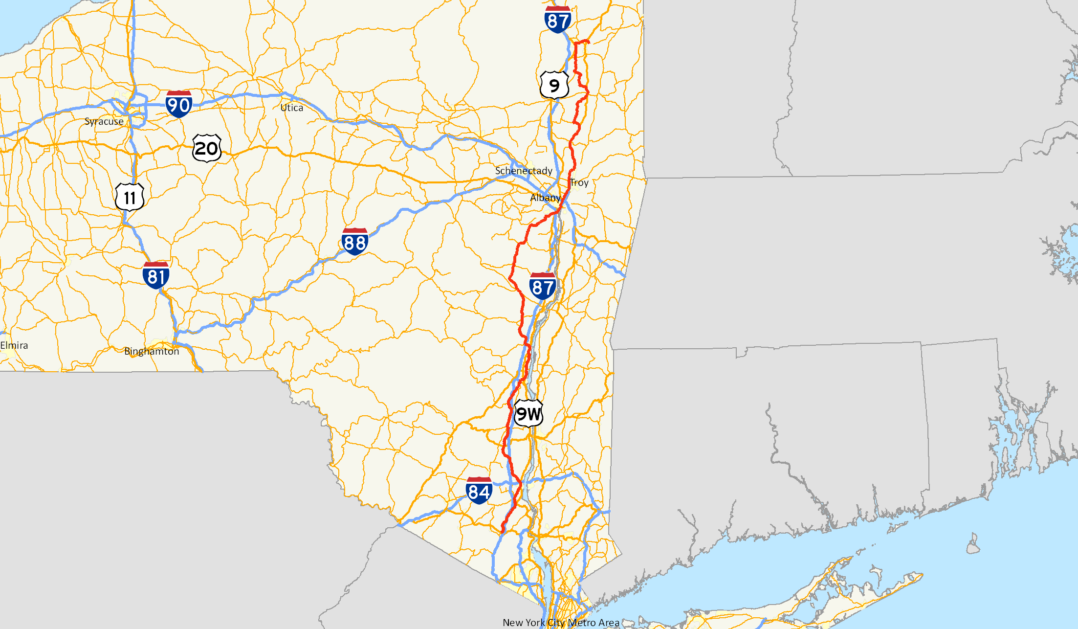
Map of New York with NY 32 highlighted in redRoute information Maintained by NYSDOT, Albany County and several cities Length: 176.73 mi[2] (284.42 km) Existed: 1930[1] – present Major junctions South end:  NY 17 in Woodbury
 I-84 / NY 52 in Newburgh

 US 44 / NY 55 in Plattekill

 I-587 / NY 28 in Kingston

 I-87 / Thruway in Saugerties
 NY 23 in Cairo
 US 20 in Albany
 US 4 near Troy
 NY 67 in Mechanicville
 NY 29 in Schuylerville

 US 9 / NY 9L in Glens Falls
North end:  NY 196 near Hudson Falls
Location Counties: Orange, Ulster, Greene, Albany, Saratoga, Warren, Washington Highway system Numbered highways in New York
Interstate • U.S. • N.Y. (former) • Reference • County←  NY 31F
NY 32A  →
→New York State Route 32 (NY 32) is a north–south state highway that extends for 176.73 miles (284.42 km) through the Hudson Valley and Capital District regions of the U.S. state of New York. It is a two-lane surface road for nearly its entire length, with few divided and no limited-access sections. From Harriman to Albany, it is closely parallel to Interstate 87 (I-87) and U.S. Route 9W (US 9W), overlapping with the latter in several places.
NY 32 begins at NY 17 on the outskirts of the New York metropolitan area in Woodbury just outside Harriman, and ends at NY 196 east of Hudson Falls just south of the Adirondacks. In between, the road passes through the cities of Newburgh, Kingston, Albany and Glens Falls. Outside of the cities, it offers views of the Hudson Highlands, Shawangunk Ridge, Catskill Mountains, and, during an overlap with US 4 north of Albany, the Hudson River.
The roads now making up the highway were originally part of several privately maintained turnpikes, which fostered settlements along the corridor. Once part of the former NY 58, it has been NY 32 since 1930. Only one of three letter-suffixed spur routes remains.
Contents
Route description
Maintenance of NY 32 is split between the New York State Department of Transportation (NYSDOT) and the highway departments of several different jurisdictions. Within the cities of Newburgh and Watervliet, the route is entirely city-maintained.[3][4] In four other cities—Albany, Cohoes, Glens Falls, and Kingston—NY 32 is mostly locally maintained.[4][5][6] The piece of the route in the city of Mechanicville, meanwhile, is city-maintained north of Frances Street, a local street four blocks south of NY 67.[7][8] One last locally maintained section exists in the Albany suburb of Bethlehem, where the route is county-maintained between Feura Bush Road and the Delmar Bypass. This section is co-signed as County Route 52 (CR 52), which continues northwest of NY 32 to a junction with NY 140 near Slingerlands.[4]
Harriman to Newburgh
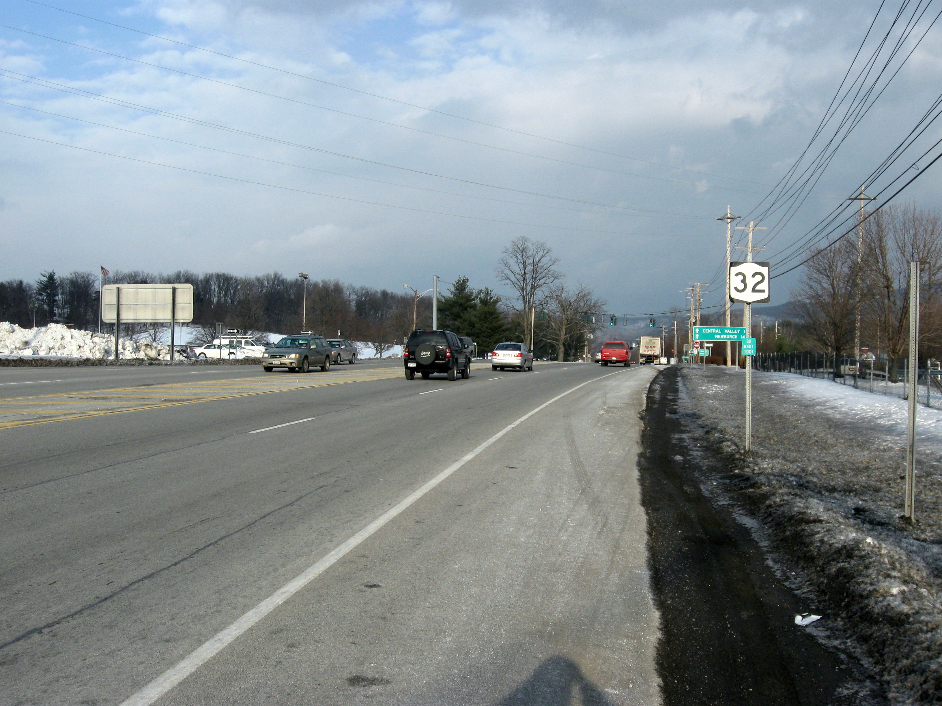
Route 32 begins where NY 17 leaves the Quickway overpass west of the New York State Thruway toll barrier, just north of the Harriman village line in Woodbury. To the east is Woodbury Common Premium Outlets, across from Central Valley Elementary School of the Monroe-Woodbury Central School District.[9] Beyond the mall, site of many major traffic jams,[10] NY 32 descends into downtown Central Valley. 2 miles (3 km) north is another of the Town of Woodbury's hamlets, Highland Mills. Beyond the Rushmore Memorial Library at the north end of the hamlet the road bends slightly west upon reaching the southwestern foot of Orange County's highest peak, Schunemunk Mountain.
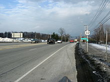 NY 32 begins here in Woodbury.
Shortly after Highland Mills, the Port Jervis Line, operated by Metro-North Railroad, crosses over on a high trestle. After crossing over Woodbury Creek and under the Thruway, NY 32 runs along the eastern side of the narrow valley between Schunemunk and the Hudson Highlands.[9] This section of highway runs through mostly wooded terrain as it leaves Woodbury for Cornwall.
Just north of Mountainville and the north end of Schunemunk, the road crosses Moodna Creek downstream from the Woodbury Creek confluence. The intersection with Angola Road 0.25 miles (0.40 km) to the south was once the beginning of the former NY 307; it is now the west end of County Route 107 (CR 107). Across the creek from CR 107 is Orrs Mills Road, another county road that leads to Storm King Art Center.[9]
 Route 32 in the Woodbury Creek valley
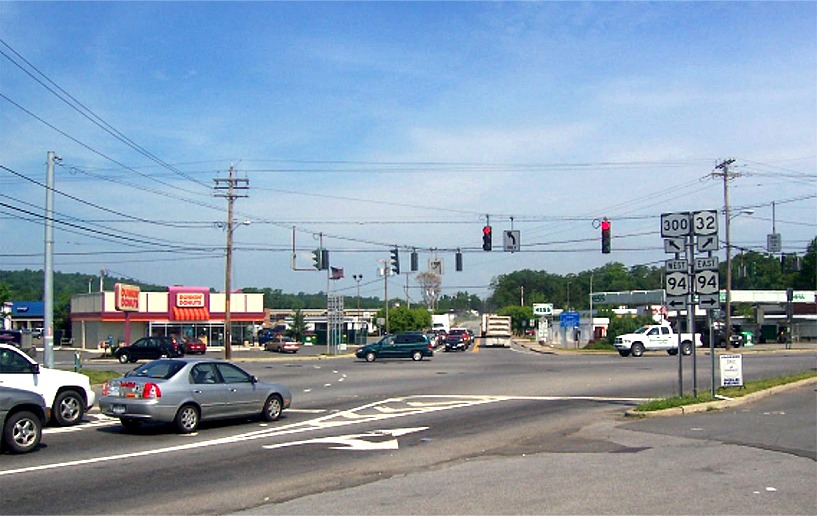
The road climbs gently out of the creek valley and enters development. At 1.6 miles (2.6 km) north of Angola Road, it crosses the New Windsor town line and reaches the complicated five-way intersection at the center of Vails Gate, intersecting NY 94 and the beginning of NY 300. The next 2 miles (3.2 km) include a middle turn lane as NY 32 becomes New Windsor's main commercial strip. This section ends at Temple Hill Avenue, with Snake Hill to the west. The road remains heavily commercial as it enters the city of Newburgh as the wide Lake Street.[9]
 Vails Gate
At Broadway (NY 17K), Newburgh's main street, NY 32 turns east. The brief, unsigned concurrency ends where 17K terminates at US 9W (Robinson Avenue), at the former Broadway School. NY 32, however, turns north again, beginning the first of several concurrencies with US 9W.
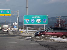
The two highways remain joined for the next 1.2 miles (1.9 km) as they pass the Frederick Law Olmsted and Calvert Vaux-designed Downing Park and reach the city limit, where I-84 and NY 52 cross the highway heading towards the Newburgh-Beacon Bridge. Immediately beyond that junction, NY 32 separates from US 9W and heads northwest.[9]
Newburgh to New Paltz
Newburgh has a commercial strip north of the city, featuring the Mid-Valley Mall and another large shopping plaza built around a supermarket anchor. This development ends after 1 mile (1.6 km) when 32 passes the Town of Newburgh's Cronomer Hill Park on the south, near a short drive to the summit observation tower.[9] 2 miles (3 km) more brings Route 32 to the center of the hamlet of Cronomer Valley and an unusual junction with NY 300. At what seems to be a conventional four-way intersection regulated by a traffic light, both highways turn, and it is necessary to turn to the northeast to stay on NY 32 headed north. Traffic that goes straight at this intersection flows onto Route 300.[9]
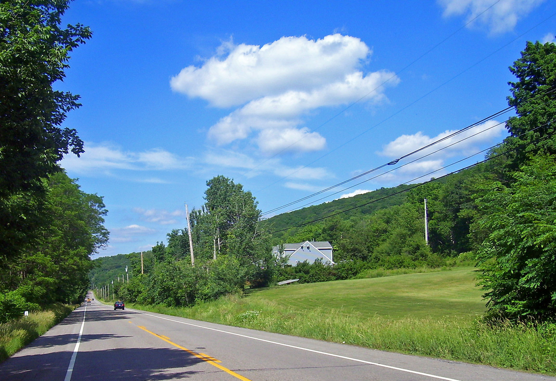
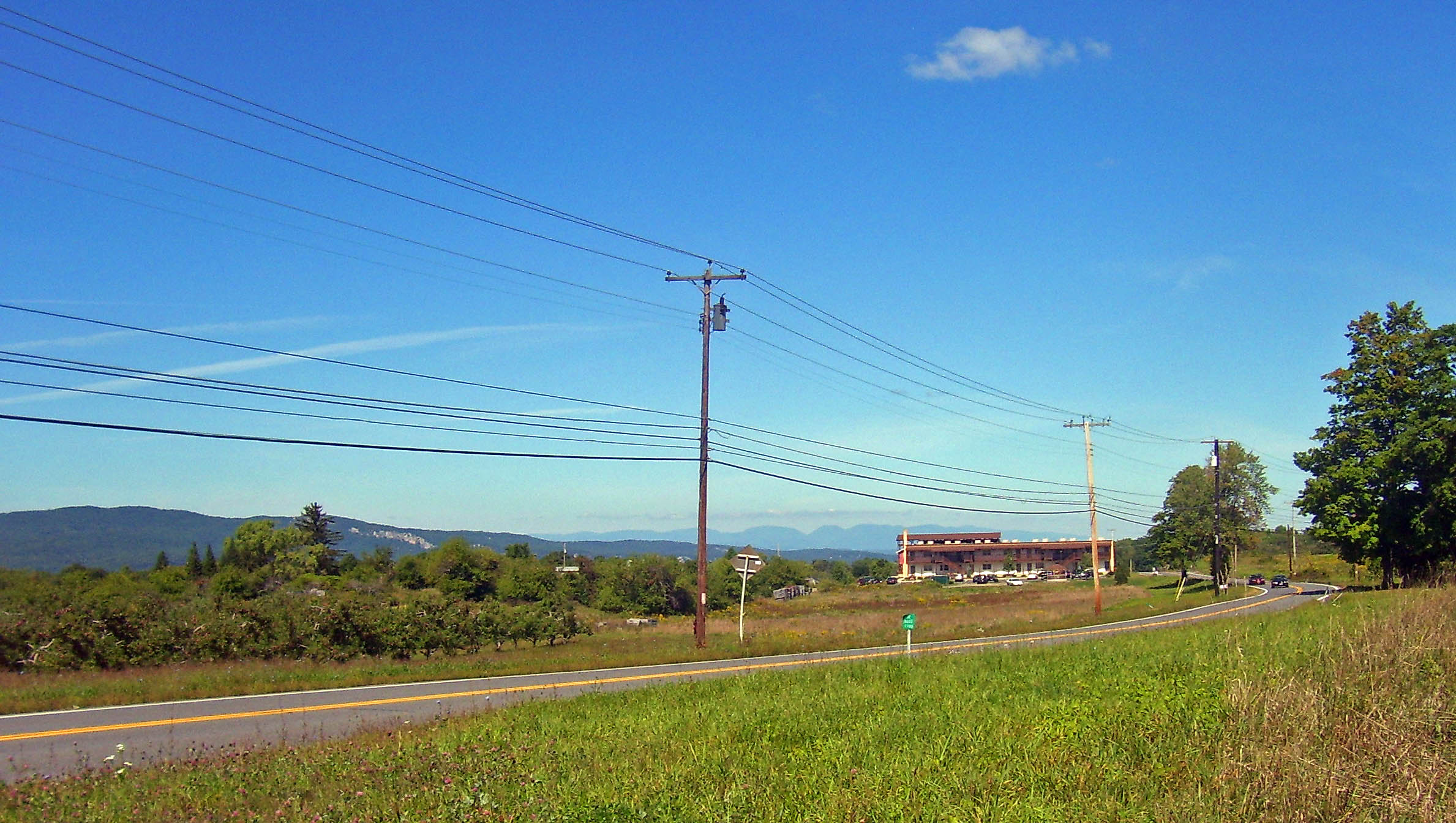
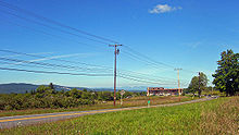 Views of the Shawangunks and Catskills as the highway nears New Paltz
From this intersection, NY 32 passes Chadwick Lake, the town's reservoir, and continues straight north through much less-developed, mostly wooded countryside for 4 miles (6 km) to the Ulster County line, almost the point at which the woods diminish.[9] Barely 1 mile (1.6 km) into Plattekill, the highway crosses the Thruway again. It curves northwards shortly thereafter, retaining a slightly westward trend through mostly open fields near the Shawangunk Ridge. At 4.5 miles (7.2 km) from the Thruway, NY 32 intersects US 44 and NY 55 in the center of another Town of Plattekill hamlet, Modena.[9] A short distance beyond, the highway crosses into Gardiner, taking a wide bend around Locust Lawn, the Federal-style home of early 19th-century politician Josiah Hasbrouck.[11]
North of Modena, the surrounding area becomes slightly more wooded near where NY 32 crosses into the Town of New Paltz. The highway curves before entering the village next to the campus of State University of New York at New Paltz. Two blocks north of campus, at New Paltz Middle School, it turns west at a traffic signal to join NY 299 as the village's Main Street.[9]
New Paltz to Kingston
While NY 32 officially remains concurrent with NY 299 all the way to the traffic light at the northern terminus of NY 208, a sign at the Elting Memorial Library, just before the center of downtown, directs northbound traffic on the highway down North Front Street. This shortcut allows that traffic to skip an often busy intersection and head out of the village on North Chestnut Street. Once past the village, the Ulster Board of Cooperative Educational Services (BOCES) building comes up on the west and the town hall along the east. NY 32 then becomes mostly rural again.[9]
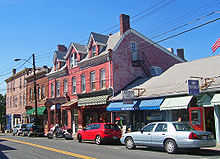 Downtown New Paltz
Over the next 5 miles (8 km), the road trends easterly until NY 213 joins it from the east right before the bridge over the Wallkill. Now concurrent, 32 and 213 bend away from the Thruway and pass through the hamlet of Tillson and then descend to cross Rondout Creek at the former village of Rosendale. Just after the crossing, at the Stewart's, NY 213 leaves to the west along the creek, ending a 2.5-mile (4.0 km) concurrency.[9]
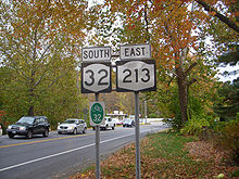 NY 213 and NY 32 concurrency in Rosendale
From Rosendale, NY 32 climbs up out of the Rondout valley and veers east into the hamlet of Maple Hill, where it crosses over the Thruway once again. It resumes a northerly course through Bloomington, and several miles further on crosses the Kingston city line.[9] This entire segment of NY 32 is also concurrent with New York State Bicycle Route 32.
Kingston and Saugerties
On its route through Kingston, NY 32 frequently changes streets and directions. It enters town as Boulevard and meanders to just past Washington Avenue, where it splits onto the more easterly Greenkill Avenue and Fair Street for several blocks. NY 213 returns, merging from the south as Wilbur Avenue. The joined routes then turn onto Clinton Avenue for two blocks, then east onto Henry Street for about 0.5 miles (0.8 km) to Broadway, where NY 32 turns north and NY 213 ends.[9][12]
Another 0.5 miles (0.8 km) brings Broadway to the wide junction where I-587 and NY 28 both terminate. NY 32 follows Albany Avenue northeast to Flatbush Avenue, where it turns to assume an eastward course. This finally bends slightly north to East Chester Street near the city limit, where US 9W again comes in to begin a brief wrong-way concurrency in which NY 32 north is US 9W south. It ends, unsigned, after 1,500 feet (460 m) with US 9W's turn onto Frank Koenig Boulevard.[9]
Continuing as Flatbush Road into the Town of Ulster, NY 32 is for the first time along its route east of US 9W and closer to the river. It encounters NY 199 at an interchange immediately west of the Kingston-Rhinecliff Bridge. Soon after, it passes Kingston-Ulster Airport. It remains on a northerly heading until 1 mile (1.6 km) south of Saugerties, where it veers west and merges with US 9W again.[9] The two routes cross Esopus Creek and enter the village, where Partition Street gives way to Main Street. At that T intersection, US 9W turns to continue north, while NY 32 picks up the new NY 212 and heads west out of town.[9]
The Catskills to Albany
After one block of Main Street, NY 32 and NY 212 turn onto Market Street, then east onto Ulster Avenue after another block. As it crosses the railroad tracks and leaves the village, the road widens and becomes a commercial highway just before reaching a Thruway exit. This, the fourth time NY 32 has crossed the Thruway, is the first time it does so at an exit. Beyond the overpass, the concurrency ends when NY 32 turns and heads north once again. A tight nearby on-ramp provides access to the southbound Thruway.[9] NY 32 does not enter the Catskills but provides access to them along this stretch.[9]

At this point, the distance between NY 32 and the Thruway begins to widen.[9] At the junction with Malden Turnpike (CR 34), Route 32 turns westward, toward the Catskill Escarpment, and starts climbing through some rock cuts. When Blue Mountain Road (CR 35) comes in from the south, NY 32 resumes heading north, parallel to the ridge. 1 mile (1.6 km) from that junction, its only suffixed route, NY 32A, splits off to the west to provide direct access via NY 23A and Kaaterskill Clove to Tannersville and Hunter.[9]
After crossing into Greene County, the road intersects NY 23A at an undeveloped junction. NY 32 remains in its straight course through the lowlands below the escarpment, passing through mostly woodlands and the hamlet of Kiskatom, then winding around the north side of Cairo Roundtop before it joins with NY 23 at Cairo. After 1.5 miles (2.4 km), NY 32 leaves the divided highway to once again strike north as a two-lane route. It trends west to its westernmost point until turning to the north-northeast just south of Freehold.[9]
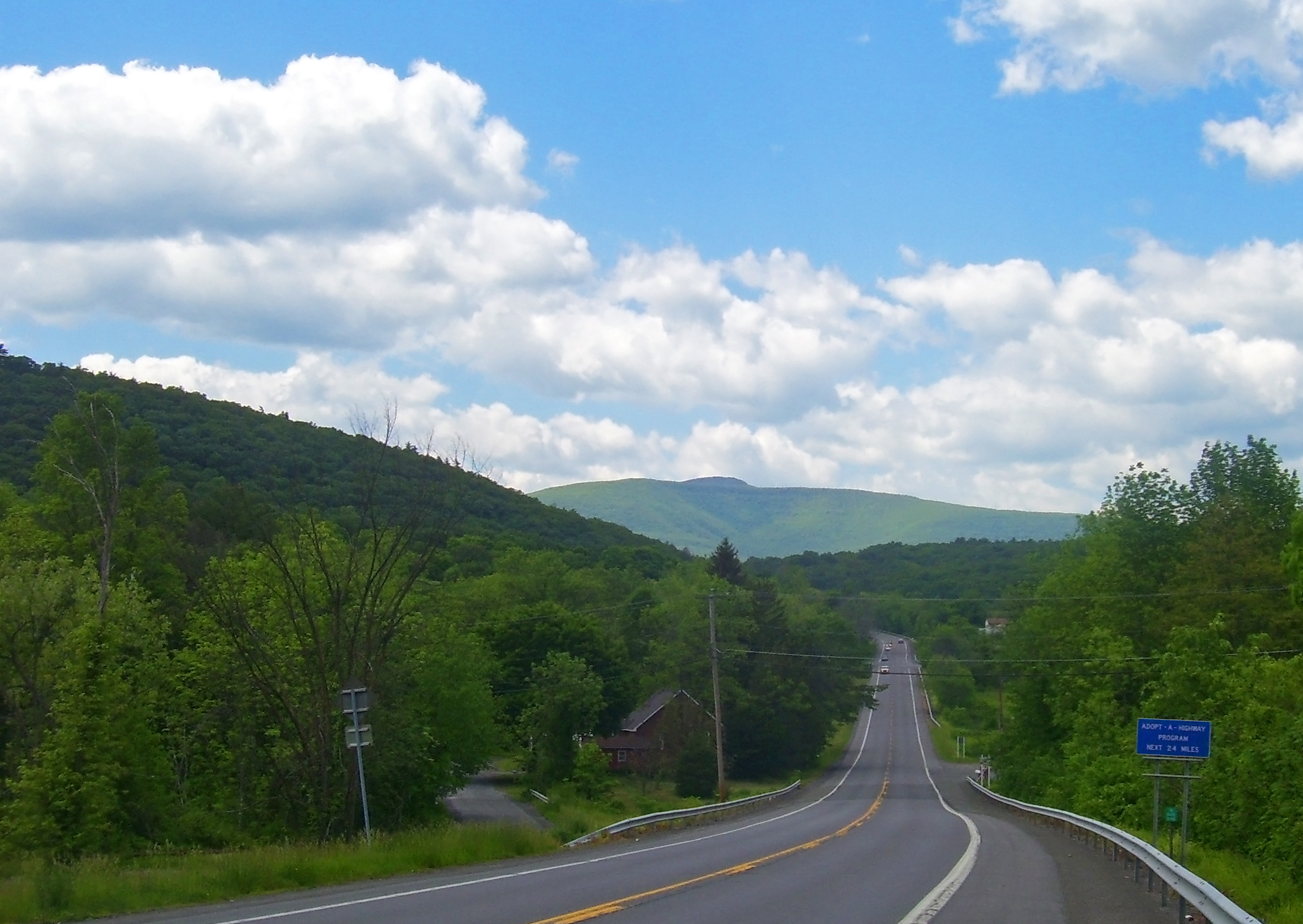
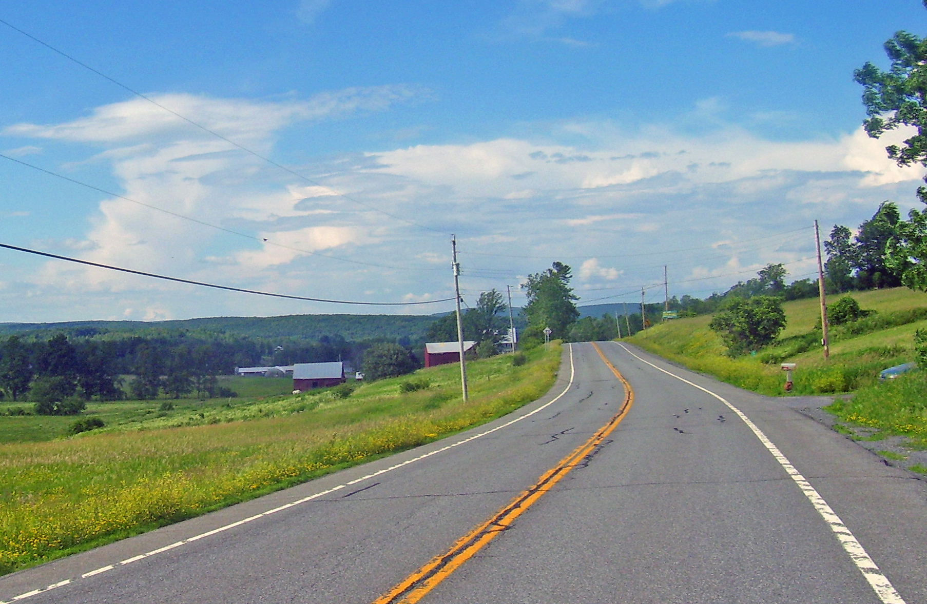
North of Freehold the road begins to climb. Views south to the Catskills appear as it nears the center of Greenville, where it crosses NY 81. 1 mile (1.6 km) further on, NY 32 enters Albany County via Westerlo near the Basic Creek Reservoir. The climbing stops another mile after the county line, where Route 32 reaches its highest elevation, 1,060 feet (320 m),[13] on the plateaus south of the Helderberg Escarpment. The road starts to curve back east as the surrounding landscape opens up, with larger fields surrounding it and a slow descent to the Hudson beginning.
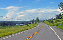 Rural landscape along Route 32 in Westerlo
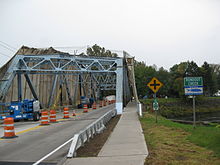
After sharing 2 miles (3.2 km) of road with NY 143, crossing the northern end of Alcove Reservoir and descending the southern end of the Helderberg Escarpment, the road veers eastward toward Albany.[9] To get there, it crosses into New Scotland just after the hamlet of Feura Bush and crosses a long bridge over the northern end of the busy rail yard northwest of Selkirk, where freight trains bound for New York City wait before crossing the Hudson at the Alfred H. Smith Memorial Bridge.
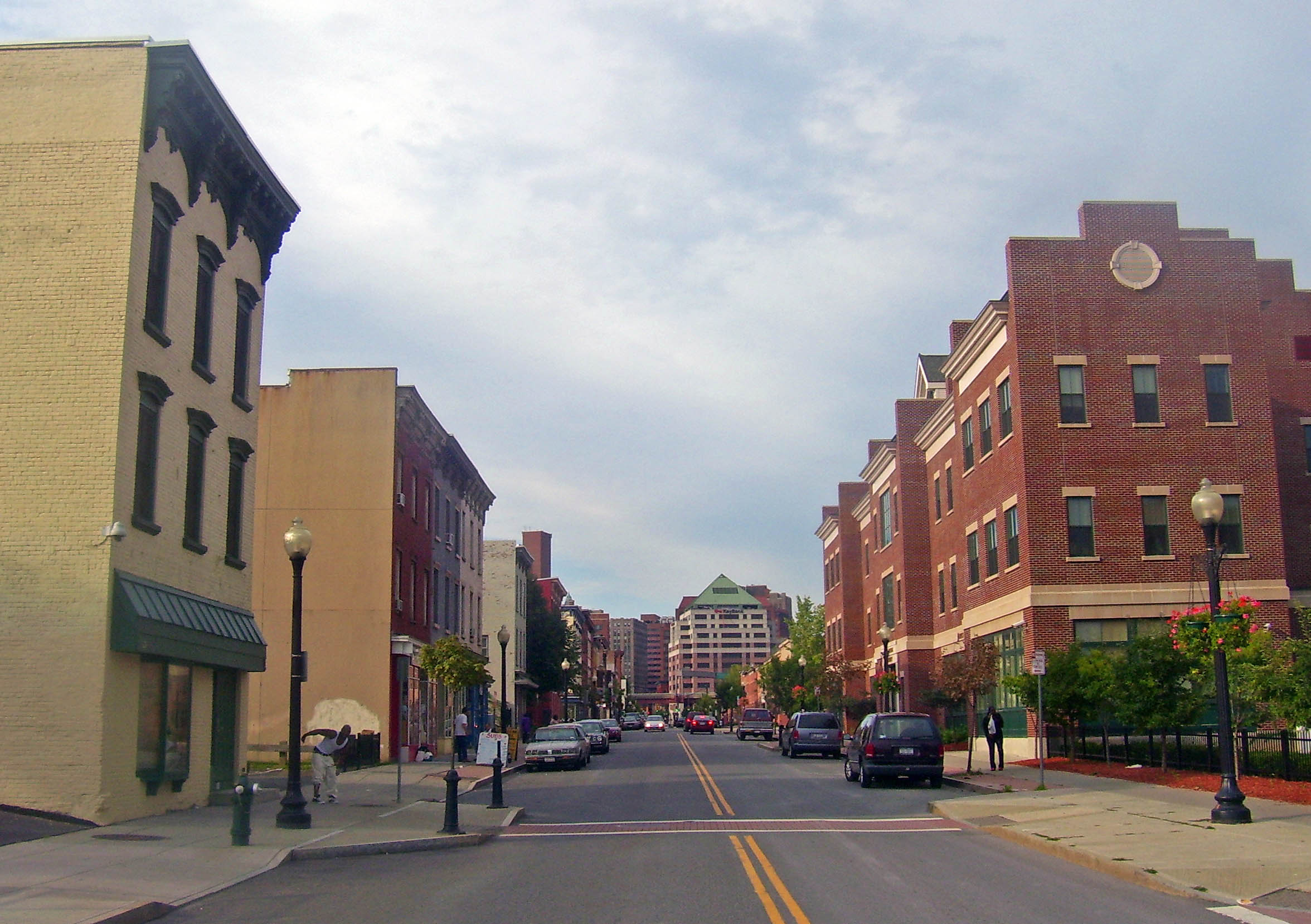
 Approaching downtown Albany
The landscape becomes more developed, though still rural, as the highway winds past a SABIC plant and other development accompanying the rail yard, entering the town of Bethlehem. At the southern corner of Delmar, NY 32 turns more to the east becomes a divided highway with grade intersections, the only non-concurrent segment of Route 32 to take this form. This segment continues, largely undeveloped, as it intersects NY 335 and crosses under the Thruway for the last time before reaching its final concurrency with US 9W. 0.5 miles (0.8 km) east of the Thruway, Route 32 again breaks from 9W and follows residential Corning Hill Road downhill to River Road, where it turns to the north again and crosses the Normans Kill into Albany, becoming South Pearl Street, and then paralleling I-787 for a short distance past the Port of Albany-Rensselaer before crossing underneath it.[9]
Albany to Hudson Falls
Route 32 follows South Pearl Street between the Mansion and Pastures neighborhoods, intersecting US 20 (Madison Avenue) near the approach to the Dunn Memorial Bridge, and then becoming one of the two main streets of downtown Albany. At Clinton Square and the Palace Theatre it intersects US 9 along Clinton Avenue. Near the city limits, NY 32 passes under I-90. Upon crossing into the neighboring village of Menands, NY 32 bears onto Wolfert Avenue to access Broadway. Broadway, a business thoroughfare originating in downtown Albany, is designated NY 910C, an unsigned reference route, for 0.06 miles (0.10 km) south of Wolfert Avenue to the Albany city line.[2] NY 32 occupies Broadway north of Wolfert Avenue, paralleling I-787. I-787's exit 6 ramps meet NY 32 in Menands, then NY 32 crosses over railroad tracks and soon leaves the village. NY 32 enters the hamlet of Schuyler Heights in the town of Colonie. After a short streatch the road enters the city of Watervliet where the name changes from Broadway to Third Avenue. The Watervliet Arsenal forces NY 32 to curve northeasterly as Ninth Street. Then at a traffic signal NY 32 turns left onto Broadway.[9]
At 13th Street, NY 32 leaves Broadway and follows 13th two blocks west to an intersection with 2nd Avenue. Here, NY 155 begins and occupies 13th to the west of 2nd while NY 32 turns north onto 2nd. NY 32 continues in the vicinity of I-787 and its continuation, NY 787, through Watervliet and back into the town of Colonie, this time its hamlet of Maplewood, to Cohoes, where NY 787 ends at NY 32 near the convergence of the Mohawk and Hudson rivers. Past NY 787, NY 32 crosses the Mohawk River into Saratoga County and the town of Waterford, after crossing into the village of Waterford NY 32 crosses the Erie Canal before intersecting US 4 in the heart of the village. The two routes merge, forming an overlap northward along the Hudson River.[9]
In Mechanicville, US 4 and NY 32 briefly overlap NY 67. Farther north, the two routes split north of Stillwater at the southern edge of the Saratoga National Historical Park. While US 4 straddles the park to the east, NY 32 follows the southern and western extents of the park before rejoining US 4 south of Schuylerville. In Schuylerville, the two routes are concurrent with NY 29 for a short distance before exiting the village. To the north of the village in Northumberland, NY 32 separates from US 4 and heads northwest to Gansevoort, where it meets NY 50. NY 32 continues north on the right-of-way of NY 50 to South Glens Falls, where US 9 joins NY 32 northward across the Hudson River into Glens Falls.[9]
Shortly after entering the city, NY 32 turns onto Warren Street, splitting from US 9 and following the Hudson River east toward Hudson Falls. At Highland Avenue, NY 32 turns east, following Highland past Quaker Road (NY 254) to Dix Avenue, where it merges east onto Dix. NY 32 remains on Dix into Hudson Falls, intersecting US 4 one last time north of the village before continuing through the intersection onto Burgoyne Avenue. The route follows Burgoyne Avenue southward around the northeastern portion of Hudson Falls to NY 196, where NY 32 terminates.[9] Burgoyne Avenue continues southwestward as CR 37 to US 4 in Fort Edward.
History
Old roads
Route 32 was once made up of several privately owned turnpikes that stretched throughout New York. A stretch from Catskill to Cairo was also once part of the Susquehannah Turnpike. Created in April 1800, the Susquehannah Turnpike began in Catskill and ended in Unadilla.[14] The Susquehannah Turnpike aided the growth of Greene County, which until then had depended on steamboats on the Susquehanna River and Catskill Creek. The turnpike attracted business from the New England states, made shipping easier for the county's farmers, and improved shipping from New York City.[15]
The turnpike was no longer maintained by a private company after 1899 and the highway remained intact for over 75 years. In 1974, part of the turnpike was added to the National Register of Historic Places.[16] Route 32 was also part of the Orange Turnpike, which stretched from the New Jersey line to Newburgh. The turnpike, created three days after the Susquehannah Turnpike, follows the current routes of NY 17 and NY 32. North of Newburgh, the road follows another old turnpike to the Route 300 junction and then the old Plattekill Turnpike into Ulster County.[14]
Designation
The segment of modern NY 32 between Albany and Mechanicville was designated as part of NY 6 in 1924. From Mechanicville to Hudson Falls, the current routing of NY 32 became part of NY 30.[17] By 1926, the portion of what is now NY 32 from Harriman to Newburgh was designated NY 58. From Newburgh to Albany, NY 32 remained unnumbered at the time.[18] When U.S. Routes were first assigned in New York in 1927, the portion of NY 6 from Albany to Waterford was designated as the northernmost portion of US 9W. In Waterford, US 9W merged with US 9E and continued north as US 9 to Mechanicville, where US 9 turned west onto modern NY 67.[19]
In the 1930 renumbering of state highways in New York, US 9W was truncated to Albany while US 9 was rerouted to follow a new stretch between Albany and Round Lake. The former routing of both routes along the Hudson River between Albany and Mechanicville, as well as the entirety of NY 58 and the portion of NY 30 from Schuylerville to Hudson Falls was integrated into the new NY 32, which followed its current routing between Harriman and the Stillwater community of Bemis Heights and from Schuylerville to Hudson Falls.[20] Between Bemis Heights and Schuylerville, NY 32 followed what is now US 4 along the Hudson River while the former routing of NY 30 between the two locations became NY 32A.[1][21][22] At the same time, US 4, which previously ended in Glens Falls, was rerouted south of Hudson Falls to end in East Greenbush.[20] From Northumberland to Waterford, the route used what is now NY 32.[22]
Reroutings
 NY 32 at its intersection with US 9 in Albany.
NY 32 has been realigned in several locations since its inception in 1930. When the route was initially assigned, it passed through Palenville instead of bypassing it to the east as it does today. In the early 1940s, NY 32 was rerouted to follow a new highway east of the hamlet. NY 32's former routing into Palenville was redesignated as NY 32A. The original NY 32A in Saratoga County—which was redundant to US 4—was supplanted at this time by a rerouted NY 32.[23][24] The Bemis Heights – Schuylerville portion of the overlap between US 4 and NY 32 was eliminated in the 1950s when the original routing of NY 32 between the two locations was upgraded. Construction on the highway began in the mid-1950s and was completed by 1958, at which time US 4 was rerouted to follow the riverside roadway.[25][26][27]
In Bethlehem, a southern suburb of Albany, NY 32 was originally routed on Feura Bush Road between the hamlets of Feura Bush and Glenmont. North of Glenmont, NY 32 followed what is now NY 144. In the mid-1960s, a four-lane arterial was constructed north of Feura Bush Road between Elm Avenue and US 9W.[28][29] The highway, known as the Delmar Bypass, became part of a rerouted NY 32 by 1970.[30] NY 32's former routing along Feura Bush Road is still state-maintained as NY 910A, an unsigned reference route.[31]
Within Queensbury and Hudson Falls, NY 32 was originally routed on Boulevard Street and Feeder Avenue.[32] On April 1, 1980, ownership and maintenance of Boulevard Street between Highland Avenue and the Washington County line was transferred from New York State to Warren County in exchange for control over Highland and Dix Avenues between Warren Avenue and the Washington County line. The portion of Boulevard Street in Hudson Falls, as well as the segment of Feeder Street south of Boulevard, was given to Washington County on April 1 of the following year in return for ownership and maintenance over all of Dix and Burgoyne Avenues north of NY 196.[33] NY 32 was rerouted to follow Highland, Dix, and Burgoyne Avenues shortly afterward.[34]
Rondout Creek bridge rehabilitation
In June 2008, NYSDOT began a rehabilitation project of the bridge over Rondout Creek in Rosendale. The 1⁄2-mile (0.8 km) project involved rehabilitating the bridge one half at a time. The project was slated to have the 74-year-old bridge up to standards by the fall of 2009. It also included improvements to the road leading up to the bridge.[35] Having only one lane open at a time congested traffic in the area. The total cost of the project was $5.5 million.[36] The bridge had been refurbished before, in 1970.[37]
Future
In several locations, traffic congestion along Route 32 has led to suggestions to change or modify the road. The problems are most severe at the southern terminus, but it is not the only section of the road with issues.
Woodbury Commons
The road's southern terminus at Woodbury Commons is the most frequent topic of discussion, especially since Black Friday in 2001, when heavy traffic from holiday shoppers along adjacent sections of not only 32 but routes 6 and 17 and the Thruway came to a complete standstill. "This should have been planned for and it wasn't", complained one local official. "Now you're trying to close the door and the horse is already out".[38] Despite several efforts and the presence of state police on later Black Fridays,[39] a similar traffic jam occurred on Labor Day weekend 2006, when a break in bad weather led to an increase in shoppers so marked that US 6 and the Thruway were backed up as far as Newburgh and the Palisades Interstate Parkway, respectively. The Woodbury police chief cited the blockage created by drivers making the left turn from Route 32 to the Thruway as the cause. Plans to build an exit ramp that would allow that traffic to go directly to the tollbooth have been expedited.[40]
On the weekend of August 17–18, 2009, another serious traffic jam occurred, in which it took some drivers two hours to get to the Thruway from the mall. Officials cited several factors: the heavy traffic on Route 17 that weekend for both the 40th anniversary of the Woodstock Music Festival in Sullivan County and the observances of the anniversary of Rabbi Joel Teitelbaum's death in Kiryas Joel, a few miles to the west. A traffic light that had been malfunctioning after a recent lightning strike may also have contributed.[41]
 NY 32 begins just ahead adjacent to the Woodbury Commons.
In 2007, New York State Department of Transportation (NYSDOT) officials announced their long-term plan to prevent further traffic jams. They will create a series of loops and overpasses allowing traffic to go directly from southbound Route 32 to the Thruway and remove some traffic lights in front of the mall. The changes are expected to be complete by 2011, as part of improvements to convert the Route 17 expressway into I-86.[42]
Vails Gate
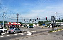
The "Five Corners" intersection of NY 32 and NY 94 was a four-way junction until World War II, when the Army extended Temple Hill Road, later NY 300, southeast to the junction so that troops and materiel could get between West Point and the airbase at what was then Stewart Field more quickly. It did not become a traffic problem until the 1990s, when gas stations, supermarkets, strip malls and fast-food restaurants had been built on every corner.[43]
By the end of the 20th century, the intersection was handling 30,000 drivers a day, from increasingly developed Cornwall, Newburgh and New Windsor. NYSDOT expanded the intersection with middle-turn lanes and overhead signs on all approaches. Many drivers still felt it was a confusing intersection and that the confusion slowed traffic down as much as the many cars' stopping to enter and exit nearby businesses. In 2001 state officials said they had done everything possible to improve traffic flows through the Five Corners. Continuing congestion was attributable to insufficient or nonexistent planning.[43]
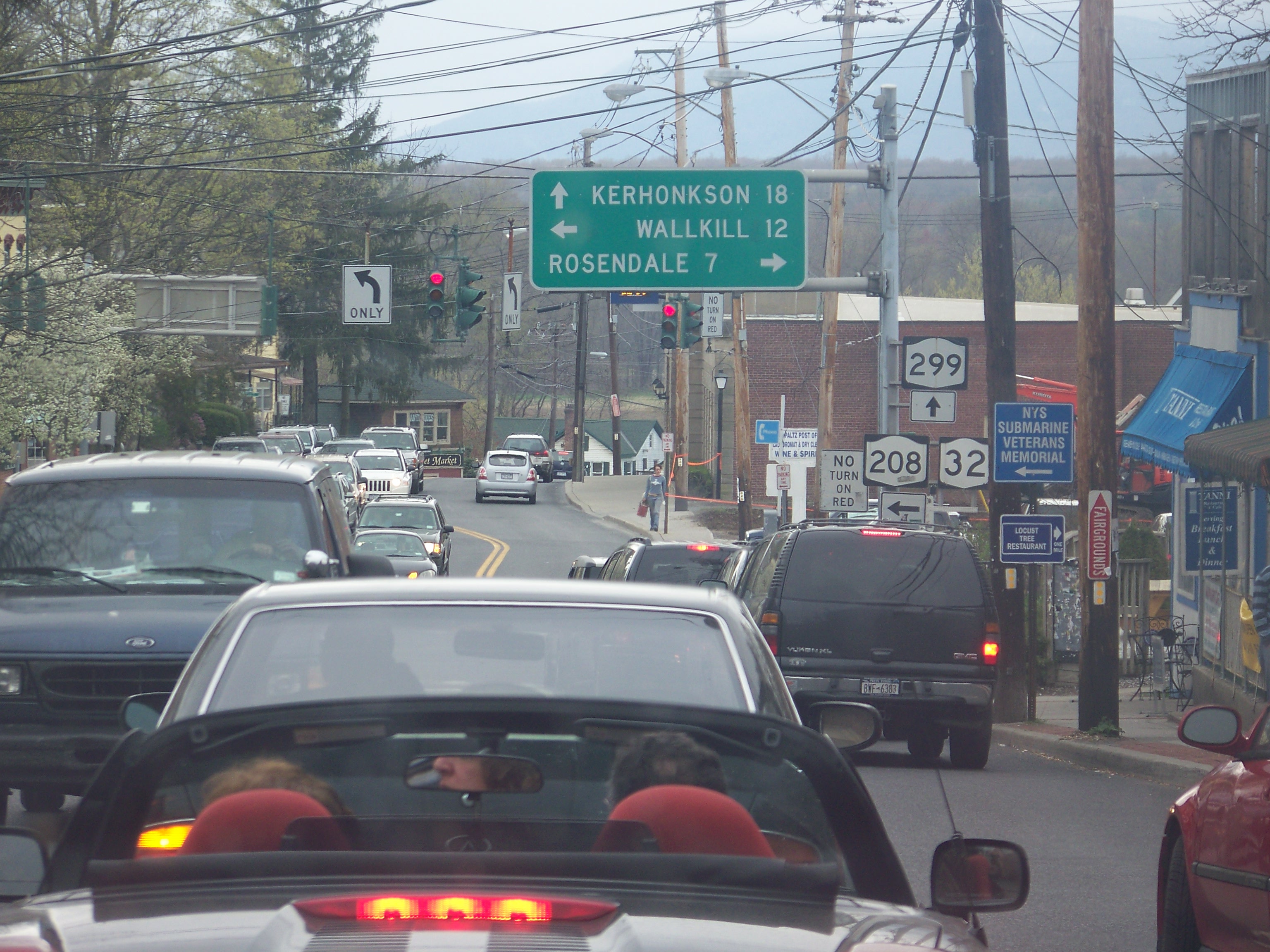
Downtown New Paltz
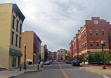
 Congestion in downtown New Paltz
Another choke point has been Main Street in New Paltz, a section shared by NY 32 and NY 299. This is the main route back to the Thruway and downstate from the heavily used hiking and climbing areas at Mohonk Preserve and Minnewaska State Park Preserve in the Shawangunks. It is also a well-developed commercial area in a college town, with ample street parking.
Traffic through the village has been so heavy on weekends during summer and peak leaf peeping weekends in early autumn that many residents have proposed making Main Street one-way, carrying traffic only to the west, while diverting eastbound traffic onto either of two parallel streets.[44] Other villages that have made such changes found making streets one-way decreased business at their retailers.
After four years of studying and reviewing the issue, the town and the village agreed to make the change. In 2007, however, the village's new mayor, who had supported the plan while a trustee, changed his mind and said the village's support was "on hold". While campaigning, he said, few village residents had expressed support for the plan. What he learned since taking over as mayor had only further convinced him that it was mostly town residents who wanted the street changes. He also believed that making Main Street one-way would reduce the total amount of routes available to vehicles passing through the village and would adversely route traffic away from the businesses along Main.[44]
Suffixed routes
Originally, NY 32 had two suffixed routes, NY 32A and NY 32B, that were absorbed by other routes. The NY 32A designation has since been revived for a short connector in the Hudson Valley.
- The NY 32A designation has been used for two distinct highways:
- The first NY 32A was assigned as part of the 1930 renumbering of state highways in New York to the segment of modern NY 32 between Bemis Heights and Schuylerville in Saratoga County.[1] At the time, NY 32 was routed on what is now US 4 between the two locations.[45] The route was supplanted by a realigned NY 32 in the early 1940s.[23][24]
- The current NY 32A is a 1.92-mile (3.09 km) connector between NY 32 and NY 23A in Ulster and Greene counties.[2] It was assigned in the early 1940s.[23][24]
- NY 32B was assigned as part of the 1930 renumbering to an alternate route of NY 32 between Northumberland and Glens Falls in Saratoga, Washington, and Warren Counties.[1] It was truncated northward to Hudson Falls in the early 1940s[23][24] and mostly replaced by NY 254 ca. 1965.[28][46]
Major intersections
County Location Mile[2] Destinations Notes Orange Woodbury 0.00 NY 17 to I-87 / ThruwayCornwall 9.72  CR 107
Hamlet of Orrs Mill; former western terminus of NY 307 New Windsor 11.48 
 NY 94 / NY 300
Hamlet of Vails Gate; southern terminus of NY 300 City of Newburgh 15.08  NY 17K west (Broadway)
Western terminus of NY 17K / NY 32 overlap 15.31  US 9W south / NY 17K
Eastern terminus of NY 17K / NY 32 overlap; southern terminus of US 9W / NY 32 overlap; eastern terminus of NY 17K Newburgh city / town line 16.61 I-84 east / NY 52 eastExit 10 (I-84) eastbound Town of Newburgh 16.67 US 9W north (Plank Road)Northern terminus of US 9W / NY 32 overlap 16.89 I-84 west / NY 52 westExit 10 (I-84) westbound 19.87 NY 300Hamlet of Cronomer Valley Ulster Plattekill 29.07 US 44 / NY 55Hamlet of Modena Village of New Paltz 34.95  NY 299 east (Main Street)
Southern terminus of NY 32 / NY 299 overlap 35.46  NY 208 / NY 299 west
Northern terminus of NY 32 / NY 299 overlap; northern terminus of NY 208 Rosendale–Esopus town line 40.28  NY 213 east
Southern terminus of NY 32 / NY 213 overlap Rosendale 42.83 NY 213 westNorthern terminus of NY 32 / NY 213 overlap City of Kingston 49.69 NY 213 westSouthern terminus of NY 32 / NY 213 overlap 50.01 NY 213Northern terminus of NY 32/ NY 213 overlap; northern terminus of NY 213 50.34 I-587 / NY 28Southern terminus of I-587; southern terminus of NY 28 51.87 US 9W northSouthern terminus of US 9W / NY 32 overlap 52.15 US 9W southNorthern terminus of US 9W / NY 32 overlap Ulster 54.54  NY 199
Town of Saugerties 60.14 US 9W southSouthern terminus of US 9W / NY 32 overlap Village of Saugerties 62.36  US 9W north / NY 212
Northern terminus of US 9W / NY 32 overlap; eastern terminus of NY 32 / NY 212 overlap; eastern terminus of NY 212 Town of Saugerties 63.62 I-87 / ThruwayExit 20 (I-87 / Thruway) 63.70 NY 212 westWestern terminus of NY 32 / NY 212 overlap 69.74 NY 32AHamlet of Saxton; eastern terminus of NY 32A Greene Town of Catskill 72.42  NY 23A
Town of Cairo 80.02 NY 23 eastSouthern terminus of NY 23 / NY 32 overlap 81.14 NY 23 westNorthern terminus of NY 23 / NY 32 overlap Town of Greenville 89.87  NY 81
NY 81Albany Westerlo 96.05  NY 143 west
Southern terminus of NY 32 / NY 143 overlap Coeymans 98.36 NY 143 eastNorthern terminus of NY 32 / NY 143 overlap Bethlehem 110.29  NY 335
112.33 US 9W southWestern terminus of US 9W / NY 32 overlap 112.72 US 9W north to I-87 / ThruwayEastern terminus of US 9W / NY 32 overlap 113.36  NY 144
Northern terminus of NY 144 Albany 114.89  I-787
I-787Exit 2 (I-787) 115.54 US 20 west (Madison Avenue)Southern terminus of US 20 / NY 32 overlap 115.62 US 20 eastNorthern terminus of US 20 / NY 32 overlap; to Dunn Memorial Bridge 115.84  NY 5 (State Street)
Not a signed intersection; left turns prohibited 116.18 US 9 (Clinton Avenue)Menands 118.69 I-787Exit 6 (I-787) 119.74  NY 378
Grade separated interchange, partial cloverleaf Watervliet 121.85  NY 155
Eastern terminus of NY 155 122.32  NY 2 (19th Street)
To Congress Street Bridge Cohoes 125.37  NY 470 (Ontario Street)
To 112th Street Bridge; access to NY 7 via I-787  NY 787
Northern terminus of NY 787 Saratoga Village of Waterford 127.20 US 4 southSouthern terminus of US 4 / NY 32 overlap Halfmoon 134.48  NY 146
Eastern terminus of NY 146 Mechanicville 136.01 NY 67 westSouthern terminus of NY 32 / NY 67 overlap 136.11 NY 67 eastNorthern terminus of NY 32 / NY 67 overlap Town of Stillwater 141.32 US 4 northNorthern terminus of US 4 / NY 32 overlap 143.61  NY 423
Eastern terminus of NY 423 Schuylerville 153.65 US 4 southSouthern terminus of US 4 / NY 32 overlap  CR 338
Former eastern terminus of NY 338 153.84 NY 29 eastSouthern terminus of NY 29 / NY 32 overlap 154.13 NY 29 westNorthern terminus of NY 29 / NY 32 overlap Northumberland 155.92 US 4 northNorthern terminus of US 4 / NY 32 overlap 163.39  NY 50
NY 50Hamlet of Gansevoort; northern terminus of NY 50 Moreau 167.68  NY 197
South Glens Falls 170.26 US 9 southSouthern terminus of US 9 / NY 32 overlap Warren Glens Falls 171.76 US 9 north / NY 9LNorthern terminus of US 9 / NY 32 overlap; southern terminus of NY 9L Queensbury 173.65  NY 254
Washington Kingsbury 175.62 US 4176.73  NY 196 / CR 37
1.000 mi = 1.609 km; 1.000 km = 0.621 mi References
- ^ a b c d Dickinson, Leon A. (January 12, 1930). "New Signs for State Highways". The New York Times: p. 136.
- ^ a b c d "2008 Traffic Data Report for New York State" (PDF). New York State Department of Transportation. June 16, 2009. pp. 175–179, 341. https://www.nysdot.gov/divisions/engineering/technical-services/hds-respository/NYSDOT_Traffic_Data_Report_2008.pdf. Retrieved October 13, 2009.
- ^ "Orange County Inventory Listing" (CSV). New York State Department of Transportation. March 2, 2010. https://www.nysdot.gov/divisions/engineering/technical-services/hds-repository2/INV_2010-03-02_orange.csv. Retrieved December 21, 2010.
- ^ a b c "Albany County Inventory Listing" (CSV). New York State Department of Transportation. March 2, 2010. https://www.nysdot.gov/divisions/engineering/technical-services/hds-repository2/INV_2010-03-02_albany.csv. Retrieved December 21, 2010.
- ^ "Ulster County Inventory Listing" (CSV). New York State Department of Transportation. March 2, 2010. https://www.nysdot.gov/divisions/engineering/technical-services/hds-repository2/INV_2010-03-02_ulster.csv. Retrieved December 21, 2010.
- ^ "Warren County Inventory Listing" (CSV). New York State Department of Transportation. March 2, 2010. https://www.nysdot.gov/divisions/engineering/technical-services/hds-repository2/INV_2010-03-02_warren.csv. Retrieved December 21, 2010.
- ^ "Saratoga County Inventory Listing" (CSV). New York State Department of Transportation. March 2, 2010. https://www.nysdot.gov/divisions/engineering/technical-services/hds-repository2/INV_2010-03-02_saratoga.csv. Retrieved December 21, 2010.
- ^ New York State Department of Transportation (1992). Mechanicville Digital Raster Quadrangle (Map). 1:24,000. http://www.nysgis.state.ny.us/gisdata/quads/drg24/dotpreview/index.cfm?code=q49. Retrieved December 21, 2010.
- ^ a b c d e f g h i j k l m n o p q r s t u v w x y z aa ab Google, Inc. Google Maps – RT-32, New York, United States (Map). Cartography by Google, Inc. http://maps.google.com/maps?hl=en&q=RT-32,+New+York,+United+States&um=1&sa=N&tab=wl. Retrieved August 29, 2007.
- ^ McKenna, Chris (September 8, 2006). "Plan tackles Woodbury traffic snarls". Times Herald-Record (Middletown, Orange County, New York). http://www.recordonline.com/apps/pbcs.dll/article?AID=/20060908/NEWS/609080330. Retrieved April 7, 2008.
- ^ "Hasbrouck, Josiah". Biographical Directory of the United States Congress. 2008. http://bioguide.congress.gov/scripts/biodisplay.pl?index=H000314. Retrieved May 20, 2008.
- ^ Google, Inc. Google Maps – overview map Of Boulevard (Map). Cartography by Google, Inc. http://maps.google.com/maps?sourceid=navclient&ie=UTF-8&rlz=1T4ADBF_enUS232US232&q=from%3A%20RT-32%20%4041.911180%2C%20-74.020370%20to%3A%20RT-32%20%4041.924440%2C%20-74.012920&um=1&sa=N&tab=wl. Retrieved June 16, 2008.
- ^ 42°27′39″N 74°00′17″W / 42.46083°N 74.00472°W
- ^ a b "Toll-Bridge and Turnpike Companies". The Revised Statutes of the State of New-York. 3. 1829. pp. 587–624. http://books.google.com/books?id=KJEDAAAAQAAJ&pg=PA587#v=onepage&q=&f=false. Retrieved February 4, 2010.
- ^ "Gateway Between River and Mountains: Historic Catskill Point". National Register of Historic Places. 2008. http://www.arch.ksu.edu/seamon/Catskill_Point.htm. Retrieved May 17, 2008.
- ^ "Greene County National Register of Historic Places". National Register of Historic Places. 2008. http://www.nationalregisterofhistoricplaces.com/ny/Greene/state2.html. Retrieved May 17, 2008.
- ^ "New York's Main Highways Designated by Numbers". The New York Times: p. XX9. December 21, 1924.
- ^ State of New York Department of Public Works (1926). Official Map Showing State Highways and other important roads (Map). Cartography by Rand McNally and Company.
- ^ Automobile Blue Book. 1 (1927 ed.). Chicago: Automobile Blue Book, Inc. 1927. This edition shows U.S. Routes as they were first officially signed in 1927.
- ^ a b Automobile Legal Association (ALA) Automobile Green Book, 1930–31 and 1931–32 editions, (Scarborough Motor Guide Co., Boston, 1930 and 1931). The 1930–31 edition shows New York state routes prior to the 1930 renumbering
- ^ Standard Oil Company of New York (1930). Road Map of New York (Map). Cartography by General Drafting.
- ^ a b Sun Oil Company (1935). Road Map & Historical Guide – New York (Map). Cartography by Rand McNally and Company.
- ^ a b c d Gulf Oil Company (1940). New York Info-Map (Map). Cartography by Rand McNally and Company.
- ^ a b c d Esso (1942). New York with Pictorial Guide (Map). Cartography by General Drafting.
- ^ Esso (1954). New York with Special Maps of Putnam–Rockland–Westchester Counties and Finger Lakes Region (Map). Cartography by General Drafting (1955–56 ed.).
- ^ Esso (1956). New York with Special Maps of Putnam–Rockland–Westchester Counties and Finger Lakes Region (Map). Cartography by General Drafting (1957 ed.).
- ^ Esso (1958). New York with Special Maps of Putnam–Rockland–Westchester Counties and Finger Lakes Region (Map). Cartography by General Drafting (1958 ed.).
- ^ a b Sinclair Oil Corporation (1964). New York and Metropolitan New York (Map). Cartography by Rand McNally and Company.
- ^ Esso (1968). New York (Map). Cartography by General Drafting (1969–70 ed.).
- ^ State of New York Department of Transportation (January 1, 1970) (PDF). Official Description of Touring Routes in New York State. http://www.greaternyroads.info/pdfs/state70.pdf. Retrieved December 4, 2009.
- ^ New York State Department of Transportation (January 2009) (PDF). Official Description of Highway Touring Routes, Bicycling Touring Routes, Scenic Byways, & Commemorative/Memorial Designations in New York State. https://www.nysdot.gov/divisions/operating/oom/transportation-systems/repository/2009%20tour-bk.pdf. Retrieved December 4, 2009.
- ^ United States Geological Survey (1966). Hudson Falls, NY Quadrangle (Map). 1:24,000. 7.5 Minute Series (Topographic).
- ^ New York State Legislature. "New York State Highway Law § 341". http://public.leginfo.state.ny.us/menugetf.cgi?COMMONQUERY=LAWS. Retrieved December 4, 2009.
- ^ Rand McNally and Company (1985). New York (Map). ISBN 0-528-91040-X.
- ^ "Bridge Rehabilitation Work to Commence on Route 32, Town of Rosendale, Ulster County" (Press release). New York State Department of Transportation. June 10, 2008. https://www.nysdot.gov/news/press-releases/2008/2008-06-10. Retrieved June 23, 2008.
- ^ Kemble, William J. (December 8, 2009). "Route 32 bridge in Rosendale open again to two-way traffic". Daily Freeman (Kingston, NY). http://www.dailyfreeman.com/articles/2009/12/08/news/doc4b1db4d2002c1804620802.txt. Retrieved February 13, 2011.
- ^ "Bridge Work Progress at Rosendale Site". Daily Freeman (Kingston, NY). June 18, 1970.
- ^ Scott, Brendan (November 25, 2001). "Woodbury Common traffic riles shoppers and neighbors". Times Herald-Record (Middletown, Orange County, New York). http://archive.recordonline.com/archive/2001/11/25/bscommon.htm. Retrieved July 6, 2008.
- ^ Rife, Judy (November 25, 2002). "An end to holiday traffic woes?". Times Herald-Record (Middletown, Orange County, New York). http://archive.recordonline.com/archive/2002/11/26/jrwc.htm. Retrieved July 6, 2008.
- ^ McKenna, Chris (September 8, 2006). "Plan tackles Woodbury traffic snarls". Times Herald-Record (Middletown, Orange County, New York). http://www.recordonline.com/apps/pbcs.dll/article?AID=/20060908/NEWS/609080330. Retrieved July 6, 2008.
- ^ Sullivan, John (August 18, 2009). "Outlet traffic a nightmare for shoppers". Times Herald-Record (Middletown, Orange County, New York). http://www.recordonline.com/apps/pbcs.dll/article?AID=/20090818/NEWS/908180319. Retrieved August 18, 2009.
- ^ King, Matt (September 28, 2007). "DOT plan could ease Woodbury Commons traffic complaints". Times Herald-Record (Middletown, Orange County, New York). http://www.recordonline.com/apps/pbcs.dll/article?AID=/20070928/NEWS/709280343. Retrieved July 6, 2008.
- ^ a b Snel, Alan (March 26, 2001). "Five Corners: a miscarriage in development". Times Herald-Record (Middletown, Orange County, New York). http://archive.recordonline.com/archive/2001/03/26/asfiveco.htm. Retrieved July 6, 2008.
- ^ a b Horrigan, Jeremiah (October 20, 2007). "Is one-way the wrong way?". Times Herald-Record (Middletown, Orange County, New York). http://www.recordonline.com/apps/pbcs.dll/article?AID=/20071020/NEWS/710200323. Retrieved July 6, 2008.
- ^ Texas Oil Company (1933). Texaco Road Map – New York (Map). Cartography by Rand McNally and Company.
- ^ Mobil (1965). New York (Map). Cartography by Rand McNally and Company.
External links
- Alps' Roads – New York State Route 32
- New York Routes – New York State Route 32
- New York State Highway Termini – New York State Route 32
Transportation routes in the Hudson River corridor between New York City and Albany West of river Roads: Interstate 87 / New York State Thruway • U.S. Route 9W • New York State Route 32
Rail (freight): CSX River SubdivisionEast of river Roads: Taconic State Parkway • U.S. Route 9
Rail (passenger): Amtrak Empire Service • Metro-North Hudson Line
Rail (freight): CSX Hudson SubdivisionCategories:- State highways in New York
- Transportation in Orange County, New York
- Transportation in Ulster County, New York
- Hudson River
- Transportation in Greene County, New York
- Transportation in Albany County, New York
- Transportation in Saratoga County, New York
- Transportation in Washington County, New York
- Transportation in Warren County, New York
- The NY 32A designation has been used for two distinct highways:


Wikimedia Foundation. 2010.