- New York State Route 254
-
This article is about the current alignment of NY 254. For the former alignment of NY 254 in Livingston and Ontario Counties, see New York State Route 254 (1930–1940).
NYS Route 254
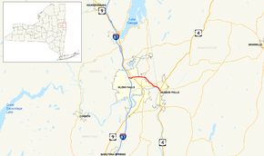
Map of the Glens Falls area with NY 254 highlighted in redRoute information Maintained by NYSDOT and Warren County Department of Public Works Length: 6.01 mi[3] (9.67 km) Existed: ca. 1965[1][2] – present Major junctions West end:  I-87 in Queensbury
 US 9 in Queensbury
East end:  US 4 in Hudson Falls
Location Counties: Warren, Washington Highway system Numbered highways in New York
Interstate • U.S. • N.Y. (former) • Reference • County←  NY 253
NY 255  →
→New York State Route 254 (NY 254) is a state highway that extends for 6.01 miles (9.67 km) through Warren and Washington Counties in the Capital District of New York, United States. The route runs from exit 19 along the Adirondack Northway (Interstate 87 or I-87) in Queensbury and follows Aviation Road, Quaker Road, and Lower Warren Street through Queensbury to Hudson Falls, where it terminates at an intersection with U.S. Route 4 (US 4) in the center of the village.
The portion of NY 254 along Lower Warren Street and River Street has had several designations over the years. From 1924 to 1930, it was part of the original NY 30. In 1927, it also became part of US 4, which initially overlapped NY 30 from Glens Falls to Whitehall. In the 1930 renumbering of state highways in New York, NY 30 was reassigned elsewhere while US 4 was rerouted to bypass Glens Falls to the east. As a result, Lower Warren Street and River Street became part of NY 32B.
The NY 32B designation remained in place until the mid-1960s when the Quaker Road arterial was built. NY 32B was partially replaced ca. 1965 by NY 254, the designation assigned to the new highway around Glens Falls. The portion of NY 254 between US 9 and Lower Warren Street is maintained by Warren County and co-designated as County Route 47 (CR 47) and CR 70.
Contents
Route description
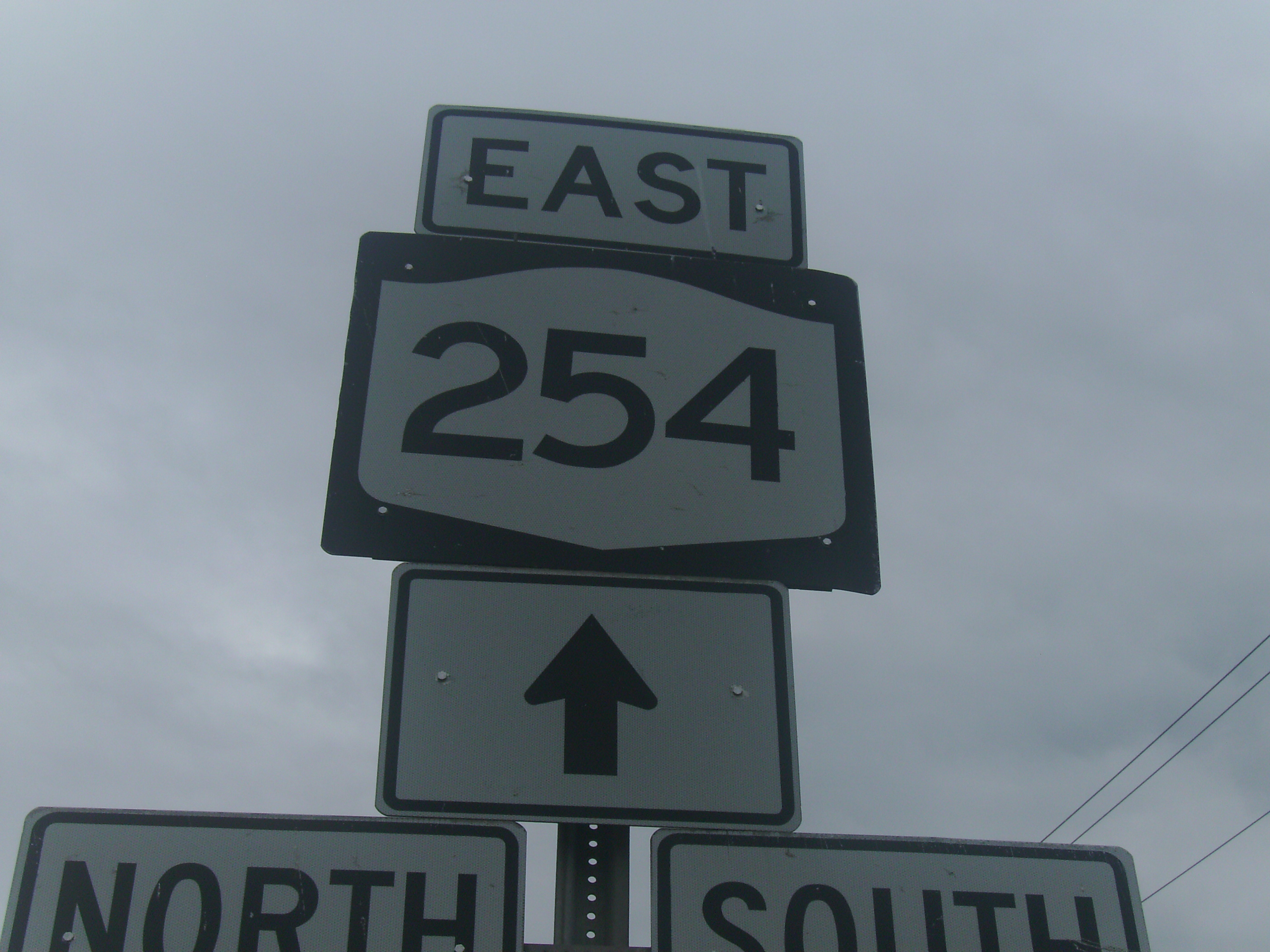
 Sign assembly depicting the western terminus of NY 254 at I-87
NY 254 begins at the southbound ramp of Adirondack Northway (I-87) exit 19[4] north of Glens Falls in the town of Queensbury. The route heads eastward from the interchange as Aviation Road, passing by many commercial buildings and Aviation Mall. As it passes along the north side of the mall, NY 254 curves to the southeast before veering back to the northeast ahead of an intersection with the four-lane US 9 (Upper Glen Street). The route continues past US 9;[5] however, maintenance of the highway is transferred from the New York State Department of Transportation (NYSDOT) to Warren County at the US 9 junction. Now co-designated as CR 47,[6] NY 254 progresses eastward along the four-lane Quaker Road, serving as a northerly bypass of the city of Glens Falls.[5]
As the route heads east, it passes Pine View Cemetery and several local businesses.[5] At an intersection with Glenwood Avenue (CR 34), the county's internal designation for NY 254 becomes CR 70,[6] whereafter the route passes over Halfway Brook and under the Gerald B. Solomon Bikeway Bridge - a part of the Warren County Bikeway.[7] The highway progresses southeasterly upon intersecting NY 9L as NY 254 turns due southeast to avoid Floyd Bennett Memorial Airport. Along this stretch, NY 254 heads through undeveloped land before entering another area of commercial development as it approaches the outskirts of Hudson Falls. Here, the route meets NY 32 at Highland Avenue before intersecting Lower Warren Street (here unsigned NY 911E) on the banks of the Hudson River.[5]
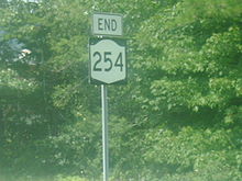
NY 254 turns east at NY 911E, becoming state maintained once more as it follows Lower Warren Street across the Glens Falls Feeder Canal and along the Hudson River into Washington County and the village of Hudson Falls.[8] As River Street, NY 254 heads to the southeast for a short distance before terminating at an intersection with US 4 in downtown Hudson Falls. NY 196 begins one block to the south of this junction.[5]
History
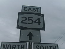 NY 254 sign at the intersection with NY 9L
Warren Street in Glens Falls, Lower Warren Street in Queensbury, and River Street in Hudson Falls were originally designated as part of NY 30 in 1924.[9][10] In late 1926, the U.S. Highway System was created. One of the routes assigned at this time was US 4, which overlapped NY 30 between Glens Falls and Whitehall.[11] In the 1930 renumbering of state highways in New York, the NY 30 designation was reassigned elsewhere while US 4 was reconfigured to continue south from Hudson Falls to East Greenbush. The former routing of US 4 into Glens Falls became part of NY 32B, an alternate route of NY 32 that followed the Hudson River between Schuylerville and Glens Falls. All of NY 32B south of Hudson Falls was concurrent to US 4.[12][13]
NY 32B was truncated over time, eventually consisting of just the portion between Boulevard (then-NY 32) in Queensbury and US 4 in Hudson Falls. In the mid-1960s, a new arterial was constructed around the northern and eastern extents of Glens Falls.[1][14] The roadway, designated as NY 254 ca. 1965, extended from I-87 in the north to Warren Street (NY 32B) in the south. NY 254 then continued east to US 4 in Hudson Falls, replacing NY 32B.[1][2] The short 0.20-mile (0.32 km) segment of Warren Street between NY 32 and NY 254, formerly the westernmost portion of NY 32B, is now NY 911E, an unsigned reference route.[3]
Major intersections
County Location Mile[3] Destinations Notes Warren Queensbury 0.00 I-87Exit 19 (I-87) 0.74 US 92.59  NY 9L
NY 9L4.46  NY 32
NY 32Washington Hudson Falls 6.01 US 41.000 mi = 1.609 km; 1.000 km = 0.621 mi References
- ^ a b c Sinclair (1964). New York and Metropolitan New York (Map). Cartography by Rand McNally and Company.
- ^ a b Mobil (1965). New York (Map). Cartography by Rand McNally and Company.
- ^ a b c "2008 Traffic Data Report for New York State" (PDF). New York State Department of Transportation. June 16, 2009. pp. 278–279, 341. https://www.nysdot.gov/divisions/engineering/technical-services/hds-respository/NYSDOT_Traffic_Data_Report_2008.pdf. Retrieved December 9, 2009.
- ^ "Warren County Inventory Listing" (CSV). New York State Department of Transportation. March 2, 2010. https://www.nysdot.gov/divisions/engineering/technical-services/hds-repository2/INV_2010-03-02_warren.csv. Retrieved July 20, 2010.
- ^ a b c d e Yahoo! Inc. Yahoo! Maps – overview map of NY 254 (Map). Cartography by NAVTEQ. http://maps.yahoo.com/#mvt=h&lat=43.304962&lon=-73.587549&zoom=18&q1=43.329675%2C-73.685547&q2=43.300667%2C-73.58609. Retrieved June 30, 2009.
- ^ a b New York State Department of Transportation (1991). Glens Falls Digital Raster Quadrangle (Map). 1:24,000. http://www.nysgis.state.ny.us/gisdata/quads/drg24/dotpreview/index.cfm?code=n49. Retrieved July 19, 2010.
- ^ Condon, Bob. "Riding through history; The Warren County Bikeway: Mile by mile" (PDF). p. 4. http://bloximages.chicago2.vip.townnews.com/poststar.com/content/tncms/assets/editorial/7/85/005/78500506-8615-11df-aa07-001cc4c002e0-revisions/4c2e471322545.pdf.pdf#page=4. Retrieved July 27, 2010.
- ^ New York State Department of Transportation (1991). Hudson Falls Digital Raster Quadrangle (Map). 1:24,000. http://www.nysgis.state.ny.us/gisdata/quads/drg24/dotpreview/index.cfm?code=n50. Retrieved December 15, 2009.
- ^ "New York's Main Highways Designated by Numbers". The New York Times: p. XX9. December 21, 1924.
- ^ Rand McNally and Company (1926). Rand McNally Auto Road Atlas (eastern New York) (Map). http://www.broermapsonline.org/members/NorthAmerica/UnitedStates/Midatlantic/NewYork/unitedstates1926ra_009.html. Retrieved December 15, 2009.
- ^ Automobile Blue Book. 1 (1927 ed.). Chicago: Automobile Blue Book, Inc. 1927. This edition shows U.S. Routes as they were first officially signed in 1927.
- ^ Standard Oil Company of New York (1929). New York in Soconyland (Map). Cartography by General Drafting.
- ^ Standard Oil Company of New York (1930). Road Map of New York (Map). Cartography by General Drafting.
- ^ United States Geological Survey (1966). Hudson Falls Quadrangle - New York (Map). 1 : 24,000. 7.5 Minute Series (Topographic). http://www.nysgis.state.ny.us/gisdata/quads/drg24/usgspreview/index.cfm?code=o43073c5. Retrieved December 6, 2007.
External links
- New York Routes – New York State Route 254
- New York State Highway Termini – New York State Route 254
Categories:- State highways in New York
- Transportation in Warren County, New York
- Transportation in Washington County, New York


Wikimedia Foundation. 2010.