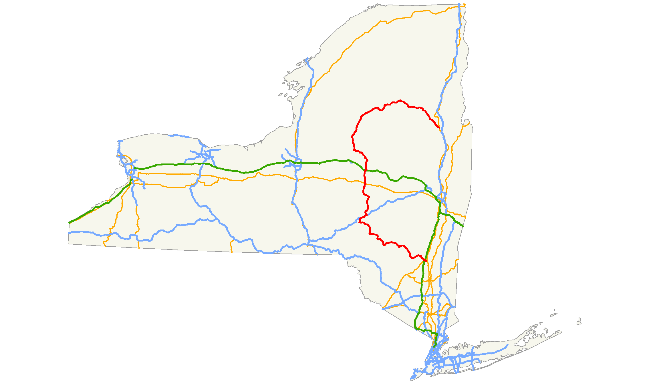
- New York State Route 28
-
"NY 28" redirects here. NY 28 may also refer to New York's 28th congressional district.
NYS Route 28
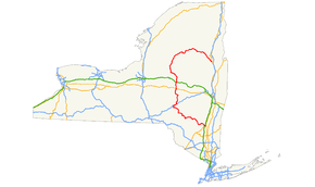
Map of New York with NY 28 highlighted in redRoute information Maintained by NYSDOT and the village of Cooperstown Length: 281.69 mi[1] (453.34 km)
I-587: 1.21 mi (1.95 km)[1]Existed: 1924[2] – present Major junctions South end: 
 I-587 / NY 32 in Kingston
 I-87 / Thruway / I-587 in Kingston
 I-88 in Oneonta
 US 20 in Richfield Springs
 I-90 / Thruway in Herkimer
 NY 12 in Trenton
 NY 30 in Blue Mountain Lake
North end:  US 9 in Warrensburg
Location Counties: Ulster, Delaware, Otsego, Herkimer, Oneida, Hamilton, Warren Highway system Numbered highways in New York
Interstate • U.S. • N.Y. (former) • Reference • County←  NY 27A
NY 28A  →
→←  NY 531
I-590  →
→New York State Route 28 (NY 28) is a state highway extending for 281.69 miles (453.34 km) in the shape of a "C" between the Hudson Valley city of Kingston and southern Warren County in the U.S. state of New York. Along the way, it intersects several major routes, including Interstate 88 (I-88), U.S. Route 20 (US 20), and the New York State Thruway twice. The southern terminus of NY 28 is at NY 32 in Kingston and the northern terminus is US 9 in Warrensburg. In Kingston, NY 28 is co-designated as Interstate 587 from its southern terminus at NY 32 to the roundabout linking it to the Thruway (I-87).
NY 28 was originally assigned in 1924 to an alignment extending from Colliersville in the south to Utica in the north via Ilion. From Colliersville to Cooperstown, the highway followed its current routing (excluding minor realignments); north of Cooperstown, NY 28 was routed along several state highways that now have other designations. The route was extended south to Kingston and north to Warrensburg as part of the 1930 renumbering of state highways in New York. At the same time, Route 28 was realigned between Cooperstown and Mohawk to follow its modern routing. Other than minor realignments in Kingston, Oneonta, and Oneida County, NY 28 has remained the same to this day.
Contents
Route description
Ulster County
NY 28's southern terminus is with NY 32 (Albany Avenue) in the city of Kingston. The route heads north, then northwest on Colonel Chandler Drive, a four-lane limited-access highway. The roadway is also designated and signed as I-587, which begins at NY 32 as well. Although Colonel Chandler Drive is built to Interstate Highway standards, it has no intermediary interchanges. After crossing over the Esopus Creek into Ulster, I-587 terminates at a roundabout linking I-587 and NY 28 to the New York State Thruway (I-87) at exit 19.[3]
West of I-87, the route crosses the Blue Line of Catskill Park and becomes the Onteora Trail. Although still four lanes wide, the route is no longer a limited-access highway as it has an at-grade intersection with Modica Lane, a local dead-end street, just west of where it passes over the Thruway. Not long afterward, the highway meets US 209 by way of a cloverleaf interchange. Past US 209, the highway enters a rural area as it heads northwest into the center of the state park.[3]
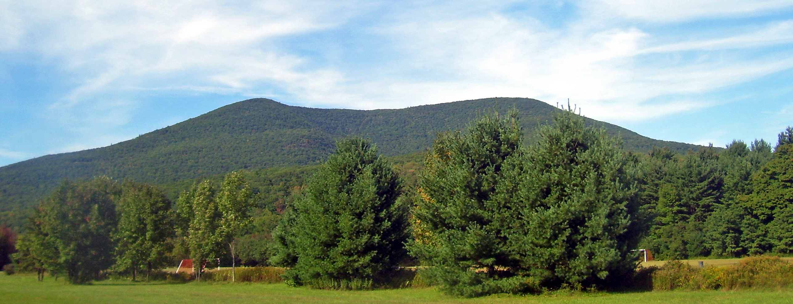
Near the eastern tip of the Ashokan Reservoir, in the town of Kingston, Route 28 intersects the eastern terminus of NY 28A. West of NY 28A, Route 28 continues towards the north and west along the northern edge of the reservoir. In West Hurley, the route intersects the southern terminus of NY 375. It proceeds along the reservoir to its western end in the town of Olive community of Boiceville, where NY 28A reconnects to the route. Here the mountains begin to loom over the road, with Mount Tremper dominating the view to the north as the route continues along Esopus Creek into the town of Shandaken after passing the southern terminus of NY 212 at Mount Pleasant. At Phoenicia, the largest settlement since Kingston, NY 214 reaches its southern terminus at the highway.[3]
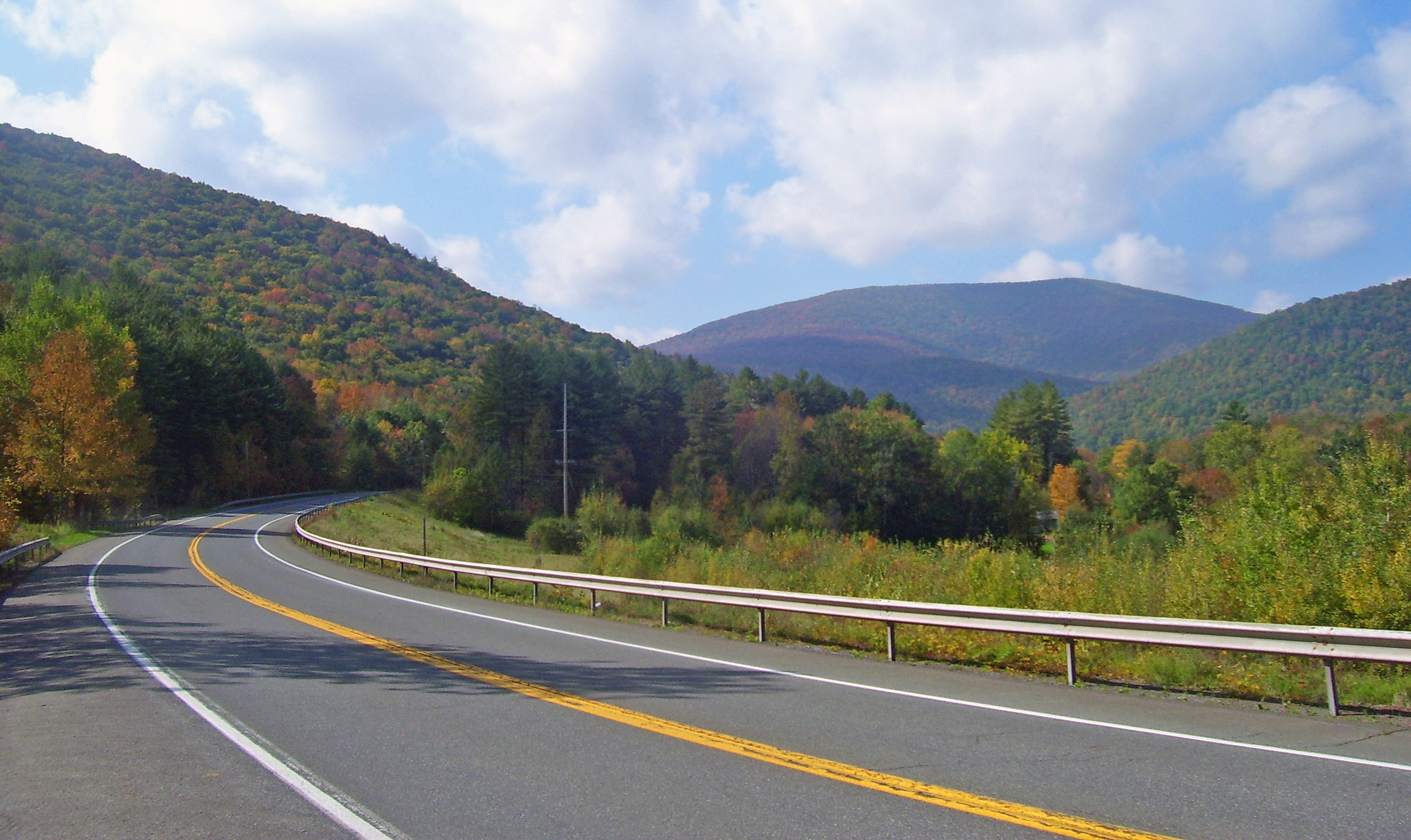
Past Phoenicia, the surrounding slopes become steeper as the road and creek curve around Panther Mountain, one of the Catskill High Peaks, to the south. At Allaben, the Shandaken Tunnel crosses under the road, bringing water from Schoharie Reservoir into the creek. The road and creek start bending to the south to the hamlet of Shandaken, where the town hall on the south side of the road is followed by the southern terminus of NY 42's northern segment. As Route 28 continues trending southwest, the valley becomes less developed. Balsam Mountain, another High Peak, looms ahead.
The northern terminus of Route 42's southern segment marks the small hamlet of Big Indian, after which Esopus Creek crosses for the last time, turning south to its source at Winnisook Lake. The road begins a sustained climb over the next two miles paralleling an Esopus tributary, Birch Creek, up to Pine Hill. At the road to Belleayre Ski Center, in Highmount, the last junction before it leaves the Catskill Park and enters Delaware County, it is for the first time signed as a north–south route.[3]
 Route 28 becomes a north–south route just prior to the Delaware County line
Delaware and Otsego Counties
Across the county line in Middletown, the highway shifts towards the west. Route 28 begins a concurrency with NY 30 in Margaretville, with the routes paralleling the East Branch of the Delaware River. After crossing the Delaware River, the route ends its concurrency with Route 30, and NY 28 continues northwest through Andes as Main Street and Delaware Avenue. In the village of Delhi, the highway becomes known as Andes Road and has a short concurrency with NY 10 in the village center. North of Delhi, it continues north towards the hamlet of Meredith, proceeding west past the hamlet. In Franklin, Route 28 makes a 90-degree turn to the north at the intersection with the eastern end of NY 357.[3]
Once in Otsego County, it traverses an s-curve before veering to the east to follow the southern bank of the Susquehanna River through the town of Oneonta. The route initially connects to the city of Oneonta, which is located across the river from Route 28, via Main Street. Shortly afterward, Route 28 meets Route 23. The route turns north, overlapping Route 23 along the four-lane James F. Lettis Highway. The two routes cross the River and enter the Oneonta city limits before separating at I-88 exit 15. NY 23 continues north on the arterial; however, NY 28 joins I-88 eastward out of the city.[3]
Back in the town of Oneonta, the overlap between Route 28 and I-88 continues along the northern bank of the Susquehanna toward the hamlet of Emmons, where the expressway meets County Route 47 (CR 47) at exit 16. The overlap ends at exit 17 in Milford; however, NY 28 remains in close proximity to the Susquehanna River, which turns northward at the interchange. Roughly 0.75 miles (1.21 km) north of I-88, the highway passes over Route 7 with no access between the two. After another 0.75 miles (1.21 km), the route meets D.K. Lifgren Drive[3] (unsigned Route 992G),[4] a connector providing access between Routes 7 and 28. North of Goodyear Lake, a body of water situated 1 mile (1.6 km) north of Lifgren Drive, the highway parallels the Susquehanna to the village of Milford, where it intersects the southern terminus of Route 166.[3]
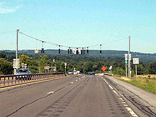 NY 28 at the intersection of Route 5S
The highway continues northward along the banks of the Susquehanna to the village of Cooperstown, home to the National Baseball Hall of Fame. Inside the village, the route is initially known as Chestnut Street. Two blocks from the business district of the village, it intersects Route 80, which occupies Chestnut Street north of this point. Both routes turn west, overlapping each other as the routes leave the village.[3] The portion of the highway between the southern border of the village of Cooperstown and the northern intersection with Grove Street is maintained by the village, and is the only section of the route not maintained by the New York State Department of Transportation (NYSDOT).[5] Routes 28 and 80 head towards the northwest, passing by the now-abandoned Cooperstown Airport. In Otsego, the Route 28/80 concurrency ends. It continues northward as it passes Canadarago Lake. In Richfield Springs, the highway has a concurrency with US 20 for 0.5 miles (0.8 km). North of Route 20, the highway exits Otsego County.[3]
Herkimer and Oneida Counties
In German Flatts, Route 28 becomes Columbia Street and intersects the northern terminus of NY 168. In Mohawk, NY 28 intersects NY 5S. After crossing the Mohawk River, Route 28 becomes Mohawk Street and meets I-90 (New York State Thruway) at exit 30. In the village of Herkimer, Route 28 has a concurrency with NY 5. North of Route 5, Route 28 begins to parallel the West Canada Creek. In Middleville, it intersects the western terminus of NY 29 and the northern terminus of NY 169. The highway executes a 90-degree turn at the three-route junction. Route 28 continues towards the north paralleling the West Canada Creek. In Poland, NY 28 begins a concurrency with NY 8.[3]
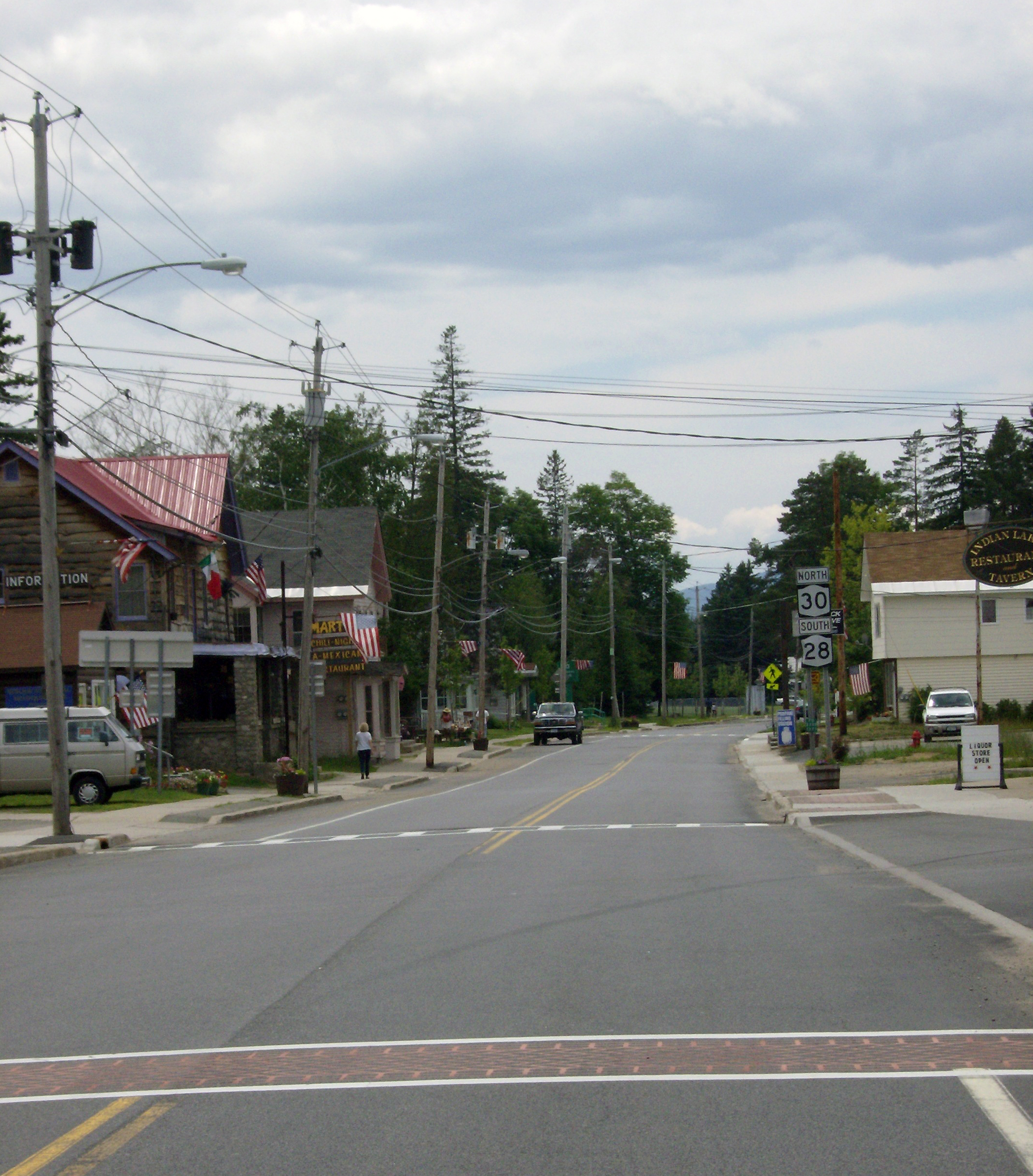
 NY 28 and NY 30 in Indian Lake
In Deerfield, Oneida County, NY 28 splits from Route 8. Route 28 crosses the West Canada Creek and leaves Oneida County for about 3 miles (5 km), then re-crosses the creek and enters Oneida County again. In Trenton, Route 28 joins NY 12 northward toward Barneveld. In Barneveld, Route 12 and Route 28 intersect NY 365. Route 28 splits from NY 12 in Remsen and heads toward the northeast, passing through numerous lakes and reservoirs. In Forestport, it enters Adirondack Park as it parallels the Adirondack Mountains.[3]
Route 28 briefly reenters Herkimer County, but does not have any major junctions. Route 28 passes the Fulton Chain Lakes, among several other large lakes, as it winds through the Adirondack Park.[3]
Hamilton and Warren Counties
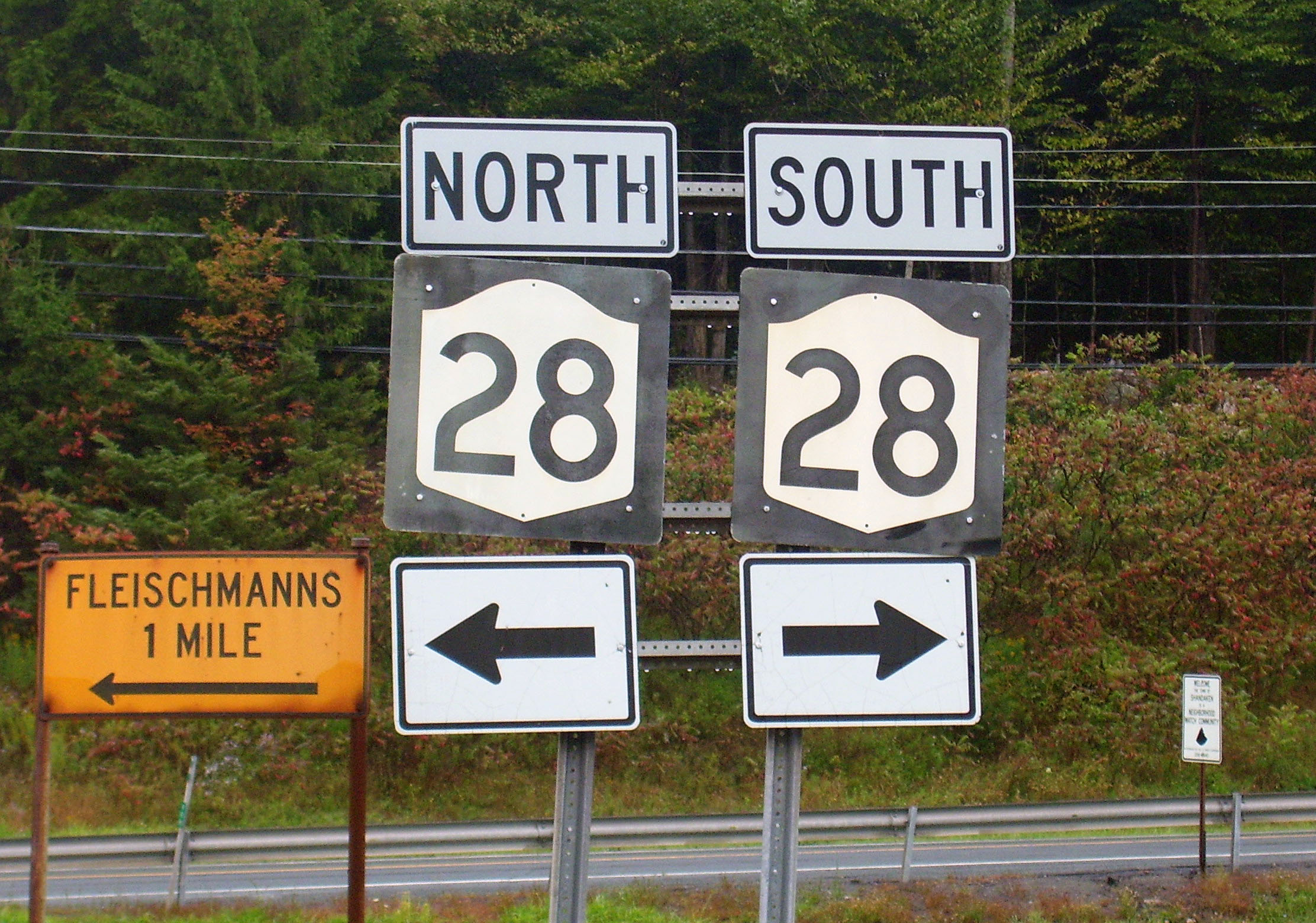
The Fulton Chain Lakes which Route 28 has been following extend into Hamilton County. The highway soon reaches the settlement of Long Lake as it passes south of Raquette Lake. In the hamlet of Blue Mountain Lake, the route begins a concurrency with NY 30; the concurrency ends in the hamlet of Indian Lake. East of Route 30, Route 28 begins to shift towards the south.[3]
Route 28 enters Warren County paralleling the Hudson River. In North Creek, it intersects the southern terminus of NY 28N. The highway continues towards the south opposite to its original course. In Wevertown, it intersects NY 8. It continues towards the southeast paralleling the Hudson River and in Warrensburg, Route 28 comes to an end at a "Y" intersection with US 9.[3]
History
Ulster and Delaware Turnpike
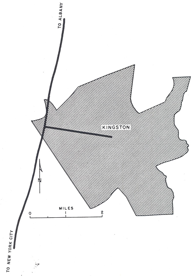
In 1802, the Ulster and Delaware Turnpike was chartered by the New York State Legislature "for improving and making a road from the west line of the Town of Salisbury in the State of Connecticut to the Susquehanna River at or near the Town of Jericho (now Bainbridge)".[6] The portion of the Ulster and Delaware Turnpike east of the Hudson River was also commonly known as the Ulster and Salisbury Turnpike or the Salisbury Turnpike. West of the river, the turnpike connected Kingston to modern-day Bainbridge. It then followed modern NY 28 west from Kingston up to the hamlet of Andes. From Andes, the turnpike alignment left NY 28 to follow modern Delaware County Road 2 to De Lancey, NY 10 to Walton, and NY 206 to the Village of Bainbridge.[7] The turnpike crossed the river via the Kingston-Rhinecliff Ferry and used modern Rhinecliff Road and West Market Street to the village center of Rhinecliff, then roughly followed modern-day NY 308 to the hamlet of Eighmyville.[8] It continued east from there using part of present-day CR 52 to eventually connect with and follow the route of current NY 199.[9] The turnpike corporation operated through the late 19th century.
Designation
NY 28 was designated in 1924 by the New York State Department of Transportation from Colliersville (near Oneonta) north to Utica.[2] At the time, NY 28 began at then-NY 9 in Colliersville and headed north on its current alignment to Cooperstown. NY 28 separated from its modern routing and continued to Springfield north of Cooperstown on what is now NY 80. Between Springfield and Richfield Springs, the highway utilized what is now US 20. At Richfield Springs, the highway turned north onto modern NY 167 and followed the current alignments of NY 167—NY 168, and NY 5S, as well as a small portion of its current alignment in Mohawk—north, then west, through Ilion to its terminus in Utica.[10]
In 1924, what is now NY 28 was part of NY 19 from Kingston to Margaretville (where NY 19 turned north to follow modern NY 30 to Grand Gorge), NY 9 from Oneonta to Colliersville, Route 28 from Colliersville to Cooperstown, NY 2 from Trenton to Forestport, and NY 10 from North Creek to Wevertown. The remaining portions of modern NY 28 were unnumbered.[2][10] By 1926, the portion of current NY 28 from Margaretville to Meredith was designated as part of NY 64. Past Meredith, NY 64 continued north to NY 23 on Palmerville Road, McDougal Road, Rathbun Road, and Prosser Hollow Road. Additionally, the segment of modern Route 28 from Middleville to Trenton was designated as part of NY 29.[10] Between 1926 and 1930, what is now NY 28 between Blue Mountain Lake and North Creek became part of NY 10A, a highway extending from Long Lake to North Creek via Blue Mountain Lake.[10][11][12]
In the 1930 renumbering, NY 28 was extended south from Colliersville to Kingston largely by way of its current alignment along the Ulster and Delaware Turnpike. North of Cooperstown, the route was realigned to follow its modern routing between Cooperstown and Mohawk, then extended into the North Country through Wevertown[11] to Warrensburg along its present alignment.[12] Between Colliersville and Cooperstown, the route remained unchanged. The small portion of NY 10A that did not become part of NY 28 in the renumbering was incorporated into NY 10.[11]
Realignments
In Oneida County, NY 28 originally broke from its modern alignment southeast of Barneveld to follow modern CR 56 into the village. At Mappa Avenue, then carrying NY 12, NY 28 turned north, overlapping NY 12 north along Mappa Avenue through the village. Outside of Barneveld, NY 12 and NY 28 were routed on Plank Road and what is now CR 82 before rejoining their modern alignment near the Remsen community of East Steuben.[13] Ca. 1940, NY 28 was rerouted slightly to enter Barneveld via an extension of Trenton Falls Road and Mappa Avenue.[14][15] Both NY 12 and NY 28 were realigned onto a new four-lane roadway from Barneveld to East Steuben in the 1950s.[16][17]

Within Kingston, NY 28 initially began at the intersection of Broadway and East Chester Street, which was part of US 9W at the time. From there, NY 28 followed Broadway, Albany Avenue, Clinton Avenue, North Front Street, and Washington Avenue through the city to Ulster, where it joined its modern routing at what is now the roundabout leading to New York State Thruway exit 19.[18] When the initial plans for the Interstate Highway System were outlined by the Bureau of Public Roads in the 1955 Yellow Book, a highway was planned for the NY 28 corridor.[19] This highway was included as part of the 1,500-mile (2,414 km) expansion to the system in 1957. Construction began on the roadway, which became Colonel Chandler Drive, in December 1958. It was designated as Interstate 587 and became part of a rerouted NY 28 upon its completion in July 1960.[20][21] NY 28 continued to extend eastward from Colonel Chandler Drive along Broadway to US 9W until its truncation to NY 32 in the early 1980s.[22][23] Washington Avenue, bypassed by the new limited-access highway, is now designated as NY 981K, an unsigned reference route 0.41 miles (0.66 km) in length, from Hurley Avenue to NY 28.[1]
In the vicinity of Oneonta, NY 28 originally crossed the Susquehanna River by way of Main Street. The route then followed Main through the city to Colliersville, where it turned north onto D.K. Lifgren Drive to rejoin its modern alignment. From downtown Oneonta to Colliersville, NY 28 overlapped NY 7. NY 28 was rerouted to follow its current alignment between Main Street south of Oneonta and D.K. Lifgren Drive near Colliersville in the early 1980s following the completion of what is now NY 28 from I-88 exit 17 to D.K. Lifgren Drive.[24][25][26][27] The portion of Main Street between NY 28 and NY 7 (0.67 miles or 1.08 kilometres long) is now designated as NY 992D while D.K. Lifgren Drive (0.50 miles or 0.80 kilometres in length) is now NY 992G.[1]
Memorial designation
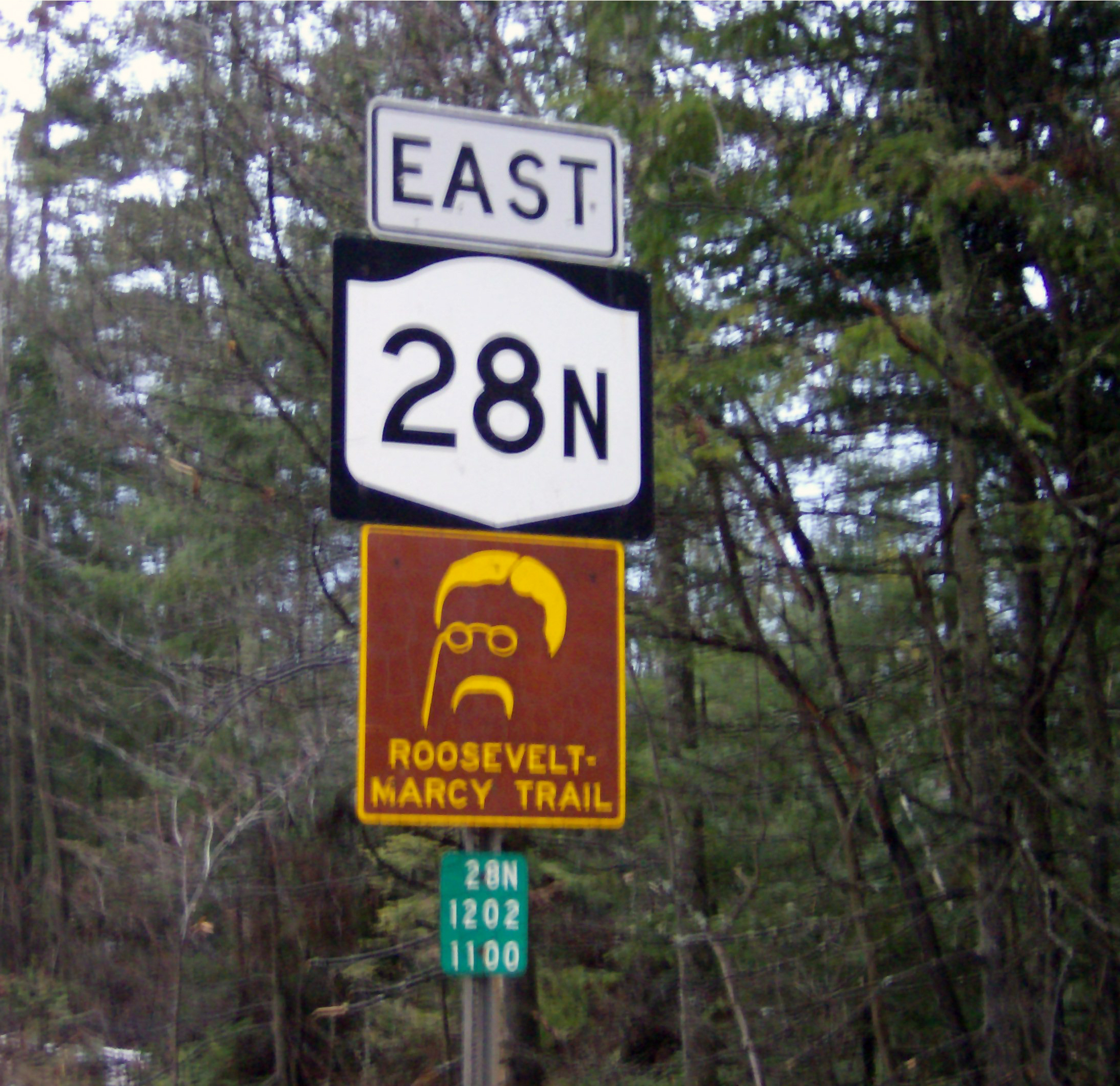
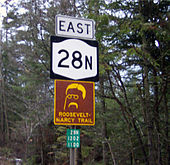 NY 28N sign with Roosevelt-Marcy Trail sign
On June 14, 2004, Governor George E. Pataki announced that a 1-mile (1.6 km) portion of the highway in the Town of Hurley in Ulster County was to be designated as the "New York State Troopers T. Michael Kelly and Kenneth A. Poorman Memorial Highway". During May 2000, troopers Kelly and Poorman were killed on this stretch of Route 28, when their police cruiser was struck by a tractor-trailer.[28]
Suffixed routes
- NY 28A (19.82 miles or 31.90 kilometres) is an alternate route of NY 28 along the southern edge of the Ashokan Reservoir in Ulster County.[1] It was assigned ca. 1933.[29][30]
- NY 28B was a spur route connecting NY 28 in Remsen to Prospect in Oneida County. When the route was initially assigned ca. 1936, it began at NY 12 and NY 28 in Barneveld and overlapped with then-NY 287 to Prospect, from where NY 28B continued northwest to NY 12 and NY 28 in Remsen by way of Prospect Road.[13][31] NY 28B was truncated to Prospect in the early 1950s[16][32] and removed in the mid-1960s.[33][34]
- NY 28N (50.95 miles or 82.00 kilometres) is a northerly alternate to NY 28 between Long Lake and North Creek in Adirondack Park.[1] It was assigned as part of the 1930 renumbering of state highways in New York.[11]
Major intersections
County Location Mile[1] Destinations Notes Ulster City of Kingston 0.00 I-587 / NY 32Eastern terminus of I-587 / NY 28 overlap; eastern terminus of I-587 1.21–
1.45 I-87 / Thruway / I-587Western terminus of I-587 / NY 28 overlap; western terminus of I-587; exit 19 (I-87 / Thruway) Ulster 1.82  US 209
Cloverleaf interchange Town of Kingston 4.31 NY 28AEastern terminus of NY 28A Town of Hurley 7.22  NY 375
Southern terminus of NY 375 Olive 17.55 NY 28AWestern terminus of NY 28A Shandaken 20.06  NY 212
Southern terminus of NY 212 23.92  NY 214
Southern terminus of NY 214 28.95  NY 42
NY 42Southern terminus of the northern segment of NY 42 Delaware Middletown 44.40 NY 30 northEastern terminus of NY 28 / NY 30 overlap Margaretville 47.88 NY 30 southWestern terminus of NY 28 / NY 30 overlap Village of Delhi 68.28  NY 10 south
Southern terminus of NY 10 / NY 28 overlap 68.56 NY 10 northNorthern terminus of NY 10 / NY 28 overlap Town of Franklin 83.61  NY 357
Eastern terminus of NY 357 Otsego Town of Oneonta 89.21  NY 23 east
Southern terminus of NY 23 / NY 28 overlap City of Oneonta 89.39 I-88 west / NY 23 westNorthern terminus of NY 23 / NY 28 overlap; southern terminus of I-88 / NY 28 overlap; exit 15 (I-88) Town of Milford 93.99 I-88 eastExit 17 (I-88); northern terminus of I-88 / NY 28 overlap 95.75  To NY 7 via NY 992G
Village of Milford 103.47  NY 166
Southern terminus of NY 166 Cooperstown 111.99  NY 80 east
Southern terminus of NY 28 / NY 80 overlap Otsego 117.26  NY 80 west / NY 205
Northern terminus of NY 28 / NY 80 overlap; northern terminus of NY 205 Richfield Springs 126.36 US 20 eastEastern terminus of US 20 / NY 28 overlap 126.82 US 20 westWestern terminus of US 20 / NY 28 overlap Herkimer Mohawk 137.29  NY 168
Western terminus of NY 168 138.14  NY 5S west
Western terminus of NY 5S / NY 28 overlap 138.59 NY 5S eastEastern terminus of NY 5S / NY 28 overlap 138.83 I-90 / ThruwayExit 30 (I-90 / Thruway) Village of Herkimer 139.22  NY 5 west
Western terminus of NY 5 / NY 28 overlap 139.91 NY 5 eastEastbound terminus of NY 5 / NY 28 overlap Middleville 148.04 
 NY 29 / NY 169
Western terminus of NY 29; northern terminus of NY 169 Poland 155.46  NY 8 north
Eastern terminus of NY 8 / NY 28 overlap Oneida Deerfield 157.63 NY 8 southWestern terminus of NY 8 / NY 28 overlap Trenton 163.60 NY 12 southSouthern terminus of NY 12 / NY 28 overlap Barneveld 165.31  NY 365
Town of Remsen 175.03 NY 12 northNorthern terminus of NY 12 / NY 28 overlap Hamilton Indian Lake 237.07  NY 28N north / NY 30
Western terminus of NY 28 / NY 30 overlap; western terminus of NY 28N 248.27 NY 30 southEastern terminus of NY 28 / NY 30 overlap Warren Chester 265.23 NY 28NEastern terminus of NY 28N Johnsburg 270.98 NY 8Town of Warrensburg 281.69 US 91.000 mi = 1.609 km; 1.000 km = 0.621 mi See also
- New York State Bicycle Route 28
References
- ^ a b c d e f g "2008 Traffic Data Report for New York State" (PDF). New York State Department of Transportation. June 16, 2009. pp. 164–167, 365, 372–373. https://www.nysdot.gov/divisions/engineering/technical-services/hds-respository/NYSDOT_Traffic_Data_Report_2008.pdf. Retrieved October 13, 2009.
- ^ a b c "New York's Main Highways Designated by Numbers". The New York Times: p. XX9. December 21, 1924.
- ^ a b c d e f g h i j k l m n o Google, Inc. Google Maps – overview map of NY 28 (Map). Cartography by Google, Inc. http://maps.google.com/maps?sourceid=navclient&ie=UTF-8&rlz=1T4ADBF_enUS232US232&q=from%3A%20Col%20George%20Chandler%20Dr%2FI-587%20W%20%4041.932748%2C%20-74.011356%20to%3A%20RT-28%20%4041.999260%2C%20-74.264580%20to%3ADelaware%20Ave%2FRT-28%20%4042.196289%2C%20-74.790083%20to%3ART-28%20%4042.441490%2C%20-75.067470%20to%3ART-28%20%4042.611560%2C%20-74.957916%20to%3ART-28%2FRT-80%20%4042.707825%2C%20-74.949060%20to%3ART-28%20%4042.750224%2C%20-75.026210%20to%3AMiddleville%20Rd%2FRT-28%20%4043.044020%2C%20-74.986180%20to%3ART-8%20%4043.232718%2C%20-75.049275%20to%3ART-28%20%4043.427590%2C%20-75.217400%20to%3ART-28%20%4043.743010%2C%20-74.896770%20to%3ART-28%20%4043.533517%2C%20-73.796808&um=1&sa=N&tab=wl. Retrieved June 23, 2008.
- ^ New York State Department of Transportation (January 2009) (PDF). Official Description of Highway Touring Routes, Bicycling Touring Routes, Scenic Byways, & Commemorative/Memorial Designations in New York State. https://www.nysdot.gov/divisions/operating/oom/transportation-systems/repository/2009%20tour-bk.pdf. Retrieved November 3, 2010.
- ^ New York State Department of Transportation (1974). Cooperstown Digital Raster Quadrangle (Map). 1:24,000. http://www.nysgis.state.ny.us/gisdata/quads/drg24/dotpreview/index.cfm?code=s39. Retrieved January 20, 2010.
- ^ Laws of the State of New York, Vol. III. Charles R. and George Webster. 1804. p. 113. http://books.google.com/books?id=e637shhPEdMC&pg=RA1-PA113.
- ^ Sive, Mary (1998). Lost Village: Historic Driving Tours in the Catskills. Delaware County Historical Association.
- ^ Sive, Mary Robinson (1998). Lost Villages: Historic Driving Tours in the Catskills. Delhi (village), New York: Delaware County Historical Association. p. 33. ISBN 1-892289-00-8. OCLC 39778943.
- ^ I Love New York (2008). New York State Map (Map). Cartography by Map Works Inc..
- ^ a b c d Rand McNally (1926). Rand McNally Auto Road Atlas (Map). http://www.broermapsonline.org/members/NorthAmerica/UnitedStates/Midatlantic/NewYork/unitedstates1926ra_009.html. Retrieved October 17, 2007.
- ^ a b c d Dickinson, Leon A. (January 12, 1930). "New Signs for State Highways". The New York Times: p. 136.
- ^ a b Automobile Legal Association (ALA) Automobile Green Book, 1930–31 and 1931–32 editions, (Scarborough Motor Guide Co., Boston, 1930 and 1931). The 1930–31 edition shows New York state routes prior to the 1930 renumbering
- ^ a b Sun Oil Company (1935). Road Map & Historical Guide - New York (Map). Cartography by Rand McNally and Company.
- ^ Standard Oil Company (1939). New York (Map). Cartography by General Drafting.
- ^ Esso (1940). New York (Map). Cartography by General Drafting.
- ^ a b Sunoco (1952). New York (Map). Cartography by Rand McNally and Company.
- ^ Gulf (1960). New York and New Jersey Tourgide Map (Map). Cartography by Rand McNally and Company.
- ^ State of New York Department of Public Works. Official Highway Map of New York State (Map). Cartography by General Drafting (1947–48 ed.).
- ^ Bureau of Public Roads (1955). Yellow Book map of Kingston, New York (Map). http://commons.wikimedia.org/wiki/Image:Kingston%2C_New_York_1955_Yellow_Book.jpg. Retrieved April 9, 2008.
- ^ Anderson, Steve. "Colonel Chandler Drive (I-587 and NY 28)". NYCRoads. http://www.nycroads.com/roads/I-587_NY/. Retrieved April 9, 2008.
- ^ United States Geological Survey (1980). Kingston West Quadrangle - New York - Ulster Co. (Map). 1 : 24,000. 7.5 Minute Series (Topographic). http://www.nysgis.state.ny.us/gisdata/quads/drg24/usgspreview/index.cfm?code=o41074h1. Retrieved April 9, 2008.
- ^ State of New York (1981). I Love New York Tourism Map (Map). Cartography by Rand McNally and Company.
- ^ Rand McNally (1985). New York (Map). ISBN 0-528-91040-X.
- ^ United States Geological Survey (1982). Oneonta Quadrangle - New York (Map). 1 : 24,000. 7.5 Minute Series (Topographic). http://www.nysgis.state.ny.us/gisdata/quads/drg24/usgspreview/index.cfm?code=o42075d1. Retrieved April 9, 2008.
- ^ United States Geological Survey (1982). West Davenport Quadrangle - New York (Map). 1 : 24,000. 7.5 Minute Series (Topographic). http://www.nysgis.state.ny.us/gisdata/quads/drg24/usgspreview/index.cfm?code=o42074d8. Retrieved April 9, 2008.
- ^ New York State Department of Transportation (1985). Oneonta Digital Raster Quadrangle (Map). 1:24,000. http://www.nysgis.state.ny.us/gisdata/quads/drg24/dotpreview/index.cfm?code=u38. Retrieved January 20, 2010.
- ^ New York State Department of Transportation (1985). West Davenport Digital Raster Quadrangle (Map). 1:24,000. http://www.nysgis.state.ny.us/gisdata/quads/drg24/dotpreview/index.cfm?code=u39. Retrieved January 20, 2010.
- ^ "Governor: Portion of State Route 28 to be named for Troopers" (Press release). New York State Division of State Police. June 14, 2004. http://www.troopers.state.ny.us/Public_Information/2004_News_Releases/06-14-04_Governor_to_name_portion_of_State_Route_28_for_Troopers.cfm. Retrieved June 2, 2008.
- ^ Texas Oil Company (1932). Texaco Road Map – New York (Map). Cartography by Rand McNally and Company.
- ^ Texas Oil Company (1933). Texaco Road Map – New York (Map). Cartography by Rand McNally and Company.
- ^ Standard Oil Company (1936). New York (Map). Cartography by General Drafting.
- ^ Socony-Vacuum Oil Company (1950). New York (Map). Cartography by Rand McNally and Company.
- ^ Mobil (1965). New York (Map). Cartography by Rand McNally and Company.
- ^ Esso (1968). New York (Map). Cartography by General Drafting (1969–70 ed.).
External links
- Alps' Roads – New York State Route 28
- New York Routes – New York State Route 28
- New York State Highway Termini – New York State Route 28
- NY Route 28: The Central Adirondack Trail
- NY 28 Scenic Drives of America Feature
 Highways in Hamilton County, New York
New York State Route 8 • New York State Route 10 • New York State Route 28 • New York State Route 28N • New York State Route 30
Auxiliary routes of Interstate 87  Categories:
- State highways in New York
- Transportation in Ulster County, New York
- Transportation in Delaware County, New York
- Transportation in Herkimer County, New York
- Transportation in Hamilton County, New York
- Transportation in Oneida County, New York
- Transportation in Otsego County, New York
- Transportation in Warren County, New York


Wikimedia Foundation. 2010.