- Middleville, New York
-
Middleville, New York — Village — Location within the state of New York
 Middleville, New York
Coordinates: 43°8′18″N 74°58′10″W / 43.13833°N 74.96944°WCoordinates: 43°8′18″N 74°58′10″W / 43.13833°N 74.96944°W Country United States State New York County Herkimer Area – Total 0.8 sq mi (2.0 km2) – Land 0.7 sq mi (1.9 km2) – Water 0.0 sq mi (0.1 km2) Elevation 597 ft (182 m) Population (2000) – Total 550 – Density 739.2/sq mi (285.4/km2) Time zone Eastern (EST) (UTC-5) – Summer (DST) EDT (UTC-4) ZIP code 13406 Area code(s) 315 FIPS code 36-47108 GNIS feature ID 0957158 Middleville is a village in Herkimer County, New York, New York. The population was 550 at the 2000 census.
The Village of Middleville is on the boundary of the Towns of Newport and Fairfield. The village is north of the Village of Herkimer and is east of Utica.
Contents
History
The community was first settled around 1806. People settled on the land purchased by Sheffield Kenyon and built houses and industries.
The village was incorporated in 1890, ten years after the railroad arrived.
Geography
Middleville is located at 43°8′18″N 74°58′10″W / 43.13833°N 74.96944°W (43.138436, -74.969408)[1].
According to the United States Census Bureau, the village has a total area of 0.8 square miles (2.1 km2), of which, 0.7 square miles (1.8 km2) of it is land and 0.1 square miles (0.26 km2) of it (6.33%) is water.
The West Canada Creek flows through the middle of the village. Maltanner Creek enters West Canada Creek in Middleville.
New York State Route 28 (North Main Street/Bridge Street), New York State Route 29 (Fairfield Street), and New York State Route 169 (South Main Street) intersect in the village.
Demographics
As of the census[2] of 2000, there were 550 people, 201 households, and 139 families residing in the village. The population density was 739.2 people per square mile (287.0/km²). There were 224 housing units at an average density of 301.1 per square mile (116.9/km²). The racial makeup of the village was 97.09% White, 1.27% African American, and 1.64% from two or more races. Hispanic or Latino of any race were 0.55% of the population.
There were 201 households out of which 31.8% had children under the age of 18 living with them, 54.2% were married couples living together, 11.4% had a female householder with no husband present, and 30.8% were non-families. 26.9% of all households were made up of individuals and 12.4% had someone living alone who was 65 years of age or older. The average household size was 2.50 and the average family size was 3.04.
In the village the population was spread out with 22.0% under the age of 18, 7.3% from 18 to 24, 24.0% from 25 to 44, 28.4% from 45 to 64, and 18.4% who were 65 years of age or older. The median age was 43 years. For every 100 females there were 89.0 males. For every 100 females age 18 and over, there were 87.3 males.
The median income for a household in the village was $39,231, and the median income for a family was $42,727. Males had a median income of $34,306 versus $22,727 for females. The per capita income for the village was $17,499. About 4.4% of families and 8.0% of the population were below the poverty line, including 13.8% of those under age 18 and 9.8% of those age 65 or over.
References
- ^ "US Gazetteer files: 2010, 2000, and 1990". United States Census Bureau. 2011-02-12. http://www.census.gov/geo/www/gazetteer/gazette.html. Retrieved 2011-04-23.
- ^ "American FactFinder". United States Census Bureau. http://factfinder.census.gov. Retrieved 2008-01-31.
External links
Municipalities and communities of Herkimer County, New York City 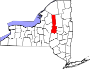
Towns Villages Cold Brook | Dolgeville‡ | Frankfort | Herkimer | Ilion | Middleville | Mohawk | Newport | Poland | West Winfield
Hamlets Footnotes ‡This populated place also has portions in an adjacent county or counties
Categories:- Villages in New York
- Utica–Rome metropolitan area
- Populated places in Herkimer County, New York


Wikimedia Foundation. 2010.