- New York State Route 5S
-
NYS Route 5S
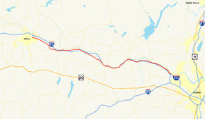
Map of the western Capital District with NY 5S highlighted in redRoute information Auxiliary route of NY 5 Maintained by NYSDOT and the village of Canajoharie Length: 73.03 mi[2] (117.53 km) Existed: 1930[1] – present Major junctions West end: 


 NY 5 / NY 5A / NY 8 / NY 12 in Utica
 NY 28 in Mohawk
 NY 10 in Canajoharie
 NY 30 near Amsterdam
East end:  NY 890 in Rotterdam
Location Counties: Oneida, Herkimer, Montgomery, Schenectady Highway system Numbered highways in New York
Interstate • U.S. • N.Y. (former) • Reference • County←  NY 5B
NY 5BUS 6  →
→New York State Route 5S (NY 5S) is an east–west state highway located in the Mohawk Valley of New York in the United States. It extends for 73.03 miles (117.53 km) from an interchange with NY 5, NY 5A, NY 8, and NY 12 in Utica to a smaller interchange with NY 890 in Rotterdam. The route runs along the south side of the Mohawk River for its entire length and parallels NY 5, which runs along the north side of the Mohawk River (hence the "S" in the route number of NY 5S). In some locations, NY 5S has been upgraded into a super two or an expressway, mostly in Utica and western Herkimer County. It also runs concurrent with part of New York State Bicycle Route 5 until it reaches NY 103.[3]
When NY 5S was assigned in 1930, the route stretched from Oneida in the west to Schenectady in the east. It was later truncated on both ends to eliminate overlaps with other state routes and to accommodate the construction of other roadways, most notably Interstate 890 (I-890) in western Schenectady.
Contents
Route description
 NY 5S and NY 10 signs in Canajoharie
NY 5S begins at an interchange with I-790 in downtown Utica, where Oriskany Street changes designations from NY 5A to NY 5S. At this interchange, I-790 is concurrent with NY 5, NY 8, and NY 12 along Utica's North–South Arterial. The freeway connects NY 5S to the New York State Thruway. From this interchange, NY 5S travels east across Utica as an urban arterial roadway with at grade intersections. After it crosses Broad Street, it continues east as a limited-access highway with grade-separated intersections to the Herkimer County line.[4]
The highway meets Culver Avenue as it enters Herkimer County. Not far to the east is an interchange for Turner Street, a small connector road. Route 5S enters West Frankfort and has an exit for Dyke Road, which connects to the Thruway and NY 5. In West Frankfort, it parallels one of its many old alignments. Route 5S continues southward, encountering Higby Road and Cemetery Street in Frankfort. Just past the Herkimer County Fairgrounds, Route 5S crosses under NY 171. In East Frankfort, Route 5S intersects with its old routing and turns to the east. Route 5S enters Ilion, where it meets NY 51. Route 5S passes to the south of Herkimer and has junctions with local roads before intersecting NY 28 in Mohawk. While in Mohawk, Route 5S also intersects with NY 922B, an unsigned reference route.[4]
Past Mohawk, Route 5S begins to parallel the Mohawk River and the Thruway as it continues eastward towards Rotterdam. Route 5S enters Little Falls and intersects with NY 167. Route 5S passes through farmlands and parallels the Thruway even farther, passing through the villages of Fort Plain and Canajoharie along the way.[4] In the latter, NY 5S is village-maintained in the immediate vicinity of its junction with NY 10. This 0.19-mile (0.31 km) stretch is the only part of the route that is not maintained by the New York State Department of Transportation (NYSDOT).[5]
Route 5S enters Fultonville and intersects with NY 30A. Route 5S begins to make different turns in direction and continues to parallel the Thruway. Route 5S enters Amsterdam and intersects with NY 30. Route 5S enters the Rotterdam area, paralleling Route 5 and the Mohawk River as it begins to head to the south. Route 5S comes to an end at an interchange with NY 890.[4]
History
In 1908, the New York State Legislature created Route 6, an unsigned legislative route that began in Buffalo and proceeded eastward across New York to Albany. From Utica to Schenectady, Route 6 followed the banks of the Mohawk River through the Mohawk Valley. Initially, Route 6 used the modern NY 5S corridor from Utica to Mohawk and from Fultonville to Amsterdam. By 1920, the piece of what is now NY 5S from Mohawk to Little Falls became part of Route 26.[6][7] On March 1, 1921, Route 26 was truncated to begin in Little Falls while Route 6 was realigned between Fultonville and Amsterdam to use NY 5 instead.[8] When the first set of posted routes in New York were assigned in 1924, the portion of legislative Route 6 between Utica and Mohawk was designated as the northernmost portion of NY 28, a north–south route connecting Oneonta to Utica via Springfield and Richfield Springs.[9][10]
In the 1930 renumbering of state highways in New York, NY 28 was rerouted north of Mohawk to follow its modern alignment toward Poland. Its former routing between Utica and Mohawk became part of NY 5S,[1] an alternate route of NY 5 between Oneida and Schenectady. As its suffix implies, NY 5S was mostly a southerly alternate route of NY 5; however, it actually followed a more northerly routing than NY 5 west of Utica. It continued west to Oneida on what is now NY 5A, NY 69, NY 365, and NY 365A and east into Schenectady along Rice and River Roads.[11] NY 5S was truncated eastward to Utica in the early 1940s, placing all of NY 5S south of NY 5 for the first time.[12][13]
On its eastern end, NY 5S was gradually truncated to its current terminus in Rotterdam as portions of I-890 was built over the former routing of NY 5S between Rotterdam and Schenectady. The first cutback occurred in the early 1970s following the completion of I-890 between downtown Schenectady and exit 4.[14][15] The freeway was completed between the New York State Thruway (I-90) and Schenectady in the mid-1970s, resulting in the truncation of NY 5S to I-890 exit 2.[15][16] It was truncated to its current eastern terminus at I-890 (now NY 890) in the late 1980s after a reconfiguration of the interchange between the Thruway and I-890 resulted in the removal of River Road between I-890 and the current stub end of Rice Road.[17][18]
From Utica to Mohawk, NY 5S was originally routed on "Old Route 5S" and Main Street.[11] It was realigned in the early 1970s to follow a new freeway between Utica and Ilion that bypassed Frankfort to the west.[15][19] A super two extension of the freeway east to Mohawk was completed sometime after 1982.[20] On April 5, 1987, the bridge carrying the New York State Thruway over Schoharie Creek collapsed. At the time, the creek was higher and flowing faster than normal due to excessive rains in the area.[21] The segment of NY 5S near Fort Hunter was reconfigured to carry westbound Thruway traffic while the bridge was rebuilt.[22]
Major intersections
County Location Mile[2] Destinations Notes Oneida Utica 0.00  I-790 / NY 5 / NY 8 / NY 12
NY 5AWestern terminus of I-790; eastern terminus of NY 5A Herkimer Frankfort 9.37  To NY 171 via Cemetery Street
Interchange; access to NY 171 via Main Street Ilion 12.80  NY 51 (Central Avenue)
Mohawk 14.31 NY 28 south (Warren Street)Western terminus of NY 5S / NY 28 overlap 14.76 NY 28 north (East Main Street)Eastern terminus of NY 5S / NY 28 overlap; to I-90 / Thruway Town of Little Falls 20.89  NY 167 north
Western terminus of NY 5S / NY 167 overlap 20.94 NY 167 southEastern terminus of NY 5S / NY 167 overlap Danube 24.00  NY 169
Southern terminus of NY 169 Montgomery Fort Plain 36.14  NY 80 east
Western terminus of NY 5S / NY 80 overlap 36.16 NY 80 westEastern terminus of NY 5S / NY 80 overlap Village of Canajoharie 39.53 NY 10 (Church Street)39.78 
 I-90 / Thruway
Exit 29 (I-90/Thruway) Root 42.37  NY 162
Northern terminus of NY 162 Fultonville 51.51  NY 30A (South Main Street)
Glen Noeltner Road (CR 164) Former northern terminus of NY 288 City of Amsterdam 61.03 NY 30 (North–South Arterial)To I-90 / Thruway Florida Thayer Road (CR 165) Former western terminus of NY 160 Schenectady Town of Rotterdam 67.62  NY 160 (Scotch Church Road)
Hamlet of Pattersonville; northern terminus of NY 160 69.82  NY 103 (Bridge Street)
Southern terminus of NY 103 72.75 I-90 / ThruwayEastbound NY 5S only 73.03 NY 8901.000 mi = 1.609 km; 1.000 km = 0.621 mi References
- ^ a b Dickinson, Leon A. (January 12, 1930). "New Signs for State Highways". The New York Times: p. 136.
- ^ a b "2008 Traffic Volume Report for New York State" (PDF). New York State Department of Transportation. June 16, 2009. pp. 13–14. https://www.nysdot.gov/divisions/engineering/technical-services/hds-respository/NYSDOT%20TVR%202008%20by%20Route.pdf. Retrieved January 31, 2010.
- ^ New York State Bicycle Route 5 maps (New York State Department of Transportation)
- ^ a b c d Google, Inc. Google Maps – overview map of NY 5S (Map). Cartography by Google, Inc. http://maps.google.com/maps?hl=en&rlz=1T4ADBF_enUS232US232&q=from:+Oriskany+St+W/RT-5S+E+%4043.107470,+-75.244640+to:+RT-5S+E+%4043.029292,+-75.079449+to:RT-167/RT-5S+%4043.016790,+-74.878410+to:W+Main+St/RT-5S+%4042.906530,+-74.574450+to:RT-5S+%4042.941037,+-74.357340+to:Unknown+road+%4042.845397,+-74.010178&um=1&ie=UTF-8&sa=N&tab=il. Retrieved February 1, 2008.
- ^ "Montgomery County Inventory Listing" (CSV). New York State Department of Transportation. March 2, 2010. https://www.nysdot.gov/divisions/engineering/technical-services/hds-repository2/INV_2010-03-02_montgomery.csv. Retrieved December 17, 2010.
- ^ State of New York Department of Highways (1909). The Highway Law. Albany, New York: J. B. Lyon Company. pp. 56–57. http://books.google.com/books?id=jZ0AAAAAMAAJ&pg=PA56. Retrieved May 13, 2010.
- ^ New York State Department of Highways (1920). Report of the State Commissioner of Highways. Albany, New York: J. B. Lyon Company. pp. 509–512, 539. http://books.google.com/books?id=Sj4CAAAAYAAJ&pg=PA509. Retrieved May 13, 2010.
- ^ New York State Legislature (1921). "Tables of Laws and Codes Amended or Repealed". Laws of the State of New York passed at the One Hundred and Forty-Fourth Session of the Legislature. Albany, New York: J. B. Lyon Company. pp. 42, 50–51, 63. http://books.google.com/books?id=6pE4AAAAIAAJ&pg=PA42. Retrieved May 13, 2010.
- ^ "New York's Main Highways Designated by Numbers". The New York Times: p. XX9. December 21, 1924.
- ^ Rand McNally and Company (1926). Rand McNally Auto Road Atlas (eastern New York) (Map). http://www.broermapsonline.org/members/NorthAmerica/UnitedStates/Midatlantic/NewYork/unitedstates1926ra_009.html. Retrieved May 13, 2010.
- ^ a b Standard Oil Company of New York (1930). Road Map of New York (Map). Cartography by General Drafting.
- ^ Gulf Oil Company (1940). New York Info-Map (Map). Cartography by Rand McNally and Company.
- ^ Esso (1942). New York with Pictorial Guide (Map). Cartography by General Drafting.
- ^ State of New York Department of Transportation (January 1, 1970) (PDF). Official Description of Touring Routes in New York State. http://www.greaternyroads.info/pdfs/state70.pdf. Retrieved January 3, 2010.
- ^ a b c Shell Oil Company (1973). New York (Map). Cartography by H.M. Gousha Company (1973 ed.).
- ^ Exxon (1977). New York (Map). Cartography by General Drafting (1977–78 ed.).
- ^ Rand McNally and Company (1985). New York (Map). ISBN 0-528-91040-X.
- ^ DeLorme Mapping (1990). Upstate New York City Street Maps (Map). 1" = 1/2 mile. Cartography by DeLorme Mapping (1st ed.). p. 34, section C1. ISBN 0-89933-300-1.
- ^ Sun Oil Company (1969). New York and Metropolitan New York City (Map). Cartography by Diversified Map Corporation (1969–70 ed.).
- ^ United States Geological Survey (1982). Ilion Quadrangle – New York – Herkimer Co. (Map). 1:24,000. 7.5 Minute Series (Topographic). http://www.nysgis.state.ny.us/gisdata/quads/drg24/usgspreview/index.cfm?code=o43075a1. Retrieved May 13, 2010.
- ^ Uhlig, Mark A. (April 7, 1987). "Inspection Of Bridge Failed To Cover Underwater Parts". The New York Times. http://www.nytimes.com/1987/04/07/nyregion/inspection-of-bridge-failed-to-cover-underwater-parts.html?pagewanted=1. Retrieved May 14, 2010.
- ^ Sinsabaugh, Mark. "New York State Route 5S". New York Routes. http://www.gribblenation.net/nyroutes/ind/001_009.htm#005s. Retrieved May 14, 2010.
External links
Categories:- State highways in New York
- Transportation in Oneida County, New York
- Transportation in Herkimer County, New York
- Transportation in Montgomery County, New York
- Transportation in Schenectady County, New York


Wikimedia Foundation. 2010.