- New York State Route 168
-
NYS Route 168
Route information Maintained by NYSDOT Length: 14.32 mi[2] (23.05 km) Existed: 1930[1] – present Major junctions West end:  NY 28 in Mohawk
East end:  NY 80 in Stark
Location Counties: Herkimer Highway system Numbered highways in New York
Interstate • U.S. • N.Y. (former) • Reference • County←  NY 167
NY 169  →
→New York State Route 168 (NY 168) is an east–west state highway in southern Herkimer County, New York, in the United States. The highway runs for 14.32 miles (23.05 km) through a largely rural area of Upstate New York, from an intersection with NY 28 in the village of Mohawk to a junction with NY 80 in Stark. Along the way, it intersects one state highway and crosses multiple creeks. The route was originally designated as part of Route 5, an unsigned legislative route, in 1908 and as part of the signed NY 28 in 1924. In the 1930 renumbering of state highways in New York, NY 28 was realigned to follow a new alignment to the west while its former routing between Mohawk and Paines Hollow became NY 168. The route was extended eastward to its current terminus at NY 80 ca. 1932.
Contents
Route description
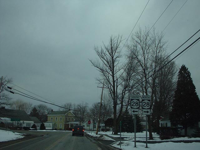
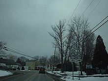 NY 168's western terminus at NY 28
NY 168's western terminus is at an intersection with NY 28 in the village of Mohawk. The highway heads southeastward out of the village and parallels Fulmer Creek. Now in a more rural area, NY 168 crosses Fulmer Creep and its tributaries multiple times as it takes on a more easterly course. Approximately halfway along its route, the highway intersects with NY 167 in the community of Paines Hollow. It passes through the populated place of Smith Corners and crosses over several more creeks before briefly bordering the Ohisa State Forest. The highway passes south of the Hawn Cemetery and continues southeastward towards its eastern terminus. NY 168 ends at a junction with NY 80 in Starkville, a hamlet within the town of Stark.[3]
History
The highway connecting Mohawk to Paines Hollow was originally designated as part of Route 5, an unsigned legislative route, by the New York State Legislature in 1908.[4][5] It was improved to state highway standards by way of two separate projects assigned and completed during the 1910s. The first contract, awarded on September 30, 1915, covered the 6.55-mile (10.54 km) portion of the road from the Mohawk village line to the current intersection with NY 167 in Paines Hollow. The second contract, let on December 14, 1916, called for the improvement of the section of modern NY 168 within the village of Mohawk and what is now NY 28 between NY 168 and West Main Street (old NY 5S), a total distance of 0.71 miles (1.14 km).[5]
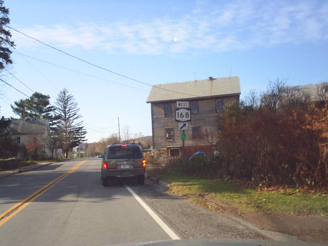
 Eastern terminus of NY 168 at NY 80 in Starkville
Construction on the Mohawk – Paines Hollow segment cost about $127,000 (equivalent to $1.61 million in 2011), and required 62,000 square yards (51,840 m2) of pavement while the latter project cost $38,000 (equivalent to $554,244 in 2011) to complete. The highway improved by the second project was added to the state highway system as State Highway 5631 (SH 5631) on May 3, 1918, and the Mohawk – Paines Hollow road was added as SH 5579 on May 31, 1919.[5][6] When the first set of posted routes in New York were assigned in 1924, the section of legislative Route 5 between Mohawk and Paines Hollow became part of NY 28.[7] In the 1930 renumbering of state highways in New York, NY 28 was realigned to use its modern alignment between Cooperstown and Mohawk while its former routing from Mohawk to Paines Hollow was redesignated as NY 168.[1] The route was extended eastward to NY 80 in Starkville ca. 1932.[8][9]
Major intersections
The entire route is in Herkimer County.
Location Mile[2] Destinations Notes Mohawk 0.00 NY 28Town of Little Falls 6.64 NY 167Hamlet of Paines Hollow Stark 14.32 NY 80Hamlet of Starkville 1.000 mi = 1.609 km; 1.000 km = 0.621 mi References
- ^ a b Dickinson, Leon A. (January 12, 1930). "New Signs for State Highways". The New York Times: p. 136.
- ^ a b "2008 Traffic Volume Report for New York State" (PDF). New York State Department of Transportation. June 16, 2009. p. 177. https://www.nysdot.gov/divisions/engineering/technical-services/hds-respository/NYSDOT%20TVR%202008%20by%20Route.pdf. Retrieved February 1, 2010.
- ^ Google, Inc. Google Maps – Map of New York State Route 168 (Map). Cartography by Google, Inc. http://maps.google.com/maps?f=d&source=s_d&saddr=Columbia+St&daddr=42.918076,-74.777101&geocode=FdApkAIdInmH-w%3B&hl=en&mra=dme&mrcr=0&mrsp=1&sz=17&sll=42.91843,-74.779977&sspn=0.00451,0.011362&ie=UTF8&ll=42.953658,-74.879379&spn=0.14524,0.363579&z=12. Retrieved April 2, 2010.
- ^ State of New York Department of Highways (1909). The Highway Law. Albany, New York: J. B. Lyon Company. p. 56. http://books.google.com/books?id=jZ0AAAAAMAAJ&pg=PA56. Retrieved June 20, 2009.
- ^ a b c New York State Department of Highways (1920). Report of the State Commissioner of Highways. Albany, New York: J. B. Lyon Company. pp. 306, 308, 507. http://books.google.com/books?id=Sj4CAAAAYAAJ&pg=PA477#v=onepage&q=5579%20&f=false. Retrieved June 10, 2009.
- ^ Consumer Price Index (estimate) 1800–2008. Federal Reserve Bank of Minneapolis. Retrieved December 7, 2010.
- ^ "New York's Main Highways Designated by Numbers". The New York Times: p. XX9. December 21, 1924.
- ^ Kendall Refining Company (1931). New York (Map). Cartography by H.M. Gousha Company.
- ^ Texas Oil Company (1932). Texaco Road Map – New York (Map). Cartography by Rand McNally and Company.
External links
Categories:- State highways in New York
- Transportation in Herkimer County, New York

Wikimedia Foundation. 2010.