- New York State Route 132
-
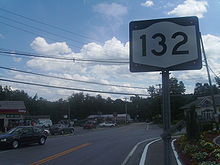
NYS Route 132
Old Yorktown Road Route information Maintained by NYSDOT Length: 2.75 mi[2] (4.43 km) Existed: 1930[1] – present Major junctions South end: 
 US 202 / NY 35 in Yorktown
 Taconic Parkway in Yorktown
North end:  US 6 in Yorktown
Location Counties: Westchester Highway system Numbered highways in New York
Interstate • U.S. • N.Y. (former) • Reference • County←  NY 131
NY 133  →
→New York State Route 132 (NY 132) is a 2.75-mile (4.43 km) long state highway located entirely within the Town of Yorktown in Westchester County, New York. The route acts as a connector between U.S. Route 202 and NY 35 in the south and U.S. Route 6 in the north. The majority of 132 coincides mostly with Old Yorktown Road; near the northern end, NY 132 is routed on East Main Street and Barger Street.
Currently, the road is almost always referred to as "Route 132", with the major exception being sending mail to places along the route as mail on 132 is usually addressed using the road name, not the number. NYSDOT has set a linear speed limit of 40 miles per hour for the entire length of 132.
Contents
Route description
NY 132 begins at a signalized intersection with the concurrent routes of U.S. Route 202 and NY 35 adjacent to both the locally-maintained Downing Park and the state-maintained Franklin D. Roosevelt State Park northwest of Yorktown Heights. The route proceeds north along Old Yorktown Road, paralleling the Taconic State Parkway for a short distance prior to meeting the parkway at a partial-diamond interchange south of Shrub Oak. No access is provided to the northbound Taconic Parkway from NY 132; likewise, traffic commuting southbound on the parkway cannot connect to NY 132. The missing exit and ramp are available just to the north at US 6. The only traffic light on 132, aside from those on its termini, is at the end of the ramp from the Taconic, with Wildwood Street directly across.
 NY 132 heading southbound from U.S. Route 6 in Yorktown
Past the Taconic, NY 132 bears off of Old Yorktown Road, which goes for a very short distance before meeting East Main Street. Route 132, now Barger Street, proceeds north to a sharp intersection with East Main Street, the former alignment of U.S. Route 6 through the area. Before US 6 was realigned, this was a cross intersection, with Main Street going directly northeast to where US 6 is now. However, since the realignment, Main Street has proceeded north on 132 from here to the present intersection of 132 and US 6, where 132 terminates. Here, Barger Street continues across 6 while East Main Street takes a right turn onto US 6.
History
When NY 132 was originally designated as part of the 1930 renumbering of state highways in New York,[1] it began at U.S. Route 6 in the hamlet of Shrub Oak and extended southeast to NY 22 near the hamlet of Katonah by way of Crompond Street, Crompond, Hallocks Mill, Saw Mill River, Amawalk, Woods Bridge, and Bedford Roads ,and Jay Street.[3] By 1932, NY 132 was realigned slightly in Yorktown Heights to bypass Hallocks Hill Road on Crompond and Saw Mill River Roads instead.[4]
In the early 1940s, all of NY 132 east of Yorktown became part of NY 35, a new cross-county route extending from Peekskill to the Connecticut state line. As a result, NY 132 was truncated to its junction with NY 35 and U.S. Route 202 in the hamlet of Yorktown.[5][6] NY 132's northern terminus was moved a short distance northward between 1968 and 1973 as a result of the re-alignment of US 6 through Yorktown.[7][8] Prior to being called Old Yorktown Road, most of 132 was named Crompond Street.[9]
NY 132A

NY 132A was a suffixed route of NY 132 in the town of Yorktown. When it was initially assigned as part of the 1930 renumbering of state highways in New York, NY 132A was an alternate route of NY 132 along Mohansic Avenue and Baldwin Road.[3] Part of Mohansic Avenue was demolished in the early 1930s to make way for the Taconic State Parkway, splitting the route into two pieces.[4] The western segment was removed from the state highway system while the eastern stub remained designated as NY 132A.[5] NY 132 was truncated to Yorktown in the early 1940s, separating it from NY 132A;[5][6] however, NY 132A was not renumbered or otherwise altered.[10] The route remained in existence until the early 1970s,[11][12] at which time maintenance of Mohansic Avenue and Baldwin Road was transferred to the town of Yorktown.[9]
Major intersections
The entire route is in Yorktown, Westchester County.
Mile[2] Destinations Notes 0.00 US 202 / NY 352.49 Taconic Parkway southNo access to Taconic Pkwy northbound 2.75 US 61.000 mi = 1.609 km; 1.000 km = 0.621 mi References
- ^ a b Automobile Legal Association (ALA) Automobile Green Book, 1930/31 and 1931/32 editions, (Scarborough Motor Guide Co., Boston, 1930 and 1931). The 1930/31 edition shows New York state routes prior to the 1930 renumbering
- ^ a b "2008 Traffic Volume Report for New York State" (PDF). New York State Department of Transportation. June 16, 2009. p. 168. https://www.nysdot.gov/divisions/engineering/technical-services/hds-respository/NYSDOT%20TVR%202008%20by%20Route.pdf. Retrieved February 1, 2010.
- ^ a b Standard Oil Company of New York (1930). Road Map of New York (Map). Cartography by General Drafting.
- ^ a b Texas Oil Company (1932). Texaco Road Map – New York (Map). Cartography by Rand McNally and Company.
- ^ a b c Gulf Oil Company (1940). New York Info-Map (Map). Cartography by Rand McNally and Company.
- ^ a b Esso (1942). New York with Pictorial Guide (Map). Cartography by General Drafting.
- ^ Esso (1968). New York (Map). Cartography by General Drafting (1969–70 ed.).
- ^ Shell Oil Company (1973). New York (Map). Cartography by H.M. Gousha Company (1973 ed.).
- ^ a b United States Geological Survey (1981). Mohegan Lake Quadrangle – New York (Map). 1:24,000. 7.5 Minute Series (Topographic). http://www.nysgis.state.ny.us/gisdata/quads/drg24/usgspreview/index.cfm?code=o41073c7. Retrieved June 1, 2009.
- ^ Sinclair Oil Corporation (1947). New York Road Map with Pictorial Sight-Seeing Guide (Map). Cartography by Rand McNally and Company.
- ^ State of New York Department of Transportation (January 1, 1970) (PDF). Official Description of Touring Routes in New York State. http://www.greaternyroads.info/pdfs/state70.pdf. Retrieved June 1, 2009.
- ^ Anderson, Steve. "State and US Roads in Westchester County". NYCRoads. http://www.nycroads.com/roads/state_westchester/. Retrieved June 1, 2009.
External links
- New York Routes – New York State Route 132
- New York State Highway Termini – New York State Route 132
- Historic American Engineering Record - Taconic State Parkway, Poughkeepsie vicinity, Dutchess County, NY - includes a photograph of the last Taconic underpass, incorrectly labelled as US 6
Categories:- State highways in New York
- Transportation in Westchester County, New York
- Yorktown, New York


Wikimedia Foundation. 2010.