- New York State Route 131
-
This article is about the current alignment of NY 131. For the former alignment of NY 131 in Westchester County, see New York State Route 131 (1930–mid-1940s).
NYS Route 131
Route information Maintained by NYSDOT Length: 12.45 mi[3] (20.04 km) Existed: late 1950s[1][2] – present Major junctions West end:  NY 37 in Louisville
East end: NY 37 in MassenaLocation Counties: St. Lawrence Highway system Numbered highways in New York
Interstate • U.S. • N.Y. (former) • Reference • County←  NY 130
NY 132  →
→New York State Route 131 (NY 131) is a 12.45-mile (20.04 km) long state highway in St. Lawrence County, New York, United States. It serves as a coastal alternate route to NY 37, going around the village of Massena instead of through it. NY 131 leaves NY 37 in the town of Louisville and rejoins it in the town of Massena. Town Line Road, a county-maintained highway straddling the Louisville–Massena town line, serves as a connector between NY 131 and Massena village.
Contents
History
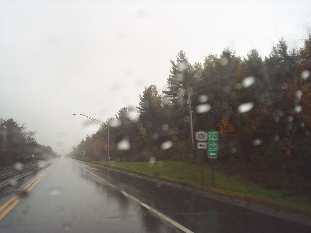
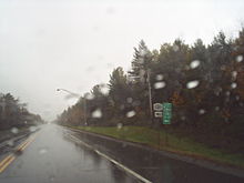 Western terminus of NY 131 at NY 37
NY 37 originally entered the village of Massena when it was assigned as part of the 1930 renumbering of state highways in New York.[4][5] In the mid-1950s, construction began on a bypass around the southern edge of the village. It opened to traffic as a realignment of NY 37 by 1958.[1][6] The former alignment of NY 37 from the bypass eastward along the Grasse River to Town Line Road was designated as NY 131 by 1960.[2] The remainder of NY 37's old routing through Massena became an extension of NY 37B,[2][7] which continued west through the town of Louisville on Town Line Road and an unnamed roadway along the St. Lawrence River to NY 37 at Louisville Corner.[2]
The alignments of NY 37B and NY 131 west of the Town Line Road / Maple Street intersection were flipped ca. 1962, placing NY 37B on NY 37's former alignment and NY 131 on the riverside highway and Town Line Road.[7][8] Within two years, NY 131 was realigned again, this time east of Town Line Road, to follow a new road along the river to Barnhart Island Road, where it turned south and followed the highway to its junction with NY 37.[9][10] A short, 0.10-mile (0.16 km)-long portion of NY 131's former alignment on Town Line Road is still maintained by the New York State Department of Transportation as NY 971J, an unsigned reference route.[3][11] The remainder of Town Line Road is maintained by St. Lawrence County as County Route 43.[12]
Major intersections
The entire route is in St. Lawrence County.
Location Mile[3] Destinations Notes Louisville 0.00 NY 376.28 Town Line Road (NY 971J) Former routing of NY 131 Town of Massena 12.45 NY 371.000 mi = 1.609 km; 1.000 km = 0.621 mi References
- ^ a b Esso (1956). New York with Special Maps of Putnam–Rockland–Westchester Counties and Finger Lakes Region (Map). Cartography by General Drafting (1957 ed.).
- ^ a b c d Gulf (1960). New York and New Jersey Tourgide Map (Map). Cartography by Rand McNally and Company.
- ^ a b c "2008 Traffic Volume Report for New York State" (PDF). New York State Department of Transportation. June 16, 2009. pp. 168, 283. https://www.nysdot.gov/divisions/engineering/technical-services/hds-respository/NYSDOT%20TVR%202008%20by%20Route.pdf. Retrieved February 1, 2010.
- ^ Dickinson, Leon A. (January 12, 1930). "New Signs for State Highways". The New York Times: p. 136.
- ^ Standard Oil Company of New York (1930). Road Map of New York (Map). Cartography by General Drafting.
- ^ Esso (1958). New York with Special Maps of Putnam–Rockland–Westchester Counties and Finger Lakes Region (Map). Cartography by General Drafting (1958 ed.).
- ^ a b Sunoco (1961). New York and Metropolitan New York (Map). Cartography by H.M. Gousha Company (1961–62 ed.).
- ^ Esso (1962). New York with Sight-Seeing Guide (Map). Cartography by General Drafting.
- ^ United States Geological Survey (1964). Massena Quadrangle – New York – Ontario (Map). 1:24,000. http://www.nysgis.state.ny.us/gisdata/quads/drg24/usgspreview/index.cfm?code=o44074h8. Retrieved May 31, 2009.
- ^ United States Geological Survey (1964). Raquette River Quadrangle – New York – Ontario (Map). 1:24,000. http://www.nysgis.state.ny.us/gisdata/quads/drg24/usgspreview/index.cfm?code=o44074h7. Retrieved May 31, 2009.
- ^ New York State Department of Transportation (January 2009) (PDF). Official Description of Highway Touring Routes, Bicycling Touring Routes, Scenic Byways, & Commemorative/Memorial Designations in New York State. https://www.nysdot.gov/divisions/operating/oom/transportation-systems/repository/2009%20tour-bk.pdf. Retrieved May 31, 2009.
- ^ Yahoo! Inc. Yahoo! Maps – Massena, New York (Map). Cartography by NAVTEQ. http://maps.yahoo.com/#mvt=m&lat=44.942038&lon=-74.922541&zoom=16. Retrieved May 31, 2009.
External links
Categories:- State highways in New York
- Transportation in St. Lawrence County, New York

Wikimedia Foundation. 2010.