- New York State Route 42
-
This article is about the current alignment of NY 42. For the former alignment of NY 42 in the Southern Tier, see New York State Route 42 (1920s–1930).
NYS Route 42
Route information Maintained by NYSDOT and the city of Port Jervis Length: 52.08 mi[2] (83.81 km) Existed: 1930[1] – present Southern segment Length: 40.66 mi[2] (65.44 km) South end: 

 US 6 / US 209 / NY 97 in Port Jervis
Major
junctions: NY 17 in Monticello
North end:  NY 55 in Neversink
Northern segment Length: 11.42 mi[2] (18.38 km) South end:  NY 28 in Shandaken
North end:  NY 23A in Lexington
Location Counties: Orange, Sullivan, Ulster, Greene Highway system Numbered highways in New York
Interstate • U.S. • N.Y. (former) • Reference • County←  NY 41A
NY 43  →
→New York State Route 42 (NY 42) is a north–south, discontinuous state highway in the Catskill Mountains region of New York in the United States. The southernmost of the highway's two segments begins at an intersection with U.S. Route 6 (US 6) and US 209 in Port Jervis and ends at a junction with NY 55 near the Rondout Reservoir in Neversink. NY 42's northern segment runs from NY 28 in Shandaken to NY 23A in Lexington. The 41-mile (66 km) southern segment is located in Orange County and Sullivan County, while the 11-mile (18 km) northern segment is in Ulster County and Greene County.
NY 42 is one of three state routes in New York that is split into two segments; the others are NY 24 and NY 878, both located on Long Island. Like NY 24, NY 42 was a continuous route when it was assigned as part of the 1930 renumbering of state highways in New York. The portion of the route between Neversink and Shandaken was eliminated in the mid-1930s.
Contents
Route description
Southern segment
The first three miles (5 km) of NY 42 are concurrent with NY 97, which also begins at the intersection with US 6 and 209 in downtown Port Jervis. NY 42 and 97 within the city of Port Jervis is maintained by the city. The concurrent roads continue out of town along the Delaware River, although it is not often visible from the highway.
At the hamlet of Sparrow Bush, 42 splits off in a more northerly direction, away from the valley, as Old Cahoonzie Road. This takes it through a lightly populated, wooded corner of Orange County. The road passes through the hamlets of Cahoonzies and Rio, and then enters Sullivan County shortly after the latter settlement.
The terrain in the new county remains similarly wooded in the aptly named Town of Forestburgh. There are no features or communities of note until the Town of Thompson and Monticello Airport. Shortly afterwards, 42 finally enters Monticello itself.
 The exit for NY 42 from NY 17 (Future I-86) in Monticello.
It serves as the county seat's Main Street, briefly going east–west to do so, then turns north again shortly after the county courthouse to intersect NY 17, the future Interstate 86, at exit 105. This is the main exit for Monticello and is often heavily trafficked at peak hours.
North of 17 a small commercial strip, including the only Wal-Mart between Middletown and Binghamton, has begun to develop, adding to the traffic and creating pressure to widen the road. Just beyond is Kiamesha Lake, site of the famed Concord Hotel. Once a premier Borscht Belt destination, it is currently closed and awaiting an uncertain future.
Sullivan County's past as a summer vacation spot can still be glimpsed at the next town along the route, South Fallsburg. In season, members of many Orthodox Jewish sects crowd the streets and shops. The historic Rivoli Theatre marks the northern end of the hamlet.
Another area attraction, the Neversink River, joins the highway corridor just north of the hamlet. The state has over the years obtained public fishing rights on much of the adjoining land, and fly fishermen come to try their luck in this famous trout stream during the April–October season.
The tinier, less crowded hamlet of Fallsburg is next, and then two miles (3 km) later 42 reaches its next state highway, NY 52, which it joins to cross the Neversink just west of the hamlet of Woodbourne, like Fallsburg a community that comes alive in the warmer months. Nearby Woodbourne and Sullivan prisons keep the local economy afloat in the off-season.
42 begins to drift away from the river after it leaves 52, with the surrounding countryside becoming once again more wooded and less peopled as the road reaches the Town of Neversink. Shortly after crossing the Blue Line and entering Catskill Park, the woods relent and offer a striking view of Peekamoose and Table Mountains, the southernmost Catskill High Peaks, directly ahead. Denman Mountain, Sullivan County's second highest peak, can also be seen to the northwest.
The southern segment then officially ends at a traffic light with NY 55 in the tiny hamlet of Grahamsville.
Former middle segment
 Sign on NY 55 near junction with beginning of former middle segment of NY 42, suggesting the concurrency still exists.
The middle segment of 42 was removed from the route decades ago, although the route remains in the text of the state's Highway Law. It can still be followed through some of the wildest sections of the Catskills. Were it still a state highway, it would be the highest-elevation in the state after the toll road up Whiteface Mountain. Today, it takes the form of three separate county routes, two in Sullivan and one in Ulster. It is even state-signed in some areas.
West of the 55 junction in Grahamsville, along the portion maintained by Sullivan County, reference markers, and at least one shield, for 42 are visible. These terminate in the former hamlet of Curry, where Sullivan County Route 19, the former route of 42, runs north and steeply uphill. A sign for westbound traffic similar to those used along other state highways indicates the road runs toward Big Indian but the distance has been painted out.
19 continues through heavily forested country, running alongside wilder stretches of the Neversink in the process. Leveling out, it reaches the southern fringe of the backwoods hamlet of Claryville. 19 goes straight ahead to it while County Route 153 and the old route of 42 head east at another junction with a state-standard sign.
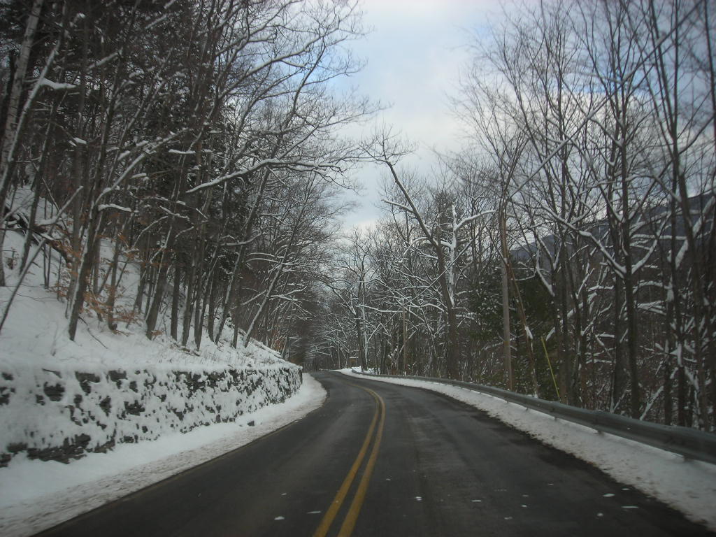
 Ulster 47 progressing through the Catskills in winter
153 crosses first the east branch of the Neversink, then the west, as it is here just above the confluence of the two. It then crosses into Ulster County; this is the start of Ulster County Route 47. Passing through a narrow valley known informally as Neversink Gorge, drivers are treated to scenic stretches of the upper West Branch on one side of the road and waterfalls created by its tributaries on the other.
Eventually, the road moves away from the river and passes Frost Valley YMCA resort, with views to Doubletop and Big Indian mountains, both among the Catskill High Peaks. The road continues to climb in elevation steadily but surely as it passes Biscuit Brook and the trailheads of Slide Mountain, the latter frequently filled with the cars of hikers ascending the range's highest summit. At one point it forms the boundary between the Slide Mountain and Big Indian-Beaverkill wilderness areas, the only artificial intrusion into over 100,000 acres (400 km²) of contiguous Forest Preserve.
After the Slide trailhead, the road climbs to Winnisook Lake, where it crosses the Catskill Divide and the tiny headwaters of Esopus Creek at approximately 2,680 feet (817 m) in elevation. This stretch of road is the highest paved free public road in New York.
Beyond that point, the road begins to descend much more sharply into scenic Big Indian Hollow. A spectacular view of Giant Ledge and Panther Mountain is available at this turn, and the corresponding trailhead is located at another sharp turn below.
The road finally levels off again at the hollow floor and proceeds alongside the Esopus to its junction with NY 28, for all practical purposes the center of the hamlet of Big Indian. Ulster County 47 crosses Route 28 and continues onward to the east (a western spur leads back to 28), where 42's northern segment starts.
Northern segment
A small motel marks the lower terminus of the upper segment where it leaves NY 28 at Shandaken. After passing the hamlet's post office, 42 follows Bushnellsville Creek north and steadily but gently upwards into Greene County. Halcott Mountain, another High Peak, can be seen ahead at the beginning, heralding a stretch of road bordering on two large areas of state Forest Preserve.
Shortly after the county line, a parking area popular with hikers that bushwhack up another High Peak, Mount Sherrill, appears on the east, its summit briefly visible from the road. The forever-wild lands of the West Kill Wilderness Area on that side and the Halcott Mountain Wild Forest on the other begin to, and then do, take over the adjoining road. Two roadside cascades on the Halcott side often draw passersby to stop and look when water is high. On the east, the raised land and air intakes of New York City's Shandaken Tunnel can be seen.
 Deep Notch
At the latter, right next to a rough parking area for hikers attempting the trailless Halcott, the dramatic drops of Deep Notch, 1,900 feet (579 m) above sea level, make a V shape with the road at the bottom. Extra fences are required to prevent landslides from blocking the road, and the steep creek chutes up the slopes attract ice climbers in winter.
Coming out of Deep Notch, 42 drops quickly into the West Kill valley, crossing the tunnel in the process. From the hamlet of West Kill, it wends its way along the stream to Lexington, where it crosses Schoharie Creek and climbs up a short slope to its final northern end at NY 23A.
History
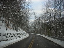
When NY 42 was originally assigned as part of the 1930 renumbering of state highways in New York, it was a continuous route extending along a previously unnumbered roadway from Port Jervis in the south to Lexington in the north via Monticello, Neversink, and Shandaken.[1][3] The section of NY 42 between Neversink and Shandaken was eliminated ca. 1934[4][5] due to its low traffic volume and maintenance difficulties arising from the road's high elevation and exposure to severe winter weather.[6] Even today the portion in Ulster County is visibly affected by these conditions.
Major intersections
County Location Mile[2] Destinations Notes Orange Port Jervis 0.00 US 6 / US 209 / NY 97Southern terminus of NY 42 / NY 97 overlap; southern terminus of NY 97 Deerpark 2.95 NY 97 northNorthern terminus of NY 42 / NY 97 overlap Sullivan Monticello 23.67 NY 17Exits 105A–B (NY 17) Fallsburg 32.17  NY 52 west
Southern terminus of NY 42 / NY 52 overlap 32.44 NY 52 eastNorthern terminus of NY 42 / NY 52 overlap Neversink 40.66 NY 55Gap in designation Ulster Shandaken 0.00 NY 28Greene Lexington 11.42 NY 23A1.000 mi = 1.609 km; 1.000 km = 0.621 mi References
- ^ a b Dickinson, Leon A. (January 12, 1930). "New Signs for State Highways". The New York Times: p. 136.
- ^ a b c d "2008 Traffic Volume Report for New York State" (PDF). New York State Department of Transportation. June 16, 2009. pp. 110–111. https://www.nysdot.gov/divisions/engineering/technical-services/hds-respository/NYSDOT%20TVR%202008%20by%20Route.pdf. Retrieved January 31, 2010.
- ^ Standard Oil Company of New York (1930). Road Map of New York (Map). Cartography by General Drafting.
- ^ Texas Oil Company (1933). Texaco Road Map – New York (Map). Cartography by Rand McNally and Company.
- ^ Texas Oil Company (1934). Texaco Road Map – New York (Map). Cartography by Rand McNally and Company.
- ^ Sinsabaugh, Mark. "New York State Route 42". New York Routes. http://www.gribblenation.net/nyroutes/ind/040_049.htm#042. Retrieved April 1, 2010.
External links
Categories:- State highways in New York
- Transportation in Orange County, New York
- Transportation in Ulster County, New York
- Transportation in Greene County, New York
- Transportation in Sullivan County, New York


Wikimedia Foundation. 2010.