- Neversink, New York
-
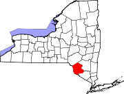
Neversink, New York — Town — Location within the state of New York
 Neversink, New York
Coordinates: 41°51′22″N 74°35′43″W / 41.85611°N 74.59528°W Country United States State New York County Sullivan Area – Total 86.4 sq mi (223.7 km2) – Land 82.9 sq mi (214.8 km2) – Water 3.4 sq mi (8.9 km2) Elevation 1,499 ft (457 m) Population (2000) – Total 3,553 – Density 42.8/sq mi (16.5/km2) Time zone Eastern (EST) (UTC-5) – Summer (DST) EDT (UTC-4) ZIP code 12765 Area code(s) 845 FIPS code 36-49847 GNIS feature ID 0979252 Neversink is a town in Sullivan County, New York, United States. The population was 3,553 at the 2000 census.
The Town of Neversink is in the northeast corner of the county. The Neversink River that flows through the town is claimed to be the birthplace of American fly fishing.
Contents
History
The town was formed from the Town of Rochester in Ulster County, New York in 1798 before Sullivan County was formed. The Town of Rockland was created from part of Neversink in 1809, and part of Neversink was used to make the newer Town of Fallsburg in 1826. When the Neversink and Rondout reservoirs were built, as part of the New York City water supply system, the communities of "Old Neversink" and "Bittersweet" (Neversink Reservoir), "Eureka", "Montela", and "Lackawack" (Rondout Reservoir) were lost.
In 1935 the town passed a dry law prohibiting the sale of alcoholic beverages, which is still in effect today.[1][2] Efforts to repeal it over the years have failed; most recently in 2006 when a petition to change it was found to have too few valid signatures.
Geography
Part of the town is in the Catskill Park. The northern and eastern town lines are the border of Ulster County, New York.
According to the United States Census Bureau, the town has a total area of 86.4 square miles (224 km2), of which, 82.9 square miles (215 km2) of it is land and 3.5 square miles (9.1 km2) of it (3.99%) is water.
Demographics
As of the census[3] of 2000, there were 3,553 people, 1,346 households, and 1,008 families residing in the town. The population density was 42.8 people per square mile (16.5/km²). There were 1,960 housing units at an average density of 23.6 per square mile (9.1/km²). The racial makeup of the town was 96.93% White, 0.56% African American, 0.23% Native American, 0.23% Asian, 0.65% from other races, and 1.41% from two or more races. Hispanic or Latino of any race were 2.20% of the population.
There were 1,346 households out of which 35.7% had children under the age of 18 living with them, 61.3% were married couples living together, 9.3% had a female householder with no husband present, and 25.1% were non-families. 21.0% of all households were made up of individuals and 8.7% had someone living alone who was 65 years of age or older. The average household size was 2.64 and the average family size was 3.06.
In the town the population was spread out with 28.1% under the age of 18, 5.6% from 18 to 24, 28.7% from 25 to 44, 25.4% from 45 to 64, and 12.2% who were 65 years of age or older. The median age was 38 years. For every 100 females there were 96.1 males. For every 100 females age 18 and over, there were 95.4 males.
The median income for a household in the town was $45,174, and the median income for a family was $55,075. Males had a median income of $40,744 versus $22,031 for females. The per capita income for the town was $19,260. About 8.7% of families and 11.3% of the population were below the poverty line, including 14.3% of those under age 18 and 13.7% of those age 65 or over.
Communities and locations in Neversink
- Aden – A hamlet in the north part of the town.
- Bittersweet – A community lost when the Neversink reservoir was constructed.
- Bradley – A hamlet on the southwest side of the Neversink Reservoir, on the border of the Town of Liberty.
- Claryville – A hamlet by the north town line.
- Curry-- A hamlet west of Unionville.
- Eureka – A community now covered by the Rondout Reservoir.
- Grahamsville – A hamlet east of Neversink village, near the Rondout Reservoir.
- Lowes Corners – A location north of the Rondout Reservoir.
- Neversink – The hamlet of Neversink was built above the reservoir after the original community, also known as "Neversink Flats," was inundated by the Neversink Reservoir. The community is on Route 55.
- Neversink Reservoir – A reservoir centrally located in the town.
- Rondout Reservoir – A reservoir partly in the eastern area of the town.
- Unionville – A hamlet west of Grahamsville.
- Willowemoc – A hamlet, formerly called "Willowcanoe," near the western town line.
References
External links
Coordinates: 41°50′50″N 74°37′09″W / 41.84722°N 74.61917°W
Municipalities and communities of Sullivan County, New York Towns Bethel | Callicoon | Cochecton | Delaware | Fallsburg | Forestburgh | Fremont | Highland | Liberty | Lumberland | Mamakating | Neversink | Rockland | Thompson | Tusten
Villages CDPs Other
hamletsBarryville | Bridgeville | Debruce | Grahamsville | Harris | Kiamesha Lake | Lew Beach‡ | Loch Sheldrake | Minisink Ford | Mountain Dale | Spring Glen | Summitville | White Lake | White Sulphur Springs | Woodbourne
Footnotes ‡This populated place also has portions in an adjacent county or counties
Categories:- Towns in New York
- Neversink River
- Populated places in Sullivan County, New York


Wikimedia Foundation. 2010.