- New York State Route 52
-
This article is about the current alignment of NY 52. For the former alignment of NY 52 in the Finger Lakes region, see New York State Route 52 (1920s–1930).
NYS Route 52

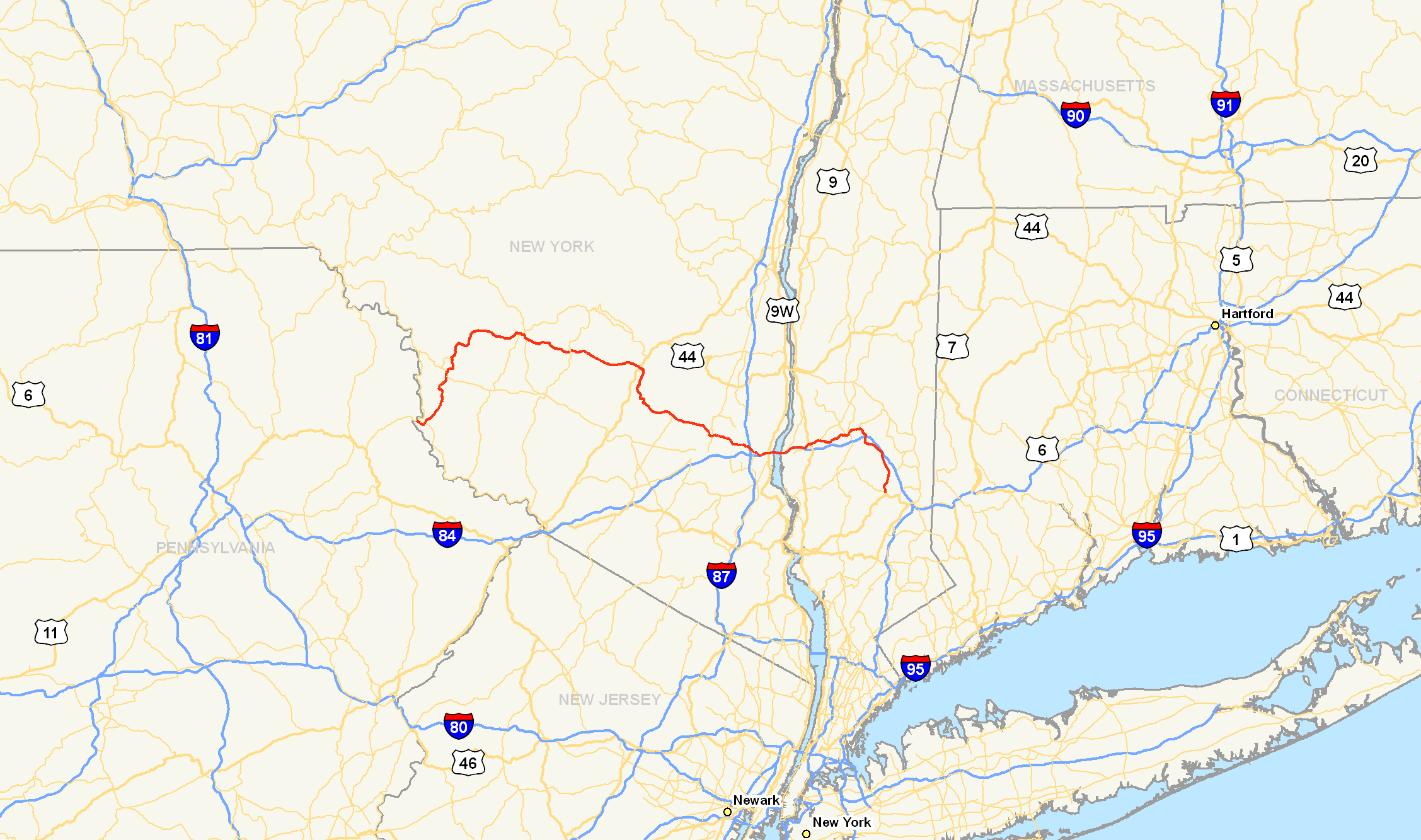
Map of southeastern New York and vicinity with NY 52 highlighted in redRoute information Maintained by NYSDOT, NYSBA, and Sullivan County Length: 108.72 mi[2] (174.97 km) Existed: 1930[1] – present Major junctions West end:  PA 652 at Tusten
 NY 17 in Liberty
 US 209 in Ellenville


 I-84 / US 9W / NY 32 in Newburgh
 US 9 in Fishkill
 Taconic Parkway in East Fishkill
East end:  US 6 in Carmel
Location Counties: Sullivan, Ulster, Orange, Dutchess, Putnam Highway system Numbered highways in New York
Interstate • U.S. • N.Y. (former) • Reference • County←  NY 51
NY 51NY 53  →
→New York State Route 52 (NY 52) is a 108.72-mile (174.97 km) long state highway in the southeastern part of New York in the United States. It generally runs from west to east, beginning at the Pennsylvania state line in the Delaware River near Narrowsburg, crossing the Hudson River on the Newburgh-Beacon Bridge, and ending in Carmel. Route 52 and Route 55, both major east–west routes of the Mid-Hudson Region, run parallel to each other, intersecting in downtown Liberty.
With the exception of the section overlapping Interstate 84, most of Route 52 is a two–lane road through lightly developed rural areas. The road west of the Hudson River serves a number of small communities in the southern Catskills, while it closely parallels I–84 east of the Hudson.
Contents
Route description
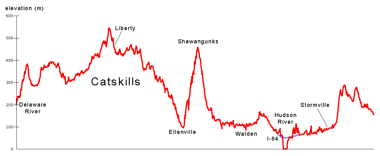
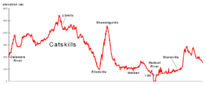 Elevation profile of Route 52
Route 52 runs through several distinct regions: the Catskills, a lightly populated area from the Delaware River to the Shawangunk Ridge; a relatively flat area from the east slope of the Shawangunks through Orange County to the Hudson River; another flat area east of the Hudson to Stormville; and part of the Taconics south through Kent and Carmel to the eastern terminus.
Delaware to Shawangunks
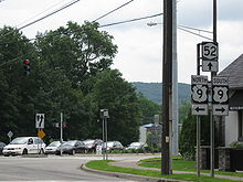
 NY 52's westbound exit from NY 17, merged with NY 55.
Although much of its length runs through less remote territory than NY 55, at its western end it is NY 52 that lies further from New York City. From the bridge over the Delaware River at Narrowsburg (where the route links to Pennsylvania Route 652 in Pennsylvania) it joins NY 97 briefly, strikes out into the countryside trending gradually northwards, picks up NY 17B for a short distance at Fosterdale, and it is firmly headed north.[3][4]
The western half of Sullivan County is actually less developed and populated despite its flatter topography, as the summer resort industry Sullivan is known for was and is concentrated in the eastern towns of the county, closer to the Catskills. Much of the surrounding land is farms or woods. There is no direct trunk route for 52 to follow, and it overlaps several county roads. Some sections are maintained by the county as CR 24 (Race Course Road) from the PA line to NY 97, CR 111 (Narrowsburg Road) from NY 97 to the Cochecton town line, CR 112 (Narrowsburg Road) from the Tutsen town line to Lake Huntington, and CR 113 (Narrowsburg Road) from Lake Huntington to NY 17B & CR 114 (Newburgh Turnpike). Some older-style New York state route signs, with the "NY" on top, can be seen here.[5]
At Kenoza Lake NY 52A, 52's only suffixed subroute, goes off to the west near a historic stone bridge.[6] A few miles later, at tiny Jeffersonville, the only incorporated village in the western half of the county, 52 finally bends back eastward. The roadway becomes smoother and its right-of-way wider. The trip through the hamlets of Youngsville and White Sulphur Springs to Liberty passes much more quickly than the previous section.[7]
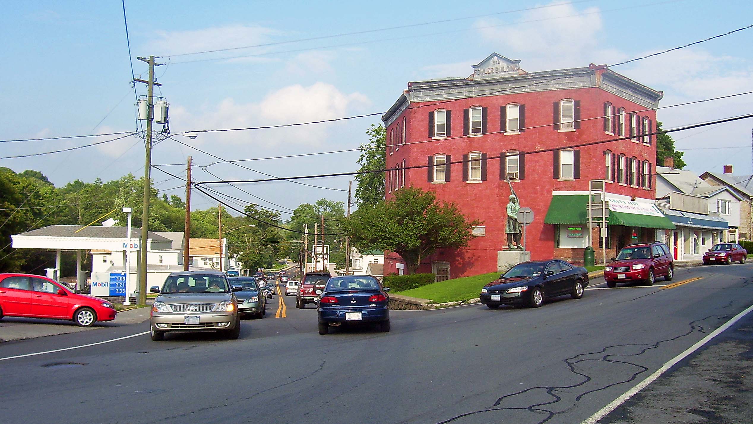
In Liberty, the first large town along NY 52, it meets up with NY 55 and the two even share a few blocks downtown.[7] At the village's eastern limit, it crosses the NY 17 Quickway, exactly a hundred driving miles from the city. Beyond 17, it passes some shopping plazas, then heads out into the country again along a good quality roadway, recently repaved.
Sullivan's eastern half offers the hamlets of Loch Sheldrake and Woodbourne, both of which bustle in the summertime, particularly with Orthodox Jews from the city who have traditionally taken their families to the area for the summer. Sullivan County Community College and the two nearby state prisons keep the economy going in the off-season.[8]
NY 52 carries NY 42 over the Neversink River, after which it leaves northward to the end of its southern segment.[8] Just past Woodbourne Correctional Facility, it crosses into Ulster County. The highway from there to Ellenville is largely a straight, gradual descent off the Catskill Plateau through primarily wooded and undeveloped land (a few buildings on either side of the road mark the hamlets of Dairyland and Greenfield Park), with the Bush Kill coming in on the south side as the village approaches.
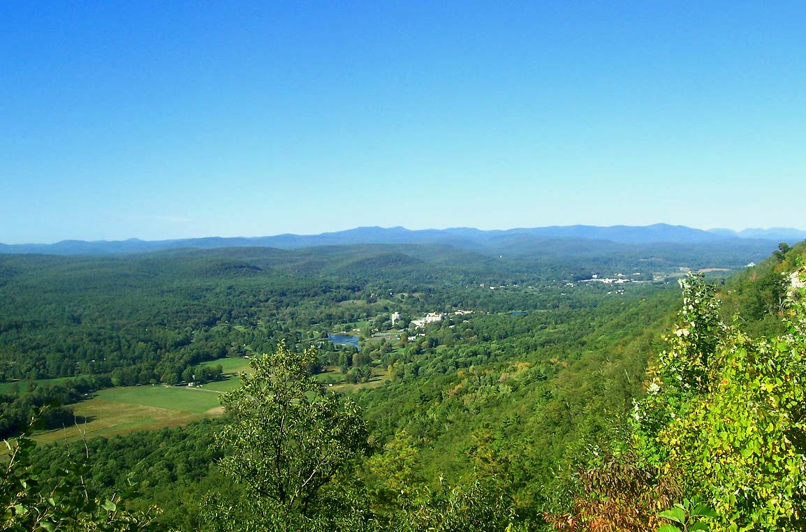
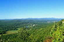 View of Catskills from 52 along Shawangunk Ridge east of Ellenville
 Route 52 climbing the Shawangunks
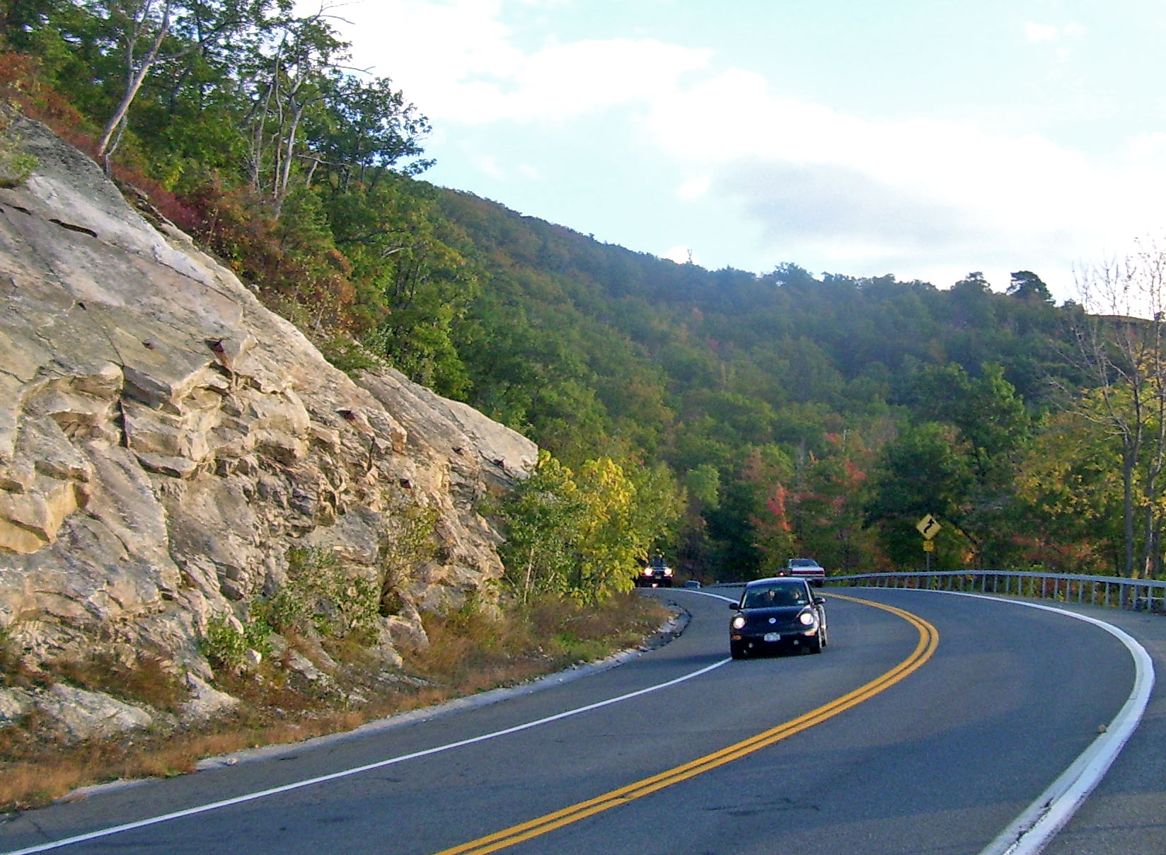
At Ellenville's western boundary, 52 appears to split (see below).[9] Both sections intersect with US 209 in the center of the village. Once across the village, just to the east, 52 encounters its most significant terrain feature, the Shawangunk Ridge, which looms over the village. The highway turns abruptly southward at the village's eastern boundary and begins a gradual three-mile (4.8 km) climb up the ridge. This is a very scenic stretch of 52, as several overlooks on the upper portions offer sweeping views of the Catskills, and closer to it there are the range's famous brilliant cliffs. The Long Path hiking trail also leaves its aqua-colored blazes on a stretch of the road it shares.[10]
At the crest, near the road to Cragsmoor, 52 reaches nearly 1,500 feet (460 m) in elevation, turns again eastward, and begins an equally gradual descent.
Shawangunks to Hudson River
The wooded route down the east side of the Shawangunks offers its own vistas of the land ahead—at one point, on clear days, it is possible to see all the way to the Hudson Highlands. Walker Valley is the first town encountered, at the point where the highway begins to level out again. From here several more miles of road, through more open country, brings 52 to the Shawangunk Kill bridge and the Orange County line.
Downtown Pine Bush immediately presents itself, along with what was until recently the well-developed hamlet's only traffic light, at NY 302's northern terminus.[11] A mile later, the hamlet ends and countryside resumes.
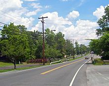
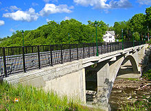 The new Walden High Bridge, carrying Route 52 across the Wallkill River.
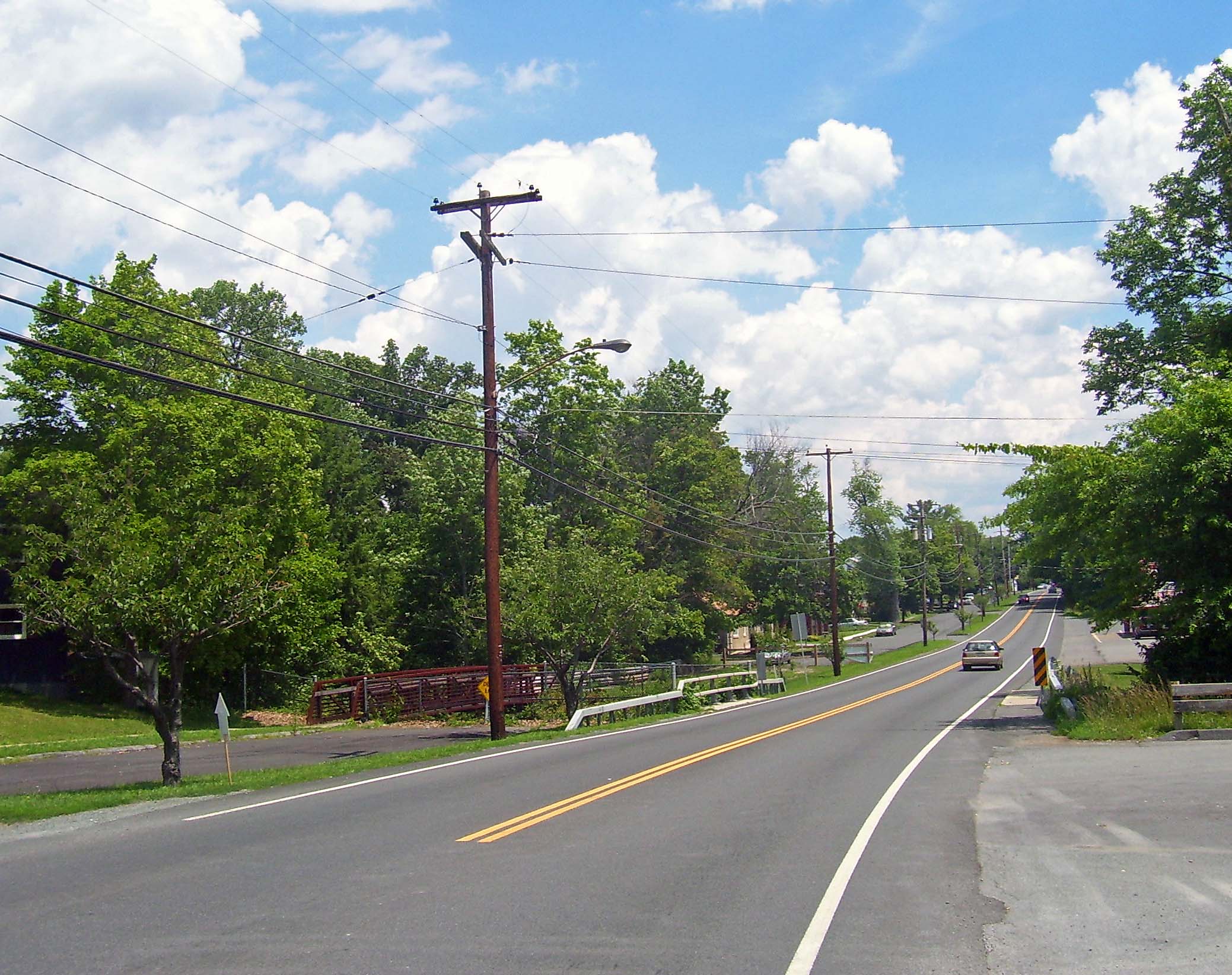
There are many panoramas of the Shawangunks along the next stretch of highway, as it passes mostly open fields with a few wooded interruptions. Six miles (9.6 km) east of Pine Bush, 52 enters Walden, the largest town on it thus far, first as North Montgomery Street.[12] This changes to South Montgomery at the Oak Street intersection, where 52 temporarily turned on to cross the Wallkill River at the Low Bridge from 2003–2005 while a new High Bridge (officially the Walden Veterans' Memorial Bridge) was being built. The new bridge, where 52 becomes Main Street, crosses the river at least 50 feet (15 m) above water level and provides a view to the waterfalls and power station just upriver.
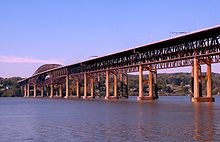 The Newburgh-Beacon Bridge
In downtown Walden, NY 52 meets NY 208 and overlaps it for two short blocks, before resuming its eastward course.[12] The road ahead runs through more farmlands and woodlots, across the Catskill Aqueduct and past the swampy south end of Orange Lake. In the Town of Newburgh, after crossing under the New York State Thruway, residential and commercial development becomes continuous along the road. 52 intersects NY 300 in the built-up area known as Gardnertown for an early settler, whose house is visible from the junction, and then passes through the suburban area around Algonquin and Winona lakes, both fed by Orange Lake's outlet brook, before reaching I-84.[13]
Hudson River to Carmel
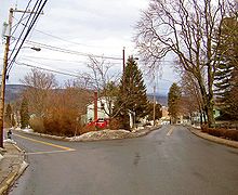
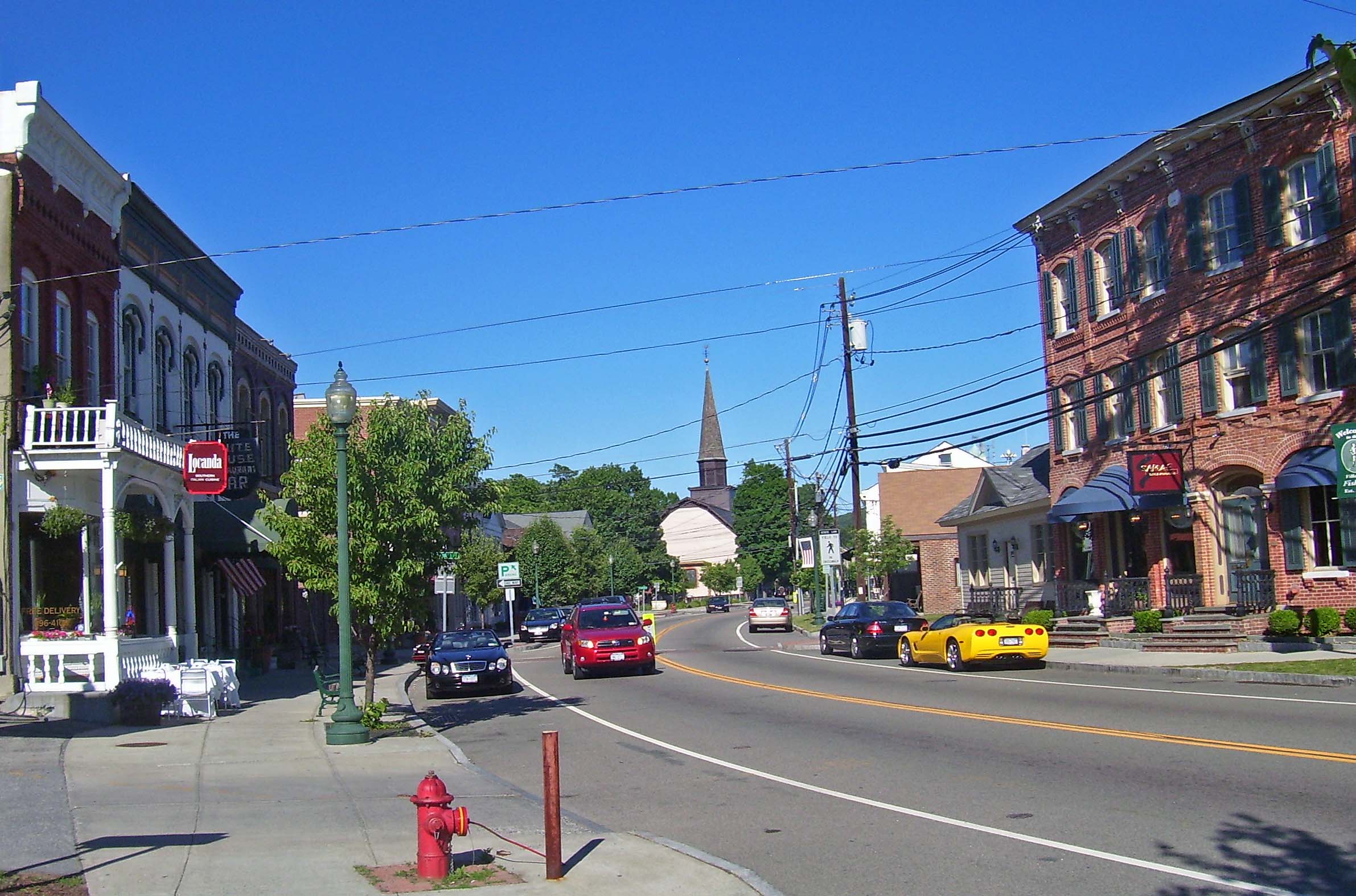
 Historic downtown Fishkill
NY 52 and I-84 have been gradually converging for several miles at this point, and the two merge at the interstate's exit 8, just outside the Newburgh city limits, to cross the Hudson together via the bridge.[14] Just past the bridge's toll plaza are the ramps for NY 9D, just on the northern line of the city of Beacon. They will continue to run close to each other for the rest of 52's route. The concurrency lasts seven miles (11.2 km), well into Dutchess County before 52 resumes its pre-bridge course at exit 12, becoming the main street of yet another village, Fishkill.[15] Here it is the backbone of a historic district. Just east of the downtown area is the major junction with US 9, and 52 through Fishkill is often heavily congested at rush hour as drivers use it as a shortcut past similarly-congested sections of I-84 from southbound 9.[15]
 NY 52's intersection with US 9 in Fishkill
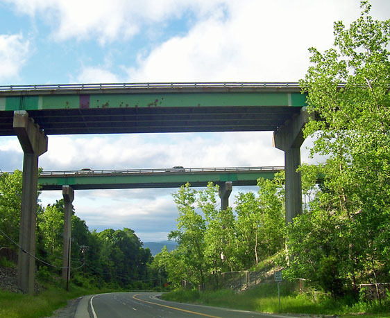
East of Route 9, there is still considerable development along the road although it opens up somewhat as it passes the southern termini of NY 376 and NY 82, in Hopewell Junction and Brinckerhoff to the Taconic State Parkway junction.[16] Traffic lessens out past the Taconic as it is no longer a major connecting route in that direction, and after Stormville and NY 216, 52 once again begins to feel like a country road, winding under a high bridge carrying 84 once again and crossing the Appalachian Trail as it leaves Dutchess to enter its last county, Putnam, at the hamlet of Ludingtonville.[17]
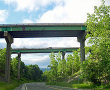 I-84 overpass above 52 near Fishkill
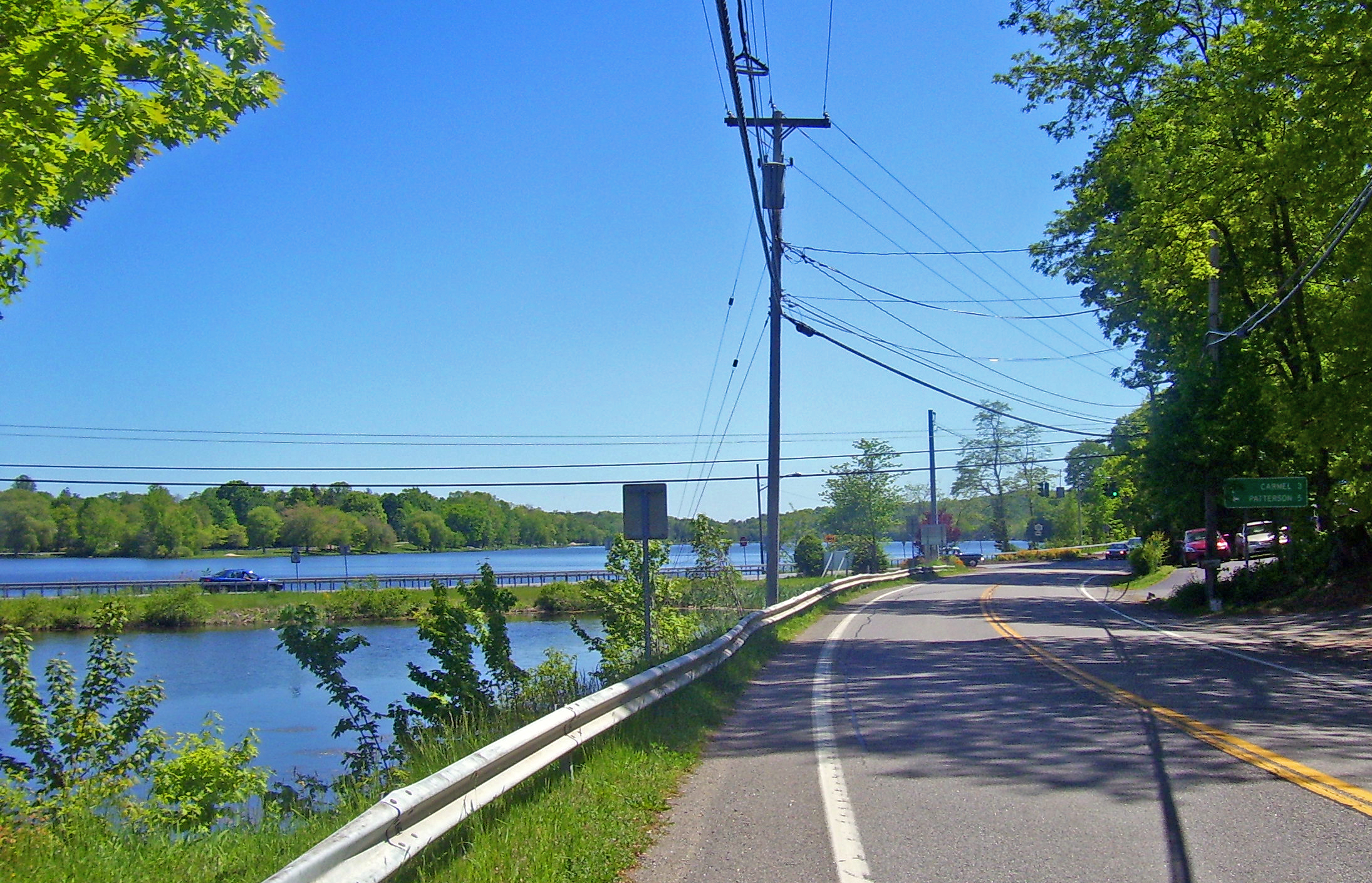
Here, it follows the eastern shore of Lake Carmel in the community of the same name, the most populous along its entire route. NY 311 crosses and provides a feeder route back to I-84. It continues along the lake, crossing a small inlet near its southern end, then descends through the small downtown of Lake Carmel, then reascends through the gently rolling, mostly wooded countryside. After passing a large shopping center, it enters Carmel proper. A few blocks into downtown it reaches the eastern terminus of NY 301 at the county courthouse, just northeast of Lake Gleneida, a controlled lake part of New York City's water supply. A short distance past that along the lake, NY 52 ends at US 6 next to Reed Memorial Library.[18]
History
Like many state highways in the region, Route 52 follows a number of roads originally built as private turnpikes during the early 19th century. While the turnpikes made significant improvements to very poor roads, they were not popular with the public and eventually failed, leaving their roads for the county or state to maintain.
Predecessor turnpikes
One of these - the Woodbourne and Ellenville Turnpike Company - ran from Woodbourne to Ellenville. After being incorporated by the New York Legislature on April 17, 1830,[19] it built and opened a turnpike from Ellenville on the Delaware and Hudson Canal west to Woodbourne in 1838, and later extended it further in that direction to Liberty.[20]
To the east of Ellenville, the Newburgh and Ellenville Plank Road Company was proposed in late 1849 to build and charge tolls on a plank road between Ellenville and Newburgh, major markets on the canal and Hudson respectively. It was incorporated on March 24, 1850 under the state's general incorporation law. The company decided shortly thereafter to build on a southern route; the supporters of a northern route organized the Newburgh and Shawangunk Plank Road two weeks later. Both roads were completed in December 1851; an opening celebration for the Newburgh and Ellenville was held at Ellenville on December 22.[21] The south route is now, with some modifications, part of Route 52, while the north route carries parts of Route 32 and Route 300, becoming a county road (Bruyn Turnpike) west of Wallkill. In 1895 the Walden and Orange Lake Railroad, later part of the Orange County Traction Company, built a trolley line along the old turnpike between Orange Lake, then the end of a suburban line from Newburgh, and Walden. It carried passengers and freight, including milk, until its demise in 1925.[22]
Other former turnpikes used by Route 52 include short lengths of the Jeffersonville and Monticello Turnpike (Jeffersonville to Briscoe Road), Ulster and Orange Branch Turnpike (Liberty to Cross Farm Road), Philipstown Turnpike (Pecksville to Ludingtonville), and Putnam and Dutchess Turnpike (Ludingtonville to the end in Carmel). By the 1890s, the entire route that would become Route 52 existed as public or turnpike roads.[23]
Public ownership
After the demise of the turnpikes, the State Commission of Highways was created by the legislature in 1898 to improve and maintain state highways. In 1909, a connected network of routes was laid out by the legislature; none of the present Route 52 was included.[24] It was also not part of the system of signed State Routes numbered in 1924.[25] By 1926, Route 39 was signed from Poughkeepsie to Patterson, using a short piece of modern Route 52 between East Fishkill and Stormville. The rest of old Route 39 used modern NY 376 from Poughkeepsie to East Fishkill, NY 216 from Stormville to Poughquag, NY 55 from Poughquag to West Pawling, NY 292 from West Pawling to West Patterson, and NY 311 from West Patterson to Patterson.[26]
Formal designation
Route 52 was designated as part of the 1930 renumbering of state highways in New York.[1] West of East Fishkill, NY 52 was assigned to its current routing along a previously unnumbered road through downstate New York to the Pennsylvania state line;[27][28] however, it was several years before Route 52 as a whole was improved and paved.[27] At its west end, Route 52 connected with U.S. Route 106, which had been designated in 1926 and ended at the Delaware River on the Pennsylvania state line.[29] US 106 was never extended into New York,[30] and is now Pennsylvania Route 652 near the border.
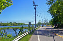 NY 311 junction at Lake Carmel
East of East Fishkill, the newly designated Route 52 used the old alignment of 1920s Route 39 from East Fishkill to West Patterson. At West Patterson, the route continued along previously unnumbered roads south to Carmel, then east to NY 22 at Sears Corners (northeast of Brewster) over modern NY 311, U.S. Route 6, and NY 312, as well as its modern alignment from Lake Carmel to Carmel.[27] At the time, modern NY 52 from Stormville to Ludingtonville (northwest of Lake Carmel) was designated as part of NY 216.[31] NY 52 and NY 216 mostly swapped locations ca. 1937; NY 52 was rerouted onto its modern alignment between Stormville and Lake Carmel, utilizing the portion of NY 216 from Stormville and Ludingtonville as well as a new roadway between Ludingtonville and Lake Carmel while NY 216 was relocated to the old Route 39 alignment (Stormville-Poughquag-West Patterson). The original NY 52 segment from West Patterson to Lake Carmel was assigned as an extension of NY 311. NY 52 was also truncated to its present terminus in Carmel at this time.[32][33]
Realignments and detours
The only major change to Route 52's routing since then came with the opening of the Newburgh-Beacon Bridge on November 2, 1963.[34] Prior to then, Route 52 had crossed the Hudson River on the Newburgh-Beacon Ferry, approaching from the west on Dupont Avenue and Broadway (overlapping Route 17K on Broadway)[35] and from the east on Fishkill Avenue and Wolcott Avenue (now mostly Route 52 Business).[36]
Natural disasters and construction have forced temporary closures and reroutings in some areas. On December 31, 2002, a rockslide along the stretch climbing the Shawangunks east of Ellenville buried an 85-foot (25 m) section of the road with an estimated 1,000 cubic yards (800 m³) of rock and dirt. The state Department of Transportation closed the road temporarily. Automobile traffic was detoured via several local roads; trucks had to make a lengthy side trip via Route 17[37] During the 2003–2005 construction of the new bridge over the Wallkill River in Walden, Route 52 was routed to Walden's other bridge (the "Low Bridge") via Oak Street, which intersects the highway twice within the village. This required the erection of two temporary traffic signals, causing some new traffic problems in the village.[38] Truck traffic was detoured to Route 17K via Albany Post Road and Stone Castle Road.[39]
Future
 The congested eastern end of the NY 208 overlap in Walden.
The village of Walden has noted, in its 2005 Comprehensive Plan, the difficulties created by the oblique intersection at the eastern end of the Route 208 concurrency. Traffic on northbound 208 comes to a stop sign at the intersection, where 52 comes in from the right at a slightly lower grade and a sharp angle, with the view mostly blocked by a building. It is also just opposite one of two curb cuts for a busy Hess-branded gas station. At rush hour, the traffic light at the nearby northern end often backs cars up along 52 for some distance, making the turn into the gas station difficult, especially when vehicles on 52 make the left turn into the curb cut.[40][original research?]
The layout of the intersection is very poor for trucks making this turn, and the congestion all these factors create has been forcing more drivers to resort to side streets, the village believes, since traffic counts have been going up on 52 and 208 but down on the concurrency. It is hoping to work with the state DOT on marking an alternate route for trucks.[41]
Anomalies
The Ellenville split
 Eastern end of Ellenville split.
Across Ellenville, both Center and Canal streets carry NY 52 shields and reference markers as they run parallel across the village. While the New York State Department of Transportation (NYSDOT) does not list a separate reference route in the village,[42] a 2005 Ulster County Transportation Council map shows both as state highways.[43]
Some of NYSDOT's own documents suggest as well that 52 divides into two two-way routes in Ellenville. An DOT-produced quadrangle map shows the designation applying to both streets.[44] State traffic signal regulations make reference to both Canal and Center being part of Route 52,[45] and the National Bridge Inventory lists two bridges over Sandburg Creek along Route 52 in the village.[46]
 Parallel roadways in eastern Walden.
Since Canal has a stop sign at its western junction with Center, and Center at the eastern fork, this results in each street being the optimum route across the village depending on the direction of travel. When coming from the west, taking the fork onto Canal at the western boundary allows a driver to build up speed before beginning the climb up the Shawangunks. Conversely, quickly bearing onto Center at the end of that climb means not having to stop at the fork on the other side of the village.[original research?]
Dual roadway in Walden
From the western of the two Tin Brook crossings within the village to the eastern village line, 52 is paralleled by an older route of East Main Street that remains in use, separated by a thin median with some trees and telephone on it. East of Woodruff Street, the older road functions as a service road for the residents and businesses in that area, mostly on the north side as the south side is a village park. The former right-of-way visibly continues to Highland Avenue although most of it has been revegetated.
NY 52A

NY 52A (2.78 miles or 4.47 kilometres) is an alternate route of NY 52 through western Sullivan County. The route begins at NY 17B near the hamlet of Fosterdale and continues north and east to its terminus at NY 52 near the north end of Kenoza Lake,[2] where a historic and picturesque stone arch bridge is visible from the junction.[citation needed] It serves mainly to shorten the trip from Callicoon to Liberty via NY 52 as without it drivers on NY 17B would have to go out of their way to reach the junction.[47] The route was assigned as part of the 1930 renumbering of state highways in New York.[28]
NY 52 Business

NYS Route 52 Business
Location: Beacon Length: 4.74 mi[2][48] (7.63 km) Existed: 1963[49]–present New York State Route 52 Business (abbreviated NY 52 Bus.) is a business route of NY 52 that extends for 4.74 miles (7.63 km) through the city of Beacon in Dutchess County, New York.[2][48] The route is signed as east–west, starting at Interstate 84 / NY 52 exit 11 and NY 9D north of Beacon and ending at I-84 / NY 52 exit 12 southwest of the village of Fishkill, where NY 52 leaves I-84, ending the I-84 / NY 52 concurrency. NY 52 Business is not posted on guide signs on I-84.
NY 52 Business begins at I-84 / NY 52 exit 11 and runs concurrent with NY 9D into Beacon. At Main Street, NY 52 Business leaves NY 9D and follows Main Street east through the Lower Main Street Historic District and across town to Fishkill Avenue. The route turns left onto that street, following Fishkill Avenue out of the city. At Prospect Street, a local road straddling the Beacon city line, NY 52 Business becomes state-maintained as NY 980J, an unsigned reference route.
After Millholland Drive, Fishkill Avenue becomes Main Street once again, this time for Fishkill, before meeting I-84 / NY 52. At the interchange, NY 52 Business, as well as the NY 980J designation, comes to an end while NY 52 continues east along Main Street.
Major intersections
County Location Mile[2] Destinations Notes Sullivan Tusten 0.00 PA 652Continuation into Pennsylvania 0.69  NY 97 north (Beach Lake Highway)
Hamlet of Narrowsburg; western terminus of NY 52 / NY 97 overlap 1.45 NY 97 southHamlet of Hunts Corner; eastern terminus of NY 52 / NY 97 overlap Cochecton 11.09  NY 17B east (Newburgh and Cochecton Turnpike)
Hamlet of Fosterdale; southern terminus of NY 17B / NY 52 overlap 11.55 NY 17B westNorthern terminus of NY 17B / NY 52 overlap Delaware 14.85  NY 52A
Eastern terminus of NY 52A Village of Liberty 29.82  NY 55 west (Lake Street)
Western terminus of NY 52 / NY 55 overlap 30.04 NY 55 east (Neversink Road)Eastern terminus of NY 52 / NY 55 overlap Town of Liberty 31.45 NY 17 (Quickway)Exit 100 (NY 17) Fallsburg 38.52  NY 42 south
Hamlet of Woodbourne; western terminus of NY 42 / NY 52 overlap 38.79 NY 42 northHamlet of Woodbourne; eastern terminus of NY 42 / NY 52 overlap Ulster Ellenville 50.29 US 209 (Main Street)Orange Crawford 62.47  NY 302 (Maple Avenue)
Hamlet of Pine Bush; northern terminus of NY 302 Walden 69.88  NY 208 north (Ulster Avenue)
Western terminus of NY 52 / NY 208 overlap 69.94 NY 208 south (Orange Avenue)Eastern terminus of NY 52 / NY 208 overlap Gardnertown 77.18  NY 300 (Union Avenue)
Town of Newburgh 78.84 I-84 westExit 8 (I-84); western terminus of I-84 / NY 52 overlap City of Newburgh 80.43 US 9W / NY 32Exit 10 (I-84) 81.62 Newburgh-Beacon Bridge over the Hudson River Dutchess Town of Fishkill 83.03 


 NY 9D / NY 52 Bus.
Exit 11 (I-84); western terminus of NY 52 Bus. 86.18
I-84 east / NY 52 Bus.Exit 12 (I-84); eastern terminus of NY 52 Bus.; eastern terminus of I-84 / NY 52 overlap Village of Fishkill 87.28 US 9Town of Fishkill 88.94  NY 82
NY 82Hamlet of Brinckerhoff; southern terminus of NY 82 East Fishkill 93.33  NY 376
Southern terminus of NY 376 94.27 Taconic ParkwayInterchange 95.44  NY 216
Western terminus of NY 216 Putnam Kent 105.35  NY 311
Hamlet of Lake Carmel; southern terminus of NY 311 Town of Carmel 108.44  NY 301
Hamlet of Carmel; eastern terminus of NY 301 108.72 US 61.000 mi = 1.609 km; 1.000 km = 0.621 mi References
- ^ a b Dickinson, Leon A. (January 12, 1930). "New Signs for State Highways". The New York Times: p. 136. http://select.nytimes.com/gst/abstract.html?res=F50A15F6355A147A93C0A8178AD85F448385F9.
- ^ a b c d e "2008 Traffic Data Report for New York State" (PDF). New York State Department of Transportation. June 16, 2009. pp. 106, 195–196, 363. https://www.nysdot.gov/divisions/engineering/technical-services/hds-respository/NYSDOT_Traffic_Data_Report_2008.pdf. Retrieved January 13, 2010.
- ^ Rand McNally and Company (2007). Motor Carriers' Road Atlas (Map) (Deluxe ed.). p. 69, section SB 3, SG 6.
- ^ Google, Inc. Google Maps – Route 52 in Narrowsburg (Map). Cartography by Google, Inc. http://maps.google.com/maps?hl=en&rlz=1T4ADBF_enUS232US232&q=NY+52,+Narrowsburg&um=1&ie=UTF-8&sa=N&tab=il. Retrieved January 2, 2008.
- ^ Google, Inc. Google Maps – Route 52 in Narrowsburg (Map). Cartography by Google, Inc. http://maps.google.com/maps?hl=en&rlz=1T4ADBF_enUS232US232&q=NY+52,+Lake+Huntington&um=1&ie=UTF-8&sa=N&tab=il. Retrieved January 2, 2008.
- ^ Google, Inc. Google Maps – Route 52 in Kenoza Lake (Map). Cartography by Google, Inc. http://maps.google.com/maps?hl=en&rlz=1T4ADBF_enUS232US232&q=NY+52,+Kenoza+Lake&um=1&ie=UTF-8&sa=N&tab=il. Retrieved January 2, 2008.
- ^ a b Google, Inc. Google Maps – Route 52 in Liberty (Map). Cartography by Google, Inc. http://maps.google.com/maps?hl=en&rlz=1T4ADBF_enUS232US232&q=NY+52,+Liberty&um=1&ie=UTF-8&sa=N&tab=il. Retrieved January 2, 2008.
- ^ a b Google, Inc. Google Maps – Route 52 in Woodbourne (Map). Cartography by Google, Inc. http://maps.google.com/maps?hl=en&rlz=1T4ADBF_enUS232US232&q=NY+52,+Woodbourne&um=1&ie=UTF-8&sa=N&tab=il. Retrieved January 2, 2008.
- ^ Google, Inc. Google Maps – Route 52 in Ellenville (Map). Cartography by Google, Inc. http://maps.google.com/maps?hl=en&rlz=1T4ADBF_enUS232US232&q=NY+52,+Ellenville&um=1&ie=UTF-8&sa=N&tab=il. Retrieved January 2, 2008.
- ^ New York - New Jersey Trail Conference (1996). Guide to the Long Path (4th ed.). pp. 79–80. ISBN 1880775069.
- ^ Google, Inc. Google Maps – Route 52 in Pine Bush (Map). Cartography by Google, Inc. http://maps.google.com/maps?hl=en&rlz=1T4ADBF_enUS232US232&q=NY+52,+Pine+Bush&um=1&ie=UTF-8&sa=N&tab=il. Retrieved January 2, 2008.
- ^ a b Google, Inc. Google Maps – Route 52 in Walden (Map). Cartography by Google, Inc. http://maps.google.com/maps?hl=en&rlz=1T4ADBF_enUS232US232&q=NY+52,+Walden&um=1&ie=UTF-8&sa=N&tab=il. Retrieved January 2, 2008.
- ^ Google, Inc. Google Maps – Route 52 in Gardnertown (Map). Cartography by Google, Inc. http://maps.google.com/maps?hl=en&rlz=1T4ADBF_enUS232US232&q=NY+52,+Gardnertown&um=1&ie=UTF-8&sa=N&tab=il. Retrieved January 2, 2008.
- ^ Google, Inc. Google Maps – Route 52 in Newburgh (Map). Cartography by Google, Inc. http://maps.google.com/maps?hl=en&rlz=1T4ADBF_enUS232US232&q=NY+52,+Newburgh&um=1&ie=UTF-8&sa=N&tab=il. Retrieved January 2, 2008.
- ^ a b Google, Inc. Google Maps – Route 52 in Fishkill (Map). Cartography by Google, Inc. http://maps.google.com/maps?hl=en&rlz=1T4ADBF_enUS232US232&q=NY+52,+Fishkill&um=1&ie=UTF-8&sa=N&tab=il. Retrieved January 2, 2008.
- ^ Google, Inc. Google Maps – Route 52 in Brinckerhoff (Map). Cartography by Google, Inc. http://maps.google.com/maps?hl=en&rlz=1T4ADBF_enUS232US232&q=NY+52,+Brinckerhoff&um=1&ie=UTF-8&sa=N&tab=il. Retrieved January 2, 2008.
- ^ Google, Inc. Google Maps – Route 52 in Ludingtonville (Map). Cartography by Google, Inc. http://maps.google.com/maps?hl=en&rlz=1T4ADBF_enUS232US232&q=NY+52,+Ludingtonville&um=1&ie=UTF-8&sa=N&tab=il. Retrieved January 2, 2008.
- ^ Google, Inc. Google Maps – Route 52 in Carmel (Map). Cartography by Google, Inc. http://maps.google.com/maps?hl=en&rlz=1T4ADBF_enUS232US232&q=NY+52,+Carmel&um=1&ie=UTF-8&sa=N&tab=il. Retrieved January 2, 2008.
- ^ The Revised Statutes of the State of New-York. III. 1829. p. 623. http://books.google.com/books?id=KJEDAAAAQAAJ. Retrieved July 20, 2010.
- ^ Quinlan, James Eldridge (1873). History of Sullivan County. p. 254.
- ^ Ruttenber, E. M. (1859). History of the Town of Newburgh. pp. 144–145. http://books.google.com/books?id=PxgXUZMJSzUC. Retrieved July 20, 2010.
- ^ Hilton, George W.; Due, John F. (1960, 2000). The Electric Interurban Railways in America. Stanford, California: Stanford University Press. p. 318. ISBN 0-8047-4014-3.
- ^ Bien, Joseph R. (1895). Atlas of the state of New York (Map). Accessed via the David Rumsey Map Collection.
- ^ State of New York Commission of Highways (1919). The Highway Law. Albany, New York: J. B. Lyon Company. pp. 64–89. http://books.google.com/books?id=hZ4AAAAAMAAJ&pg=PA64. Retrieved July 20, 2010.
- ^ "New York's Main Highways Designated by Numbers". The New York Times: p. XX9. December 21, 1924. http://select.nytimes.com/gst/abstract.html?res=F20E13F73F5B12738DDDA80A94DA415B848EF1D3.
- ^ State of New York Department of Public Works (1926). Official Map Showing State Highways and other important roads (Map). Cartography by Rand McNally and Company.
- ^ a b c Automobile Legal Association (ALA) Automobile Green Book, 1930–31 and 1931–32 editions, (Scarborough Motor Guide Co., Boston, 1930 and 1931). The 1930–31 edition shows New York state routes prior to the 1930 renumbering
- ^ a b Pennsylvania Department of Highways (1930) (PDF). Tourist Map of Pennsylvania (Map). ftp://ftp.dot.state.pa.us/public/pdf/BPR_pdf_files/Maps/Statewide/Historic_OTMs/1930fr.pdf. Retrieved July 20, 2010.
- ^ United States Department of Agriculture (November 11, 1926). United States System of Highways (Map).
- ^ Pennsylvania Department of Highways (1941) (PDF). General Highway Map – Wayne County, Pennsylvania (Map). ftp://ftp.dot.state.pa.us/public/pdf/BPR_PDF_FILES/Maps/Type_10_GHS_Historical_Scans/Wayne_1941.pdf. Retrieved July 20, 2010.
- ^ Standard Oil Company of New York (1930). Road Map of New York (Map). Cartography by General Drafting.
- ^ Standard Oil Company (1936). New York (Map). Cartography by General Drafting.
- ^ Standard Oil Company (1937). New York (Map). Cartography by General Drafting.
- ^ Stengren, Bernard (November 3, 1963). "Ceremony Opens Newburgh Span". The New York Times: p. 50. http://select.nytimes.com/gst/abstract.html?res=FB0813FF345912718DDDAA0894D9415B838AF1D3.
- ^ United States Geological Survey (1957). Newburgh Quadrangle – New York (Map). 1:24,000. 7.5 Minute Series (Topographic). http://www.nysgis.state.ny.us/gisdata/quads/drg24/usgspreview/index.cfm?code=o41074e1. Retrieved July 20, 2010.
- ^ United States Geological Survey (1981). Wappingers Falls Quadrangle – New York (Map). 1:24,000. 7.5 Minute Series (Topographic). http://www.nysgis.state.ny.us/gisdata/quads/drg24/usgspreview/index.cfm?code=o41073e8. Retrieved July 20, 2010.
- ^ Gardner, Jessica (January 2, 2003). "Rock slide shuts down Route 52". Times Herald-Record (Middletown, Orange County, New York). http://archive.recordonline.com/archive/2003/01/02/jgrocksl.htm. Retrieved June 24, 2007.
- ^ Sausa, Bianca (May 24, 2003). "Route 52 bridge closure could cause problems". Times Herald-Record (Middletown, Orange County, New York). http://archive.recordonline.com/archive/2003/05/24/brf233.htm. Retrieved June 24, 2007.
- ^ "When will it end?". Times Herald-Record (Middletown, Orange County, New York). August 18, 2003. http://archive.recordonline.com/archive/2003/08/18/dctransp.htm. Retrieved June 24, 2007.
- ^ This can be verified by traveling to Walden and observing traffic at the intersection during rush hour.
- ^ "Chapter 7: Transportation" (PDF). Comprehensive Plan – Village of Walden, New York. August 2005. pp. 4–5. http://www.villageofwalden.org/Portals/0/media/masterplan/Chapters%207-8%20Final.pdf. Retrieved July 20, 2010.
- ^ New York State Department of Transportation (January 2009) (PDF). Official Description of Highway Touring Routes, Bicycling Touring Routes, Scenic Byways, & Commemorative/Memorial Designations in New York State. https://www.nysdot.gov/divisions/operating/oom/transportation-systems/repository/2009%20tour-bk.pdf. Retrieved January 18, 2010.
- ^ Ulster County Transportation Council (August 25, 2005) (PDF). Ulster County 2005 Traffic Signal Locations (Map). http://www.co.ulster.ny.us/planning/uctc/documents/maps/tsignal.pdf. Retrieved July 20, 2010.
- ^ New York State Department of Transportation (1995). Ellenville Digital Raster Quadrangle (Map). 1:24,000. http://www.nysgis.state.ny.us/gisdata/quads/drg24/dotpreview/index.cfm?code=aa43. Retrieved January 18, 2010.
- ^ 15 NYCRR 2051.02 (Canal), 15 NYCRR 2351.02 (Center); both retrieved from loislaw.com June 28, 2007.
- ^ National Bridge Inventory, records 000000002026610 and 000000003346520 retrieved from nationalbridges.com June 28, 2007.
- ^ I Love New York (2009). New York State Map (Map). Cartography by Map Works.
- ^ a b Yahoo! Inc. Yahoo! Maps – overview map of NY 52 Business from NY 9D to the Beacon city line (Map). Cartography by NAVTEQ. http://maps.yahoo.com/#mvt=m&lat=41.51017&lon=-73.961265&zoom=16&q1=41.508332%2C-73.977609&q2=41.516912%2C-73.944886. Retrieved January 18, 2010.
- ^ Sinsabaugh, Mark. "New York State Route 52". New York Routes. http://www.gribblenation.net/nyroutes/ind/050_059.htm#052. Retrieved January 18, 2010.
External links
Categories:- State highways in New York
- Transportation in Ulster County, New York
- Transportation in Orange County, New York
- Transportation in Dutchess County, New York
- Transportation in Putnam County, New York
- Transportation in Sullivan County, New York


Wikimedia Foundation. 2010.