- New York State Route 302
-
NYS Route 302
Route information Maintained by NYSDOT Length: 10.46 mi[2] (16.83 km) Existed: 1930[1] – present Major junctions South end:  NY 17M near Middletown
 NY 17 near Middletown
North end:  NY 52 in Crawford
Location Counties: Orange Highway system Numbered highways in New York
Interstate • U.S. • N.Y. (former) • Reference • County←  NY 301
NY 303  →
→New York State Route 302 (NY 302) is a state highway in northern Orange County, New York, United States. The southern terminus of the route is at an intersection with NY 17M north of the city of Middletown. Its northern terminus is at a junction with NY 52 in the hamlet of Pine Bush, located within the town of Crawford.
Contents
Route description
NY 302 begins at a signalized intersection with NY 17M just north of the hamlet of Rockville in the town of Wallkill. It proceeds northward towards the hamlet of Circleville, first crossing over the defunct O&W RR. Although there are no longer any tracks, the railbed is visible in each direction, one direction going towards Middletown and the other direction going towards Fair Oaks. After that, the road intersects with NY 17 at its interchange 119, with access to both direction of NY 17 being available. NY 302 crosses over NY 17 and proceeds towards Circleville.
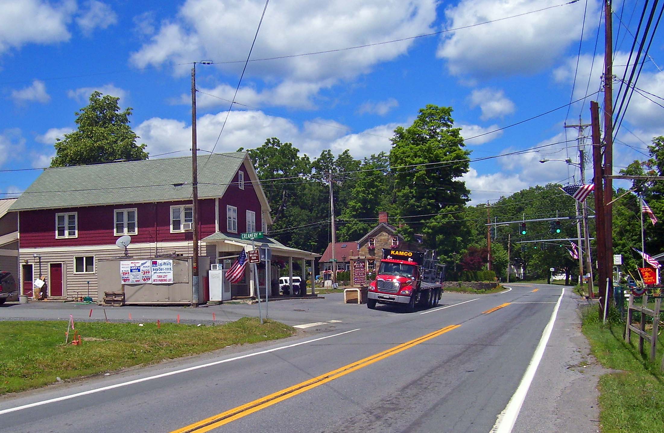
 Circleville
In Circleville, the intersection with Goshen Turnpike is also controlled by a traffic signal. NY 302 then continues to Bullville, intersecting there with NY 17K. This intersection is also controlled by a traffic signal. NY 302 continues through the hamlet of Thompson Ridge, with panoramic views of the nearby Shawangunk Ridge along the way due to the many open meadows of surrounding horse farms. At Pine Bush, it terminates at the intersection with NY 52, which is also controlled by a traffic signal, just east of the bridge coming in from Ulster County over the Shawangunk Kill.
History
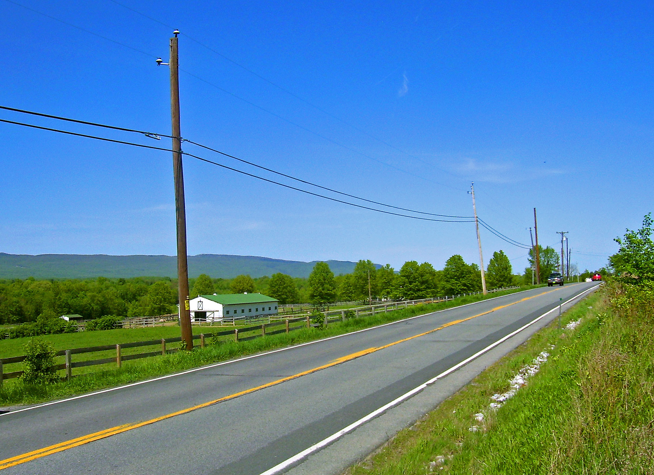
 Narrow, two-lane section south of Pine Bush with panoramic view of the Shawangunk Ridge.
NY 302 was assigned as part of the 1930 renumbering of state highways in New York and has not been altered since.[1]
In April 2006 the deaths of four teenagers at Pine Bush High School in two separate accidents along the stretch of 302 between Roberson Avenue and Crans Mill Road just north of Bullville led the school district to ask the state Department of Transportation to do something about what residents considered a deadly stretch of highway. Since all seven of the district's schools are either on or close to the highway, its officials fear that a school bus could be involved in the next fatal accident.[3]
It has claimed other lives in recent years as well, as development has increased in the area. Residents have joined the district in pleading for safety improvements, such as a lower speed limit on the whole road (there are no less than six speed limit changes on a road that is just over ten miles (16 km) long), the removal of large trees close to the roadway, a double-yellow line banning passing in the opposite lane (the driver in the April crash had just passed five cars when he was hit), a widening of the stretch (currently only two lanes with passing permitted in either direction) and traffic lights at the intersections with Black Hawk Road and Orange County Route 48.[4]
Within a week of the deaths, state troopers had put up flashing warning signs at both ends of the segment.[5] The district made available form letters on its website to DOT commissioner Thomas Madison and other elected officials in the region to request the more permanent improvements.[6] However, many in the area said the road was not as much to blame for the accident as the teenaged drivers of the cars that crashed.[7] A DOT study later endorsed that conclusion, although the state said it would make some safety improvements.[8]
Town police began to make their presence felt along the road, stopping traffic on a recent weekend at the spot of one of the crashes to check registration and inspection stickers for validity. While that has little to do directly with whatever caused the accidents, they expressed the hope that it would remind drivers the police were on the road and that they should thus be more careful.[9]
Major intersections
The entire route is in Orange County.
Location Mile[2] Destinations Notes Wallkill 0.00 NY 17MHamlet of Rockville 0.68 NY 17Exit 119 (NY 17) Crawford 4.65  NY 17K
Hamlet of Bullville 10.46 NY 52Hamlet of Pine Bush 1.000 mi = 1.609 km; 1.000 km = 0.621 mi References
- ^ a b Standard Oil Company of New York (1930). Road Map of New York (Map). Cartography by General Drafting.
- ^ a b "2008 Traffic Volume Report for New York State" (PDF). New York State Department of Transportation. June 16, 2009. p. 210. https://www.nysdot.gov/divisions/engineering/technical-services/hds-respository/NYSDOT%20TVR%202008%20by%20Route.pdf. Retrieved February 1, 2010.
- ^ Israel, Steve (April 11, 2006). "Pine Bush Pushes DOT to fix road". Times Herald-Record (Middletown, Orange County, New York). http://www.recordonline.com/archive/2006/04/11/news-sideaths-04-11.html.
- ^ Sullivan, John (April 10, 2006). "A Deadly Stretch of Road". Times Herald-Record (Middletown, Orange County, New York). http://www.recordonline.com/archive/2006/04/10/news_community-js302folo-04-10.html.
- ^ Al-Rikabi, Ramsey (April 13, 2006). "On Route 302, signs warn of dangers". Times Herald-Record (Middletown, Orange County, New York). http://www.recordonline.com/archive/2006/04/13/news-1railbrf413-04-13.html.
- ^ "Pine Bush form letter to NYSDOT Commissioner Thomas Madison" (PDF). Pine Bush Central School District. April 2006. http://www.pinebushschools.org/district/letters/madison.pdf. Retrieved April 15, 2010.
- ^ "Letters to the editor". Times Herald-Record (Middletown, Orange County, New York). April 17, 2006. http://www.recordonline.com/archive/2006/04/17/opinion-17opedletsmon-04-17.html.
- ^ Israel, Steve (March 9, 2007). "DOT study finds Route 302 accidents caused by driver speed, not the road". Times Herald-Record (Middletown, Orange County, New York). http://www.recordonline.com/apps/pbcs.dll/article?AID=/20070309/NEWS/703090338/-1/NEWS. Retrieved March 10, 2007.
- ^ Al-Rikabi, Ramsey (April 24, 2006). "Keeping Route 302 drivers in check". Times Herald-Record (Middletown, Orange County, New York). http://www.recordonline.com/archive/2006/04/24/news-ral302-04-24.html.
External links
Categories:- State highways in New York
- Transportation in Orange County, New York

Wikimedia Foundation. 2010.