- New York State Route 252
-
NYS Route 252
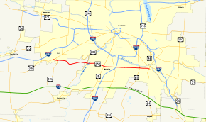
Map of Rochester with NY 252 highlighted in redRoute information Maintained by NYSDOT Length: 12.95 mi[3] (20.84 km) Existed: early 1930s[1][2] – present Major junctions West end:  NY 33A in Chili
 I-390 in Henrietta
East end: 
 NY 64 / NY 96 in Pittsford
Location Counties: Monroe Highway system Numbered highways in New York
Interstate • U.S. • N.Y. (former) • Reference • County←  NY 251
NY 252A  →
→New York State Route 252 (NY 252) is an east–west state highway south of Rochester in Monroe County, New York, in the United States. The western terminus of the route is at an intersection with NY 33A in Chili and the eastern terminus is at a junction with NY 64 and NY 96 in the village of Pittsford. NY 252 passes through the center of the town of Henrietta's commercial district, where it intersects NY 15. The route passes through three distinct areas: a lightly populated, rural area of Chili west of the Genesee River, the heavily developed commercial district centered around NY 252's intersections with NY 15 and NY 15A, and a mostly residential area of the town of Pittsford.
When NY 252 was assigned in the early 1930s, it extended from Scottsville Road (NY 383) in Chili to the village of Pittsford. NY 252 was extended northwest to Chili Center in the late 1940s by way of modern NY 252A and east to Bushnell's Basin in the mid-1950s after NY 96 was realigned onto part of the Eastern Expressway. The route was shifted southward onto its present alignment through Chili in the late 1950s and cut back to Pittsford ca. 1961. The segment of NY 252 west of NY 383 was initially county-maintained; however, ownership and maintenance of it was transferred to the state of New York in 2007.
Contents
Route description
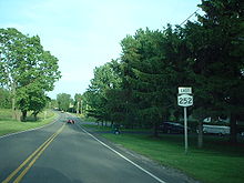 First reassurance marker on NY 252 eastbound
NY 252 begins at an intersection with NY 33A in the Monroe County town of Chili. The route heads eastward, following Beaver Road through a sparsely populated area of Chili. About 0.5 miles (0.8 km) from NY 33A, NY 252 intersects NY 386. The highway continues onward, partially paralleling Black Creek eastward to an intersection with Archer Road. Here, Beaver Road comes to an end while NY 252 adopts the Archer Road name and heads southeastward, crossing over Black Creek as it approaches Ballantyne Road. At Ballantyne Road, Archer Road terminates and NY 252 changes names once more to Ballantyne Road.[4]
As Ballantyne Road, the route progresses northeastward, paralleling Black Creek as it crosses the Rochester and Southern Railroad. Roughly 0.5 miles (0.8 km) past the railroad crossing, the road curves to the southeast, entering a residential area as it approaches the Genesee River and NY 383 (Scottsville Road), which runs along the river's western bank. At NY 383, NY 252 becomes Jefferson Road, a name that follows NY 252 eastward to its terminus in the village of Pittsford. NY 252 traverses the river and enters the town of Henrietta by way of the Ballantyne Bridge. On the opposite bank of the river, NY 252 intersects East River Road, Scottsville Road's counterpart on the eastern river bank.[4]
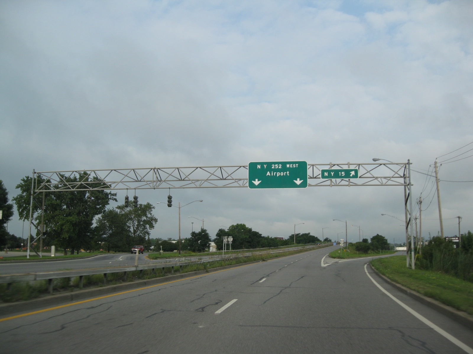
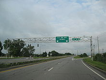 NY 252 at its interchange with NY 15 in Henrietta
Just east of the river, the route passes north of the campus of the Rochester Institute of Technology, one of the two largest colleges in the Rochester area. NY 252 connects to the college by way of Lomb Memorial Drive and Lowenthal Road before proceeding eastward into an area of Henrietta dominated by commercial establishments. From Brighton–Henrietta Town Line Road east to South Winton Road, NY 252 is at least four lanes wide and is lined with plazas, stores and shopping centers. The approximate center of Henrietta's commercial district is situated near the modified diamond interchange that links NY 252 to NY 15. The Marketplace Mall and South Town Plaza, the two largest shopping centers in the area, are both located in the vicinity of this intersection. NY 252 intersects NY 15A and meets Interstate 390 (I-390) at an interchange prior to intersecting Winton Road.[4]
East of Winton Road, NY 252 narrows to two lanes and enters a highly residential neighborhood. At the Henrietta–Pittsford town line, the route passes the Locust Hill Country Club,[4] which has hosted the annual Wegmans LPGA tournament since 1977.[5] Past Locust Hill, NY 252 continues past a series of residential neighborhoods to an intersection with NY 65. East of NY 65, NY 252 becomes West Jefferson Road and briefly enters an area of open, cultivated fields before entering the village of Pittsford. The route heads east for four blocks as a residential street, passing Pittsford Sutherland High School before ending at an intersection with South Main Street (NY 64 and NY 96).[4]
History
Designation and maintenance
NY 252 was assigned in the early 1930s to the portion of its modern alignment east of Scottsville Road (current NY 383) in Chili.[1][2] It was extended northwest to NY 33A and then-NY 251 (now NY 386) in the hamlet of Chili Center via Scottsville and Paul Roads in the late 1940s, replacing NY 198.[6][7] In the mid-1950s, NY 96 was realigned onto the new Eastern Expressway from Bushnell's Basin to East Rochester. Its former surface routing between the village of Pittsford and Bushnell's Basin became part of an extended NY 252.[8][9] The west end of NY 252 was altered in the late 1950s to follow Ballantyne, Archer, and Beaver Roads between NY 33A and NY 383,[9][10] while the east end was truncated back to Pittsford ca. 1961 when the Eastern Expressway was redesignated as I-490.[11][12] The former routing of NY 252 along Paul Road was redesignated as NY 252A.[9][10]
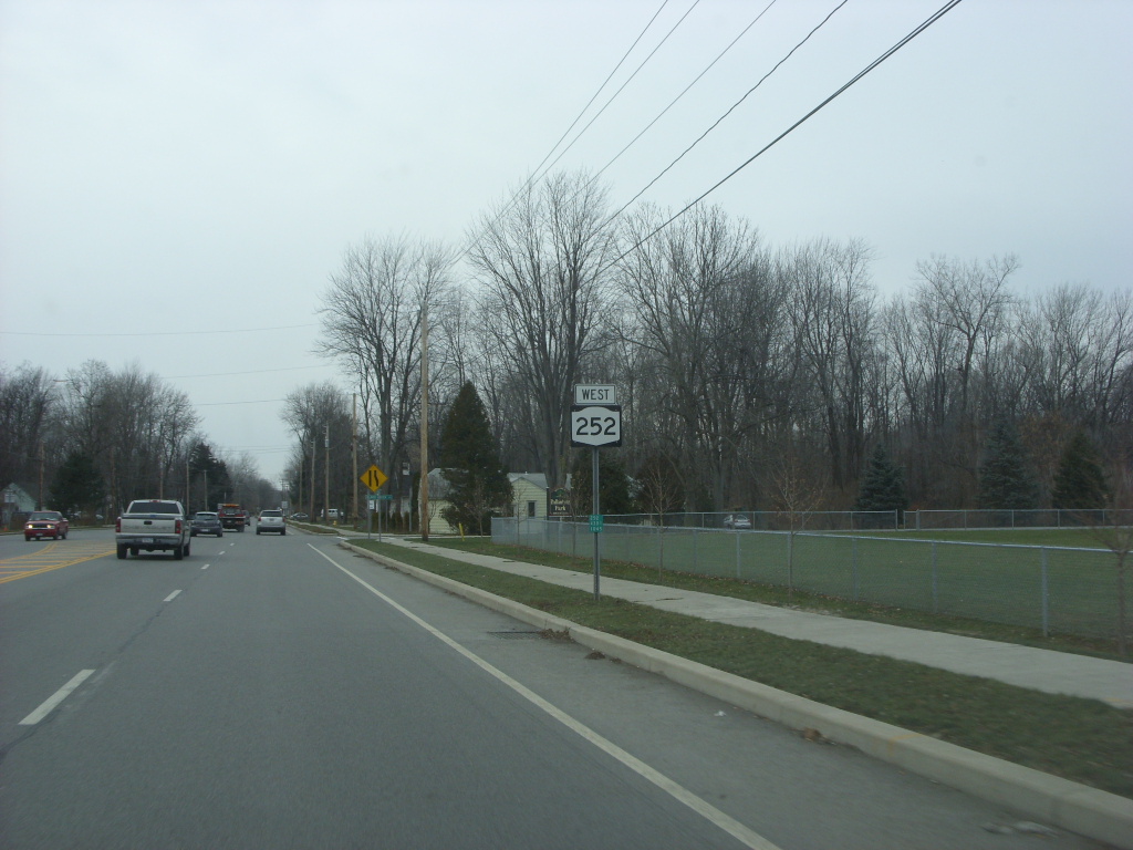
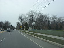 Westbound on NY 252 just west of NY 383 in Chili. This section of the route was transferred to the state of New York in 2007.
The portion of NY 252 west of NY 383 was originally maintained by Monroe County. This section was concurrent with three different county route designations, one for each of the three different road names along this stretch. The portion of NY 252 on Ballantyne Road was designated by Monroe County as County Route 125 (CR 125) while the Beaver Road segment was CR 127 and the Archer Road piece was CR 129.[13][14] In 2007, ownership and maintenance of NY 252 west of NY 383 was transferred from Monroe County to the state of New York as part of a highway maintenance swap between the two levels of government. A bill (S4856, 2007) to enact the swap was introduced in the New York State Senate on April 23 and passed by both the Senate and the New York State Assembly on June 20. The act was signed into law by Governor Eliot Spitzer on August 28. Under the terms of the act, it took effect 90 days after it was signed into law; thus, the maintenance swap officially took place on November 26, 2007.[15] The entirety of NY 252 is now maintained by the New York State Department of Transportation (NYSDOT).[16]
Widening projects
In August 2008, construction began on a $5.5 million project to improve the intersection between Clover Street (NY 65) and Jefferson Road (NY 252) in the town of Pittsford. The project, which had been in development for a decade, involved the widening of Jefferson Road from two to four lanes in the vicinity of the intersection, the addition of green arrow signal lights for all left-hand turns, and the installation of sidewalks alongside both Clover Street and Jefferson Road.[17] Work on the project was temporarily halted during the winter months;[18] however, it resumed on April 1, 2009.[19] The project was completed in late 2009.[17][20]
The portion of NY 252 in Henrietta between Marketplace Drive and Ridgeland Road was widened from four to six lanes as part of a multi-year, $15.6 million project that began in mid-2009. Phase one of the five-phase project, completed during the second half of 2009, involved the relocation of utility poles and water mains. The next four phases involved the actual widening of the highway. During phase two, all traffic on Jefferson Road was routed along the eastbound lanes while the westbound half of the road was reconstructed and widened; this was reversed during phase three. A raised median between the two directions, which will prohibit left-hand turns at all points except signalized intersections, was constructed during phase four, and phase five covers the finishing touches of the project.[21][22] As part of the project, the intersection between Jefferson Road and East Henrietta Road (NY 15A) was widened to have two dedicated left turn lanes in all four directions.[23] Work on the last four phases began on March 29, 2010,[24] and is expected to be fully completed in November 2011.[23]
NY 252A

NY 252A (4.40 miles or 7.08 kilometres) is an alternate route of NY 252 along Paul Road in the town of Chili. It extends from the eastern terminus of the overlap between NY 33A and NY 386 in the hamlet of Chili Center to NY 383 in the vicinity of the Greater Rochester International Airport. Despite its designation, NY 252A never connects to NY 252.[3] It was assigned in the late 1950s.[9][10]
Major intersections
The entire route is in Monroe County.
Location Mile[3] Destinations Notes Chili 0.00 NY 33A0.46  NY 386
4.55  NY 383
Henrietta 6.94  NY 15
NY 15Interchange 8.31  NY 15A
8.52 I-390Exit 14 (I-390) Town of Pittsford 11.68  NY 65
NY 65Village of Pittsford 12.95 NY 64 / NY 96Northern terminus of NY 64 1.000 mi = 1.609 km; 1.000 km = 0.621 mi References
- ^ a b Standard Oil Company of New York (1930). Road Map of New York (Map). Cartography by General Drafting.
- ^ a b Texas Oil Company (1933). Texaco Road Map – New York (Map). Cartography by Rand McNally and Company.
- ^ a b c "2008 Traffic Data Report for New York State" (PDF). New York State Department of Transportation. June 16, 2009. p. 278. https://www.nysdot.gov/divisions/engineering/technical-services/hds-respository/NYSDOT_Traffic_Data_Report_2008.pdf. Retrieved January 10, 2010.
- ^ a b c d e Yahoo! Inc. Yahoo! Maps – overview map of NY 252 (Map). Cartography by NAVTEQ. http://maps.yahoo.com/#mvt=h&lat=43.091645&lon=-77.64257&zoom=13&q1=43.096778%2C-77.766976&q2=43.086538%2C-77.518153. Retrieved April 6, 2010.
- ^ "Wegmans LPGA Tournament History" (PDF). LPGA. http://www.lpga.com/content/WegmansSummary.pdf. Retrieved April 7, 2010.
- ^ State of New York Department of Public Works. Official Highway Map of New York State (Map). Cartography by General Drafting (1947–48 ed.).
- ^ Esso (1949). New York (Map). Cartography by General Drafting (1950 ed.).
- ^ Esso (1954). New York with Special Maps of Putnam–Rockland–Westchester Counties and Finger Lakes Region (Map). Cartography by General Drafting (1955–56 ed.).
- ^ a b c d Esso (1956). New York with Special Maps of Putnam–Rockland–Westchester Counties and Finger Lakes Region (Map). Cartography by General Drafting (1957 ed.).
- ^ a b c Esso (1958). New York with Special Maps of Putnam–Rockland–Westchester Counties and Finger Lakes Region (Map). Cartography by General Drafting (1958 ed.).
- ^ Gulf Oil Company (1960). New York and New Jersey Tourgide Map (Map). Cartography by Rand McNally and Company.
- ^ Sunoco (1961). New York and Metropolitan New York (Map). Cartography by H.M. Gousha Company (1961–62 ed.).
- ^ New York State Department of Transportation (1997). Clifton Digital Raster Quadrangle (Map). 1:24,000. http://www.nysgis.state.ny.us/gisdata/quads/drg24/dotpreview/index.cfm?code=p16. Retrieved April 6, 2010.
- ^ New York State Department of Transportation (1997). West Henrietta Digital Raster Quadrangle (Map). 1:24,000. http://www.nysgis.state.ny.us/gisdata/quads/drg24/dotpreview/index.cfm?code=p17. Retrieved April 6, 2010.
- ^ New York State Legislature. "Bills of New York State – bill number-based search". http://public.leginfo.state.ny.us/menugetf.cgi. Retrieved February 5, 2010.
- ^ "Monroe County Inventory Listing" (CSV). New York State Department of Transportation. March 2, 2010. https://www.nysdot.gov/divisions/engineering/technical-services/hds-repository2/INV_2010-03-02_monroe.csv. Retrieved April 6, 2010.
- ^ a b Goldman, Dan (August 5, 2008). "Pittsford intersection set for changes". Brighton–Pittsford Post (Messenger Post Media). http://www.mpnnow.com/news/x380000275/Pittsford-intersection-set-for-changes. Retrieved April 8, 2010.
- ^ "Road Work Resumes at Clover St, Jefferson Road Intersection in Pittsford" (Press release). New York State Department of Transportation. March 30, 2009. https://www.nysdot.gov/news/traveler-advisories/2006/2009-03-302. Retrieved April 8, 2010.
- ^ "Extensive road work begins in Pittsford". Democrat and Chronicle (Rochester, New York). April 1, 2009. http://www.democratandchronicle.com/article/20090401/NEWS01/904010351/1002/NEWS. Retrieved April 8, 2010.
- ^ "Weekend construction work in Pittsford". WHEC-TV (Rochester, New York). July 10, 2009.
- ^ "Project Update – Jefferson Road Reconstruction" (PDF). New York State Department of Transportation. Summer 2009. https://www.nysdot.gov/regional-offices/region4/projects/jeffersonroad/repository/Summer%202009%20Flyer.pdf. Retrieved April 8, 2010.
- ^ "NYSDOT: $15.6 million to upgrade Jefferson Road in Henrietta" (Press release). New York State Department of Transportation. August 24, 2009. https://www.nysdot.gov/portal/page/portal/news/press-releases/2009/2009-08-245. Retrieved April 8, 2010.
- ^ a b Levato, Ray (April 5, 2010). "Going with the flow in Henrietta". WHEC-TV (Rochester, New York). http://www.whec.com/news/stories/S1498809.shtml?cat=566. Retrieved April 8, 2010.
- ^ Pensgen, Stacey (March 20, 2010). "Construction Begins Again on Jefferson Road". WHAM-TV (Rochester, New York). http://www.13wham.com/news/local/story/Construction-Begins-Again-on-Jefferson-Road/VuG9RJ3BgkCoo4S8aTjxXg.cspx. Retrieved April 8, 2010.
External links
Categories:- State highways in New York
- Transportation in Monroe County, New York


Wikimedia Foundation. 2010.