- East Rochester, New York
-
East Rochester Town and Village  Seal of East Rochester
Country United States State New York County Monroe Elevation 436 ft (132.9 m) Coordinates 43°06′44″N 77°29′13″W / 43.11222°N 77.48694°W Area 1.4 sq mi (3.6 km2) - land 1.4 sq mi (4 km2) - water 0.0 sq mi (0 km2), 0% Population 6,587 (2010) Density 4,972 / sq mi (1,919.699932 / km2) Incorporated 1906 Town Supervisor/Mayor Jason W. Koon (D) First elected 2007 Town Council/Trustees- Mark A. Florack (R)
- Michael J. Flanigan (R)
- Andrew Serrano (D)
- Ted Conners (R)
Timezone EST (UTC-5) - summer (DST) EDT (UTC-4) ZIP code 14445 Area code 585 FIPS code 36-22865 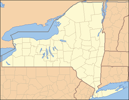
 Location of East Rochester in New York
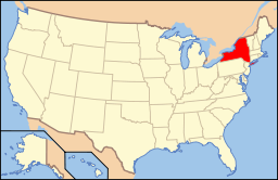 Location of New York in the United States
Website: http://www.eastrochester.org/ East Rochester is a coterminous town and village located southeast of the City of Rochester in Monroe County, New York. The village, home to about 6,587 people, is bounded by Pittsford to the west and south and Perinton to the north and east. The southern boundary is delimited by New York State Route 31F, which runs parallel to but never enters East Rochester. The village line in the remaining three directions are less distinct.
Contents
History
Beginnings
The Village of East Rochester was originally known as the Village of Despatch when the community was incorporated in 1897. Despatch was laid out as a planned community designed around the New York Central Railroad mainline that ran through the center of the village. Much of the original land which became the village came from Fairport businessman Walter Parce. This land was used to develop housing for employees of the earliest employers: The Merchants Despatch Corporation and the Aeolian Piano Corporation. The original buildings of the Aeolian Piano Corporation are still in use today as a shopping center and office complex called Piano Works Mall.
To better showcase the village's proximity to the city of Rochester, the village was incorporated as the Village of East Rochester in 1906.
The boundaries of the village were divided between the towns of Perinton, Pittsford, and Penfield.
Coterminous status
In 1982, the residents of the village voted to become a coterminous town and village.
Disasters
Two notable disasters have occurred in East Rochester, both involving derailments on the double-track mainline running through town. The first occurred on 29 October 1969 when a 30-car Penn Central freight train carrying produce derailed onto West Maple Avenue (which, along with East Maple Avenue, runs parallel to the tracks between NY 153 and South Lincoln Road), crushing numerous automobiles and toppling telephone poles. Remarkably, no one was injured.[1][2]
On 16 January 2007, a 13-car CSX intermodal train traveling 60 miles per hour and carrying retail goods partially derailed at the South Lincoln underpass, spilling at least five containers and two intermodal wells onto the road below. The wreckage extended west from South Lincoln along East Maple Avenue to Madison Street as derailed cars crushed a number of vehicles parked alongside the tracks and dumped intermodal containers into the front yards of residents on Maple. Overall, eight wells and 15 to 20 containers came off the rails. As in 1969, no one was injured in the accident.[1] The presence of mangled intermodal cars in the southbound lanes of Lincoln Road, as well as one teetering on the edge of the bridge, forced the closure of the road. It reopened January 18 following two days of cleanup. The 200 block of East Maple Avenue, however, remained closed for repair work for several days afterward.[3]
Geography
East Rochester is located at 43°6′44″N 77°29′13″W / 43.11222°N 77.48694°W (43.112413, -77.487)[4].
According to the United States Census Bureau, the village has a total area of 1.4 square miles (3.5 km²).None of the area is covered with water; however, Irondequoit Creek runs along the eastern edge of the village.
Demographics
As of the census[5] of 2000, there were 6,650 people, 2,774 households, and 1,625 families residing in the village. The population density was 4,915.4 people per square mile (1,901.9/km²). There were 2,916 housing units at an average density of 2,155.4 per square mile (834.0/km²). The racial makeup of the village was 95.92% White, 1.38% African American, 0.26% Native American, 0.74% Asian, 0.02% Pacific Islander, 0.36% from other races, and 1.32% from two or more races. 2.38% of the population were Hispanic or Latino of any race.
There were 2,774 households out of which 29.7% had children under the age of 18 living with them, 39.4% were married couples living together, 15.0% had a female householder with no husband present, and 41.4% were non-families. 34.1% of all households were made up of individuals and 12.6% had someone living alone who was 65 years of age or older. The average household size was 2.34 and the average family size was 3.04.
In the village the population was spread out with 24.1% under the age of 18, 8.7% from 18 to 24, 31.7% from 25 to 44, 20.8% from 45 to 64, and 14.8% who were 65 years of age or older. The median age was 36 years. For every 100 females there were 88.2 males. For every 100 females age 18 and over, there were 83.1 males.
The median income for a household in the village was $39,221, and the median income for a family was $48,553. Males had a median income of $32,094 versus $26,953 for females. The per capita income for the village was $18,875. About 6.2% of families and 9.3% of the population were below the poverty line, including 10.8% of those under age 18 and 5.3% of those age 65 or over.
Culture
East Rochester has been considered by the public as Rochester's "Little Italy," as over a half of the town's residents have Italian ancestry, and Italian can even be heard in offices and homes. It has also been home to some of the finest Italian restaurants in the Rochester area including The Northside Inn, Perlo's, The Grapevine Restaurant and for many years, Giuseppe's. Surace's Pizza, located along Commercial Street, adds to this reputation and is a lunch time institution in the community.
Due to the success of its high school sports teams, (despite the small size of the village and school in relation to surrounding towns) East Rochester has been affectionately referred to as "The Home of Champions." Its high school men's basketball, football and wrestling teams each won numerous sectional championships from the 1960s until the early 1990s. The majority of these football and wrestling squads found their success under the direction of local legend Don Quinn. In recent years, the school's women's sports teams have carried on this tradition as field hockey and lacrosse have enjoyed dominance on both the regional and state-wide level. Interestingly enough, it is Quinn's daughter who coaches these teams. Also one of the most successful teams in East Rochester is the varsity cheerleading squad. With 6 national champion titles and 9 section five champion titles, as well as various titles from local competitions, this team has become a "legend". The 2007–2008 East Rochester Boys Basketball team won a sectional title, the team's first since 1963.
Baseball has always been an integral part of village life.[citation needed]. In 1966, the East Rochester Little League's Senior Division Baseball All-Star team became world champions, winning the World Series, which was held in Des Moines, Iowa.[6] Moreover, the East Rochester Boys Varsity Baseball team won their first Section V baseball title in 1989 and went on to win five more under coach Ron Rucker in the early 1990s.[citation needed]
The Bombers were the first High School in the Rochester area to play its outdoor sports upon a FieldTurf artificial playing surface, with one being installed in 2001. Until the late 1980s, the Bomber football team played an annual game with their rivals from Fairport; the Red Raiders. The winner of this game took home the coveted Little Brown Jug and was played until the enrollment of Fairport High grew much too large to make such a contest feasible. The rivalry, however, is still somewhat understood between the two neighbors as it is often referred to in other capacities outside of athletics.
Government
The village is governed by a mayor and village board on which the mayor, vice mayor, and three elected village trustees are seated. There are additional boards for architectural review, assessment review, library, and zoning appeals, two commissions for the village cable channel and planning, and a housing authority.
Village Presidents and Mayors Name Title Term T. Joseph Mitchell President 1907–1909 Howard R. Worden President 1909–1910 William J. Genthner President 1910–1911 Charles H. Derby President 1911–1913 Charles S. King President 1913–1914 Howard R. Worden President
Mayor1914–1928
1928–1931George H. McInerney Mayor 1931–1933 W. Duane Smith Mayor 1933–1935 T. Joseph Mitchell Mayor 1935–1936 George Schreib Mayor 1936–1947 Lee R. Arcuri Mayor 1947–1949 Howard A. Hustleby Mayor 1949–1951 Kenneth D. Mackenzie Mayor 1951–1953 Paul N. Bower Mayor 1953–1971 Anthony Della Pietra Mayor 1971–1979 Ralph Celantani Mayor 1979–1983 Peter D. Quinzi Mayor 1983–2000 David P. Bonacchi Mayor 2000–2007 Jason W. Koon Mayor 2007 – present Transportation
Three state highways enter the vicinity of East Rochester: the aforementioned NY 31F, better known locally as Fairport Road, New York State Route 153 (Washington Street), and unsigned New York State Route 940U (West Commercial Street). NY 153 has the highest average annual daily traffic of any street serving East Rochester proper, carrying 11,000 vehicles per day between NY 31F and Commercial and 18,000 vehicles daily from Commercial to Linden Avenue as of 2004. NY 31F carries over 27,000 vehicles per day but does not enter the village.[7] NY 153 is also the only north-south street in the village that runs from one end of the village to the other and continues into neighboring towns. Linden Avenue is the only east-west street accomplishing this feat.
The double-tracked CSX Transportation Rochester Subdivision rail line runs east-west through East Rochester, dividing the town in half. No grade crossings exist within the East Rochester limits. Two streets, NY 153 and South Lincoln Road, pass under the mainline by way of underpasses roughly 0.5 miles apart.
Emergency response
Access to emergency services is obtained by dialing 9-1-1 which connects the caller to the City of Rochester's Emergency Communications Department (9-1-1 Center). The East Rochester Police Department provides primary law enforcement for the town residents.
The East Rochester Fire Department is staffed by volunteers and provides emergency fire, rescue and non-transport emergency medical services within the town.
The East Rochester Volunteer Ambulance Corps (ERVAC) provides primary emergency medical response, including Basic Life Support, with trained Emergency Medical Technicians. Advanced Life Support services are provided by the Southeast Quadrant Mobile Critical Care Unit (SEQ MCCU).
Notable residents
References
- ^ a b "Train derailment in East Rochester". http://www.whec.com/index.asp?template=item&story_id=21240. Retrieved 2007-01-19.[dead link]
- ^ "Crane arrives to assist East Rochester derailment". http://www.star-gazette.com/apps/pbcs.dll/article?AID=/20070117/UPDATE/301170001. Retrieved 2007-01-19.
- ^ "Road in East Rochester reopens after train derailment". http://www.10nbc.com/index.asp?template=item&story_id=21252. Retrieved 2007-01-19.[dead link]
- ^ "US Gazetteer files: 2010, 2000, and 1990". United States Census Bureau. 2011-02-12. http://www.census.gov/geo/www/gazetteer/gazette.html. Retrieved 2011-04-23.
- ^ "American FactFinder". United States Census Bureau. http://factfinder.census.gov. Retrieved 2008-01-31.
- ^ http://www.littleleague.org/series/history/divisions/slbbhistory.htm
- ^ NYSDOT Traffic Counts - Monroe County
External links
Municipalities and communities of Monroe County, New York City 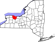
Towns Villages Brockport | Churchville | East Rochester | Fairport | Hilton | Honeoye Falls | Pittsford | Scottsville | Spencerport | Webster
CDPs Other
hamletsAdams Basin | Garbutt | Gates Center | Mumford
Categories:- Villages in New York
- Towns in New York
- Rochester, New York metropolitan area
- Populated places in Monroe County, New York


Wikimedia Foundation. 2010.