- Gates-North Gates, New York
-
Gates-North Gates, New York — CDP — Location within the state of New York
 Gates-North Gates, New York
Coordinates: 43°9′59″N 77°41′54″W / 43.16639°N 77.69833°WCoordinates: 43°9′59″N 77°41′54″W / 43.16639°N 77.69833°W Country United States State New York County Monroe Area – Total 4.7 sq mi (12.2 km2) – Land 4.7 sq mi (12.1 km2) – Water 0.0 sq mi (0.1 km2) Population (2000) – Total 15,138 – Density 3,252.5/sq mi (1,255.8/km2) Time zone Eastern (EST) (UTC-5) – Summer (DST) EDT (UTC-4) ZIP Code 14606 Area code(s) 585 FIPS code 36-28458 Gates-North Gates is a census-designated place (CDP) in the town of Gates in Monroe County, New York, United States. The population was 15,138 at the 2000 census.
Geography
Gates-North Gates is located at 43°9′59″N 77°41′54″W / 43.16639°N 77.69833°W (43.166295, -77.698275).[1].
According to the United States Census Bureau, the CDP has a total area of 4.7 square miles (12 km2), of which, 4.7 square miles (12 km2) of it is land and 0.04 square miles (0.10 km2) of it (0.85%) is water.
Demographics
Historical populations Census Pop. %± 1980 15,244 — 1990 14,995 −1.6% 2000 15,138 1.0% source: [2] As of the census of 2000,[3] there were 15,138 people, 6,202 households, and 4,142 families residing in the CDP. The population density was 3,252.5 per square mile (1,256.9/km²). There were 6,361 housing units at an average density of 1,366.7/sq mi (528.2/km²). The racial makeup of the CDP was 87.86% White, 6.14% African American, 0.17% Native American, 2.81% Asian, 0.03% Pacific Islander, 1.46% from other races, and 1.53% from two or more races. Hispanic or Latino of any race were 3.28% of the population.
There were 6,202 households out of which 28.5% had children under the age of 18 living with them, 51.1% were married couples living together, 11.5% had a female householder with no husband present, and 33.2% were non-families. 28.6% of all households were made up of individuals and 12.7% had someone living alone who was 65 years of age or older. The average household size was 2.44 and the average family size was 3.00.
In the CDP the population was spread out with 22.9% under the age of 18, 7.0% from 18 to 24, 29.6% from 25 to 44, 23.1% from 45 to 64, and 17.5% who were 65 years of age or older. The median age was 39 years. For every 100 females there were 91.5 males. For every 100 females age 18 and over, there were 87.3 males.
The median income for a household in the CDP was $42,010, and the median income for a family was $51,661. Males had a median income of $37,791 versus $29,248 for females. The per capita income for the CDP is $20,027. About 5.5% of families and 6.8% of the population were below the poverty line, including 7.6% of those under the age of 18 and 7.0% of those ages 65 or older.
References
- ^ "US Gazetteer files: 2010, 2000, and 1990". United States Census Bureau. 2011-02-12. http://www.census.gov/geo/www/gazetteer/gazette.html. Retrieved 2011-04-23.
- ^ "CENSUS OF POPULATION AND HOUSING (1790-2000)". U.S. Census Bureau. http://www.census.gov/prod/www/abs/decennial/index.html. Retrieved 2010-07-17.
- ^ "American FactFinder". United States Census Bureau. http://factfinder.census.gov. Retrieved 2008-01-31.
Municipalities and communities of Monroe County, New York City 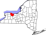
Towns Villages Brockport | Churchville | East Rochester | Fairport | Hilton | Honeoye Falls | Pittsford | Scottsville | Spencerport | Webster
CDPs Brighton | Gates-North Gates | Greece | Irondequoit
Other
hamletsAdams Basin | Garbutt | Gates Center | Mumford
Categories:- Census-designated places in New York
- Hamlets in New York
- Populated places in Monroe County, New York


Wikimedia Foundation. 2010.