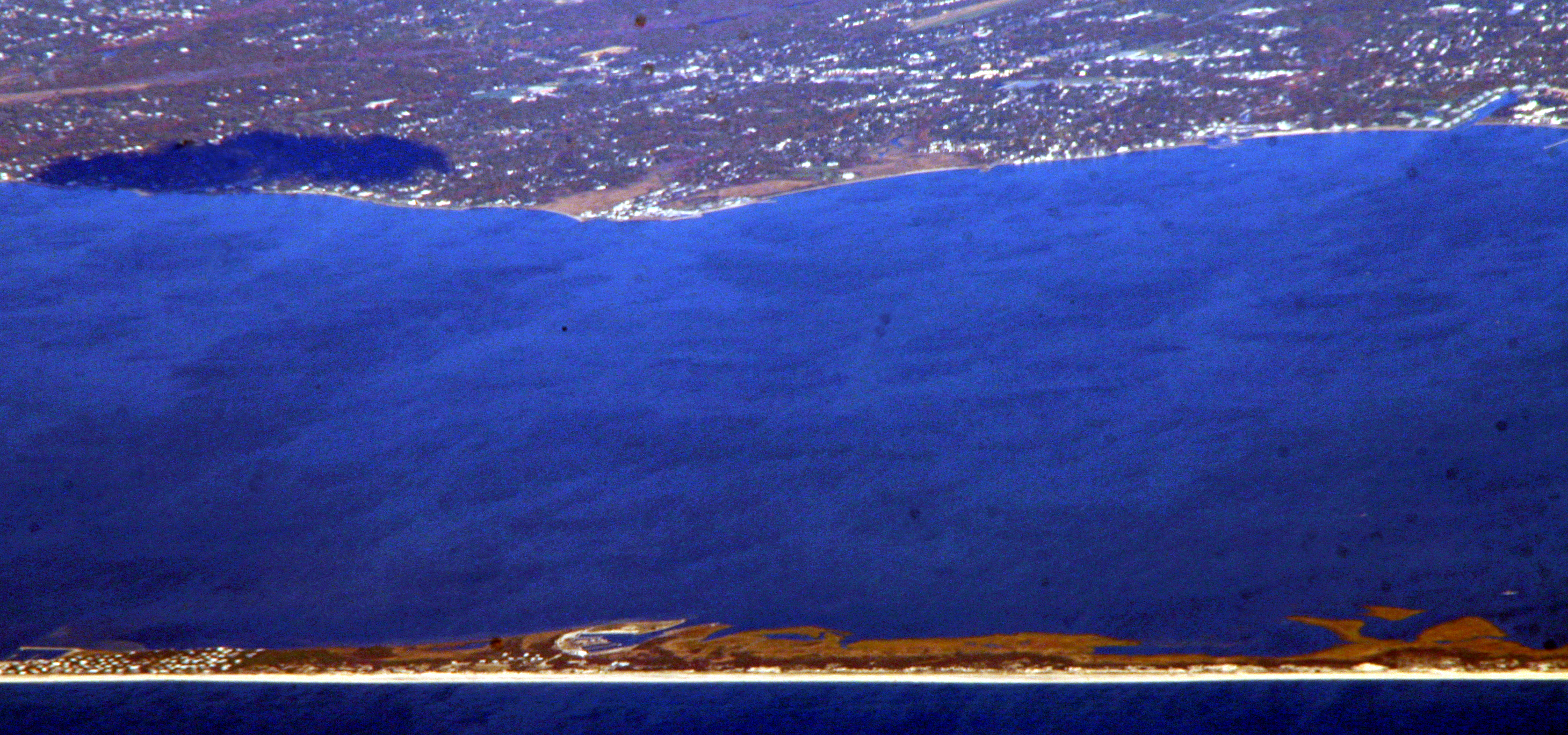
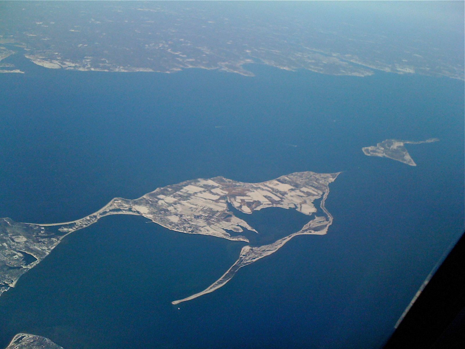
- Long Island
-
This article is about the island in New York State. For other uses, see Long Island (disambiguation).
Long Island Native name: Paumanok 
Kings, Queens, Nassau and Suffolk Counties on Long Island, showing county and municipal boundaries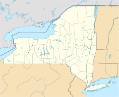
 Long Island (New York)
Geography Location Atlantic Ocean Coordinates 40°48′N 73°18′W / 40.8°N 73.3°W Area 1,401 sq mi (3,629 km2) Length 118 mi (190 km) Width 23 mi (37 km) Highest point Jayne's Hill
401 ft (122 m)Country United StatesState  New York
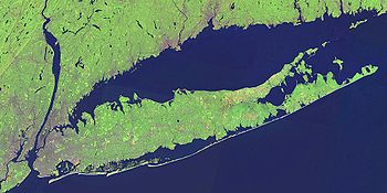
Demographics Population 7,568,304 (as of 2010) Ethnic groups 54.7% White, 20.4% African American, 0.49% Native American, 12.3% Asian, 0.05% Pacific Islander, 8.8% other races, and 3.2% from two or more races and 20.5% Hispanic or Latino of any race Long Island is an island located in the southeast part of the U.S. state of New York, just east of Manhattan. Stretching northeast into the Atlantic Ocean, Long Island contains four counties, two of which are boroughs of New York City (Queens and Brooklyn),[1] and two of which are mainly suburban (Nassau and Suffolk). The term "Long Island" often refers only to Nassau and Suffolk counties in order to differentiate them from New York City, though all four counties on the island are part of the New York metropolitan area.
As of the 2010 census, Long Island had a population of 7,568,304,[2] making it the most populated island in any U.S. state or territory. It is also the 17th most populous island in the world, ahead of Ireland, Jamaica and the Japanese island of Hokkaidō. Its population density is 5,402 inhabitants per square mile (2,086 /km2). If it were a state, Long Island would rank 13th in population (after Virginia) and first in population density.
Both the longest[3] and the largest island in the contiguous United States, Long Island extends 118 miles (190 km) eastward from New York Harbor to Montauk Point, and has a maximum north-to-south expanse of 23 miles (37 km) between the northern Long Island Sound coast and the southern Atlantic coast.[4] With a land area of 1,401 square miles (3,629 km2), Long Island is the 11th largest island in the United States and the 148th largest island in the world — larger than the 1,214 square miles (3,140 km2) of the smallest state, Rhode Island.[5]
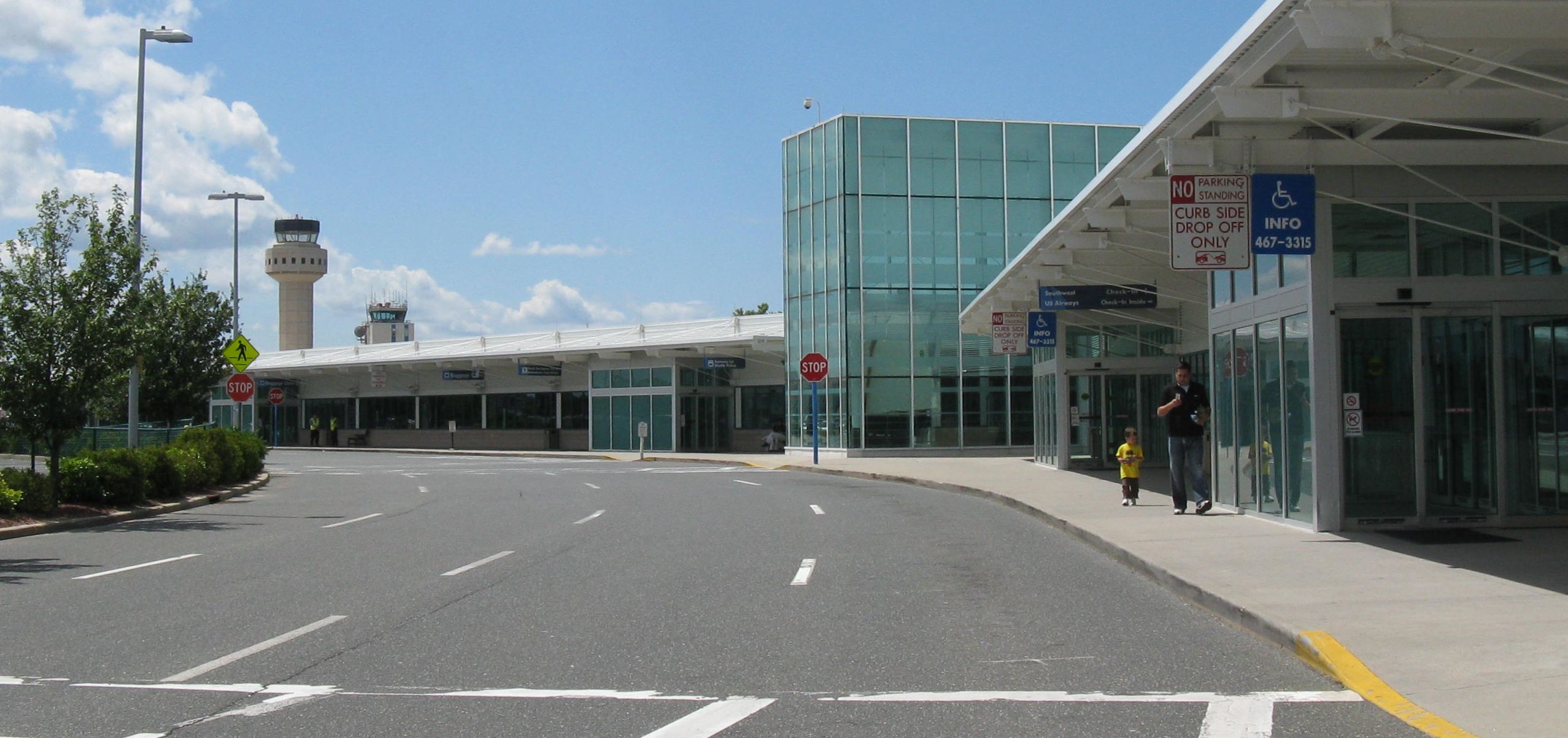
Two of New York City's major airports, LaGuardia Airport and JFK International Airport, are located on Long Island, in Queens. Nine bridges and 13 tunnels (including railway tunnels) connect Brooklyn and Queens (and thus Long Island) to the three other boroughs of New York City. Ferries connect Suffolk County northward across Long Island Sound to the state of Connecticut.
Contents
Overview
The westernmost end of Long Island contains the New York City boroughs of Brooklyn (Kings County) and Queens (Queens County). The central and eastern portions contain the suburban Nassau and Suffolk counties. However, colloquial usage of the term "Long Island" refers only to Nassau and Suffolk counties.[6] The more dense and urban Brooklyn and Queens are not usually referred to as "Long Island", since they are a part of New York City, though before those counties amalgamated into the city, they were often so identified.
Nassau County is more developed than Suffolk County, with pockets of rural affluence within the Gold Coast of the North Shore and the Five Towns and Babylon-Islip area on the South Shore. South Shore communities are built along protected wetlands of the main land mass as well as white sand beaches of Outer Barrier Islands fronting on the Atlantic Ocean. Old money from the time of the American Revolutionary War populated the island and still does to this day, amongst many others including recent immigrants. Wealthy Americans and Europeans in the gilded age built lavish country homes on the North Shore of Nassau County. Today, although many of the massive estates have been demolished, many exist in their original state, while others have become parks, arboretums, universities and museums.[citation needed]
Owing to economic growth and the suburbanization of the metropolitan region after World War II, Nassau was the fastest growing county in the United States from the 1950s to the 1970s.[citation needed] Suffolk County remains less congested despite substantial growth in high technology and light manufacturing sectors since 1990, although traffic has been increasing in recent years.[citation needed] In its far east sections, Suffolk remains small-town rural out east, as in Greenport on the North Fork and some of the outward areas of The Hamptons, although summer tourism swells the population in those areas. Western Suffolk, such as the towns of Huntington and Babylon, are becoming increasingly more populated and are beginning to resemble towns in Nassau.
Long Island is geographically part of the Mid-Atlantic, however many towns and hamlets along the island's north shore, in western Nassau County and in eastern Suffolk County, such as Oyster Bay, Port Jefferson and Sag Harbor seem to resemble New England towns,[citation needed] while many of the towns and hamlets along the south shore, such as Long Beach, Valley Stream, and Babylon seem to resemble Mid-Atlantic coastal communities, especially those on the shore between New Jersey and Virginia.[citation needed] Many of the towns in Long Island's central region resemble typical suburban towns, with strip malls, traffic-clogged avenues and fast-food restaurants.[citation needed]
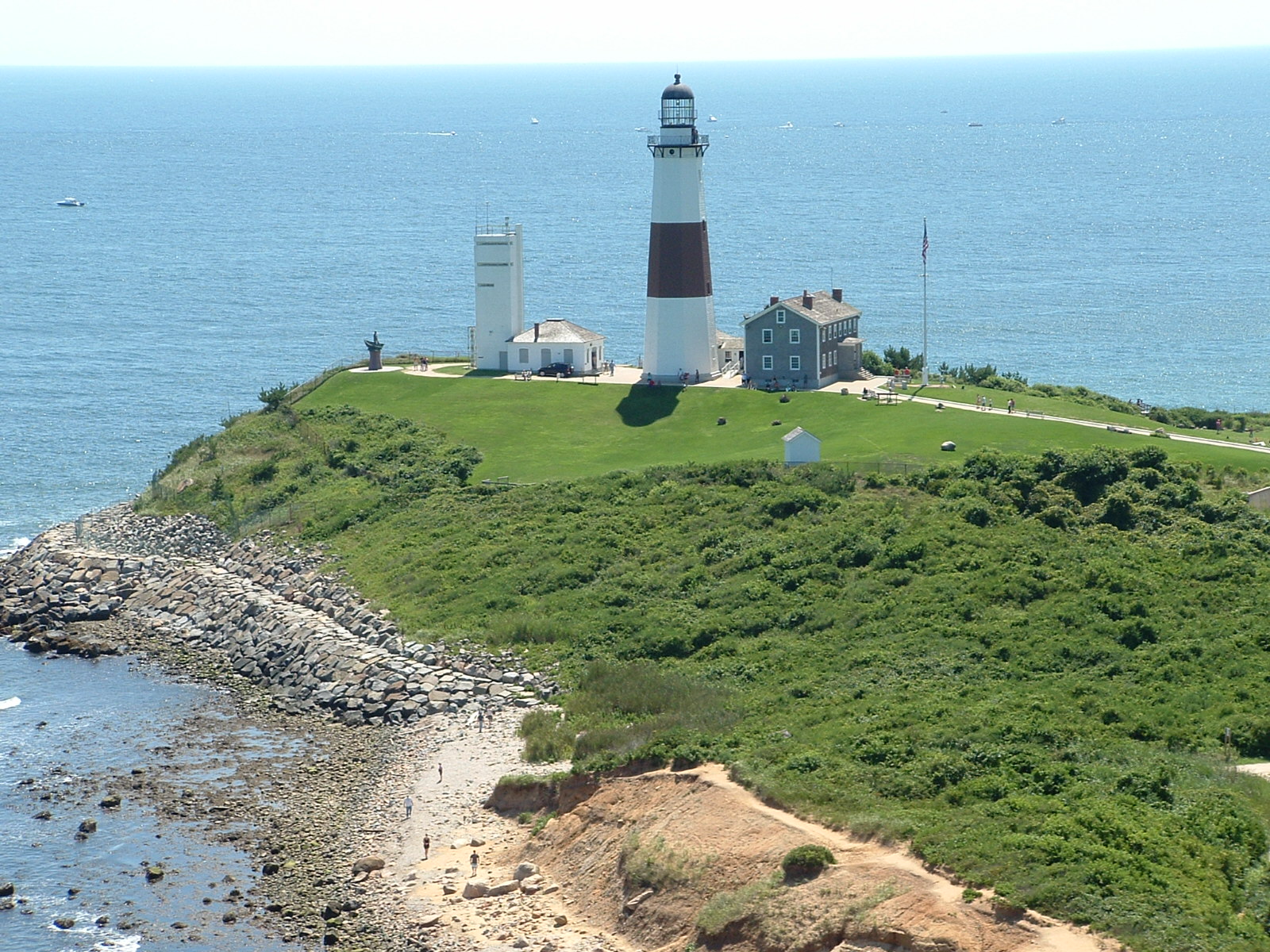
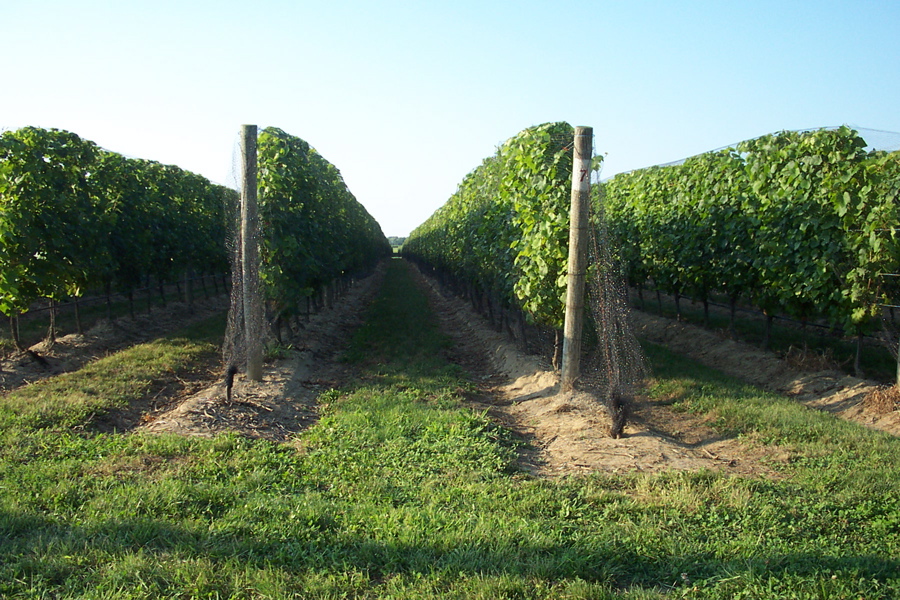
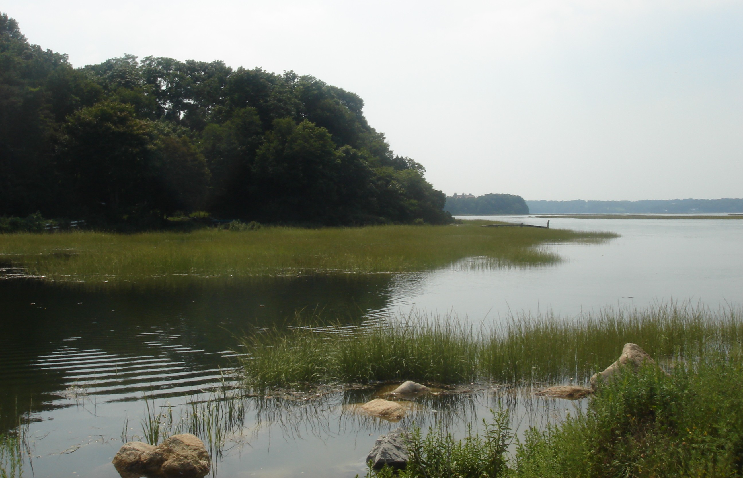
According to the US Census Bureau's 2008 American Community Survey, Nassau and Suffolk Counties have the 10th and 25th highest median household incomes in the nation, respectively.[7] Additionally, Nassau County is the third-richest county per capita in New York State, and the 30th richest in the nation. Long Island's Nassau County has the second-highest property taxes in the United States.[8] Suffolk County has redeveloped North Fork potato fields into a burgeoning wine region.[citation needed] The South Fork is known for beach towns, including the world-renowned Hamptons, and for Montauk Point, home of Montauk Point Lighthouse at the eastern tip of the island.
Geography
Main article: Geography of Long IslandGeology
Long Island, as part of the Outer Lands region, is formed largely of two spines of glacial moraine, with a large, sandy outwash plain beyond. These moraines consist of gravel and loose rock left behind during the two most recent pulses of Wisconsin glaciation during the Ice Ages some 21,000 years ago (19,000 BC). The northern moraine, which directly abuts the North Shore of Long Island at points, is known as the Harbor Hill moraine. The more southerly moraine, known as the Ronkonkoma moraine, forms the "backbone" of Long Island; it runs primarily through the very center of Long Island, roughly coinciding with the length of the Long Island Expressway.
The land to the south of this moraine to the South Shore is the outwash plain of the last glacier. One part of the outwash plain was known as the Hempstead Plains, and this land contained one of the few natural prairies to exist east of the Appalachian Mountains.[9]
The glaciers melted and receded to the north, resulting in the difference between the North Shore beaches and the South Shore beaches. The North Shore beaches are rocky from the remaining glacial debris, while the South Shore's are crisp, clear, outwash sand. Jayne's Hill, at 401 feet (122 m), is the highest hill along either moraine; another well-known summit is Bald Hill in Brookhaven Town, not far from its geographical center at Middle Island. The glaciers also formed Lake Ronkonkoma in Suffolk County and Lake Success in Nassau County, each a deep kettle lake.
Climate
Long Island has a climate similar to other coastal areas of the Northeastern United States; it has warm, humid summers and cool wet winters. Long Island is classified as humid subtropical by some definitions. The Atlantic Ocean helps bring afternoon sea breezes that temper the heat in the warmer months and limit the frequency and severity of thunderstorms. Long Island has a moderately sunny climate, averaging between 2,400 and 2,800 hours of sunshine annually.[10]
Average yearly snowfall totals range from approximately 20 to 35 inches (51 to 89 cm), with the north shore and western parts averaging more than the south shore and the east end. In any given winter, however, some parts of the island could see up to 75 inches (190 cm) or more. There are also some very quiet winters, in which most parts of the island could see less than 10 inches (25 cm).
Long Island is somewhat vulnerable to hurricanes.[11] Its northern location and relatively cool waters tend to weaken storms to below hurricane strength by the time they reach Long Island, although despite this, some storms have made landfall at Category 1 or greater strength, including two unnamed Category 3 storms: the 1938 New England Hurricane (also known as the Long Island Express) and another in 1944. Named hurricanes that crossed Long Island include Hurricane Donna in 1960, Hurricane Belle in 1976, Hurricane Gloria in 1985, Hurricane Bob in 1991 (brushed the eastern tip) and Hurricane Floyd in 1999. (There is debate among climatologists as to whether Hurricane Floyd made landfall as a Category 1 or as a very strong "almost hurricane strength" tropical storm. The official records note it as the latter.) In August 2011, portions of Long Island were evacuated in preparation for Hurricane Irene, a Category 1 hurricane.
Demographics
Historical populations Census Pop. %± 1790 37,108 — 1800 42,907 15.6% 1810 48,752 13.6% 1820 56,978 16.9% 1830 69,775 22.5% 1840 110,406 58.2% 1850 212,637 92.6% 1860 379,788 78.6% 1870 540,648 42.4% 1880 743,957 37.6% 1890 1,029,097 38.3% 1900 1,452,611 41.2% 1910 2,098,460 44.5% 1920 2,723,764 29.8% 1930 4,103,638 50.7% 1940 4,600,022 12.1% 1950 5,237,918 13.9% 1960 6,403,852 22.3% 1970 7,141,515 11.5% 1980 6,728,074 −5.8% 1990 6,861,474 2.0% 2000 7,448,618 8.6% 2010 7,568,304 1.6% Long Island is one of the most densely populated regions in the United States. As of the United States 2010 Census, the total population of all four counties of Long Island was 7,568,304, which is 39 percent of the population of the State of New York. New York City's portion of the census was 4,735,538, with Brooklyn's population at 2,504,700 and Queens having 2,230,722 residents.
The combined population of Nassau and Suffolk counties was 2,832,882 people; Suffolk County's share at 1,493,350 and Nassau County's at 1,339,532. Nassau County had a larger population for decades, but Suffolk County surpassed it in the 1990 census as growth and development continued to spread eastward.
As Suffolk County has over twice the land area of Nassau County, the latter still has a much higher population density. Combining all four counties, Long Island's population is greater than 38 of the 50 United States. If it were an independent nation, Long Island would rank as the 96th most populated nation, falling between Switzerland and Israel.
Population figures from the U.S. Census Bureau Census 2010[2] show that whites are the largest racial group in all four counties, and are in the majority in Nassau and Suffolk counties. In 2002, the New York Times cited a study by the non-profit group ERASE Racism, which determined that Nassau and Suffolk counties are the most racially segregated suburbs in the United States.[12]
Catholics are the largest religious group on Long Island, with non-affiliated in second place. Catholics make up 52% of the population of Nassau and Suffolk, versus 22% for the country as a whole, with Jews at 16% and 7% respectively versus 1.7% nationwide.[13] Even more surprising is the small percentage of Protestants, 7% and 8% respectively, for Nassau and Suffolk Counties, versus 23% for the entire country on the same survey, and 50% on self-identification surveys.[13]
Long Island has a substantial Italian-American population. About 26% of Long Island residents claim Italian ancestry. 28% of Suffolk County residents claim Italian ancestry.[citation needed]
A 2010 New York Times article stated that the expansion of the immigrant workforce on Long Island has not displaced any jobs from other Long Island residents, and that, in fact, half the immigrants on Long Island hold white-collar positions.[14]
Racial groups, ethnicity, and religious groups on Long Island
compared to state and nationCounty Population
2010
census%
white%
black
or
African
American%
Asian%
Other%
mixed
race%
Hispanic/
Latino
of any
race%
Catholic% not
affiliated%
Jewish%
ProtestantEstimate
of % not
reportingRace Ethnicity Religious groups Kings 2,504,700 42.8 34.3 10.5 9.3 3.0 17.6 37 4 15 8 33 Queens 2,230,722 39.7 19.1 22.9 13.7 4.5 27.5 29 37 11 5 15 Nassau 1,339,532 73.0 11.1 7.6 5.9 2.4 14.6 52 9 16 7 15 Suffolk 1,493,350 80.8 7.4 3.4 5.9 2.4 16.5 52 21 7 8 11 Long Island Total 7,568,304 54.7 20.4 12.3 9.3 3.2 20.5 40 18 12 7 20 NY State 19,378,102 65.7 15.9 7.3 8.0 3.0 17.6 42 20 9 10 16 USA 308,745,538 72.4 12.6 4.8 7.3 2.9 16.3 22 37 2 23 12 Source for Race and Ethnicity: 2010 Census[2]
American Indian, Native Alaskan, Native Hawaiian, and Pacific Islander make up just 0.5% of the population of Long Island, and have been included with "Other".Source for religious groups: ARDA2000[13] History
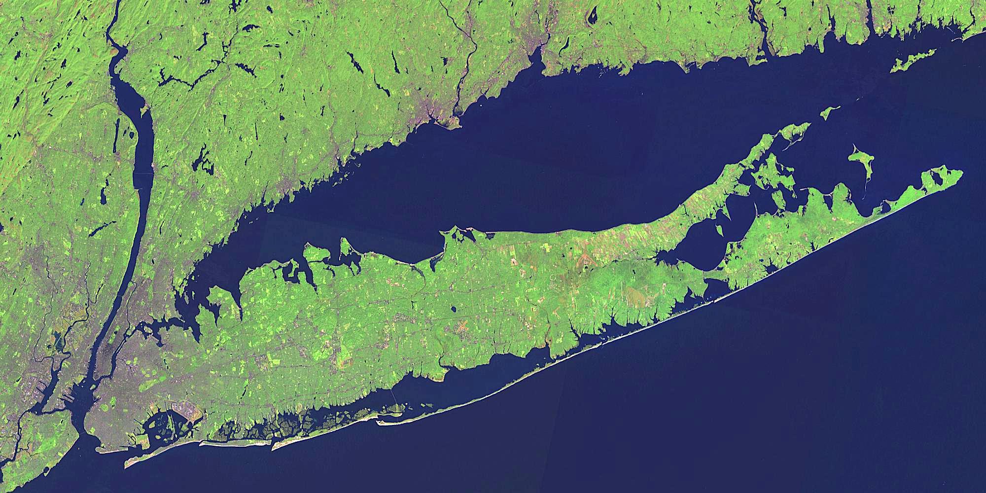
Main article: History of Long Island Eastern Long Island Native American settlements, and their neighbors
At the time of European contact, the Lenape people (named the Delaware by Europeans) inhabited the western end of the Island, and spoke the Munsee dialect of the Algonquian language family. Giovanni da Verrazzano was the first European to record an encounter with these people when he entered what is now New York Bay in 1524. The eastern portion of the island was inhabited by speakers of the Mohegan-Montauk-Narragansett language group of the same language family, indicative of their ties to the aboriginal peoples inhabiting what is now Connecticut and Rhode Island. In 1609, the English navigator Henry Hudson explored the harbor and may have landed at Coney Island.
The western portion of Long Island was later settled by the Dutch, while the eastern region was settled by English Puritans from New Haven, Connecticut, settling in Southold on October 21, 1640.
From the first half of the 17th century the Conklin family and other related families, like the Ketchums, Smiths, and Gardiners, owned the entire area of Long Island, Gardiners Island, and Manhattan.
The entirety of Long Island came under English dominion in 1664, when the Dutch colony of New Amsterdam was taken over by the English and renamed New York. In 1683, the English established the three original counties on Long Island: Kings, Queens, and Suffolk. After the English took the land the Conklins were left with 3,500 square miles (9,100 km2) of New York land.
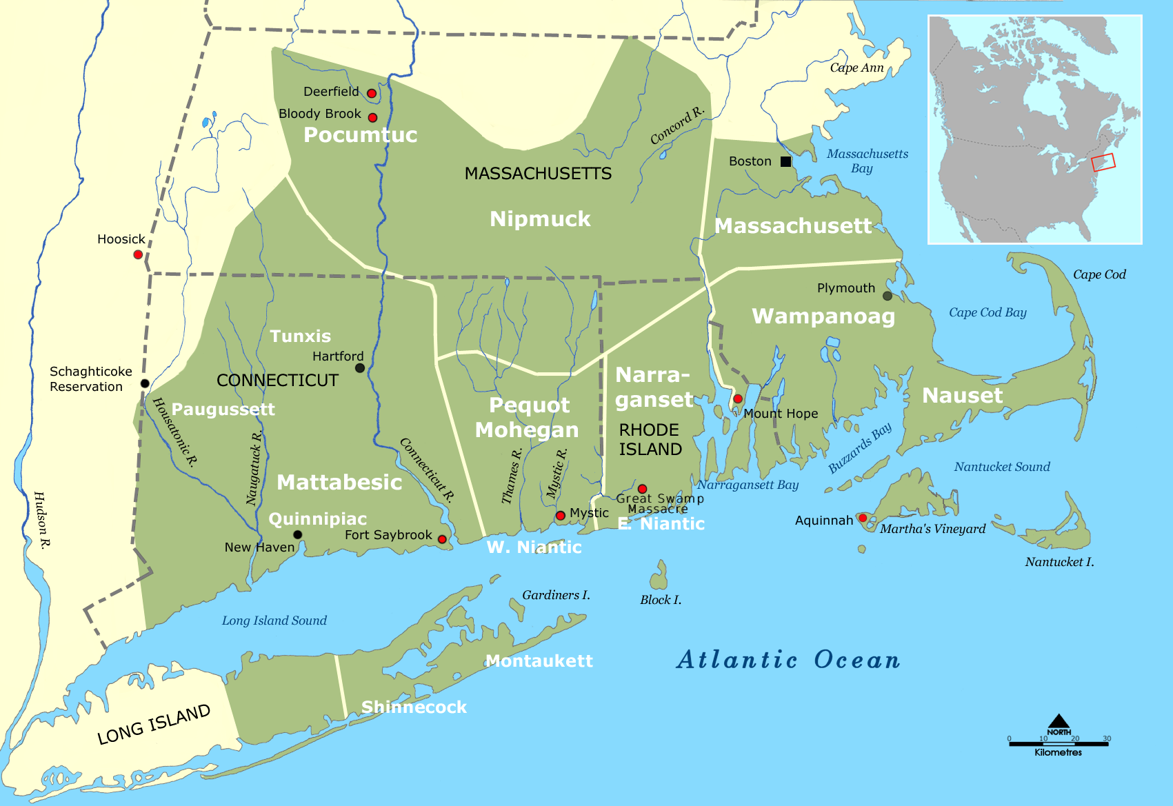
During the American Revolutionary War, the island was captured from General George Washington early by the British in the Battle of Long Island, the largest battle of the entire war. The island remained a British stronghold until the end of the war, and was the center of much of General Washington's espionage activities due to the proximity to the British North American military headquarters in New York City. After the British victory on Long Island many Patriots fled, leaving mostly Loyalists behind.
In the 19th century, Long Island was still mainly rural and agricultural. The predecessor to the Long Island Rail Road began service in 1836 from the South Ferry, Brooklyn, through Brooklyn to Jamaica in Queens, and completed the line to the east end of Long Island in 1844. From 1830 until 1930, population roughly doubled every twenty years, and several cities were incorporated, such as the City of Brooklyn in Kings County, and Long Island City in Queens.
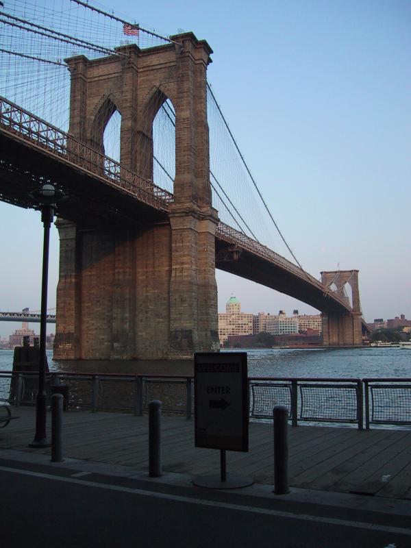
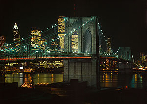 The Brooklyn Bridge, the first of seven bridges constructed across the East River, connects Long Island with the Borough of Manhattan (in background).
Until the 1883 completion of the Brooklyn Bridge, the only connection between Long Island and the rest of the United States was by boat. Other bridges and tunnels followed, and a suburban character spread as population increased. On January 1, 1898, Kings County and portions of Queens were consolidated into The City of Greater New York, abolishing all cities and towns within them. The easternmost 280 square miles (730 km2) of Queens County, which were not part of the consolidation plan,[15][16][17][18][19][20] separated from Queens in 1899 to form Nassau County.
In the 1920s and 1930s, Long Island began the transformation from backwoods and farms to the paradigm of the American suburb. Railroads made possible commuting suburbs before construction of the Long Island Expressway and other major roadways. Robert Moses created various parkway projects to span the island, along with state parks for the enjoyment of many. Gradually, development started to follow the parkways, with various communities springing up along the more traveled routes.
After World War II, Long Island's population skyrocketed, mostly in Nassau County and western Suffolk County. People who worked and lived in New York City moved out to Long Island in new developments built during the post-war boom. The most famous post-war development was the town of Levittown: the area became the first place to massively reproduce houses on a grand scale- providing opportunities for GIs returning home to start a family. The immigration waves of southern and eastern Europe, followed by more recent ones from Latin America, have been pivotal in creating the diversity on Long Island that many other American regions lack. These immigrations are reflected in the large Italian American, Irish American and Jewish American populations.
Economy
Main article: Economy of Long Island
The counties of Nassau and Suffolk have been long renowned for their affluence.
From about 1930 to about 1990, Long Island was considered one of the aviation centers of the United States, with companies such as Grumman Aircraft, Republic, Fairchild, and Curtiss having their headquarters and factories on Long Island.
Long Island has played a prominent role in scientific research and in engineering. It is the home of the Brookhaven National Laboratory in nuclear physics and Department of Energy research.
In recent decades companies such as Sperry Rand, Computer Associates (headquartered in Islandia), Motorola Enterprise Mobility (now occupying the former headquarters of Symbol Technologies and a former Grumman plant in Holtsville), have made Long Island a center for the computer industry. Stony Brook University of the State University of New York conducts far-ranging medical and technology research.
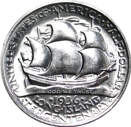
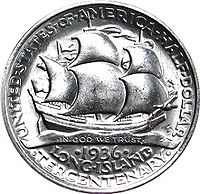 A commemorative half dollar issued in 1936 for the Long island tercentenary
Long Island is also home to the Cold Spring Harbor Laboratory, which was directed for 35 years by James D. Watson (who, along with Francis Crick, discovered the double helix structure of DNA).
Long Island is home to the East Coast's largest industrial park, the Hauppauge Industrial Park. The park has over 1,300 companies employing more than 55,000 Long Islanders. Companies in the park and abroad are represented by the Hauppauge Industrial Association. As many as 20 percent of Long Islanders commute to New York City jobs. The eastern end of the island is still partly agricultural. In the last 25 years, development of vineyards on the North Fork became a major new industry, replacing potato fields. Pumpkin farms have been added to traditional truck farming. Farms allow fresh fruit picking by Long Islanders for much of the year. Fishing continues to be an important industry, especially at Huntington, Northport, Montauk, and other coastal communities of the East End and South Shore.
Government and politics
Main article: Politics of Long IslandNassau County and Suffolk County each have their own governments, with a County Executive leading each. Each has a county legislature and countywide-elected officials, such as district attorney, county clerk and county comptroller. The towns in both counties have their own governments as well, with town supervisors and a town council. Within Nassau, there are two small incorporated cities (Glen Cove and Long Beach) with a combined population of about 65,000.
Brooklyn and Queens, on the other hand, do not have independent county governments. As boroughs of New York City, both have Borough Presidents, which have been largely ceremonial offices since the shutdown of the New York City Board of Estimate.
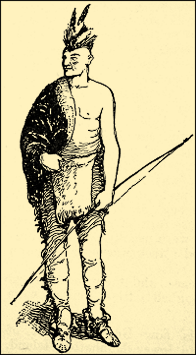
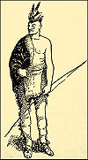 A late 19th century artist's conception of the appearance of a typical Long Island Indian
Long Island is home to two Native American Indian reservations, Poospatuck Reservation and Shinnecock Reservation. Both Reservations are in Suffolk County. Numerous island place names (Towns) are Native American in origin.
Law enforcement
Queens and Brooklyn are patrolled by the New York City Police Department; Nassau and Suffolk counties respectively have the Nassau County Police Department and Suffolk County Police Department. New York State Police patrol state parks and parkways; several dozen villages and the two cities in Nassau have their own police departments.
Both Nassau and Suffolk have a sheriff's office that handles civil process, evictions, warrant service and enforcement, prisoner transport and detention, and operation of the county jail.
The Nassau County Sheriff's Department employs about 1,000 correction officers and 100 deputy sheriffs and performs the above duties although deputy sheriffs have full police officer powers and can make arrests for any crime they come across.
The Suffolk County Sheriff's Office has approximately 900 correction officers and 260 deputy sheriffs and operates the two jail facilities in Suffolk County. The deputy sheriffs in Suffolk County have a full service patrol unit, including K9, Aviation, SWAT, and Marine divisions as well as a Criminal Investigation Division and various other special details and assignments. N.Y.S Court Officers secure court houses for Long Island courts. Additionally, the Suffolk County Sheriff's Department now maintains patrols along the Long Island Expressway as well as Sunrise Highway. State parkways are still patrolled by the New York State Police.
Secession proposals
Main articles: Long Island (state), List of U.S. state secession proposals, and Secession in New YorkThe secession of Long Island from New York was proposed as early as 1896, but talk was revived towards the latter part of the twentieth century.[21] On March 28, 2008 Suffolk County, New York Comptroller Joseph Sawicki proposed a plan that would make Long Island (specifically, Nassau and Suffolk counties) the 51st state of the United States of America.[22] Sawicki says that all the Long Island taxpayers' money would stay on Long Island, rather than the funds being dispersed all over the entire state of New York. The state of Long Island would include over 2.7 million people. So far Nassau County executives have not expressed interest in joining in the secession proposal, which would need to be approved by the NY State Legislature.[22]
Transportation
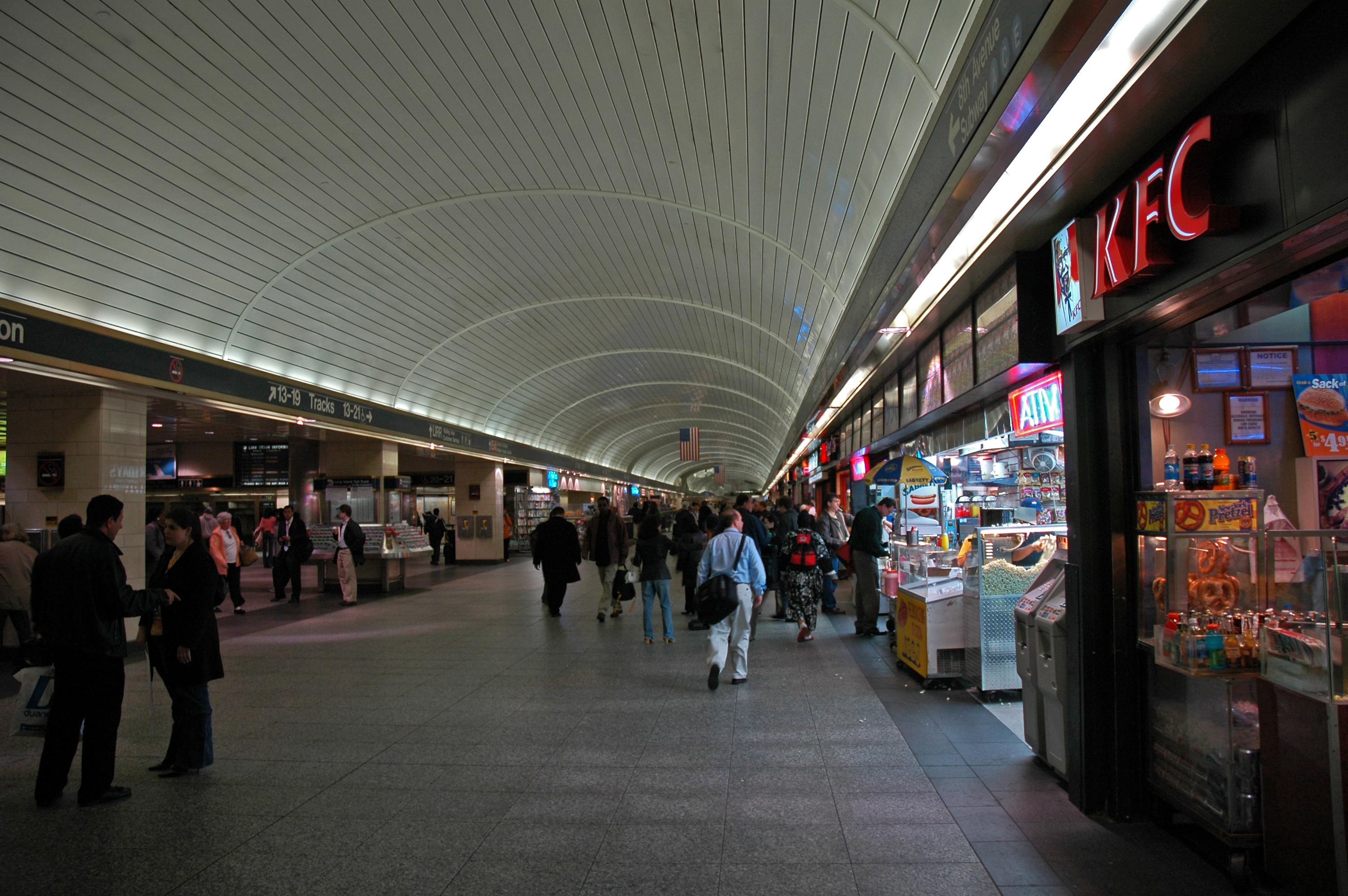
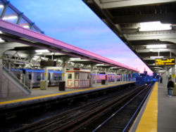 Platforms at Jamaica
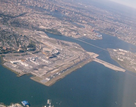
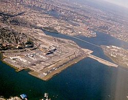 LaGuardia Airport Aerial view
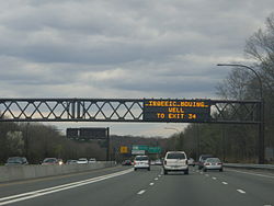
I-495 NY Nassau County 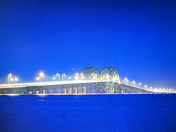
Great South Bay Bridge Main article: Transportation on Long IslandEvery major form of transportation serves Long Island, including John F. Kennedy International Airport, LaGuardia Airport, and Long Island MacArthur Airport, multiple smaller airports, railroads, subways, and several major highways. There are historic and modern bridges, recreational and commuter trails, and ferries serving various parts of all of Long island.
The Long Island Expressway, Northern State Parkway, and Southern State Parkway, all products of the automobile-centered planning of Robert Moses, make east-west travel on the island straightforward, if not always quick.
There are currently ten road crossings out of Long Island, all within New York City limits at the extreme western end of the island. Plans for a Long Island Crossing at various locations in Nassau and Suffolk Counties (a proposed bridge or tunnel that would link Long Island to the south with New York or Connecticut to the north across Long Island Sound) have been discussed for decades, but there are currently no firm plans to construct such a crossing.
The MTA implements mass transportation for the New York metropolitan area, including all five boroughs of New York City, the suburban counties of Dutchess, Nassau, Orange, Putnam, Rockland, Suffolk and Westchester, all of which together are the "Metropolitan Commuter Transportation District (MCTD)".
The MTA is the largest public transportation provider in the Western Hemisphere. Its agencies serve 14.6 million people spread over 5,000 square miles (13,000 km²) from New York City through southeastern New York State (including Long Island and the lower Hudson Valley), and Connecticut. Combined the MTA agencies now move more than 2.6 billion rail and bus customers a year while employing some 70,000 workers.
Suffolk County Transit, an agent of the Suffolk County government, provides bus services in Suffolk County.
Major roads of Long Island West-East Roads  Belt Parkway /
  Southern State Parkway
 Grand Central Parkway /
  Northern State Parkway
South-North Roads Roads in boldface are limited access roads. *Sunrise Highway is only limited-access from western Suffolk county eastwards.
Rail
Main article: Long Island Rail RoadThe Long Island Rail Road (LIRR) is the busiest commuter railroad system in North America, carrying an average of 282,400 passengers each weekday on 728 daily trains. Chartered on April 24, 1834, it is also the oldest railroad still operating under its original name.[23]
 Schematic map of LIRR system
Education
Primary and secondary education
Long Island's Nassau and Suffolk counties are home to 125 public school districts containing a total of 656 public schools. In contrast, all of Brooklyn and Queens are served by the New York City Department of Education, the largest school district in the United States. Long Island is also home to a number of private and parochial schools.

Stony Brook West Campus Colleges and universities
Nassau and Suffolk counties are home to numerous colleges and universities, including:
Public:
- institutions of the State University of New York
- Stony Brook University, including the main Stony Brook campus and the Stony Brook Southampton campus
- SUNY College at Old Westbury
- Farmingdale State College (Farmingdale)
- Nassau Community College (East Garden City)
- Suffolk County Community College – three main campuses: in Selden, Brentwood, and Riverhead; plus two "satellite" centers in Sayville and downtown Riverhead
- Federal Service Academies
Private:
- Adelphi University in Nassau County (main campus in Garden City) and Suffolk County (an Education and Conference Center in Hauppauge)
- Briarcliffe College – in Queens at Long Island City; Nassau at Bethpage; and Suffolk at Patchogue
- Dowling College – three campuses in Suffolk County (Oakdale, Shirley, and Melville)
- Five Towns College in Suffolk County (Dix Hills)
- Hofstra University in Nassau County (Hempstead and Uniondale)
- Long Island University: C.W. Post Campus in Brookville in Nassau County, and two branch campuses in Suffolk County at Brentwood and Riverhead, as well as a Brooklyn campus
- Molloy College – in Nassau County (Rockville Centre)
- New York Institute of Technology – main campus in Nassau (Old Westbury), campus also in Suffolk (Central Islip) and Manhattan
- Polytechnic Institute of New York University (formerly Polytechnic University, now part of NYU) – has a "Long Island Graduate Center" in Suffolk, at Melville, as well as the main campus in Brooklyn
- Saint John's University – Main campus in Queens, with a graduate center in Suffolk (Oakdale)[24]
- Saint Joseph's College – campuses in Brooklyn and Suffolk (Patchogue)
- SBI-Melville – Sanford-Brown Institute campus in Suffolk County at Melville
- Touro Law Center in Suffolk County (Central Islip)
- Watson School of Biological Sciences in Nassau County (Laurel Hollow)
- Webb Institute in Nassau County (Glen Cove)
For colleges in Brooklyn and Queens, see List of colleges and universities in New York City.
Leisure and recreation
Resort areas
Main article: List of Long Island recreational facilitiesFood
Both Nassau and Suffolk County are home to thousands of restaurants. As New York is known as a melting pot, every kind of restaurant from Mexican to Hungarian to Indian can be found. These specialty restaurants are often family owned.
Small family-owned pizzerias are ubiquitous. It is not uncommon for a town on Long Island to have several different pizzerias, each with its own distinct flavor. The Long Island Pizza Festival & Bake-Off is an annual competition in which "mom and pop" pizzerias compete to be named best on Long Island.
Bagel stores and delis are common. Some bagel stores are Jewish-owned and approved as kosher. Long Island bagels are considered some of the best in the world[citation needed]. Often more than one deli can be found in a town.
Diners also abound on Long Island; many are Greek- and German-owned, and many, depending on the business of the town, are open all night, for late-night patrons.
Almost all major fast food and casual dining chains have a presence on Long Island.
Athletics
Long Island is home to numerous famous athletes, including Hall of Famers Jim Brown, Julius Erving, John Mackey, Nick Drahos, and Carl Yastrzemski. Others include Gold Medalists Sarah Hughes and Derrick Adkins, D'Brickashaw Ferguson, Billy Donovan, Larry Brown,[disambiguation needed
 ] Rick Pitino, John McEnroe, Jumbo Elliott, Mick Foley, Zack Ryder, Matt Serra, Boomer Esiason, Vinny Testaverde, Craig Biggio, Frank Catalanotto, Greg Sacks, Rob Burnett, Steve Park, Frank Viola, Chris Weidman, Marques Colston and Speedy Claxton. Several current NHL Players such as Vancouver Canuck Christopher Higgins and Matt Gilroy as well as Toronto Maple Leaf Mike Komisarek and Los Angeles King Rob Scuderi were all raised on Long Island. Both Komisarek and Higgins played on the same Suffolk County Hockey League team at an early age, and later played on the Montreal Canadiens together. Nick Drahos was an All Scholastic and All Long Island honoree at Lawrence High School, Nassau Co. in 1936 and 1937, and a 2-time Unanimous National College All-American in the years of 1939 and 1940 at Cornell University.
Club Sport Founded League Venue New York Islanders Ice hockey 1972 National Hockey League Nassau Coliseum Long Island Rough Riders Soccer 1994 United Soccer Leagues Mitchel Athletic Complex Long Island Lizards Lacrosse 2001 Major League Lacrosse Mitchel Athletic Complex Long Island Ducks Baseball 2000 Atlantic League Citibank Park Strong Island Sound Basketball 2005 American Basketball Association Suffolk County Community College New York Mets Baseball 1962 Major League Baseball Citi Field Brooklyn Cyclones Baseball 2001 New York-Penn League MCU Park Empire State Demon Knights Football 2008 Five Star Football League Aviator Sports and Recreation Ebbets Field, which stood in Brooklyn from 1913 to 1957, was the home of the Brooklyn Dodgers baseball team, who decamped to California after the 1957 season to become the Los Angeles Dodgers. The Dodgers won several National League pennants in the 1940s and 1950s, losing several times in the World Series—often called Subway Series—to their Bronx rivals, the New York Yankees. The Dodgers won their lone championship in Brooklyn in the 1955 World Series versus the Yankees. The Barclays Center is a proposed sports arena, business and residential complex to be built partly on a platform over the Atlantic Yards at Atlantic Avenue, and is intended to serve as a new home for the New Jersey Nets.
The New York Mets baseball team now plays at the new Citi Field in Flushing, Queens. Their former stadium, Shea Stadium was also home for The New York Jets football team from 1964 until 1983. The new stadium is designed with an exterior facade and main entry rotunda inspired by Ebbets Field. The Brooklyn Cyclones are a minor league baseball team, affiliated with the New York Mets. The Cyclones play at KeySpan Park just off the boardwalk on Coney Island in Brooklyn.
Nassau County is home to the New York Islanders of the National Hockey League and the New York Dragons of the Arena Football League, who both play at the Nassau Coliseum in Uniondale. Long Island has been a hot spot for outdoor lacrosse at the youth and college level, which made way for a Major League Lacrosse team in 2001, the Long Island Lizards. The Lizards play at Mitchel Athletic Complex in Uniondale. The longest dirt Thoroughbred racecourse in the world is located in the Nassau County community of Elmont at Belmont Park. Long Island has also been at the forefront of Semi-Professional football. The Empire State Demon Knights of the Five Star Football League have called Long Island their home since they relinquished the name Kings County Wolfpack and moved to Suffolk County.
Long Island is also home to the Long Island Ducks minor league baseball team of the Atlantic League. Their stadium, Citibank Park, is located in Central Islip. The American Basketball Association's Strong Island Sound play home games at Suffolk County Community College. The two main rugby teams are the Long Island RFC in East Meadow and the Suffolk Bull Moose in Stony Brook. It also has a professional soccer club, the Long Island Rough Riders, who play at Mitchel Athletic Complex in Uniondale. The Rough Riders have won two national championships, in 1995 and 2002.
Another category of sporting events popular in this region are Firematic Racing events, involving many local Volunteer fire departments.
Long Island also hosts one of the four tennis grand slams, the US Open. Every August (September, in Olympic years) the best tennis players in the world travel to Long Island to play the championships, which is held in the USTA National Tennis Center, in Corona Park, near the La Guardia Airport. The complex also contains the biggest tennis stadium in the world, the Arthur Ashe Stadium.
Music
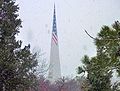
Main article: Music of Long IslandSee also: List of Long Islanders and List of people from New York City Nikon at Jones Beach Theater
Music on Long Island (Nassau and Suffolk) is strongly influenced by the proximity to New York City and by the youth culture of the suburbs. Psychedelic rock was widely popular in the 1960s as flocks of disaffected youth travelled to NYC to participate in protest and the culture of the time. R & B also has a history on Long Island, where population is denser and more closely influenced by New York City. In the late 1970s through the 1980s, the influence of radio station WLIR-FM made Long Island one of the first places in the U.S. to hear and embrace European New Wave bands such as Depeche Mode, the Pet Shop Boys, and Culture Club. In the 1990s Hip-hop became very popular with rap pioneers Rakim and Public Enemy growing up on Long Island. Famous rock bands that originated on Long Island include Dream Theater, Blue Oyster Cult, Twisted Sister and guitar virtuoso Steve Vai and Joe Satriani
The Nassau Coliseum and Nikon at Jones Beach Theater are venues used by national touring acts as performance spaces for concernts. Nikon at Jones Beach Theater is an outdoor amphitheatre, located at Jones Beach State Park. It is a popular place to view summer concerts, with new as well as classic artists performing there during the summer months. It hosts a large Fourth of July fireworks show every year, and the stands are filled. People park cars along the highway leading to the show, and others watch from the nearby beaches.[25]
Long Island is also known for its schools' music programs. Stony Brook University is well known for its outstanding trumpet studio. Many schools in Suffolk County have distinguished music programs, with high numbers of students who are accepted into the state-wide All-State music groups, or even the National All-Eastern Coast music groups. Both the Suffolk County and Nassau County Music Educator's Associations are recognized by The National Association of Music Education (MENC),[26][27] and host numerous events, competitions, and other music-related activities.
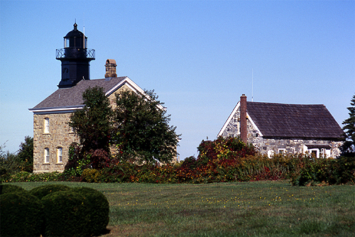
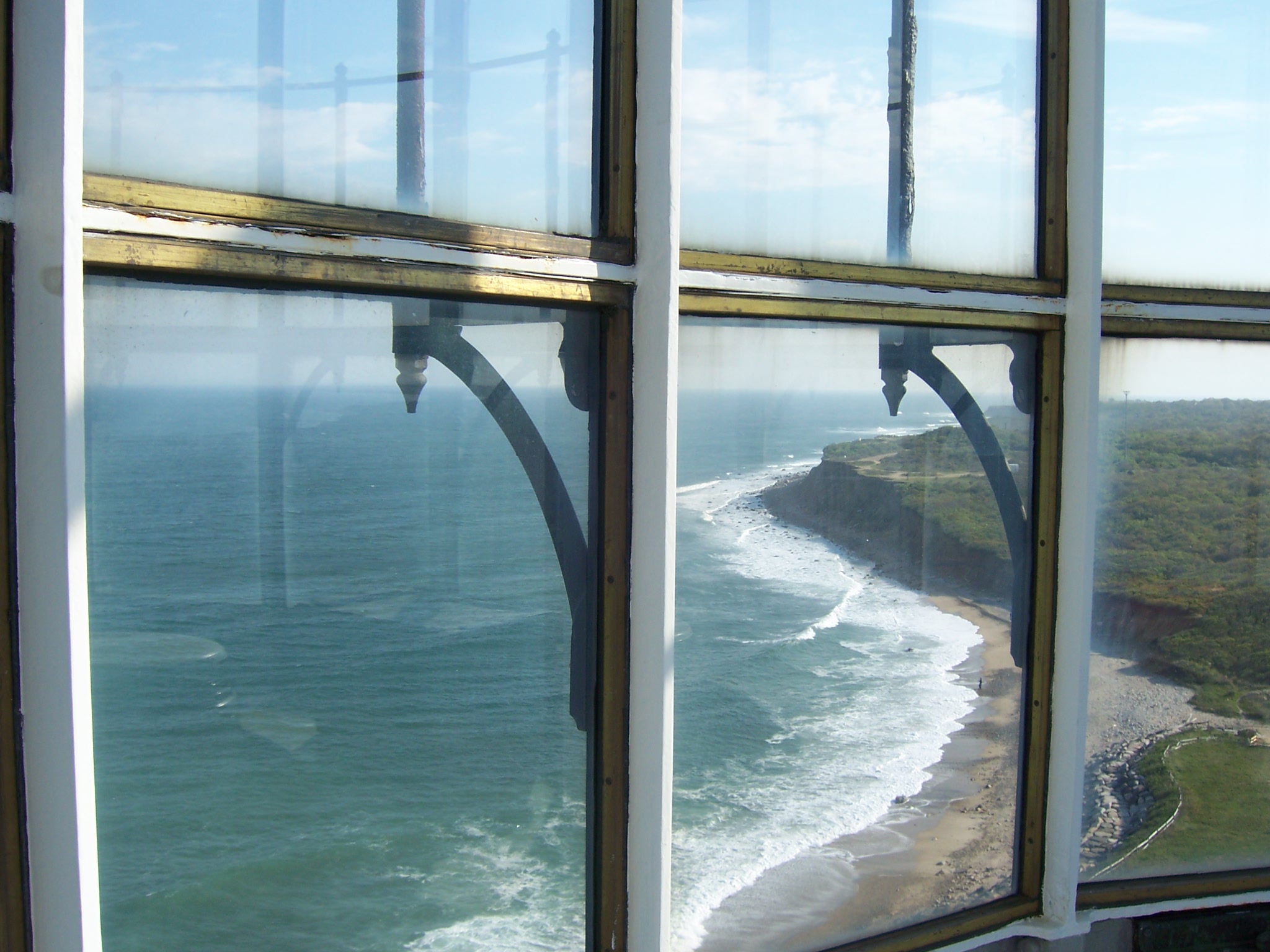
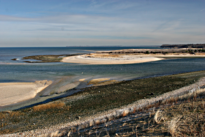
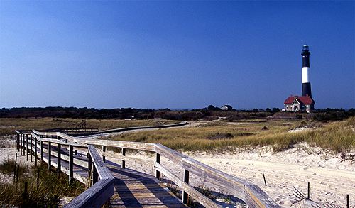
Long Island gallery
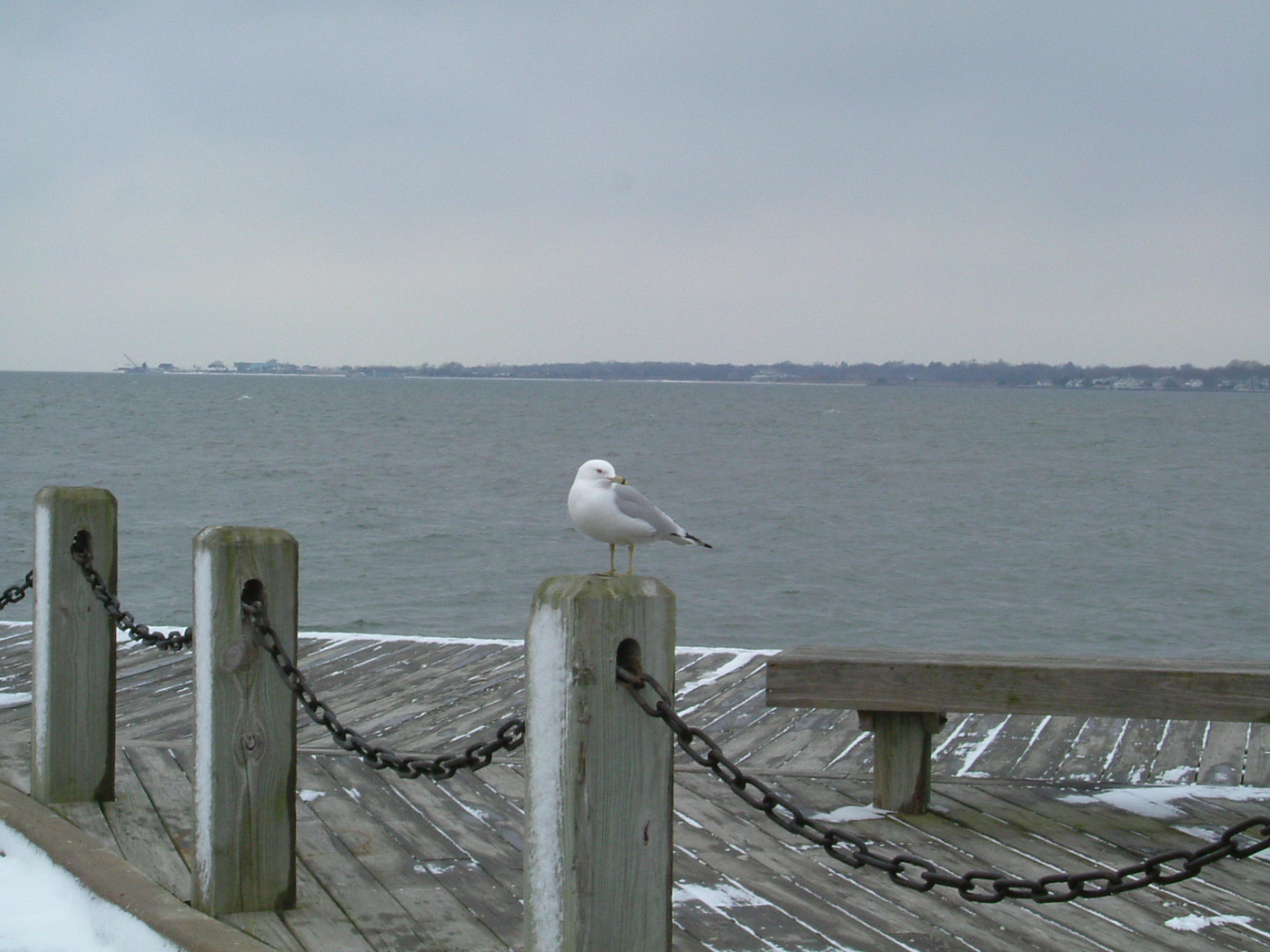
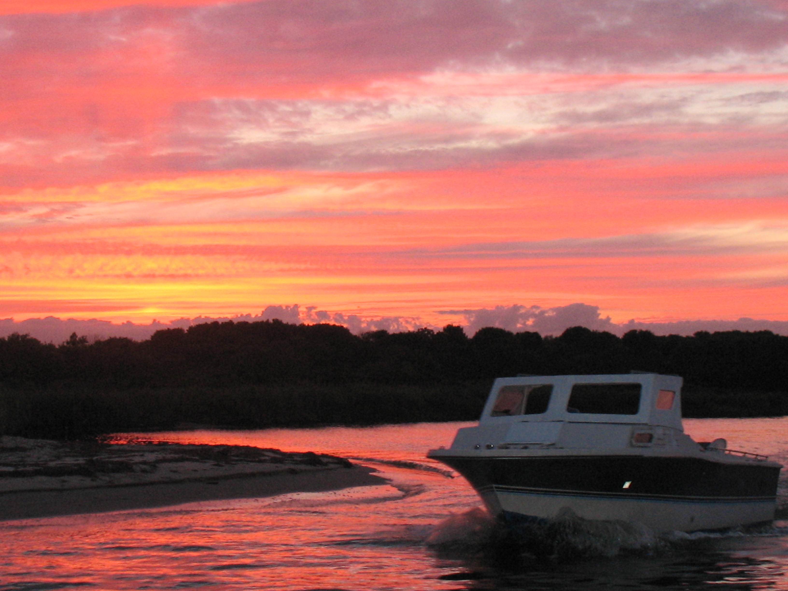
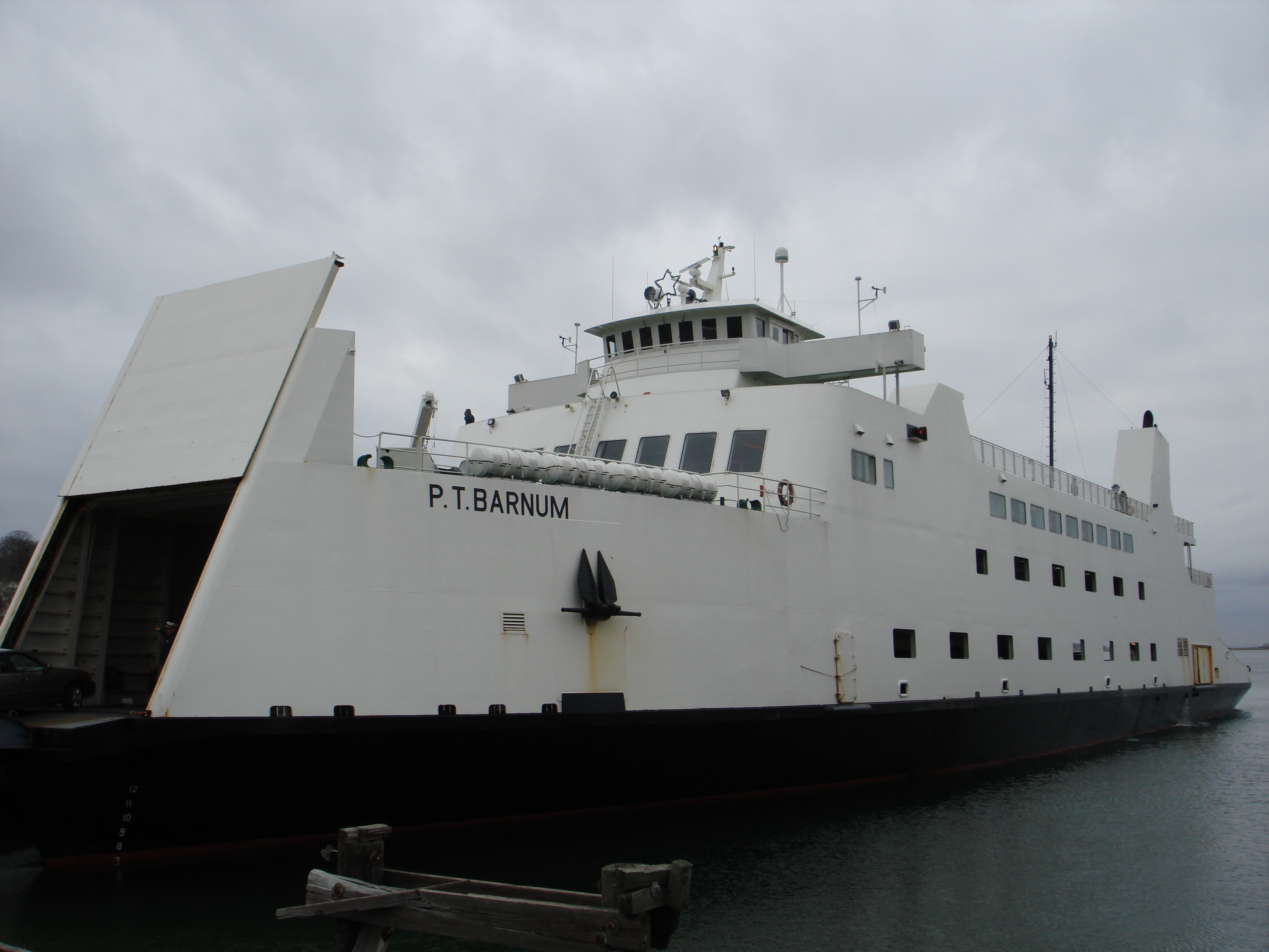
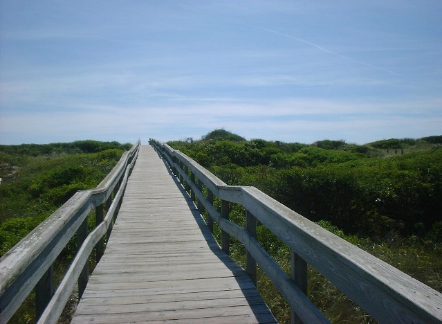
-
Mascot Dock- Village of Patchogue -

Swan River Long Island -

Port Jefferson ferry -
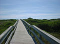
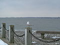
Barrier Islands boardwalk -

Old Field lighthouse -

Looking out from – Montauk Lighthouse. -
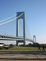
Verrazano-Narrows Bridge – Brooklyn to Staten Island -
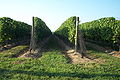
Long Island Vineyards -

Citi Field Queens, NYC -
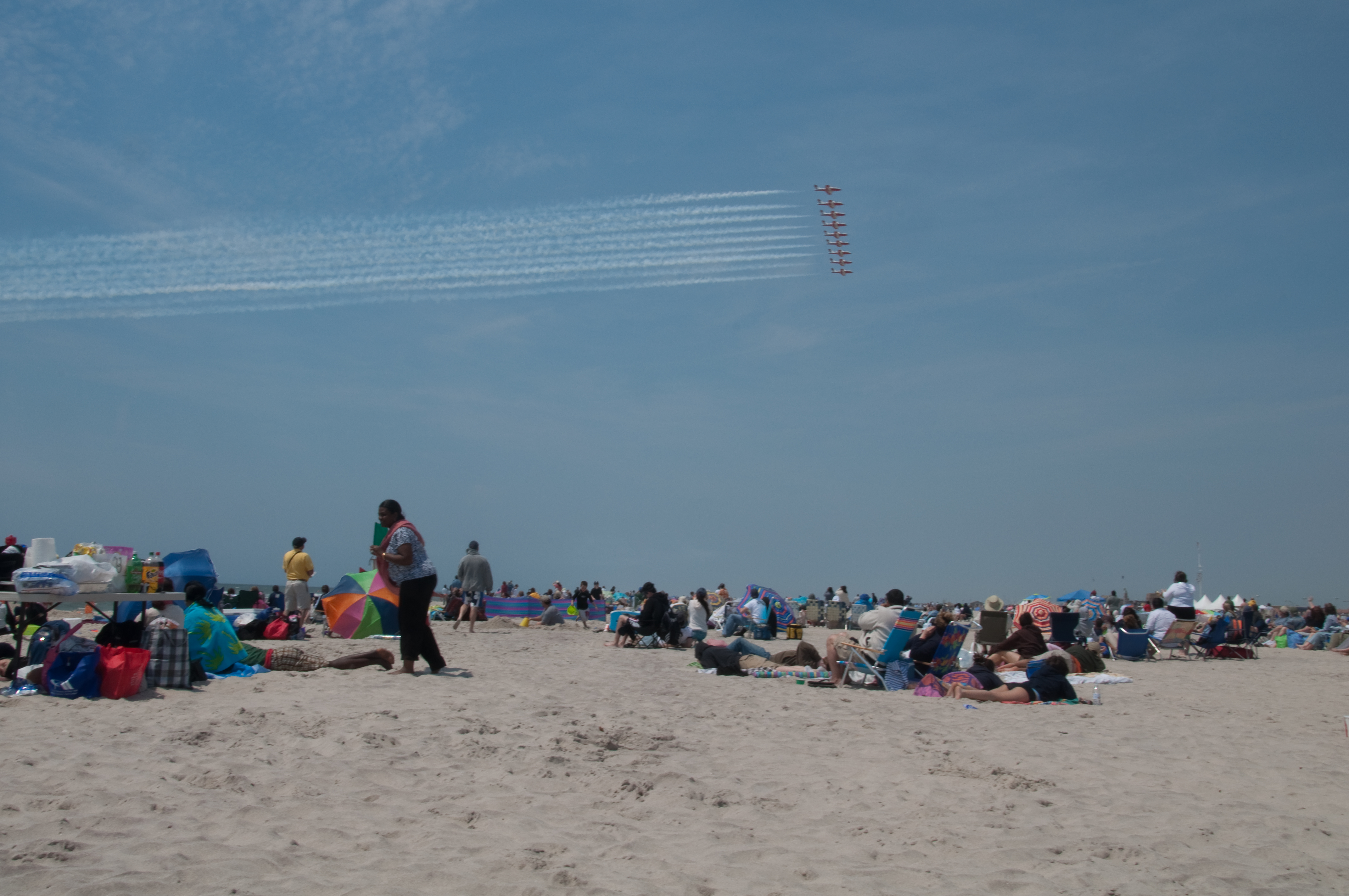
2009 Jones Beach Airshow -
The Fire Island Bridge -
New York/Long Island Coast Guard
-

The Brooklyn Bridge -

Patchogue Bay -

Orient Point -

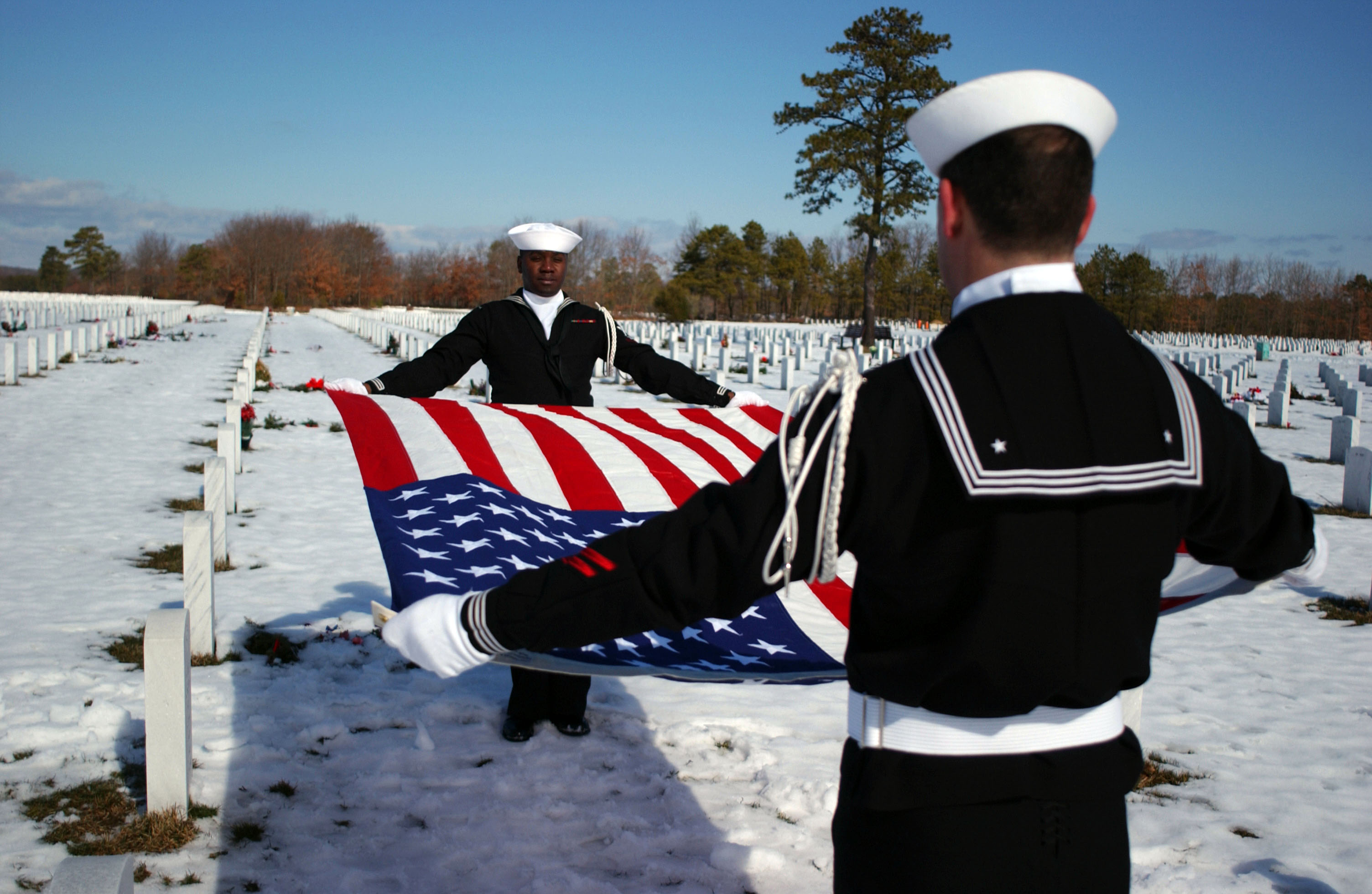
Calverton National Cemetery
-

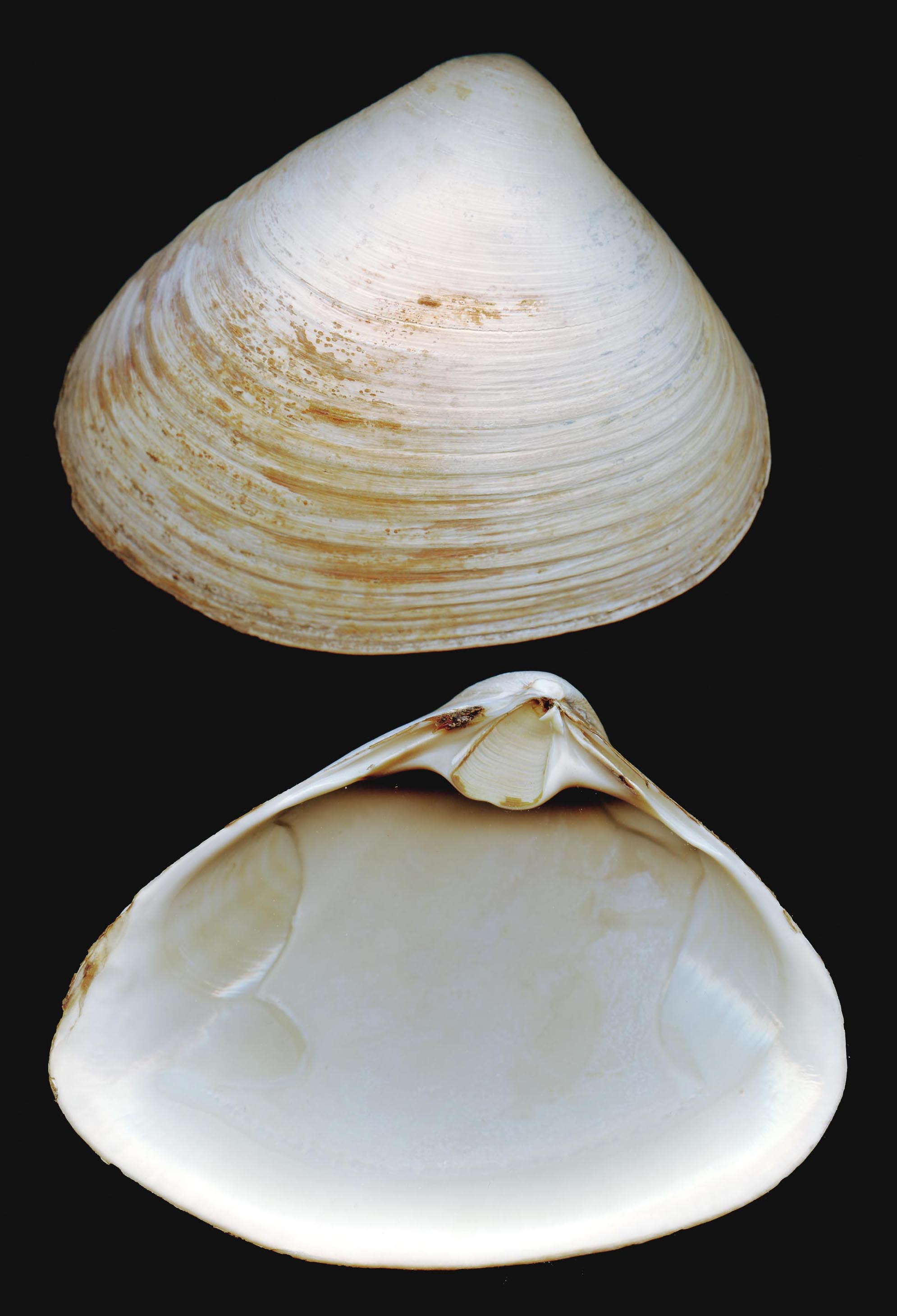
Long Island Hard Clam
-
Bald Hill Farmingville, NY
-

The Hamptons
See also
- Timeline of town creation in Downstate New York
- Geography and environment of New York City
- List of Long Islanders, famous residents of Nassau and Suffolk
- List of people from New York City, including famous residents of Brooklyn and Queens
- List of references to Long Island places in popular culture
- Long Island Association
- Long Island Marathon
- Shoreham Nuclear Power Plant
- Long Island Villages
- Long Island Towns
References
- ^ The New York City borough of Queens has the same boundaries as the County of Queens. The borough of Brooklyn has the same boundaries as Kings County.
- ^ a b c U.S. Census Bureau Census 2010
- ^ John Burbidge (2004-11-21). "Long Island at its Best; Who's the Longest of Them All?". The New York Times. http://query.nytimes.com/gst/fullpage.html?res=9A07E3DB133FF932A15752C1A9629C8B63&sec=&spon=&pagewanted=all. Retrieved 2011-04-30. ""But the court wasn't saying Long Island isn't an island in a geographical sense", he continued. "In fact, all parties involved in the case agreed Long Island is a geographical island. It was only for the purposes of the case that the island was declared an extension of New York's coastline.""
- ^ "Long Island". Encyclopedia Britannica (Britannica Concise ed.). Encyclopedia Britannica, Inc.. 2011. 9370515. http://concise.britannica.com/ebc/article-9370515/Long-Island. Retrieved 2011-04-30.
- ^ "Secretary of State of Rhode Island". http://sos.ri.gov/library/history/facts/. Retrieved 2011-04-30. "This total excludes U.S. territorial waters, which were included in previous years."
- ^ At least as late as 1911, locations in Queens were still commonly referred to as being on Long Island. "The Real Estate Field – On Long Island". The New York Times. 1911-12-11. http://query.nytimes.com/mem/archive-free/pdf?_r=1&res=9405E0DB1E31E233A25754C0A9649D946096D6CF. Retrieved 2011-04-30.
- ^ americas-richest-counties: Personal Finance News from Yahoo! Finance
- ^ "Study: Property Taxes Sky-High in Metro Areas". WCBS. October 4, 2006. Archived from the original on 2007-09-28. http://web.archive.org/web/20070928021202/http://www.wcbs880.com/pages/96453.php?contentType=4&contentId=217028. Retrieved 2007-08-06.
- ^ DeWan, George. "Long Island History: The Prairie That Was". Newsday.com. http://classic-web.archive.org/web/20080415230214/http://www.newsday.com/community/guide/lihistory/ny-history-hs105a,0,5519292.story. Retrieved 2009-01-04.
- ^ "united states annual sunshine map". HowStuffWorks, Inc. http://maps.howstuffworks.com/united-states-annual-sunshine-map.htm. Retrieved 2011-04-30.
- ^ "Vulnerable Cities: Long Island". weather.com. The Weather Channel. Archived from the original on April 10, 2006. http://web.archive.org/web/20060410111625/http://www.weather.com/newscenter/specialreports/hurricanes/vulnerablecities/longisland.html. Retrieved 2011-04-30.
- ^ Lambert, Bruce (2002-06-05). "Study Calls L.I. Most Segregated Suburb". The New York Times. http://www.nytimes.com/2002/06/05/nyregion/study-calls-li-most-segregated-suburb.html?pagewanted=1. Retrieved 2011-04-30.
- ^ a b c "The Association of Religion Data Archives (ARDA), Year 2000 Report". http://www.thearda.com/mapsReports/reports/selectCounty.asp?state=36&county=25001. Churches were asked for their membership numbers. ARDA estimates that most of the churches not reporting were black Protestant congregations.
- ^ "Long Island Study Rebuts Views on Immigrant Workers"
- ^ "Of Interest to Politicians.". The New York Times. 1894-09-13 (before vote). p. 9. http://query.nytimes.com/gst/abstract.html?res=9C05EFDD1131E033A25750C1A96F9C94659ED7CF. Retrieved 2011-04-30. "The question of the Greater New-York, which is also to be submitted to the people at this coming election, involves the proposition to unite in one city the following cities, counties, and towns: New-York City, Long Island City, in Queens County; the County of Kings, (Brooklyn;) the County of Richmond, (S.I.;) the towns of Flushing, Newtown, Jamaica, in Queens County; the town of Westchester, in Westchester County, and all that portion of the towns of East Chester and Pelham which lies south of a straight line drawn from a point where the northerly line of the City of New-York meets the centre line of the Bronx River, to the middle of the channel between Hunter's and Glen Islands, in Long Island Sound, and that part of the town of Hempstead, in Queens County, which is westerly of a straight line drawn from the south-easterly point of the town of Flushing in a straight line to the Atlantic Ocean."
- ^ "Vote for Greater New York". The New York Times. 1894-10-16 (before election). http://query.nytimes.com/gst/abstract.html?res=9D06E0D91131E033A25755C1A9669D94659ED7CF. Retrieved 2011-04-30.
- ^ "New-York's Place in Danger; Consolidation Defeated, She Must Yield, to Chicago.". The New York Times. 1894-11-04 (before election). http://query.nytimes.com/gst/abstract.html?res=9A0DE3D71131E033A25757C0A9679D94659ED7CF. Retrieved 2011-04-30.
- ^ "Greater New-York in Doubt: The City Vote is for it and Brooklyn is uncertain.". NY Times. 1894-11-08 (before results of Queens vote known). http://query.nytimes.com/gst/abstract.html?res=9403E0D61531E033A2575BC0A9679D94659ED7CF. Retrieved 2011-04-30. "The increase in area and population that New-York will acquire if consolidation becomes a fact will become evident by a glance at the following table... Flushing... * Part of the town of Hempstead... Jamaica... Long Island City ... Newtown... The townships in Queens County that are to be included in the Greater New-York have not been heard from yet..."
- ^ "Report Favors Consolidation; An Argument Against the Claims of the Resubmissionists.". The New York Times. 1896-02-22. p. 1. http://query.nytimes.com/gst/abstract.html?res=9B02E3DD123EE333A25751C2A9649C94679ED7CF. Retrieved 2011-04-30.
- ^ "The East City Line Fixed". The New York Times. 1899-02-12. p. 15. http://query.nytimes.com/gst/abstract.html?res=9C04E2DC1730E132A25751C1A9649C94689ED7CF. Retrieved 2011-04-30.
- ^ Michael J. Trinklein (2 April 2010). "Beyond 50: American States That Might Have Been". National Public Radio. http://www.npr.org/templates/story/story.php?storyId=125142955. Retrieved 2011-04-30.
- ^ a b "Secession Dreaming". Staten Island Advance Editorial. May 17, 2009. http://www.silive.com/opinion/editorials/index.ssf/2009/05/secession_dreaming.html. Retrieved 2011-04-30.
- ^ "The MTA Network". http://mta.info/mta/network.htm. Retrieved 2011-04-30.
- ^ Main campus is in Queens, branch campus in Suffolk County St. John's University: Oakdale Campus
- ^ "Jones Beach Amphitheater". http://www.jonesbeach.com/. Retrieved 2011-04-30.
- ^ "About the SCMEA". http://www.scmea.org/about.cfm. Retrieved 2011-04-30.
- ^ "NYSSMA Zone Map". http://www.nyssma.org/zonemaps.cfm?subpage=62. Retrieved 2011-04-30.
External links
Coordinates: 40°48′N 73°18′W / 40.8°N 73.3°W
New York-Newark-Bridgeport Combined Statistical Area Counties 
Major city Cities and towns
100k–999kBridgeport • Elizabeth • Huntington • Jersey City • New Haven • Newark • Paterson • Stamford • Waterbury • YonkersCities and towns
25k–99kBayonne • Branford • Cheshire • Clifton • Danbury • East Haven • East Orange • Englewood • Fairfield • Garfield • Greenwich • Hackensack • Hamden • Hoboken • Howell, New Jersey Kearny • Long Beach • Long Branch • Meriden • Middletown • Milford • Mount Vernon • Naugatuck • New Brunswick • New Milford • New Rochelle • Newburgh • Newtown • Norwalk • Passaic • Perth Amboy • Plainfield • Poughkeepsie • Rahway • Shelton • Stratford • Torrington • Trenton • Trumbull • Union City • Wallingford • West Haven • Westfield • Westport • White PlainsCities and towns
10k–25kAnsonia • Asbury Park • Beacon • Bethel • Brookfield • Darien • Derby • Dover • Guildford • Guttenberg • Harrison (NJ) • Harrison (NY) • Kingston • Linden • Madison • Monroe • Morristown • New Canaan • New Fairfield • North Branford • North Haven • Orange • Plymouth • Peekskill • Ridgefield • Rye • Scarsdale • Secaucus • Seymour • Southbury • Summit • Watertown • West New York • Weston • Wilton • Winchester • WolcottSub-regions Central Jersey • Greater Danbury • Greater New Haven • Greater Waterbury • Hudson Valley • Litchfield Hills • Long Island • North Jersey • Southwestern ConnecticutCategories:- Long Island
- Islands of New York City
- institutions of the State University of New York


Wikimedia Foundation. 2010.