- Holtsville, New York
Infobox Settlement
official_name = Holtsville, New York
settlement_type = CDP
nickname =
motto =
imagesize =
image_caption =
image_pushpin_
pushpin_label_position =
pushpin_map_caption =Location within the state of New York
pushpin_mapsize =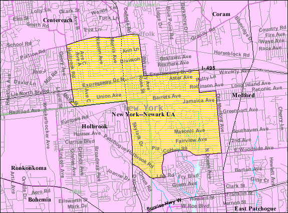
mapsize = 250px
map_caption = U.S. Census Map
mapsize1 =
map_caption1 =subdivision_type = Country
subdivision_name =United States
subdivision_type1 = State
subdivision_name1 =New York
subdivision_type2 = County
subdivision_name2 = Suffolk
government_footnotes =
government_type =
leader_title =
leader_name =
leader_title1 =
leader_name1 =
established_title =
established_date =area_footnotes =
area_magnitude =
area_total_km2 = 18.0
area_land_km2 = 18.0
area_water_km2 = 0.0
area_total_sq_mi = 7.0
area_land_sq_mi = 7.0
area_water_sq_mi = 0.0population_as_of = 2000
population_footnotes =
population_total = 17006
population_density_km2 = 943.8
population_density_sq_mi = 2444.3timezone = Eastern (EST)
utc_offset = -5
timezone_DST = EDT
utc_offset_DST = -4
elevation_footnotes =
elevation_m = 32
elevation_ft = 105
latd = 40 |latm = 48 |lats = 48 |latNS = N
longd = 73 |longm = 2 |longs = 50 |longEW = Wpostal_code_type =
ZIP code s
postal_code = 00501, 00544, 11742
area_code = 631
blank_name = FIPS code
blank_info = 36-35254
blank1_name = GNIS feature ID
blank1_info = 0953030
website =
footnotes =Holtsville is a hamlet (and
census-designated place ) in Suffolk County,New York ,United States . The population was 17,006 at the 2000 census.Holtsville is the location of an IRS Processing Center (which has the lowest assigned numerical
ZIP Code , 00501) and is in the Town of Brookhaven and the Town of Islip.Geography
Holtsville is located at coor dms|40|48|48|N|73|2|50|W|city (40.813394, -73.047175)GR|1.
According to the
United States Census Bureau , the CDP has a total area of 7.0square mile s (18.0km² ), all land.Demographics
As of the
census GR|2 of 2000, there were 17,006 people, 5,316 households, and 4,454 families residing in the CDP. Thepopulation density was 2,444.3 per square mile (943.4/km²). There were 5,418 housing units at an average density of 778.8/sq mi (300.6/km²). The racial makeup of the CDP was 89.0% White, 1.11% African American, 0.18% Native American, 1.74% Asian, 0.01% Pacific Islander, 1.21% from other races, and 1.38% from two or more races. Hispanic or Latino of any race were 7.1% of the population.There were 5,316 households out of which 43.7% had children under the age of 18 living with them, 70.4% were married couples living together, 9.9% had a female householder with no husband present, and 16.2% were non-families. 12.0% of all households were made up of individuals and 3.4% had someone living alone who was 65 years of age or older. The average household size was 3.19 and the average family size was 3.47.
In the CDP the population was spread out with 28.2% under the age of 18, 7.5% from 18 to 24, 33.5% from 25 to 44, 23.9% from 45 to 64, and 6.9% who were 65 years of age or older. The median age was 34 years. For every 100 females there were 96.1 males. For every 100 females age 18 and over, there were 93.9 males.
The median income for a household in the CDP was $68,544, and the median income for a family was $71,784. Males had a median income of $50,361 versus $31,709 for females. The
per capita income for the CDP was $24,031. About 2.4% of families and 3.6% of the population were below thepoverty line , including 2.7% of those under age 18 and 4.0% of those age 65 or over.References
External links

Wikimedia Foundation. 2010.