- Medford, New York
-
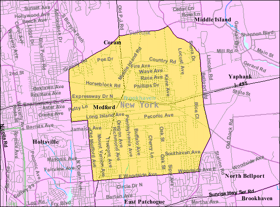
Medford, New York — Hamlet and CDP — U.S. Census Bureau map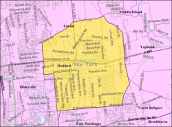
Coordinates: 40°49′4″N 72°59′10″W / 40.81778°N 72.98611°WCoordinates: 40°49′4″N 72°59′10″W / 40.81778°N 72.98611°W Country United States State New York County Suffolk Area – Total 10.5 sq mi (27.3 km2) – Land 10.5 sq mi (27.3 km2) – Water 0.0 sq mi (0.0 km2) Elevation 89 ft (27 m) Population (2000) – Total 21,985 – Density 2,088.5/sq mi (806.4/km2) Time zone Eastern (EST) (UTC-5) – Summer (DST) EDT (UTC-4) ZIP code 11763 Area code(s) 631 FIPS code 36-46404 GNIS feature ID 0956903 Medford is a hamlet (and census-designated place) in Suffolk County, New York, United States. The population was 21,985 at the 2000 census.
Medford is a community in the southwest part of the Town of Brookhaven. It is served by the Patchogue-Medford School District, except for extreme southeastern Medford, which is served by the South Country Central School District, and extreme northeastern Medford, which is served by the Longwood Central School District. Some neighborhoods in Yaphank have Medford's zip code (11763.)
Contents
History
The Long Island Railroad established the Medford Station in 1843 in a flat wilderness in the Central Long Island Pine Barrens. The station connected to the Patchogue Stage Road between Patchogue, New York and Port Jefferson, New York and a post office was established.[1]
In 1850 the LIRR auctioned the land around the station which was purchased by the O.L. Schwenke Land & Investment Co. which bought four square miles and then subdivided them into 25-by-100-foot lots which sold for $10 to $75. The land remained poor for farming and according to legend, in a marketing attempt a mock factory with a phony roof was built near the tracks and when a train neared tar paper was burned to give the impression that a booming industry existed in the community.[1]
In 1907 the LIRR established the Medford Prosperity Farm to show that crops could be raised in the Pine Barrens. Theodore Roosevelt visited the station in August 1910. As the car drove across a trail between Medford and Wading River, New York, it got stuck in the mud and Roosevelt was said to take a "flying leap" to get out.[1]
Growth and development
By the mid-to-late-20th Century, developers were building new neighborhoods within Medford. Eagle Estates was built along Horse Block Road east of NY 112 in 1966, although it was planned as far back as the 1930s. The development included a King Kullen shopping center on Horse Block Road west of Eagle Avenue, and a youth baseball and athletic field east of Sipp Avenue between Wave and Race Avenues. The Long Island Expressway ran through Medford in 1970, with interchanges at NY 112 and Horse Block Road, the latter of which is close to an older interchange with Horse Block Road and Long Island Avenue, and was not completed until 1999. The Pines was established in the 1970s east of Buffalo Avenue, south of Jamaica Avenue, north of Woodside Avenue and far west of Patchogue-Yaphank Road.
A segment of Peconic Avenue east of Buffalo Avenue has been lined with automotive junk yards since the mid-20th Century. Two long standing auto wreckers have been Medford Auto Wreckers and Gershow Recycling.
Geography
Medford is located at 40°49′4″N 72°59′10″W / 40.81778°N 72.98611°W (40.817733, −72.986125).[2]
According to the United States Census Bureau, the CDP has a total area of 10.5 square miles (27 km2), all land.
Medford, New York is serviced by several busy roadways, such as Horseblock Road (Suffolk CR 16), NY 112, Patchogue-Yaphank Road/Sills Road (Suffolk CR 101) and the Long Island Expressway.
Public transportation in Medford has been provided by the Long Island Rail Road since the town was created. Suffolk County Transit provides bus service.
Demographics
As of the census[3] of 2000, there were 21,985 people, 6,791 households, and 5,629 families residing in the CDP. The population density was 2,088.5 per square mile (806.1/km²). There were 6,939 housing units at an average density of 659.2/sq mi (254.4/km²). The racial makeup of the CDP was 89.18% White, 3.98% African American, 0.25% Native American, 1.38% Asian, 0.02% Pacific Islander, 3.11% from other races, and 2.07% from two or more races.
There were 6,791 households out of which 42.6% had children under the age of 18 living with them, 68.2% were married couples living together, 10.7% had a female householder with no husband present, and 17.1% were non-families. 13.2% of all households were made up of individuals and 5.2% had someone living alone who was 65 years of age or older. The average household size was 3.23 and the average family size was 3.52.
In the CDP the population was spread out with 27.7% under the age of 18, 8.9% from 18 to 24, 30.9% from 25 to 44, 24.7% from 45 to 64, and 7.8% who were 65 years of age or older. The median age was 35 years. For every 100 females there were 96.8 males. For every 100 females age 18 and over, there were 94.7 males.
The median income for a household in the CDP was $67,153, and the median income for a family was $70,493 (these figures had risen to $91,400 and $100,323 respectively as of a 2007 estimate[4]). Males had a median income of $66,485 versus $50,427 for females. The per capita income for the CDP was $52,579. About 1.5% of families and 3.3% of the population were below the poverty line, including 3.5% of those under age 18 and 4.4% of those age 65 or over.
Notable residents
- Tricia Cast, soap opera actress.
- Bryant Neal Vinas, convicted of participating in and supporting al-Qaeda plots in Afghanistan and the U.S., and helping al-Qaeda plan a bomb attack on the LIRR
References
- ^ a b c Medford – Long Island History – Newsday
- ^ "US Gazetteer files: 2010, 2000, and 1990". United States Census Bureau. 2011-02-12. http://www.census.gov/geo/www/gazetteer/gazette.html. Retrieved 2011-04-23.
- ^ "American FactFinder". United States Census Bureau. http://factfinder.census.gov. Retrieved 2008-01-31.
- ^ http://factfinder.census.gov/servlet/ACSSAFFFacts?_event=Search&geo_id=06000US3402352560&_geoContext=01000US%7C04000US34%7C05000US34023%7C06000US3402352560&_street=&_county=medford&_cityTown=medford&_state=04000US36&_zip=&_lang=en&_sse=on&ActiveGeoDiv=geoSelect&_useEV=&pctxt=fph&pgsl=060&_submenuId=factsheet_1&ds_name=ACS_2007_3YR_SAFF&_ci_nbr=null&qr_name=null®=null%3Anull&_keyword=&_industry=
Town of Brookhaven, New York County Villages Belle Terre · Bellport · Lake Grove · Mastic Beach · Old Field · Patchogue · Poquott · Port Jefferson · ShorehamHamlets Blue Point · Brookhaven · Calverton · Canaan Lake · Center Moriches · Centereach · Cherry Grove · Coram · Crystal Brook · Cupsogue Beach · Davis Park · East Moriches · East Patchogue · East Setauket · East Shoreham · Eastport · Farmingville · Fire Island Pines · Gordon Heights · Hagerman · Holbrook · Holtsville · Lake Ronkonkoma · Manorville · Mastic · Medford · Middle Island · Miller Place · Moriches · Mount Sinai · North Bellport · North Patchogue · Ocean Bay Park · Point O' Woods · Port Jefferson Station · Ridge · Rocky Point · Ronkonkoma · Selden · Setauket · Shirley · Sound Beach · South Haven · Stony Brook · Strongs Neck · Terryville · Upton · Wading River · Water Island · West Manor · YaphankIndian
reservationPoospatuckWebsite: brookhaven.orgCategories:- Brookhaven, New York
- Hamlets in New York
- Census-designated places in New York
- Populated places in Suffolk County, New York
Wikimedia Foundation. 2010.