- New York State Route 112
-
NYS Route 112

Map of Long Island and vicinity with NY 112 highlighted in redRoute information Maintained by NYSDOT Length: 12.50 mi[2] (20.12 km) Existed: 1930[1] – present Major junctions South end: Main Street in Patchogue  NY 27 in Patchogue
 I-495 in Medford
 NY 347 in Port Jefferson Station
North end:  NY 25A in Port Jefferson Station
Location Counties: Suffolk Highway system Numbered highways in New York
Interstate • U.S. • N.Y. (former) • Reference • County←  NY 111
NY 113  →
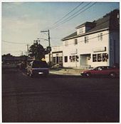
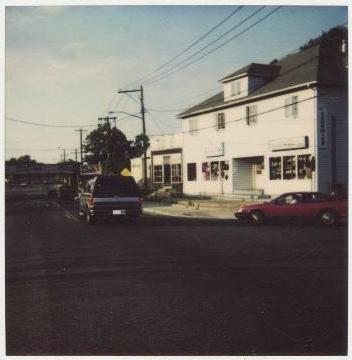
→New York State Route 112 (NY 112) is a New York state highway, entirely within the Town of Brookhaven in Suffolk County. It runs from Montauk Highway, formerly part of NY 27A, in the village of Patchogue to NY 25A in Port Jefferson Station. It is known locally as Medford Ave in Patchogue and Patchogue Road in Terryville and Port Jefferson Station. The official name for the road outside these areas is "Patchogue – Port Jefferson Road", though it is often signed simply as "Route 112".[citation needed]
Contents
History
NY 112 was known as the Patchogue Stage Road in the 19th and early 20th Centuries, because it was the main thoroughfare for New England residents taking stagecoaches to the theaters in Patchogue.[3][not in citation given][4][5] Additionally, the Medford Avenue segment in Patchogue and North Patchogue was part of the historic Long Island Bicycle Path, which ran from Patchogue to Port Jefferson in the 1890s and into the early 20th century.[6][7][8] NY 112 was assigned to the former stage road as part of the 1930 renumbering.[1]
A former segment lies behind a New York State Department of Transportation maintenance yard in Coram. Other former sections included part of Middle Island Road and an abandoned road in Medford, a section near Pine Road in Coram, and a segment near East Gate in Terryville.[9]
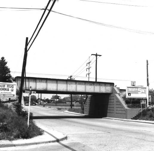
 NY 112 near LIRR Bridge in Medford that was built in 1940
In the 1960s and 1970s, NYSDOT wanted to realign both Route 112 and Route 25 in Coram, although plans to realign Route 112 go as far back as the 1930s.[10]
Developments
The hazardous railroad crossing in Medford was finally replaced with a steel bridge in 1940.[11] The bridge has a low 12 foot 9 inch clearance.[12][13] In 1964, the segment of NY 112 between East Main Street and Clark Street was widened to four lanes.[14]
When the Long Island Expressway (Interstate 495) was built across central Suffolk County between 1969 and 1971, NY 112 was widened to a four-lane divided highway in the vicinity of the new expressway. This project included tilting the curved embankment of the southbound lane, which has unfortunately created a series of floods in moderate to heavy rainstorms.[15][16] Several soultions for the dangerous issue were proposed, including raising the grade of the road in the area.[citation needed] These plans were scrapped, however, when a Lowe's hardware franchise [17] was built along NY 112 near the Long Island Expressway.[citation needed] Since the 1970s a major increase in automotive dealerships have been built in Medford and North Patchouge.[16] This segment has been referred to by some as "Automotive Alley."[citation needed] Plans to widen Route 112, which have been discussed since before World War Two have been delayed by the establishment of these dealerships, as well as other strip malls and shopping centers.[citation needed]
Extension proposals
During the period when New York State Department of Transportation was planning to realign NY 25A along the Setauket – Port Jefferson Bypass, Route 112 was supposed to be extended to East and West Broadway in Downtown Port Jefferson Harbor.[18][not in citation given] Sign trees along West and East Broadway near Main Street point motorists to both the sharp right turn of Route 25A and towards Route 112.[19][20] Upon completion of the bypass, the NY 25A shields would have been moved from Main Street onto the byapass. The Long Island Rail Road gives the official address for Port Jefferson Railroad Station as being on Route 112, despite the fact that NY 112 currently ends south of the station at Hallock Avenue.[18]
Another failed extension proposal was suggested in the late 1970s in Patchogue.[21][citation needed] This would have added a whole new road south of East Main Street over the Montauk Line of the Long Island Rail Road, then west to Division Street finally terminating in front of Patchogue Station at West Street (Suffolk CR 19).[22][citation needed]
Also in Patchogue, there was a proposal to extend it over the Long Island Rail Road tracks then shift it to Bay Avenue, providing easier access to Patchogue Beach, along the Great South Bay.[citation needed]
Major intersections
The entire route is in Suffolk County.
Location Mile[2] Destinations Notes Patchogue 0.00 East Main Street Formerly part of NY 27A and CR 80 North Patchogue 0.89 NY 27 (Sunrise Highway)Exit 53 (NY 27) 1.88  CR 99 (Woodside Avenue)
Medford 4.07 I-495 (Long Island Expressway)Exit 64 (I-495) 4.26  CR 16 (Horse Block Road)
Coram 7.22  NY 25 (Middle Country Road)
8.43  CR 83 (Patchogue – Mount Sinai Road)
Port Jefferson Station 11.94 NY 347 (Nesconset – Port Jefferson Highway)12.50 NY 25A (Hallock Avenue / Main Street)1.000 mi = 1.609 km; 1.000 km = 0.621 mi References
- ^ a b Dickinson, Leon A. (January 12, 1930). "New Signs for State Highways". The New York Times: p. 136. http://select.nytimes.com/gst/abstract.html?res=F50A15F6355A147A93C0A8178AD85F448385F9. Retrieved July 18, 2010.
- ^ a b "2008 Traffic Data Report for New York State" (PDF). New York State Department of Transportation. June 16, 2009. p. 242. https://www.nysdot.gov/divisions/engineering/technical-services/hds-respository/NYSDOT_Traffic_Data_Report_2008.pdf. Retrieved January 24, 2010.
- ^ Patchogue: A Brief History(Patchogue-Medford Library Local History Department)
- ^ Pictorial History of Medford: 1844-1944(Patchogue-Medford Library Local History Department)
- ^ [1850 Map of Auctioned Lands around the Long Island Rail Road and Meford Station, by Adrian H Muller]
- ^ Belcher and Hyde (1906). Atlas of Suffolk County, New York (Map).
- ^ Belcher and Hyde (1909). Atlas of Suffolk County, New York (Map).
- ^ Belcher and Hyde (1917). Atlas of Suffolk County, New York (Map).
- ^ [Old Hagstroms Long Island and Suffolk County Maps (various years)][vague]
- ^ Proposed Revised Plan of Major Highways. Town of Brookhaven (Suffolk County). August 4, 1937.
- ^ Federal Highway Administration (2009). "Structure 7037030". National Bridge Inventory. United States Department of Transportation. http://nationalbridges.com/nbi_record.php?StateCode=36&struct=000000007037030. Retrieved July 14, 2010.
- ^ 1969 Dave Keller photo of LIRR Main Line over Route 112 (TrainsAreFun.com)
- ^ Commons photograph taken on April 19, 2011.
- ^ "Some Day, Folks Will Say "Remember When...?"". The Main Street Press: p. 1. January 31, 1964.
- ^ [Newsday; February 28, 1999; "Ask Dr. Conehead"]
- ^ a b [Newsday; February 27, 2000; "Ask Dr. Conehead"]
- ^ Lowe's Store Locator (Medford, New York)
- ^ a b "Port Jefferson Station". Long Island Rail Road. http://lirr42.mta.info/stationInfo.php?id=67. Retrieved July 14, 2010.
- ^ Image of Main Street from East/West Broadway, with NY 25A-112 sign tree to the left (Commons)
- ^ Image of NY 25A-112 sign tree on East Broadway (Flickr)
- ^ Suffolk County Planning Department[vague]
- ^ Suffolk County Planning Department.[vague]
External links
Categories:- State highways in New York
- Transportation in Suffolk County, New York


Wikimedia Foundation. 2010.