- New York State Route 347
-
This article is about the current alignment of NY 347. For previous alignments of NY 347, see New York State Route 347 (disambiguation).
NYS Route 347
Nesconset – Port Jefferson Highway Route information Maintained by NYSDOT Length: 14.48 mi[2] (23.30 km) Existed: 1966[1] – present Major junctions West end: 
 NY 454 / Northern Parkway in Hauppauge
East end:  NY 25A in Mount Sinai
Location Counties: Suffolk Highway system Numbered highways in New York
Interstate • U.S. • N.Y. (former) • Reference • County←  NY 346
NY 348  →
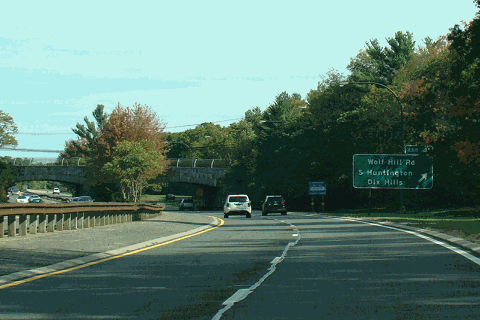
→New York State Route 347 (NY 347) is an east–west state highway located in Suffolk County, New York, in the United States. It connects the Northern State Parkway in Hauppauge to NY 25A in Mount Sinai. The route serves as a southern bypass of Smithtown and as a direct link between Nesconset and Port Jefferson. Along the way, NY 347 intersects NY 25 in Nesconset and Nicoll's Road (County Route 97) in Lake Grove. The westernmost 2 miles (3.2 km) of NY 347 is concurrent with NY 454 while the portion northeast of NY 25 parallels NY 25A, which follows a more northerly alignment through the town of Brookhaven than NY 347.
The highway was built by Suffolk County in the 1950s and designated as part of two county routes. It gained a single designation in 1966 when the state of New York assumed ownership and maintenance of the highway and designated it as NY 347. Several proposals to extend or improve the highway have been developed in the years since; however, none have been implemented, mostly due to community opposition.
Contents
History
Construction and designation
What is now NY 347 was originally built by Suffolk County in the 1950s as two separate highways.[3][1] Southwest of NY 25, it was known as the Smithtown Bypass and designated as County Route 85 (CR 85). Northeast of NY 25, it was named the Nesconset – Port Jefferson Highway and designated as CR 80.[3] Although the road acts as an eastward extension of the Northern State Parkway (with a 2-mile or 3.2-kilometre section of Veterans Memorial Highway, now NY 454, connecting the two), Robert Moses planned an altogether different right-of-way for an extension of the Northern State. In fact, the Parkway was planned to have an interchange with the Smithtown Bypass west of CR 16 (Terry Road).[4][5]
In 1966, the state of New York acquired both CR 80 and CR 85 and designated the new, unified route as NY 347.[1] Suffolk County hoped that by transferring jurisdiction to the state, it would be easier to upgrade the road into the limited-access highway as was originally intended.[citation needed] The CR 80 and CR 85 designations were later reused for portions of Montauk Highway, then part of NY 27A, that were transferred from the state to the county. CR 80 was reassigned to the portion of Montauk Highway between Patchogue and Hampton Bays on October 6, 1966, while CR 85 was given to the section between Oakdale and Patchogue on March 29, 1972.[6]
Extensions
For six years, the western terminus of NY 347 was at the then-county-maintained Veterans Memorial Highway.[3] The state acquired the Veterans Memorial Highway on March 29, 1972, placing both termini of NY 347 at state highways.[6] Originally, the state of New York had planned on building a spur between the Long Island Expressway (Interstate 495) and the Smithtown Bypass. The location of the terminus was intended to be between exits 55 and 56, although some maps have indicated that the terminus was to be at or just west of exit 55. The southern half of Simeon Woods Road (unsigned NY 901A) follows part of the spur's proposed path.[7][8] The plan was cancelled in 1977, at which time the NY 347 designation was extended westward along NY 454 to the interchange with the Northern State Parkway.[9]
Another extension was planned by the Suffolk County Department of Public Works in the early 1980s.[10][11] The highway, known as the North Brookhaven Expressway[citation needed] and proposed as CR 26,[10][11] would have begun west of Pipe-Stave Hollow Road and ended at the intersection of NY 25A and William Floyd Parkway (CR 46).[10][11] This idea was never carried out due to community opposition.[citation needed] A very faint vestige lives on, however, in the Rocky Point Bypass section of NY 25A,[12] which was constructed in the late 1990s.[citation needed]
Impact of sprawl
Soon after the state of New York assumed ownership of the roadway in 1966, plans were immediately developed to improve it to a limited-access highway flanked by service roads. The new plans required doubling the right-of-way of the roadway from the original 116-foot (35 m) width. When the Smith Haven Mall was built in 1969, it became a major retail attraction for those Long Islanders living east of Huntington. The success of the mall spurred further commercial and residential development along NY 347, effectively killing the proposed upgrade to the highway. The two townships through which the newly redesignated NY 347 traversed initially enforced setback requirements on new developments. For example, developers of the Billy Blake Department Store shopping center in Port Jefferson Station between Old Town Road and Arrowhead Lane built a service road to access that retail outlet. The Hess gas station and McDonald's restaurant in Stony Brook were built several hundred feet away from the roadway.
By the late 1980s, however, the town of Brookhaven allowed development along the artery if the developer received a letter from the New York State Department of Transportation (NYSDOT) indicating that such development would not interfere with any transportation improvements contemplated for completion within the next five years. Owing to meager highway construction budgets during the 1970s and 1980s and the lack of strong political support for widening NY 347, NYSDOT budgeted and spent its funds elsewhere. The combination of Brookhaven's policies and NYSDOT's budget woes lead to the construction of many buildings that would had to have been razed in order to improve the highway. These new "facts on the ground" sowed the seeds of political opposition to making major improvements in later decades.
The parcels alongside most of NY 347 were strip zoned for commercial properties, allowing the rapid development to take place. Considered state of the art planning at the time it was implemented, today it is considered a poor practice that leads to suburban sprawl and blight. This combination of factors gave a green light to developers to encroach development on the roadway. One person who exemplified the development frenzy was John M. McNamara, a local automotive dealer and developer. McNamara, and many other politically connected developers, cluttered the road with new developments. The Billy Blake shopping center which had a service road in front of it, had fallen on hard times. McNamara took over the reconstruction of the shopping center in the late 1980s as part of an effort to revitalize it, dismantling of the service road in the proecess. His project failed, but eventually it was discovered that he was bribing various government officials in the town of Brookhaven, Suffolk County, village of Port Jefferson, and even NYSDOT. However, this revelation had no impact on either facilitating improvements to the highway or curbing development.
Conversion to limited-access
In 1973, NYSDOT tried once again to transform NY 347 into an expressway; however, this proposal included the widening of NY 25 west of NY 347 and the addition of frontage roads along NY 25.[13] This too, was cancelled by community opposition, as were revived plans to upgrade the road again between 1987 and 1988. In 1991, after an extensive study considering numerous alternative plans for rebuilding Nesconset Highway, NYSDOT selected "Alternative 12a" as its preferred option. This option retained the limited-access features of a freeway while limiting the use of frontage roads to those areas which truly needed them. The footprint of this option was kept to a minimum through the use of single-point urban interchanges rather than complex and expansive cloverleaf-type interchanges. Inexplicably, plans for building this option were shelved.
Ten years later, NYSDOT announced a new proposal for a community friendly alternative. This alternative retained only three interchanges, retained most other grade crossings, and widened the highway to three lanes in each direction. Notably, few residential homes and a handful of business were targeted for public taking in this variation from Alternative 12a. Nonetheless, many civic associations opposed the new plan. The Tri-State Transportation Campaign, ABCO, and others opposed the proposed improvements. Other organizations, like the Long Island Association, derided NYSDOT's decision to not make NY 347 a limited access highway after nearly 35 years of planning to make it so.
In 2001, a local civic organization called the Committee for a New 347 was formed, advocating turning NY 347 into the "Nesconset Greenway", a six-lane highway with the functionality of a limited-access highway and the aesthetic designs of a Long Island parkway. Design elements included stone arch and stone-faced overpasses, earthen berms as soundwall protection, and separate, dedicated space for a bike path. Nick Klissas, a founding member of the group, later made "End 347 Gridlock!" as a major theme in his 2002 campaign for State Assembly in New York's Fourth Assembly District.
Major intersections
The entire route is in Suffolk County.
Location Mile[2] Destinations Notes Hauppauge 0.00 Northern Parkway / NY 454 westWestern terminus of NY 347 / NY 454 overlap 2.19 NY 454 eastEastern terminus of NY 347 / NY 454 overlap 3.00  NY 111 (Hauppauge Road)
Smithtown 4.94  CR 16 (Terry Road)
Nesconset 6.91  NY 25 (Jericho Turnpike)
Lake Grove 9.16  CR 97 (Nicoll's Road)
Port Jefferson Station 13.44  NY 112 (Patchogue Road)
Originally a traffic circle[14] Mount Sinai 14.48 NY 25A (Hallock Avenue)1.000 mi = 1.609 km; 1.000 km = 0.621 mi References
- ^ a b c Anderson, Steve. "North Shore Expressway (NY 347, unbuilt)". NYCRoads. http://www.nycroads.com/roads/NY-347/. Retrieved July 14, 2010.
- ^ a b "2008 Traffic Volume Report for New York State" (PDF). New York State Department of Transportation. June 16, 2009. pp. 216–217. https://www.nysdot.gov/divisions/engineering/technical-services/hds-respository/NYSDOT%20TVR%202008%20by%20Route.pdf. Retrieved January 31, 2010.
- ^ a b c Anderson, Steve. "Suffolk County Roads 76–100". NYCRoads. http://www.nycroads.com/roads/suffolk_076-100/. Retrieved July 14, 2010.
- ^ Anderson, Steve. "Northern State Parkway". NYCRoads. http://www.nycroads.com/roads/northern/. Retrieved March 18, 2010.
- ^ Suffolk County Department of Public Works (1963). Map of proposed interchange (Map). http://www.nycroads.com/roads/northern/img20.gif. Retrieved March 18, 2010.
- ^ a b "County Road System – County of Suffolk, New York" (PDF). Suffolk County Department of Public Works. December 29, 2005. http://www.greaternyroads.info/pdfs/suffcr.pdf. Retrieved April 1, 2010.
- ^ "Unveil Hauppauge Spur Plan". Sunken Meadow Messenger. February 26, 1967.
- ^ Hagstrom Map (1973). Atlas of Suffolk County, New York (Map).
- ^ Anderson, Steve. "Veterans Memorial Highway (NY 454)". NYCRoads. http://www.nycroads.com/roads/NY-454/. Retrieved July 14, 2010.
- ^ a b c Hagstrom Map (1983). Atlas of Suffolk County, New York (Map).
- ^ a b c Hagstrom Map (1988). Atlas of Suffolk County, New York (Map).
- ^ Anderson, Steve. "Suffolk County Roads 26–50". NYCRoads. http://www.nycroads.com/roads/suffolk_026-050/. Retrieved March 18, 2010.
- ^ Proposed Improvements; Route 347 Veterans Memorial Highway to Route 25A/Route 25 Sunny Drive to Hawkins Avenue. New York State Department of Transportation. 1973.
- ^ NETR Online (1954). NY 112-Nesconset-Port Jefferson Highway Traffic Circle (Map). http://www.historicaerials.com/aerials.php?scale=2.06333543745594E-05&lat=38.8004486049574&lon=-77.1218065636159&year=1954. Retrieved July 23, 2011.
External links
Categories:- State highways in New York
- Transportation in Suffolk County, New York

Wikimedia Foundation. 2010.