- Northern State Parkway
-
Northern State Parkway
Route information Length: 28.88 mi[1] (46.48 km) Existed: 1931[citation needed] – present Major junctions West end:  Grand Central Parkway at Queens
 I-495 in East Williston
 Meadowbrook Parkway in Mineola
 Wantagh Parkway in Westbury
 NY 135 in Plainview
I-495 in Plainview

 Sagtikos Parkway / Sunken Meadow Parkway in Brentwood
East end: 
 NY 347 / NY 454 in Hauppauge
Location Counties: Nassau, Suffolk Highway system Numbered highways in New York
Interstate • U.S. • N.Y. (former) • Reference • CountyThe Northern State Parkway (also known as The Northern State) is a 29.88-mile (48.09 km) long limited-access state parkway on Long Island in the U.S. state of New York. The western terminus is at the Queens-Nassau County line, where the parkway continues westward into New York City as the Grand Central Parkway. The eastern terminus is at New York State Route 347 and New York State Route 454 in Hauppauge. The parkway is designated New York State Route 908G, an unsigned reference route. As its name implies, the parkway services communities along the northern half of the island.
In western Nassau County the parkway sports six lanes, three eastbound and three westbound, narrowing to four lanes total in central Nassau at the Wantagh Parkway (exit 33) and through its twelve miles (19 km) or so in western Suffolk County, where it ends. It was constructed in stages throughout the 1930s and again post-World War II in the late 1940s/early 1950s until it reached its current terminus in Hauppauge in 1965. The Northern State Parkway is an eastern extension of the Grand Central Parkway. It was part of master planner Robert Moses' extensive road-building campaign and was built as a sister road to the Southern State Parkway. In recent years its design has quickly become dated due to an increase in commuter traffic using the roadway, and numerous improvements have been made (including the widening from four to six lanes in Central Nassau west to the Nassau-Queens line where it becomes the Grand Central) or are still on paper.
Like its siblings in the State Parkway system on Long Island, the Hudson Valley, and in New York City, commercial truck traffic is banned from the parkway due to low overpasses. The Long Island Expressway (designated Interstate 495, abbreviated LIE) was built later on by Moses to handle truck traffic traveling between New York City and Long Island's famed East End. The LIE runs directly alongside the Northern State in some parts of Nassau County.
Contents
Route description
Nassau County
The Northern State Parkway begins at the eastern terminus of the Grand Central Parkway at the Nassau-Queens border near Lake Success. 1/2 mile into Nassau County, the parkway interchanges with Lakeville Road then New Hyde Park Road. The parkway then curves north and back east, running directly alongside the Long Island Expressway and interchanges with Shelter Rock Road (at this point, the LIE curves north away from the parkway). The parkway continues east and interchanges with Willis Avenue then Roslyn Road. After the Long Island Expressway interchange in Old Westbury, the parkway takes a sharp curve south and widens to eight lanes. Next, the parkway interchages with I.U. Willets Road and Glen Cove Road. After that, the parkway rises to a high grade and enters a directional-T interchange with the Meadowbrook Parkway, at which the parkway narrows to six lanes. The parkway returns to its east–west alignment and transitions to a modern expressway, complete with interstate standard shoulders and new overpasses. The parkway then interchanges with Post Avenue and then goes for 1-mile (1.6 km) before entering a trumpet interchange with the Wantagh Parkway. At this point the parkway narrows to four lanes.
Immediately after the Wantagh Parkway interchange, the parkway interchanges with Brush Hollow Road. The parkway winds through Hicksville then curves north to run alongside the Long Island Expressway before interchanging with Routes 106/107. Immediately after the interchange, the ramps from the Long Island Expressway merge with the parkway. The parkway continues to wind through Jericho for .75 miles before interchanging with South Oyster Bay Road then straightens out en route to Route 135/Seaford-Oyster Bay Expressway. This tight cloverleaf interchange does not allow movements from the westbound mainline (traffic bound for that exit should use the LIE via exit 37A). The parkway takes a slight curve north and interchanges with Manetto Hill Road then immediately interchanges with the Long Island Expressway in Woodbury. 0.25 miles (0.40 km) later, the parkway interchanges with Sunnyside Boulevard.
Suffolk County
As the parkway enters Suffolk County it takes on a more hilly terrain and thus curves more frequently; in addition, the exit points become more sparse as the parkway winds through the more rural sections of northern Suffolk. The parkway interchanges with Round Swamp Road. The parkway continues with sparse exits, frequent curves, and takes on hilly terrains while interchanging with NY 110, Wolf Hill Road, NY 231, and Commack Road. The parkway then continues into a cloverleaf interchange with the Sagtikos Parkway and Sunken Meadow Parkway (which is the same mainline). The parkway then provides one last interchange with New Highway before finally terminating at NY 454 and becomes NY 347 in Hauppauge.
History
Between exits 38 and 39, the northern terminus of Bethpage State Parkway and southern terminus of Caumsett State Parkway were proposed to have an unconventional interchange at exits 38A and 38B, respectively.[citation needed]
Three service areas used to exist in widened areas of the median along the Parkway. The first was east of Meadowbrook State Parkway; the second was west of County Route 4 (Commack Road) in Suffolk County;[2] the third was at the former terminus of the Northern State Parkway and existing terminus of the Sagtikos State Parkway.[citation needed]
The final 2.5-mile (4.0 km) long extension of the parkway, constructed between Sagtikos State Parkway and Veterans Memorial Highway, opened in June 1965.[3] The only evidence of the formerly shared termini of the Northern and Sagtikos State Parkways can be found in what is now the east-to-south ramp of exit 44, which is wider than the other ramps, as well as those for exit 45 to the Sunken Meadow State Parkway.[citation needed]
Beyond NY 454, there were plans to extend the Northern State Parkway further east through Caleb Smith State Park Preserve, then along the Nissequogue River. After crossing NY 111, it would have turned south across Long Island until entering Connetquot River State Park Preserve, where it would include additional park entrances, then turn west finally terminating at Heckscher State Parkway between Suffolk CR 17(Carleton Avenue) and NY 27.[4][5]
Future
The interchange with New Highway in Commack will become a full diamond when the NY 347 reconstruction project is complete.[citation needed]
Exit list
County Location Mile[1] Exit Destinations Notes Nassau Lake Success 0.00 Grand Central Parkway – New YorkContinuation into New York City 0.54 25 Lakeville Road – New Hyde Park, Great Neck Signed as exits 25S (south) and 25N (north) westbound 1.35 26 New Hyde Park Road – New Hyde Park, North Hills Signed as exits 26S (south) and 26N (north) Searingtown 2.53 27 Shelter Rock Road – Searingtown, Manhasset Signed as exits 27S (south) and 27N (north) eastbound Albertson 3.85 28 To I-495 / Willis Avenue – Roslyn, MineolaSigned as exits 28S (south) and 28N (north) eastbound 4.40 29 Roslyn Road – East Hills, East Williston Old Westbury 5.13 29A I-495 west (Long Island Expressway) – New YorkWestbound exit and eastbound entrance 5.60 30 I.U. Willets Road – Albertson, Old Westbury Eastbound exit and entrance Carle Place 6.99 31  To NY 25 – Glen Cove, Hempstead
Additional westbound exit is part of exit 31A 31A Meadowbrook Parkway south – Jones BeachWestbury 8.65 32 Post Avenue – Old Westbury, Westbury 9.77 33 Wantagh Parkway south – Jones Beach34 Brush Hollow Road – Westbury Additional eastbound exit is part of exit 33 Jericho 11.91 35 
 NY 106 / NY 107 – Hicksville, Oyster Bay
Signed as exits 35S (south) and 35N (north) Plainview 13.65 36 South Oyster Bay Road – Bethpage, Syosset Signed as exits 36S (south) and 36N (north) Woodbury 14.53 36A NY 135 south – SeafordWestbound exit is via exit 37A 14.53 36B NY 135 north, SyossetWestbound exit is via exit 37A 14.92 37 Manetto Hill Road – Woodbury, Plainview 37A I-495 east (Long Island Expressway) – RiverheadEastbound exit and westbound entrance 37A I-495 west (Long Island Expressway) – New YorkWestbound exit and eastbound entrance 15.60 38 Sunnyside Boulevard – Plainview Suffolk Melville 39 Round Swamp Road – Farmingdale 18.38 40  NY 110 – Huntington, Amityville
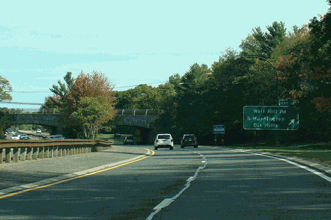
Signed as exits 40S (south) and 40N (north) Dix Hills 21.04 41 Wolf Hill Road – Dix Hills, South Huntington 23.52 42S  NY 231 south – Babylon
23.52 42N 
 CR 35 north / CR 66 north – Northport, Huntington
Commack 26.38 43  CR 4 – Commack
26.56 44 Sagtikos Parkway south – South Shore26.56 45 Sunken Meadow Parkway north – Sunken Meadow Park26.68 46 New Highway Eastbound exit and westbound entrance 28.88 NY 347 east / NY 454 east – HauppaugeEastbound exit and westbound entrance 1.000 mi = 1.609 km; 1.000 km = 0.621 mi References
- ^ a b "2007 Traffic Data Report for New York State" (PDF). New York State Department of Transportation. July 25, 2008. https://www.nysdot.gov/divisions/engineering/technical-services/hds-respository/NYSDOT_Traffic_Data_Report_2007.pdf. Retrieved July 17, 2009.
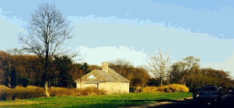
- ^ "Former parkway gas station in the center median of the Northern State Parkway in Dix Hills between exits 42 and 43". NYCRoads. http://www.nycroads.com/history/parkway/img6.gif. Retrieved March 18, 2010.
- ^ Porterfield, Byron (June 8, 1965). "Suffolk Gets New Parkway Strip; 2.5-Mile Extension of Northern State to Open Today". The New York Times: p. 43. http://select.nytimes.com/gst/abstract.html?res=F40C11F63D5F147A93CAA9178DD85F418685F9. Retrieved April 24, 2010.
- ^ Anderson, Steve. "Northern State Parkway". NYCRoads. http://www.nycroads.com/roads/northern/. Retrieved March 18, 2010.
- ^ Suffolk County Department of Public Works (1963). Map of proposed extension (Map). http://www.nycroads.com/roads/northern/img20.gif. Retrieved March 18, 2010.
External links
Parkways on Long Island, New York East-west North-south Formerly proposed Categories:- Parkways in New York
- Robert Moses projects
- Long Island highways
- Unfinished buildings and structures in the United States
- Transportation in Nassau County, New York
- Transportation in Suffolk County, New York

Wikimedia Foundation. 2010.