- Manhasset, New York
-
"Manhasset" redirects here. For other uses, see Manhasset (disambiguation).
Manhasset, New York — CDP —  U.S. Census Map
 Location within the state of New York
 Manhasset, New York
Coordinates: 40°47′34″N 73°41′36″W / 40.79278°N 73.69333°WCoordinates: 40°47′34″N 73°41′36″W / 40.79278°N 73.69333°W Country United States State New York County Nassau Area - Total 2.4 sq mi (6.3 km2) - Land 2.4 sq mi (6.2 km2) - Water 0.0 sq mi (0.1 km2) Elevation 95 ft (29 m) Population (2010) - Total 8,080 - Density 3,505.8/sq mi (1,353.6/km2) Time zone Eastern (EST) (UTC-5) - Summer (DST) EDT (UTC-4) ZIP code 11030 Area code(s) 516 FIPS code 36-44897 GNIS feature ID 0956342 Website www.manhasset.com 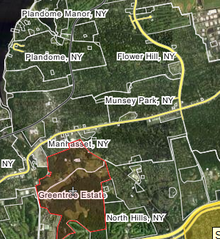 Manhasset and vicinity political boundaries
Manhasset is a hamlet (a census-designated place) and neighborhood in Nassau County, New York, on the North Shore of Long Island. As of the United States 2010 Census, the population was 8,080.
Manhasset is a Native American term that translates to "the island neighborhood." In 2005, a Wall Street Journal article ranked Manhasset as the best town for raising a family in the New York metropolitan area [1]. As with other unincorporated communities in New York, its local affairs are administered by the town in which it is located, the Town of North Hempstead, New York.
The Manhasset neighborhood is served by the Long Island Rail Road, which provides direct and convenient access to New York City at the Manhasset and Plandome stations.
Contents
Geography
In addition to the unincorporated areas of Manhasset proper -- North and South Strathmore, Strathmore Village, Strathmore Vanderbilt, Shorehaven, Terrace Manor and Norgate, those with a Manhasset address also include three incorporated villages – Munsey Park, Plandome and Plandome Heights – and parts of three others – Flower Hill, Plandome Manor and North Hills.
- The Plandomes
The three Plandomes: Plandome, Plandome Manor and Plandome Heights are in the north. Incorporated in 1911, the Village of Plandome is an affluent community adjacent to Manhasset Bay. Its Village Hall, a local landmark at the Village Green, in the center of Plandome, once served as an elementary school. Its own LIRR Station is no more than a mile away from each home in the Village. Plandome Manor is an incorporated village, a very beautiful section of Manhasset with water front properties, well known celebrities and a beautiful golf club. Plandome Heights is also an incorporated village, with a rich history of Spanish architectural styles of white stucco exterior and red-tile roof, bordering downtown (unincorporated) Manhasset.
- Munsey Park
In 1922, Louis Sherry, the wealthy French confectioner, sold his estate and mansion to prominent newspaper publisher Frank A. Munsey. Over time, Munsey amassed 663 acres which included all of the present day Munsey Park, a small village where vintage street lamps lace narrow, tree lined roads and traditional homes grace manicured properties. Munsey had no heirs, no family and his entire estate and assets were left to the Metropolitan Museum of Art in New York . One portion of the Munsey lands - the Strathmore area and the magnificent chateau - was sold to Mrs. Graham Fair Vanderbilt. The 320 acres north were shaped into a model restricted community to reflect the generosity of Frank Munsey. The Metropolitan Museum developed a model community with all the homes built as authentic American colonial reproductions and the streets named for American artists. A walk along Copley pond in Munsey Park, there never were, not are there today, anywhere in the village any adjacent or nearby homes of identical design.
- The Strathmores and Vanderbilts
After a decade of providing a gracious setting for lawn parties and social festivities, the Vanderbilt family sold the 100 acre property to architect William Levitt who developed the Strathmore Vanderbilt community centered around the presence of the French Chateau at the end of the long and winding tree-lined drive. Strathmore Vanderbilt is located south of Quaker Ridge Rd. and to the west of Chapel Rd. Those living in Strathmore Vanderbilt receive deeded membership shares to the Strathmore Vanderbilt Country Club. East of Mill Spring Rd, the residents of Strathmore Village do not receive deeded shares. South Strathmore is the area in front of Strathmore Vanderbilt and Strathmore Village. It runs from Northern Blvd. back to Quaker Ridge Rd. and Hilltop Dr. North Strathmore is between Northern Blvd. and Munsey Park, north of the early 21st century library, and runs east.
- North Hills
Once owned by John Hay Whitney, publisher of the New York Herald Tribune and Ambassador to England, the Whitney estate, known as Greentree, encompasses almost a quarter of the lands in Manhasset.
Shelter Rock is a 18-ton granite boulder, the largest known on Long Island, deposited by a glacier more than 11,000 years ago near what is now Shelter Rock Road, in the Village of North Hills. The Matinecock Indians used its 30 foot overhang for shelter in their village on the site. Many legends woven by both Indians and colonists who arrived in the 1600s are still told. By the 1900s a dozen families owned huge estates, including railroad magnate Nicholas F. Brady, who built Inisfada, the fifth largest residence in the country, now the St. Ignatious Retreat House.
- Flower Hill
Flower Hill is an incorporated village. A popular theory of how the name came to be, is the that there was an abundance of flowering cherry trees lining the road to one of the farms as well as fields and meadows always filled with lovely wildflowers.
- Greentree
Approximately a quarter of Manhasset lands still belong to the private 408 acres (1.65 km2) Greentree Whitney estate. The family mansion and surrounding lands are among the few remaining largely intact Long Island "Gold Coast" estates. The Greentree Foundation occupies the property as a conference center dedicated to international justice and human rights issues.
Manhasset is located at 40°47′34″N 73°41′36″W / 40.79278°N 73.69333°W (40.792754, −73.693263).[1]
 Community Reformed Church
According to the United States Census Bureau, the CDP has a total area of 2.4 square miles (6.2 km2), of which, 2.4 square miles (6.2 km2) of it is land and 0.04 square miles (0.10 km2) of it (1.24%) is water.
Demographics
As of the census[2] of 2000, there were 8,362 people, 2,831 households, and 2,185 families residing in the census-designated place (CDP). The population density was 3,505.8 per square mile (1,350.9/km²). There were 2,917 housing units at an average density of 1,223.0/sq mi (471.2/km²). The racial makeup of the CDP was 88.1% White, 2.3% African American, 0.9% Native American, 0.6% Asian, 0.1% Pacific Islander, 5.5% from other races, and 2.4% from two or more races. Hispanic or Latino of any race were 12.5% of the population.
There were 2,831 households out of which 66.4% had children under the age of 18 living with them, 63.1% were married couples living together, 11.5% had a female householder with no husband present, and 22.8% were non-families. 20.2% of all households were made up of individuals and 10.0% had someone living alone who was 65 years of age or older. The average household size was 6.81 and the average family size was 5.73.
In the CDP the population was spread out with 24.2% under the age of 18, 5.0% from 18 to 24, 27.5% from 25 to 44, 24.2% from 45 to 64, and 19.0% who were 65 years of age or older. The median age was 41 years. For every 100 females there were 87.4 males. For every 100 females age 18 and over, there were 81.7 males.
According to a 2009 estimate,[3] the median income for a household in the CDP was $105,938, and the median income for a family was $130,909. The per capita income in the CDP was $51,698. 5.7% of the population and 3.9% of families were below the poverty line. Out of the total people living in poverty, 5.4% are under the age of 18 and 6.9% are 65 or older.
History
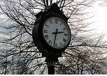 Manhasset Clock
The Matinecock had a village on Manhasset Bay. These Native Americans called the area Sint Sink, meaning "place of small stones".[4][5] They made wampum from oyster shells. In 1623 the area was claimed by the Dutch West India Company and they began forcing English settlers to leave in 1640. A 1643 land purchase made it possible for English settlers to return to Cow Neck (the peninsula where present-day Port Washington, Manhasset and surrounding villages).[6]
Manhasset Bay was previously known as Schout's Bay (a Schout roughly being the Dutch equivalent of a sheriff), Martin Garretson's Bay (Martin Garretson was the Schout at one point), and later Cow Bay or Cow Harbor.[5] Cow Neck was so called because it offered good grazing land. By 1659 there were over 300 cows and a five-mile (8 km) fence separating Cow Neck from the areas south of it. The settlers came to an agreement that each of them could have one cow on the neck for each section of fence the individual had constructed. The area was more formally divided among the settlers when the fence was removed in 1677. Manhasset took on the name Little Cow Neck, Port Washington was known as Upper Cow Neck.[6]
During the American Revolution, Little Cow Neck suffered at the hands of the British. Many structures and properties, such as the 1719 Quaker Meeting House were burned, seized or damaged. The Town of North Hempstead had separated from the Town of Hempstead in 1784 because the South was loyal to the king. The Northern towns and villages supported independence.[6]
In 1801 it cost 2 cents to travel between Roslyn and Spinney Hill on North Hempstead Turnpike, the newly opened toll road (now Northern Boulevard).[6]
The Manhasset name was adopted in 1840 and comes from the native word "Manhansett", meaning "island neighborhood". Dairy farming was still a major endeavor but the oyster industry was also on the rise. In 1898, the Long Island Railroad arrived, bringing with it wealthy New Yorkers looking for country homes with easy transportation to more urban areas of New York City.[6]
Manhasset Valley and the area called Spinney Hill attracted a number of skilled workers and immigrant families.[6]
The North Hempstead Town Hall opened in Manhasset on Plandome Road in 1907.[6] Town councilmen had previously been meeting in Roslyn taverns after North Hempstead split away from Hempstead in 1775.[7]
 Site of Plandome Road School
The Valley School, serving Manhasset's African American community, was closed in the 1960s by a desegregation lawsuit. The centrally located and antiquated Plandome Road School was demolished in the 1970s, having been replaced by the new Shelter Rock School.
Schools
 Manhasset High School
- Manhasset High School (public)
- Manhasset Middle School (public)
- Shelter Rock Elementary School (public)
- Munsey Park Elementary School (public)
- St Mary's Elementary School (private)
- St Mary's High School (private)
- Our Lady of Grace Montessori School (private)
The Manhasset School District covers not only the unincorporated areas discussed in the census reports, but several incorporated villages including Plandome, Plandome Manor, Munsey Park and part of Flower Hill. Manhasset High School is rated among the top in the country. In the 2010 Newsweek magazine's annual list of the top American high schools, Manhasset is ranked 87th nationally out of the 1,700 schools evaluated.[8]
Manhasset has a locally operated School Community Association (SCA) instead of electing to be a local chapter of the Parent Teacher Association. The SCA, which boasts great support within the community, annually hosts the SCA fair at Munsey Park School to raise money. Membership dues and profits from fund-raising efforts benefit the schools in Manhasset; no percentage of funds goes to a state or national offices of a larger organization, thus all monies raised benefit the Manhasset schools directly.[2]
Sports
Manhasset High School
- See Manhasset High School#Sports
St. Mary's
Economy
 Louis Vuitton Manhasset
Manhasset is well-known for its high-end premium open-air shopping center, the Americana Manhasset. The center is situated along Northern Boulevard's "Miracle Mile" which is referenced in Billy Joel's 1980 hit "It's Still Rock and Roll to Me". The Beastie Boys also mention the Miracle Mile in their song "Three MC's and One DJ" from the album Hello Nasty: "I rock from Manhattan to the Miracle Mile." The Americana first opened in 1956 as a simple community-style shopping mall; however, in the early 2000's gradually it catered to luxury boutiques such as Ralph Lauren, Williams-Sonoma, Brooks Brothers, Oilily, Prada, Giorgio Armani , Chanel, Louis Vuitton, Hermès, and Burberry, among others. In addition, a short distance away from the Miracle Mile is Lord & Taylor, which is historically the first branch store in America. In addition to Lord & Taylor, Manhasset has supported branches of some of the most well known stores in New York over the years – B. Altman and Company, Bonwit Teller, Abraham & Straus, Best & Co., Arnold Constable, Franklin Simon & Co., Peck & Peck, W. & J. Sloane and J.J. Newberry.
 Americana Manhasset
The old commercial center of Manhasset is situated around the railroad station on Plandome Road, where the LIRR connects directly into Manhattan for a 27-minute commute. The area has bakeries, pizzerias, delis, bars, coffee shops, an AT&T Cell Phone Store, and a movie theater. Centralized in town is a small park and a gazebo. The public library is more distant, having moved a block south of its location on Onderdonk Avenue to the corner of Onderdonk Ave. and Northern Boulevard, next door to the historic Quaker Meeting House.
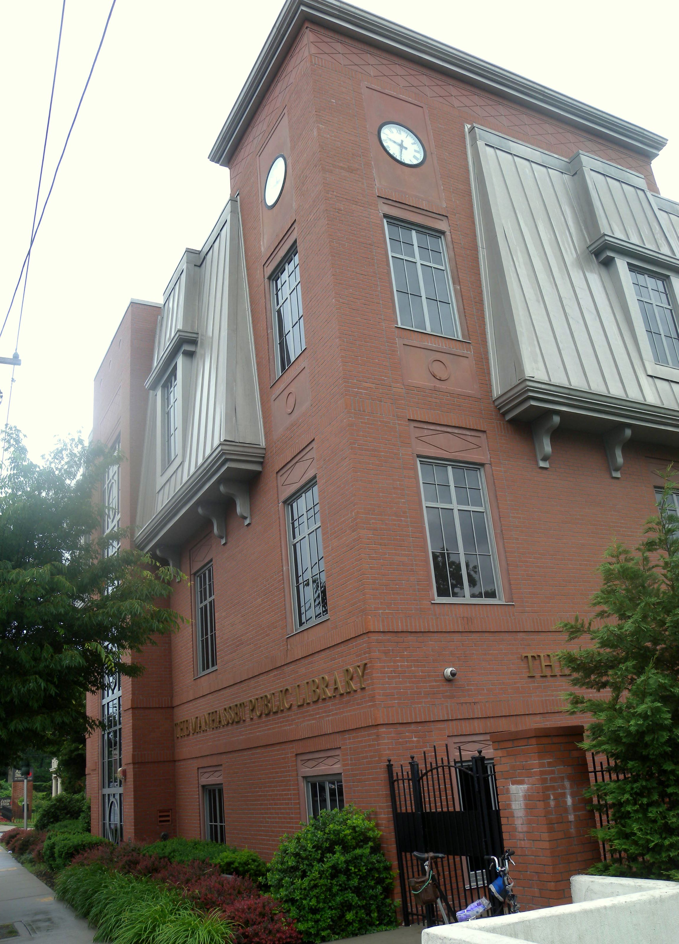
 New library
The North American headquarters of Sabena were located in a 36,000 square feet (3,300 m2) office building in Manhasset. In April 2002 Knightsbridge Properties Corp. bought the building for $4.9 million. Due to the bankruptcies of Sabena and Swissair, the real estate deal took over a year to finish. During that month the building was 30% occupied. Sabena was scheduled to move out of the building on May 10, 2002. The buyer planned to spend an additional $2 million to convert the building into a multi-tenant, Class A office and medical facility.[9]
References
Movie references
- Miracle on 34th Street (1947) − In the film, Fred Gailey tells Mr. Kringle that he would like to buy a colonial home in Manhasset [3].
- Boiler Room (2000) – Portions of the driving scenes feature noticeable areas of Manhasset
- The Good Shepherd (2006) − Portions of the movie were filmed in Manhasset. [4].
Television references
- The Good Wife - (2009) Portions of this show were filmed in Manhasset
- Jim Brown: All-American (2002) − Portions of the Spike Lee's HBO documentary were filmed in Manhasset.
- Made (2003) − Scenes from MTV's TV Series Made were filmed in Manhasset.
- Will & Grace – Karen states in one episode that she would like to use her helicopter to fly to Fortunoff's in Manhasset. (There is no Fortunoff in Manhasset).
- Saturday Night Live (1980) – A short film called Manhasset was presented. It was a parody of Woody Allen's Manhattan, with sweeping shots of the Miracle Mile instead of the Manhattan skyline.[10]
Literary references
- The Great Gatsby (1925) − The eastern shore of the Manhasset Bay was F. Scott Fitzgerald's inspiration for "East Egg".
- The Tender Bar (2005) − Coming of age memoir by J.R. Moehringer that takes place in Manhasset. [5]
International references
- Manhasset negotiations (2007-2008) - The Manhasset negotiations (also known as Manhasset I, II, III and IV) were a series of talks that took place in four rounds in 2007-2008 at Manhasset, New York between the Moroccan government and the representatives of the Saharawi liberation movement, the Polisario Front to resolve the Western Sahara conflict.
- Greentree Accord (2006) - Otherwise known as the Bakassi Accord was an agreement between Nigeria and Cameroon on the issue of the Bakassi peninsula. Presidents Olusegun Obasanjo and Paul Biya signed what is now being called the Greentree Accord, in regard to the location of the meeting in Manhasset, Long Island.
Notable residents/natives
- Bruce R. Bent – inventor of the money market fund
- Mike Breen – NBA play-by-play commentator
- Jim Brown – Hall of Fame football player.[11]
- Billy Crudup – actor, in movies such as Big Fish & Almost Famous.[12]
- Johnny Desmond – singer
- Peter Duchin – pianist, bandleader, and son of Eddy Duchin, bandleader
- Don Dunphy (1908–98) – television & radio sports announcer specializing in boxing broadcasts
- Melissa Errico – former ingenue in Broadway musicals/performer; married to Patrick McEnroe
- Boomer Esiason (born 1961) – former professional football player, and sports radio talk show host of WFAN's Boomer and Carton.[13]
- Jinx Falkenburg (1919–2003) – model and radio personality with husband Tex McCrary.[14]
- Peter T. Farrell (c. 1901–1992), judge who presided over the trial of bank robber Willie Sutton.[15]
- Mike Francesa – sports radio talk show host of WFAN's "Francesa on the FAN"
- John Gambling – radio personality
- Ray Goulding (1922–90) – radio personality, comedian, partner of Bob Elliott of "Bob and Ray" fame
- J. Peter Grace (1913–95) – former CEO of W.R. Grace and Company
- Al Groh (1944–) – former head coach of New York Jets and the University of Virginia
- Leroy Grumman (1895–1982) – founder of the Grumman Aircraft Corp
- Roy Harter (1973–) – recording artist/television & film composer
- Al Hodge (1912–79) – actor, in movies such as Captain Video and The Green Hornet
- Ken Howard (1944–) – actor, best known for the TV series The White Shadow[16]
- Chris Jericho – musician/WWE professional wrestler, who was "born in the backseat of my parents station wagon off the Jericho turnpike"
- Eric Junge – minor league baseball player
- Sean Landeta – professional football player
- Stephen A. Lesser – architect
- Nancy Lopez – professional golfer
- Jason Marquis – All Star starting pitcher for the Washington Nationals
- Jim McCann - founder and CEO of 1-800-Flowers
- Patrick McEnroe – former tennis player & US Davis Cup captain
- Justin Nozuka 1988 – singer songwriter
- George Nozuka 1986 – R&B/pop singer
- Philip Nozuka 1987 – actor
- Lucia Cifarelli 1970 – vocalist and keyboardist for industrial music group KMFDM
- Bill O'Reilly – television commentator and author
- William S. Paley – founder of CBS
- Joan Whitney Payson (1903–75) – American heiress, businesswoman, philanthropist, patron of the arts and art collector, and member of the prominent Whitney family; owner of the New York Mets.[17]
- José Reyes - professional baseball player for the New York Mets.[18]
- Bobby Riggs – professional tennis player
- Dwayne Roloson – professional hockey player
- Erika Slezak – actor, best known for her portrayal of "Vicki," on "One Life to Live," since March 17, 1971
- Elie Siegmeister – composer, educator and author
- Arthur Treacher (1894–1975) - actor
- John Hay "Jock" Whitney (1904–82) wealthy American socialites
- Payne Whitney (1876–1927) – wealthy businessman
References
- ^ "US Gazetteer files: 2010, 2000, and 1990". United States Census Bureau. 2011-02-12. http://www.census.gov/geo/www/gazetteer/gazette.html. Retrieved 2011-04-23.
- ^ "American FactFinder". United States Census Bureau. http://factfinder.census.gov. Retrieved 2008-01-31.
- ^ http://factfinder.census.gov/servlet/ACSSAFFFacts?_event=ChangeGeoContext&geo_id=16000US3644897&_geoContext=01000US%7C04000US36%7C16000US3641333&_street=&_county=manhasset&_cityTown=manhasset&_state=04000US36&_zip=&_lang=en&_sse=on&ActiveGeoDiv=geoSelect&_useEV=&pctxt=fph&pgsl=010&_submenuId=factsheet_1&ds_name=ACS_2009_5YR_SAFF&_ci_nbr=null&qr_name=null®=null%3Anull&_keyword=&_industry=
- ^ Manhasset Bay Protection Committee: Historical Background of Manhasset Bay
- ^ a b Proceedings of the New York State Historical Association: ... annual meeting with constitution and by-laws and list of members, Volume 6. New York State Historical Association, 1906. Retrieved June 7, 2010.
- ^ a b c d e f g Aronson, Harvey, ed. Home Town Long Island. (Newsday, 1999). ISBN 1885134215.
- ^ North Hempstead, New York
- ^ Newsweek Staff. "America's Best High Schools: The List." Newsweek. Sunday June 13, 2010.
- ^ Anastasi, Nick. "Knightsbridge Properties buys former Sabena HQ." Long Island Business News. Friday April 26, 2002. Retrieved on April 26, 2010.
- ^ Saturday Night Live Show 178
- ^ Holden, Stephen. "FILM REVIEW; Jim Brown as Football Legend, Sex Symbol and Husband", The New York Times, March 22, 2002. Accessed October 27, 2007. "At the age of 8 he moved to Manhasset, N.Y., where his mother worked as a domestic. It was at Manhasset High School that he became a football star and athletic legend."
- ^ Green, Jesse. "Billy Crudup: Almost Infamous", The New York Times, October 10, 2004. Accessed December 3, 2007. "That he was born of humans somewhere – Manhasset, on Long Island, the rumor goes – may be too far to speculate..."
- ^ Fabrikant, Geraldine. "TALKING MONEY WITH: BOOMER ESIASON; Quarterback Lets Adviser Call the Plays", The New York Times, April 26, 1998. Accessed November 20, 2007. "Mr. Esiason, 37, also owns a home in Manhasset, N.Y., on Long Island, worth an estimated $1.3 million, where he lives with his wife, Cheryl (the girlfriend he put through school), and their two children, Gunnar, 7, and Sydney, 5."
- ^ Obituaries, Manhasset Press, September 5, 2003. Accessed December 7, 2007. "Jinx Falkenberg McCrary of Mill Neck, longtime resident of Manhasset, died on Aug. 27 at the age of 84."
- ^ Pace, Eric. "Peter T. Farrell, 91; Judge Who Presided At the Sutton Trial", The New York Times, November 10, 1992. Accessed October 11, 2009.
- ^ Tarshis, Alex. "Hanging Out in the NBA TV Green Room With ... Ken Howard", NBA.com. Accessed November 23, 2007. "A native of Manhasset, N.Y., Howard had basketball in his blood well before "The White Shadow" debuted, having played in both high school and college, serving as the captain on his Amherst College team before he attended the Yale School of Drama."
- ^ Reif, Rita. "The Paysons' home on view", The New York Times, April 27, 1984. Accessed November 12, 2007. "JOAN WHITNEY PAYSON, the ebullient, highly visible owner of the New York Mets until her death in 1975, was the extremely private mistress of a 50-room, fieldstone mansion in Manhasset, L.I., that she and her industrialist husband, Charles Shipman Payson, filled with art, antiques, collectibles and souvenirs."
- ^ Red, Christian. "Move over, Derek Jeter: Jose Reyes is now New York's finest shortstop", New York Daily News, May 6, 2007. Accessed September 30, 2007. "Reyes and his girlfriend moved from a two-bedroom apartment in Queens to the comforts of a Manhasset, L.I. home last year."
External links
- Manhasset Chamber of Commerce
- Manhasset Community Website
- Manhasset Lacrosse Homepage
- Manhasset-Lakeville Volunteer Fire Department
- Manhasset Public Library
- Manhasset Press
- Americana Manhasset
- A detailed history of the town
- Keep Manhasset Beautiful
- Congregational Church of Manhasset
- Christ Episcopal Church
- Shelter Rock Church (non-denominational)
Town of North Hempstead, New York County Villages Baxter Estates · East Hills · East Williston · Floral Park · Flower Hill · Garden City · Great Neck · Great Neck Estates · Great Neck Plaza · Kensington · Kings Point · Lake Success · Manorhaven · Mineola · Munsey Park · New Hyde Park · North Hills · Old Westbury · Plandome · Plandome Heights · Plandome Manor · Port Washington North · Roslyn · Roslyn Estates · Roslyn Harbor · Russell Gardens · Saddle Rock · Sands Point · Thomaston · Westbury · Williston Park
Hamlets Albertson · Carle Place · Floral Park Centre · Garden City Park · Glenwood Landing · Great Neck Gardens · Greenvale · Harbor Hills · Herricks · Lakeville Estates · Manhasset · Manhasset Hills · New Cassel · New Hyde Park · North New Hyde Park · Port Washington · Roslyn Heights · Saddle Rock Estates · Searingtown · University Gardens
Website: northhempstead.comCategories:- Manhasset, New York
- Census-designated places in New York
- Hamlets in New York
- Populated places in Nassau County, New York
- Place names in New York of Native American origin


Wikimedia Foundation. 2010.