- Nassau County, New York
-
- There is also a Town of Nassau in Rensselaer County.
Nassau County, New York 
Flag
Seal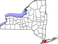
Location in the state of New York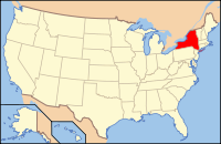
New York's location in the U.S.Founded 1899 Seat Mineola Area
- Total
- Land
- Water
453 sq mi (1,173 km²)
287 sq mi (743 km²)
166 sq mi (430 km²), 36.72%Population
- (2010)
- Density
1,339,532
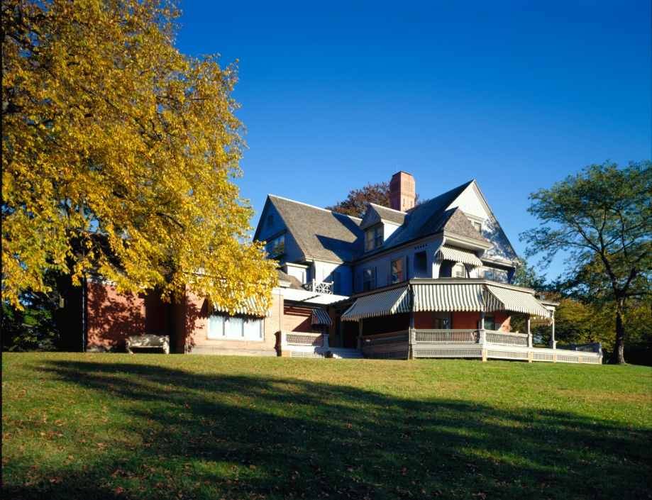
4,669/sq mi (1,802.8/km²)Website www.nassaucountyny.gov  Theodore Roosevelt home at Sagamore Hill
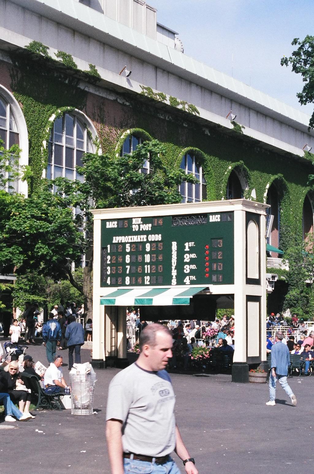
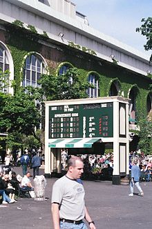 The elegant, ivy-framed arched windows of the Belmont Park grandstand in this 1999 photo. The current grandstand, Thoroughbred racing's largest, was completed in 1968 after five years of renovations to the Belmont complex.
Nassau County (pronounced /ˈnæsɔː/) is a suburban county on Long Island, east of New York City in the U.S. state of New York, within the New York Metropolitan Area. As of the 2010 census, the population was 1,339,532. The name of the county comes from an old name for Long Island, which was at one time named Nassau, after the Dutch Prince William of Nassau, Prince of Orange (who later also ruled as King William III of England.) The county colors, orange and blue, are also the colors of the House of Orange. Nassau's county seat is located in the village of Garden City, within the Mineola 11501 zip code.[1][2]
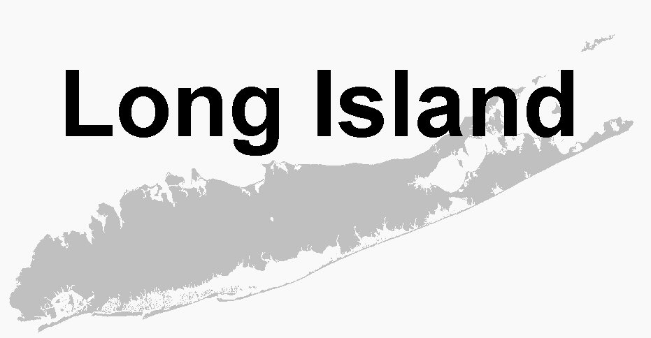
Nassau, together with Suffolk County to its immediate east, are generally referred to as "Long Island" by area residents — as distinct from the New York City boroughs of Queens (Queens County) and Brooklyn (Kings County), which are geographically on the island's westernmost end. Two cities, three towns, 64 incorporated villages, and numerous unincorporated hamlets are located within the county.
In 2010, Forbes magazine released its American Community Survey and named Nassau County number 11 in its list of the top 25 richest counties in America. The survey also named Nassau County the number one richest county per capita in the State of New York, with a median household income of $93,579.[3]
Contents
Name
Several alternate names had been considered for the county, including Matinecock (a village within the county currently has that name), Norfolk (presumably because of the proximity to Suffolk County), Bryant, and Sagamore. However, Nassau had the historical advantage of having at one time been the name of Long Island itself, and was the name most mentioned when the new county was proposed as early as 1876.
History
The area now designated Nassau County was originally the eastern 70% of Queens County, one of the original 12 counties formed in 1683, and was then contained within two towns: Hempstead and Oyster Bay.
In 1784, following the American Revolutionary War, the Town of Hempstead was split in two, when Patriots in the northern part formed the new Town of North Hempstead, leaving Loyalist majorities in the Town of Hempstead.
In 1898 the western portion of Queens County became a borough of the City of Greater New York, leaving the eastern portion a part of Queens County but not part of the Borough of Queens. As part of the city consolidation plan, all town and county governments within the borough were dissolved. The areas not part of the consolidation included all of the Town of North Hempstead, all of the Town of Oyster Bay, and most of the Town of Hempstead (excluding the Rockaway Peninsula, which was separated from the Town of Hempstead and became part of the city borough). In 1899, following approval from the state legislature, the three towns were separated from Queens County and the new county of Nassau was constituted.
In preparation for the new county, in November 1898, voters had selected Mineola to become the county seat for the new county[4] (before Mineola incorporated as a village in 1906 and set its boundaries almost entirely within the Town of North Hempstead), winning out over Hicksville and Hempstead.[5] The Garden City Company (founded in 1893 by the heirs of Alexander Turney Stewart)[6] donated four acres of land for the county buildings in the town of Hempstead, just south of the Mineola train station and the present day village of Mineola.[7][8] The land and the buildings have a Mineola postal address, but are within the present day Village of Garden City,[9] which did not incorporate, nor set its boundaries, until 1919.
In 1917,[10] the village of Glen Cove was granted a city charter, making it independent from the Town of Oyster Bay. In 1918, the village of Long Beach was incorporated in the Town of Hempstead. In 1922, it became a city, making it independent of the town. These are the only two cities in Nassau County.
The United Nations Security Council was temporarily located in Nassau County from 1946 to 1951. Council meetings were held at the Sperry Gyroscope headquarters in the village of Lake Success near the border with Queens County. It was here on June 27, 1950, that the Security Council voted to back U.S. President Harry S Truman and send a coalition of forces to the Korean Peninsula, leading to the Korean War.
In 1947, William Levitt built his first planned community in Nassau County, in the Island Trees section (later renamed Levittown). (This should not be confused with the county's first planned community, in general, which is Garden City). In later decades, communities such as Wantagh, East Meadow, Massapequa, Massapequa Park, and Franklin Square began to grow.
During the latter part of the 20th Century, Nassau County saw an influx of migrants from the five boroughs of New York City, especially Brooklyn and Queens, who left their urban dwellings for a more suburban setting. This led to a massive population boom in the county, especially on the south shore.
In 1994, Federal Judge Arthur Spatt declared the Nassau County Board of Supervisors unconstitutional and directed that a 19-member legislature be formed.[11] Elections were held and Republicans won 13 seats and elected Bruce Blakeman as its first Presiding Officer (Speaker).[12] Among the first class were current legislators Peter J. Schmitt, Judith Jacobs, John Ciotti, Dennis Dunne Sr., Francis X. Becker, Vincent T. Muscarella, and Current County Executive, Ed Mangano.
In the 1990s, Nassau County saw huge budget problems, forcing the county to near bankruptcy. The county government increased taxes to prevent a takeover by the state of New York. This has led to the county having notoriously high property taxes, leaving some migrants from New York City, who were seeking a suburban lifestyle, to move to Suffolk County, the Hudson Valley, New Jersey, Connecticut or Pennsylvania.
The economy has been booming and according to the United States Census Bureau, residents of Nassau County have among the highest per capita wealth in the country.[citation needed] Nassau County has also experienced heavy urbanization in many areas, including Hempstead, Freeport, Mineola and Westbury, leading some observers to say that parts of the county resemble the New York City boroughs outside Manhattan rather than being a suburb.[citation needed]
Despite its booming economy, on January 27, 2011, a New York State oversight board seized control of Nassau County’s finances, saying the wealthy and heavily taxed county had nevertheless failed to balance its $2.6 billion budgets.[13]
Law and government
The head of the county's governmental structure is the County Executive, a post created in Nassau County in 1938. The current county executive is Ed Mangano, a Republican who was elected in an upset victory over the prior County Executive Thomas R. Suozzi in 2009. The District Attorney is Democrat Kathleen Rice, who in November, 2005 defeated 30-year incumbent Republican Denis Dillon in an upset victory. The county comptroller is George Maragos, a Republican, the county clerk is Republican Maureen O'Connell, and the county assessor is an appointed position who serves at the pleasure of the County Executive.
Nassau County Executives Name Party Term J. Russell Sprague Republican 1938–1953 A. Holly Patterson Republican 1953–1962 Eugene Nickerson Democrat 1962–1970 Ralph G. Caso Republican 1970–1978 Francis T. Purcell Republican 1978–1987 Thomas Gulotta Republican 1987–2001 Thomas Suozzi Democrat 2002–2009 Ed Mangano Republican 2010–present The county legislature has 19 members. There are eleven Republicans, eight Democrats.
Nassau County Legislature District Legislator Party 1 Kevan Abrahams Democrat 2 Robert Troiano Democrat 3 John Ciotti Republican 4 Denise Ford Republican 5 Joseph Scannell Democrat 6 Francis X. Becker, Jr. Republican 7 Howard Kopel Republican 8 Vincent Muscarella Republican 9 Richard Nicolello Republican 10 Judi Bosworth Democrat 11 Wayne H. Wink, Jr. Democrat 12 Peter J. Schmitt, presiding officer Republican 13 Norma L. Gonsalves Republican 14 Joseph V. Belesi Republican 15 Dennis Dunne, Sr. Republican 16 Judith Jacobs Democrat 17 Rose Marie Walker Republican 18 Diane Yatauro, minority leader Democrat 19 David Denenberg Democrat Law enforcement
Main article: Nassau County Police DepartmentCounty police services are provided by the Nassau County Police Department. The cities of Glen Cove and Long Beach, as well as a number of villages are not members of the county police district and maintain their own police forces. The following village police departments exist in Nassau County: Centre Island, Floral Park, Freeport, Garden City, Great Neck Estates, Hempstead, Kensington, Kings Point, Lake Success, Lynbrook, Malverne, Muttontown, Old Brookville (Old Brookville P.D. provides police protection for Old Brookville, Brookville, Upper Brookville, Matinecock, Mill Neck and Cove Neck), Old Westbury, Oyster Bay Cove, Rockville Centre and Sands Point. The Port Washington Police Department is not a village department but is authorized by a special district, the only such district in New York State[citation needed]. These smaller forces, however, make use of such specialized county police services as the police academy and the aviation unit. Also, all homicides in the county are investigated by the county police, regardless of whether or not they occur within the police district.
On June 1, 2011, the Muttontown Police Department commenced operations. The Old Brookville Police formerly provided police services to the Village of Muttontown.
In 2006, village leaders in the county seat of Mineola expressed dissatisfaction with the level of police coverage provided by the county force and actively explored seceding from the police district and having the village form its own police force. A referendum on December 5, 2006, however, decisively defeated the proposal.[14]
Since the Long Island State Parkway Police was disbanded in 1980, all of Nassau County's state parkways have been patrolled by Troop L of the New York State Police. State parks in Nassau are patrolled by the New York State Park Police. In 1996, the Long Island Rail Road Police Department was consolidated into the Metropolitan Transportation Authority Police. The MTA Police patrol Long Island Rail Road tracks, stations and properties. The New York State Department of Environmental Conservation Police provides enforcement of state environmental laws and regulations. The State University of New York Police provides enforcement for SUNY Old Westbury.
The Nassau County Police Department posts the mug shots of DWI offenders as press releases on their website. This practice has come under the scrutiny of residents, media, and those pictured in these press releases. This practice has been criticized as being able to cost potential employees, students, or public figures their positions.[15]
County correctional services and enforcement of court orders are provided by the Nassau County Sheriff's Department. New York State Court Officers provide security for courthouses.
Politics
Main article: Politics of Long IslandPresidential elections results Year Republican Democrat 2008 45.9% 293,758 53.4% 337,067 2004 46.6% 288,355 52.2% 323,070 2000 38.5% 226,954 57.9% 341,610 1996 36.1% 196,820 55.7% 303,587 1992 40.5% 246,881 46.4% 282,593 1988 57.0% 337,430 42.2% 250,130 1984 61.8% 392,017 38.0% 240,697 1980 56.0% 333,567 34.8% 207,602 1976 53.7% 329,176 47.6% 302,869 1972 63.3% 438,723 36.5% 252,831 1968 51.3% 329,792 43.3% 278,599 1964 39.4% 248,886 60.5% 382,590 1960 55.1% 324,255 44.8% 263,303 Like neighboring Suffolk County, Nassau County residents primarily supported the Republican Party in national elections until the 1990s. That decade, it began to shift toward the Democratic Party. Democrat Bill Clinton carried the county in the presidential elections of 1992 and 1996. Later Nassau voters gave a large margin of victory to Al Gore in 2000 (19.4%), but John Kerry's winning margin in 2004 was considerably slimmer (5.6%). In that election, Kerry won the towns of Hempstead and North Hempstead, but lost the Town of Oyster Bay.
Democratic strength is chiefly concentrated in the central, certain southern areas, and northern part of the county. This includes the south eastern Village of Freeport which is roughly sixty-eight percent Democrat, central areas near the Village of Hempstead and Uniondale, where there are large middle-class populations as well as the affluent northern half of the county. This includes Great Neck, Glen Cove and Roslyn. There are also staunch Democratic pockets in the equally affluent Five Towns area in the southwest part of the county and in Long Beach.
Republican voters are chiefly concentrated in the more suburban areas of the county. The middle class southeastern portion of the county is heavily Republican, and communities such as Massapequa, Seaford, Wantagh, Levittown, Bethpage, and Farmingdale are the political base of Congressman Peter T. King. In the western portion of the county, wealthy Garden City is solidly Republican, as is the more middle-class community of Floral Park.
Areas of the county containing large numbers of swing voters are in East Meadow, Mineola, Oceanside and Rockville Centre.
Long Island's only Republican member of Congress, Representative Peter T. King, is from Nassau County. His 3rd District includes heavily populated suburban neighborhoods like Long Beach, Massapequa, Levittown, Hicksville, Seaford, Wantagh, and Farmingdale. But Nassau County is also home to the popular gun control advocate, Democrat Carolyn McCarthy, whose 4th District includes Garden City, Carle Place, Hempstead, Uniondale, East Meadow, Valley Stream, Franklin Square, West Hempstead and portions of the Village of Freeport and Rockville Centre. McCarthy defeated Republican congressman Dan Frisa in 1996 and has held the seat since.
Nassau County's other two congressmen are both Democrats. Representative Gary Ackerman, represents the 5th District, which includes the northwestern part of the county, including Great Neck, Sands Point, and Port Washington, and stretches into northeastern Queens. Steve Israel's 2nd District is mainly in Suffolk County, but also includes parts of Plainview, Old Bethpage, Jericho, Syosset, and Woodbury in Nassau County.
All of Nassau County's state senators were Republicans until February 2007 when Nassau County Legislator Craig Johnson was elected to the State Senate in a special election in the 7th district. The Democrats added another seat during the 2008 election, so the Republicans now have a 7-2 advantage in the State Senate on Long Island. The two Democratic seats though were regained by the GOP in the fall of 2010. Long Island's 9 state senators became Republican again at the start of the 2011-2012 legislative term in January 2011. With Craig Johnson's loss to Jack Martins, the Senate also once has a GOP majority.
Geography
Further information: List of municipalities on Long Island and List of places in Nassau County, New YorkNassau County occupies a portion of Long Island immediately east of the New York City borough of Queens. It is divided into two cities and three towns, the latter of which contain 64 villages and numerous hamlets.
According to the U.S. Census Bureau, the county has a total area of 453 square miles (1,173 km²) of which 287 square miles (743 km²) of it is land and 166 square miles (431 km²) of it (36.72%) is water.
Between the 1990 census and the 2000 census, the county exchanged territory with Suffolk County and lost territory to Queens County.[16]
Adjacent counties
- Bronx County, New York - west-northwest, water boundary only, across Long Island Sound
- Fairfield County, Connecticut - north, water boundary only, across Long Island Sound
- Queens County, New York - west
- Suffolk County, New York - east
- Westchester County, New York - northwest, water boundary only, across Long Island Sound
National protected areas
- Oyster Bay National Wildlife Refuge
- Sagamore Hill National Historic Site
Demographics
Historical populations Census Pop. %± 1900 55,448 — 1910 83,930 51.4% 1920 126,120 50.3% 1930 303,053 140.3% 1940 406,748 34.2% 1950 672,765 65.4% 1960 1,300,171 93.3% 1970 1,428,080 9.8% 1980 1,321,582 −7.5% 1990 1,287,348 −2.6% 2000 1,334,544 3.7% 2010 1,339,532 0.4% [17] As of the census[18] of 2010, there were 1,339,532 people, 447,387 households, and 347,172 families residing in the county. The population density was 4,655 people per square mile (1,797/km²). There were 458,151 housing units at an average density of 1,598 per square mile (617/km²). The racial makeup of the county was 65.5% White , 14.1% African American, 0.2% Native American, 7.6% Asian (3.0% Indian, 1.8% Chinese, 1.0% Korean, 0.7% Filipino, 0.1% Japanese, 0.1% Vietnamese, 0.9% Other Asian), 0.03 Pacific Islander, 3.5% from other races, and 2.4% from two or more races. Hispanic or Latino of any race were 14.6% of the population.
As of 2000, there were about 207,000 Jewish people in Nassau County,[19] representing 15.5% of the population, (as compared to 2.0% of the total U.S. population). Italian Americans make up a large portion of Nassau. The top 5 ancestries are 23% Italian, 14% Irish, 7% German, 5% American and 4% Polish. According to the Census Bureau, the population of the county has slightly decreased to 1,351,625 people in 2008, although it had increased to 1,356,867 in 2004.[20] The county population was at its greatest for the 1970 Census.
There were 447,387 households, out of which 35.30% had children under the age of 18 living with them, 63.10% were married couples living together, 10.90% had a female householder with no husband present, and 22.40% were non-families. 18.80% of all households were made up of individuals and 9.40% had someone living alone who was 65 years of age or older. The average household size was 2.93 and the average family size was 3.34.
In the county the population was spread out with 24.70% under the age of 18, 7.30% from 18 to 24, 28.90% from 25 to 44, 24.00% from 45 to 64, and 15.00% who were 65 years of age or older. The median age was 38 years. For every 100 females, there were 92.80 males. For every 100 females age 18 and over, there were 89.00 males.
The median income for a household in the county was $72,030, and the median income for a family was $81,246 (these figures had risen to $87,658 and $101,661 respectively as of a 2007 estimate[21]). Males had a median income of $52,340 versus $37,446 for females. The per capita income for the county was $32,151. About 3.50% of families and 5.20% of the population were below the poverty line, including 5.80% of those under age 18 and 5.60% of those age 65 or over.
The New York Times cited a 2002 study by the non-profit group ERASE Racism, which determined that Nassau, and its neighboring county, Suffolk, are the most de facto racially segregated suburbs in the United States.[22]
Colleges and universities
Nassau County is home to numerous colleges and universities, including Adelphi University, Molloy College, Briarcliffe College, New York Institute of Technology, SUNY Old Westbury, Nassau Community College, Hofstra University, C.W. Post Campus of Long Island University, United States Merchant Marine Academy, and Webb Institute.
Sports
Nassau County is home to the New York Islanders of the National Hockey League, who play at the Nassau Veterans Memorial Coliseum in Uniondale.
It is also the home of F.C. New York of the United Soccer Leagueswhich folded after their inaugural season, and the Long Island Lizards of Major League Lacrosse.
County symbols
- County bird: Osprey
- County flower: Birdsfoot Violet (Viola pedata)
See also
- Metropolitan Suburban Bus Authority (MSBA) MTA Long Island Bus
- Nassau County Police Department
- Nassau County Sports Commission
- List of counties in New York
- National Register of Historic Places listings in Nassau County, New York
- List of Long Islanders
References
- ^ Nassau County Atlas, 6th Large Scale Edition, Hagstrom Map Company, Inc., 1999
- ^ Toy, Vivian S. (2003-03-30). "For Sale: Nassau's County Seat". The New York Times. http://www.nytimes.com/2003/03/30/nyregion/for-sale-nassau-s-county-seat.html?pagewanted=all?pagewanted=all. "The county's properties all have mailing addresses in Mineola, the official county seat, but are actually within Garden City's boundaries."
- ^ [1], Forbes.com, March 4, 2010
- ^ "Mineola Chosen Nassau County's Seat". New York Times. 1898-11-10. http://query.nytimes.com/gst/abstract.html?res=9506EEDA1F3DE433A25753C1A9679D94699ED7CF. Retrieved 2010-06-06.
- ^ "County of Nassau Elections". New York Times. 1898-09-01. http://query.nytimes.com/gst/abstract.html?res=9A02EEDE1438E433A25752C0A96F9C94699ED7CF&scp=3&sq=mineola+%22county+seat%22&st=p. Retrieved 2010-06-06.
- ^ "Incorporated Village of Garden City: History". Incorporated Village of Garden City. http://www.gardencityny.net/history1.htm. Retrieved 2010-06-06.
- ^ "Sites for Nassau County Buildings". New York Times. 1898-09-29. http://query.nytimes.com/gst/abstract.html?res=9F00EEDB1F3DE433A2575AC2A96F9C94699ED7CF&scp=1&sq=nassau+%22county+seat%22+garden+city&st=p. Retrieved 2010-06-06.
- ^ "The History of Nassau's County Seat". rootsweb. http://www.rootsweb.ancestry.com/~nynassa2/populationsurvey2.htm. Retrieved 2010-06-06.
- ^ Fischler, Marcelle S (1998-11-15). "An Immigrant's Vision Created Garden City". The New York Times. http://www.nytimes.com/1998/11/15/nyregion/an-immigrant-s-vision-created-garden-city.html?pagewanted=all. Retrieved 2010-06-06.
- ^ Antonia Petrash, Carol Stern, and Carol McCrossen. "HISTORY OF GLEN COVE". http://www.nassaulibrary.org/glencove/History%20of%20Glen%20Cove.html.
- ^ McQuiston, John T. "Judge Says He Will Create a Nassau Legislature on His Own if Supervisors Fail to Act", The New York Times, June 9, 1994. Accessed December 11, 2007.
- ^ McQuiston, John T. "Amid Pomp, Nassau County Inaugurates Its Legislature", The New York Times, January 13, 1996.
- ^ "New York State Takes Control of Nassau’s Finances". New York Times. 27 January 27, 2011. http://www.nytimes.com/2011/01/27/nyregion/27nassau.html?hp. Retrieved 2011-01-27.
- ^ Residents Make Statement Against Village Police Department, Mineola American, December 15, 2006
- ^ Nassau County Should be Ashamed, The Statesman, October 20, 2008
- ^ "New York: 2000 Population and Housing Unit Counts". September 2003. p. III-9. http://www.census.gov/prod/cen2000/phc-3-34.pdf. Retrieved 2010-12-22.
- ^ http://factfinder2.census.gov
- ^ "American FactFinder". United States Census Bureau. http://factfinder.census.gov. Retrieved 2008-01-31.
- ^ "County Membership Report: Nassau County, New York". Association of Religious Data Archives. http://www.thearda.com/mapsReports/reports/counties/36059_2000_Rate.asp. Retrieved 22 October 2010.
- ^ "US Census Bureau population estimate by county". 2009. http://www.census.gov/popest/counties/files/CO-EST2008-POPCHG2000_2008-36.csv. Retrieved 2010-02-23.
- ^ Nassau County, New York
- ^ Lambert, Bruce (2002-06-05). "Study Calls L.I. Most Segregated Suburb". The New York Times. http://www.nytimes.com/2002/06/05/nyregion/study-calls-li-most-segregated-suburb.html?pagewanted=1. Retrieved 2010-05-11.
External links
Part of the article series on

Topics
Geography
History
Economy
Transportation
Politics
Music
People
Popular culture
Recreation
Law enforcementRegions
Nassau County
Suffolk County
(Brooklyn, Queens)
Municipalities
North Shore · South Shore
North Fork · South Fork
Long Island Sound · Barrier islands