- Shelter Island (town), New York
Infobox Settlement
official_name = Shelter Island, New York
settlement_type = Town
nickname =
motto =
imagesize = 250px
image_caption =
image_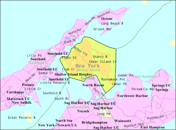
mapsize = 250px
map_caption =
pushpin_
mapsize1 =
map_caption1 =subdivision_type = Country
subdivision_name =United States
subdivision_type1 = State
subdivision_name1 =New York
subdivision_type2 = County
subdivision_name2 = Suffolk
government_footnotes =
government_type =Civil Township
leader_title = Supervisor
leader_name = James Dougherty
leader_title1 =
leader_name1 =
established_title =
established_date =unit_pref = Imperial
area_footnotes =
area_magnitude =
area_total_km2 = 70.2
area_land_km2 = 31.4
area_water_km2 = 38.7
area_total_sq_mi = 27.1
area_land_sq_mi = 12.1
area_water_sq_mi = 15.0population_as_of = 2000
population_footnotes =
population_total = 2228
population_density_km2 = 70.9
population_density_sq_mi = 183.6timezone = Eastern (EST)
utc_offset = -5
timezone_DST = EDT
utc_offset_DST = -4
elevation_footnotes =
elevation_m = 17
elevation_ft = 56
latd = 41 |latm = 4 |lats = 41 |latNS = N
longd = 72 |longm = 21 |longs = 3 |longEW = Wpostal_code_type =
ZIP code
postal_code = 11965
area_code = 631
blank_name = FIPS code
blank_info =
blank1_name = GNIS feature ID
blank1_info = 0965037
website = http://www.shelterislandtown.us/
footnotes =Shelter Island is a town at the eastern end of
Long Island in theU.S. state ofNew York . It forms the tip of Suffolk County and is separated from the rest of the county by water. The population was 2,228 at the 2000 census.Geography
Shelter Island is nestled between the North and South Forks of
Long Island . The island is surrounded on three sides byShelter Island Sound . The fourth side, on the east, is adjacent toGardiners Bay . It can be reached viaferry from Greenport to the north (approximately 15-minute trip) or from North Haven to the south (approximately 5-minute trip).New York State Route 114 runs through the island.The island is around 8,000 acres (32 km²) in size. However, vast tracts are protected wetlands nature preserve marshland. Nearly one-third of the island is owned by
The Nature Conservancy and kept in a forever-wild state. The Preserve has four nature and bird-watching trails, varying in length from convert|1.5|mi|km to convert|11|mi|km, as well as a barrier-free Braille trail for the visually impaired.According to the
United States Census Bureau , Shelter Island has a total area of 27.1 square miles (70.2 km²), of which, 12.1 square miles (31.4 km²) of it is land and 15.0 square miles (38.7 km²) of it (55.20%) is water.Demographics
As of the
census GR|2 of 2000, there were 2,228 people, 996 households, and 656 families residing in the town. However, during the summer months the population can exceed 8,000. Thepopulation density was 183.6 people per square mile (70.9/km²). There were 2,370 housing units at an average density of 195.3/sq mi (75.4/km²). The racial makeup of the town was 96.32% White, 0.72% Black or African American, 0.04% Native American, 0.49% Asian, 0.09% from other races, and 2.33% from two or more races. Hispanic or Latino of any race were 2.38% of the population.There were 996 households out of which 20.3% had children under the age of 18 living with them, 56.1% were married couples living together, 7.2% had a female householder with no husband present, and 34.1% were non-families. 28.8% of all households were made up of individuals and 17.8% had someone living alone who was 65 years of age or older. The average household size was 2.24 and the average family size was 2.75.
In the town the population was spread out with 18.1% under the age of 18, 4.0% from 18 to 24, 20.1% from 25 to 44, 29.1% from 45 to 64, and 28.6% who were 65 years of age or older. The median age was 49 years. For every 100 females there were 91.9 males. For every 100 females age 18 and over, there were 90.8 males.
The median income for a household in the town was $53,011, and the median income for a family was $63,750. Males had a median income of $41,508 versus $36,316 for females. The
per capita income for the town was $30,346. About 4.7% of families and 7.7% of the population were below thepoverty line , including 14.0% of those under age 18 and 1.4% of those age 65 or over.Communities and locations
Villages (incorporated)
* Dering Harbor, on the north side of the island.
Hamlets (unincorporated)
* "Montclair Colony", on the south side of the island.
* Shelter Island, the hamlet of Shelter Island.
* Shelter Island Heights, on the north side of the island.
* "Silver Beach", on the southwest side of the island.
* "Westmoreland", on the west side of the island.Geographic features
* "Coecles Harbor", an inlet on the east side of the island.
* "Smith Cove", an inlet on the south side of the island.
* "West Neck Harbor", an inlet at the southwest end of the island.
* "Located on Long IslandHistory
Early settlers
Shelter Island was part of the original
Plymouth Company land grant made byJames I of England in 1620 to theEarl of Stirling . In 1651 it was sold to a group ofBarbados sugar merchants for 1,600 pounds of sugar.Nathaniel Sylvester (1610-1680), one of the merchants, was the island’s first white settler. On March 23, 1652, he made the purchase official by agreement with “Yoki” (called “Pogatticut”) who was the sachem of the Manhanset tribe. The other owners, Sylvester’s brother, Constant, and Thomas Middleton, never came toLong Island . In 1673 Nathaniel Sylvester claimed ownership of Shelter Island,Fishers Island , and other parts of Long Island. [Helen Otis Lamont, "The Story of Shelter Island in the Revolution", The Shelter Island Historical Society, 1975, p. 3]In 1652 Sylvester constructed a house on the island for his 16-year-old bride, Grissel Brinley. The manor house was rebuilt by his descendants about 1733. Sylvester Manor exists today, just off
New York State Route 114 . The Sylvesters gave shelter to many persecutedQuakers .Following the death in 1680 of Nathaniel Sylvester, Shelter Island was divided among his two sons, Giles and Nathaniel II. In 1695, William Nicoll, a resident of Islip, bought from Giles the area now called Mashomack Nature Preserve. Three years later, in 1698, another newcomer, George Havens, bought convert|1000|acre|km2 from Nathaniel II. This parcel comprises what today is the Center and stretched south to South Ferry and west to West Neck Creek. Over time these estates and parcels were split and divided by marriage and purchase so that by the early 1700s there were 20 families living on Shelter Island. By order of the Provincial Government, the town of Shelter Island was established in 1730. The community developed from there. [Helen Otis Lamont, "The Story of Shelter Island in the Revolution", The Shelter Island Historical Society, 1975, p. 3]
Colonial era
James Nicoll Havens , a member of theNew York Provincial Congress , built a home on the island in 1743. He was the first town supervisor on the island. His home is still on the island and is owned by the local historical society.Jonathan Nicoll Havens (1757-1799), born on Shelter Island, was a member of theFirst Continental Congress in 1774. He also served in New York’s delegation that approved the federal constitution in 1788. Mashomack Forest (today Mashomack Nature Preserve) was owned by the Nicolls family for 230 years. A few Native Americans still lived in the wooded Sachem’s Neck area up until the 1790s. Nicolls Creek carries the family name.Shelter Island had brushes with early Colonial military activity:
*The British shipped hay from Hay Beach during theAmerican Revolution .
*The schooner "Paragon" was built on the island at Lord’s Shipyard, located on West Neck Creek. In 1804 it successfully ran a blockade during theNapoleonic Wars under Capt. Sam Lord.
*During theWar of 1812 , the British ransacked numerous homes on the island.The first ferryboat to serve the island was run by the Boisseau family at Stearns Point, nearby Crescent Beach. The North Ferry began service to
Greenport in 1868.helter Island Heights established
Shelter Island Heights started in 1871 as a summer resort developed by the Shelter Island Grove and Camp Meeting Association of theMethodist Episcopal Church . A group ofBrooklyn businessmen purchased theFrederick Chase estate. For eight years the camp meetings took place on the island, before moving to Jamesport. During this time, the Union Chapel was erected in 1875, designed byRobert Morris Copeland . In 1984 it was added to theNational Register of Historic Places . Shelter Island Heights was a planned development by Copeland. The houses that were built here were in classic American styles:Stick-Eastlake ,Queen Anne Style , andColonial Revival . In the eight years from 1872 to 1880 about 70 summer cottages were built in the Heights. By 1890 the district was well-defined; it has not changed much since then. Shelter Island Heights was listed on both the United States Register and the New York State Register of Historic Places in 1993. [http://www.shelter-island.org/heights.html Shelter Island Heights Historical District]At the turn of the Century, fish processing plants were still on the island. One was located at the end of Burns Road, another on Big Ram Island, off what is today Tuthill Road. Summer residents could be brought to the island by steam ferries from New York City.
White Hill is the name of the hill that is above the North Ferry landing in Shelter Island Heights. At one time the Prospect Hotel was there, it burned down, was rebuilt, and was destroyed by fire a second time in 1942. Today it is a town park.
Growth after 1900
Francis Marion Smith (1846-1931) was known as the “Borax King ” for his mining successes. Smith and his family bought a home on the island in 1892. He expanded it to more than 30 rooms and called his estate Presdeleau. By 1906 he owned more than convert|500|acre|km2 on the south side of the island. Today, Smith Cove and Smith Street carry on his name. The remains of his property are reinforced concrete retaining walls and a footbridge, built byErnest L. Ransome about 1898, behind Merkle Lane. Smith also shipped in deer from California to hunt on his “deer park”; the descendants are still on the island.Another 19th Century millionaire who had an estate on Shelter Island was Artemas Ward (1848-1925), a pioneer in mass-market advertising. Ward made millions by monopolizing all advertising on New York City elevated trains, subways, and streetcars. Ward had a large estate on the south side of the island. Ward wrote a biography of his great-grandfather, Major General
Artemas Ward (1727-1800), a commander in theAmerican Revolutionary War . Ward’s house still stands on Shelter Island.Following
World War I , development slowly crept onto the island. Summer camps were started in the 1920s, including Camp Quinipet, aUnited Methodist Church camp and retreat center on Rocky Point Road. On West Neck Harbor, developers Albert and Fred Dickerson built houses on what is today called Montclair Colony. Homes were built on Silver Beach, Ram Island, and Hilo Farms.Following the Depression, some of the summer cottages were abandoned or left to rot. Recovery was slow, and it was not until after
World War II that summer residents started returning in larger numbers. During the 1950s a farm cooperative grew lima beans on the island. This was the end of commercial farming on Shelter Island.In the 1960s and 1970s more families started to move to Shelter Island and become year-round residents. The Gerard family owned the property at Sachem’s Neck that had once belonged to the Nicoll family for more than 200 years, and later to financier
Otto Kahn . Developers eyed the convert|2000|acre|km2. However, the land was purchased by TheNature Conservancy to keep the land a nature park in perpetuity; half of the funds to buy the forest was raised on the island to create Mashomack Preserve. The Preserve was acquired by The Nature Conservancy in January 1980.Today, there are many Shelter Island residents who have family roots dating to island families of the
American Revolution . Some summer residents are fifth generation seasonal visitors.Politics
Shelter Island has been known as a center for political conservatism on
Long Island . Residents have consistently voted Republican. In the 1996 presidential election, it was the only town on Long Island to vote forBob Dole . However, in 2004,John Kerry became the first Democrat in recent history to win Shelter Island, even though he failed to receive as many votes asAl Gore did four years earlier throughout Long Island.Religion
There are six places of worship on Shelter Island:
*Grace Evangelical Church, non-denominational, Shelter Island Public Library basement, 37 North Ferry Road.
*Our Lady of the Isle,Roman Catholic , 5 Prospect Avenue, inShelter Island Heights . Founded in 1907.
*Shelter Island Friends Meeting,Quakers , Sylvester Manor, 116 North Ferry Road (May-October), Havens House, 16 South Ferry Road (November-April)
*Shelter Island Presbyterian Church, 32 North Ferry Road
*St. Mary's Episcopal Church, 26 St. Mary's Road
*Union Chapel in the Grove, interdenominational, Bay Avenue, inShelter Island Heights . Open June-September.There is a Methodist camp, Camp Quinipet, on the northwestern tip of the island. It is used as a camp in the summer and as a retreat center for churches throughout the year.
Cemeteries
There are five cemeteries on Shelter Island:
*Emily F. French Memorial Cemetery, Thomas Street
*Our Lady of the Isle Cemetery,Roman Catholic , Manhanset Road
*Quaker Cemetery,Quakers , near Gardiner’s Creek/Friends Meeting House
*St. Mary's Episcopal Church Cemetery, 26 St. Mary’s Road
*Shelter Island Churchyard Cemetery,New York State Route 114 Notable residents
Shelter Island has been the home for many notable residents, both fulltime and part-time homeowners. Among them:
*
Faith Baldwin (1893-1978) -- American-bornromance novel author. She penned about 100 books from 1925 until her death. Baldwin was also part of theFamous Writers School . Before World War II, Baldwin spent time in a Shelter Island cottage in what was called Hilo Farms.*
Hugh Carey (1919- ) -- American-born politician and attorney. Beginning in 1960, Carey served seven terms in theUnited States House of Representatives as a Democrat. He served two full terms as the governor of theState of New York from 1975-1982. After he left public service Carey joined a law practice inNew York City . Carey owns a large property in the Shorewood section.*
Amanda Clark -- American-born competitive sailor. Clark is a native of Shelter Island and started racing on the island. She and her teammate,Sarah Mergenthaler , compete in the women's470 (dinghy) event. In 2006 they finished first place in the United States Pre-Olympic Trials. They represented the United States at the 2008Olympic Games in Beijing, China, but did not earn medal. [ [http://www.teamgosail.org Team GO Sail 2008 ] ] Clark and her husband, Greg Nissen, are the directors ofCamp Quinipet on the island.*
Simon Doonan -- English-born creative director of Barney’s. Newspaper columnist and author of "Confessions of a Window Dresser, Nasty: My Family and Other Varmints", and "Wacky Chicks: Life Lessons from Fearlessly Inappropriate and Fabulously Eccentric Women".*
Otto Kahn (1867-1934) -- German-born financier. Beginning in 1924, Kahn owned property in what is now Mashomack Nature Preserve.*
Julie Kavner (1950- ) -- American-born actress. She has appeared in severalWoody Allen -directed films. Kavner won anEmmy award for being the voice ofMarge Simpson .*
Robert Lipsyte (1938- ) -- American-born sportswriter for "The New York Times ". Also a successful author of books for young readers, including "Raiders Night, The Contender, The Brave, The Chief", and "Warrior Angel". Lipsyte won anEmmy award for the public affairs show "The Eleventh Hour".*
Daniel Thomas Moran -- Suffolk County,New York poet laureate. [ [http://www.danielthomasmoran.net/ Daniel Thomas Moran ] ]*
Itzhak Perlman (1945- ) -- Israeli-bornviolinist andGrammy Award winner. He has performed throughout the world as a soloist. In 1996 Perlman and his wife, Toby, founded thePerlman Music Program on Shelter Island. It offers gifted young string players a summer residential course inchamber music . The students perform regular concerts on the island.*
Leon Uris (1924-2003) -- American-born novelist. His first novel, "Battle Cry", was based on his own experiences in theMarine Corps . Among his bestsellers were "Redemption, Trinity, Exodus, QB VII", and "Topaz", among others. Uris passed away in June 2003 at his Shelter Island home on Chase Creek.In popular culture
* Author
John Steinbeck began his 1960 cross-country journey by leaving his home inSag Harbor and driving to Shelter Island. This was the start of the trip that became his book "". He took both the South and North ferries viaNew York State Route 114 . [ [http://www.steinbeck.org National Steinbeck Center: John Steinbeck, American Author ] ]* The feature film "
Margot at the Wedding " was shot in the spring of 2006 in various New York locations including, Shelter Island. [ [http://www.margotatthewedding.com Margot At The Wedding ] ]References
External links
* [http://www.shelterislandtown.us/ Town of Shelter Island (official site)]
* [http://www.Shelter-Island.org Shelter Island (island guide and history)]
* [http://www.shelterislandhistsoc.org/ Shelter Island Historical Society]
* [http://www.sireporter.com/ Shelter Island Reporter]
* [http://www.southferry.com South Ferry Company]
* [http://www.northferry.com North Ferry Company]

Wikimedia Foundation. 2010.