- Riverhead (town), New York
Infobox Settlement
name = Riverhead
official_name = Town of Riverhead
settlement_type = Town
nickname =
motto =
imagesize =
image_caption =
image_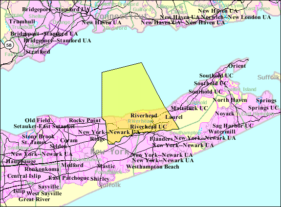
mapsize = 250x200px
map_caption =
pushpin_
mapsize1 =
map_caption1 =subdivision_type = Country
subdivision_name =United States
subdivision_type1 = State
subdivision_name1 =New York
subdivision_type2 = County
subdivision_name2 = Suffolk
government_footnotes =
government_type =Civil Township
leader_title = Supervisor
leader_name = Phil Cuntinale
leader_title1 =
leader_name1 =
established_title =
established_date =unit_pref = Imperial
area_footnotes =area_magnitude =
area_total_km2 = 521.3
area_land_km2 = 174.5
area_water_km2 = 346.8
area_total_sq_mi = 201.3
area_land_sq_mi = 67.4
area_water_sq_mi = 133.9population_as_of = 2000
population_footnotes =
population_total = 27680
population_density_km2 = 158.6
population_density_sq_mi = 410.8timezone = Eastern (EST)
utc_offset = -5
timezone_DST = EDT
utc_offset_DST = -4
elevation_footnotes =
elevation_m = 4
elevation_ft = 13
latd = 40 |latm = 55 |lats = 42 |latNS = N
longd = 72 |longm = 39 |longs = 44 |longEW = Wpostal_code_type =
ZIP code
postal_code = 11901
area_code = 631
blank_name = FIPS code
blank_info =
blank1_name = GNIS feature ID
blank1_info = 0962565
website = http://www.riverheadli.com/
footnotes = The town of Riverhead is in Suffolk County,New York on the north shore ofLong Island . The population was 27,680 at the 2000 census. The name signifies that the mouth of thePeconic River is in this town.There is also a smaller hamlet of Riverhead, which lies in the town.
History
The town was created in 1792 when the New York State Legislature divided it from the extant Southold,
New York . The Southold land mostly had been "purchased" from the local Native Americans by in 1649, with an additional portion purchased from Col. William Smith and divided among settlers in 1742. The poor section of Southold, with no harbor and little commerce, the town was separated at the behest of its inhabitants, who "represented to the Legislature that their town is so long that it is very inconvenient for them to attend at [sic] town meetings, and also to transact the other necessary business of the said town, and have prayed that the same may be divided into two towns". OnMarch 13 ,1792 , the Legislature passed a bill splitting off this section under the name River Head. The new enclave's first town meeting was scheduled to be holdApril 3 , 1792.Ross, Peter. [http://freepages.genealogy.rootsweb.com/~jdevlin/ny/riverhead_hist.htm "River Head: A History of Long Island: From its Earliest Settlement to the Present Time"] (Lewis Publishing: New York, 1902)] River Head was named thecounty seat (called "county town" at the time), and its name was later combined as Riverhead. By 1902, its approximate population was 2,500.Demographics
As of the
census GR|2 of 2000, there were 27,680 people, 10,749 households, and 7,288 families residing in the town. Thepopulation density was 410.8 people per square mile (158.6/km²). There were 12,479 housing units at an average density of 185.2/sq mi (71.5/km²). The racial makeup of the town was 85.23% White, 10.52% Black or African American, 0.27% Native American, 0.90% Asian, 0.09% Pacific Islander, 1.43% from other races, and 1.56% from two or more races. Hispanic or Latino of any race were 6.06% of the population.There were 10,749 households out of which 28.1% had children under the age of 18 living with them, 54.0% were married couples living together, 10.3% had a female householder with no husband present, and 32.2% were non-families. 26.4% of all households were made up of individuals and 14.1% had someone living alone who was 65 years of age or older. The average household size was 2.50 and the average family size was 3.01.
In the town the population was spread out with 23.0% under the age of 18, 6.1% from 18 to 24, 28.2% from 25 to 44, 24.2% from 45 to 64, and 18.5% who were 65 years of age or older. The median age was 41 years. For every 100 females there were 95.3 males. For every 100 females age 18 and over, there were 91.3 males.
The median income for a household in the town was $46,195, and the median income for a family was $55,939. Males had a median income of $40,855 versus $32,288 for females. The
per capita income for the town was $24,647. About 5.3% of families and 8.6% of the population were below thepoverty line , including 8.7% of those under age 18 and 7.4% of those age 65 or over.Media
The Riverhead
newspaper "The News-Review", owned by Times-Review Newspapers as of at least 2007, was founded in 1868. Its parent company also owns "The Suffolk Times", "Shelter Island Reporter", "The North Shore Sun", and "The Wine Press". [ [http://www.riverheadnewsreview.com "The News-Review"] ]Radio stations WFTU-AM, WRCN-FM and WRIV-AM are licensed to Riverhead.
Communities and locations
Events and places of interest
Riverhead is the home each summer of the Long Island
Blues Festival, and the Polish festival. There is an aquarium called Atlantis Marine World. There is also a train museum, thewater park Splish Splash , and the Tanger Outlet Mall. Also, the eastern terminus of the Long Island Expressway is in Riverhead.The medium/maximum security Riverhead Correctional Facility
prison is located at 100 Center Drive. It is administered by the Suffolk County Office of theSheriff . [ [http://www.co.suffolk.ny.us/webtemp1.cfm?dept=36&ID=1937 Suffolk County Office of the Sheriff] ]Hamlets (unincorporated)
* Aquebogue
* Baiting Hollow
* Calverton "(partially; shared with Town of Brookhaven)"
* Jamesport
* Laurel "(partially; shared with Town of Southold)"
* Northville
* Riverhead
* Wading River "(partially; shared with Town of Brookhaven)"Other communities
* Centerville
* Polishtown
* Reeves Park
* Roanoke
* South Jamesport
* Sweyze
* Wildwood
* FlandersState parks
*
Wildwood State Park Footnotes
References
* [http://www.riverheadli.com Town of Riverhead] official site
* [http://www.co.suffolk.ny.us/planning/00RV.pdf 2000 census data]External links
* [http://www.riverhead.net Riverhead Central School District]
* [http://earlyradiohistory.us/1922RCA.htm Taussig, Charles William, "The Book of Radio" (1922), Chapter XXI "The World's Greatest Radio Station", pp. 312-327]

Wikimedia Foundation. 2010.